View a special project message from
the Roseburg Police
The OR 138E Corridor Solutions project will improve safety and the flow of traffic between Interstate 5 and Diamond Lake Boulevard in downtown Roseburg. In this online open house you can learn what the project will look like when it’s completed and how construction will affect traffic.
This open house includes maps, photo galleries and videos of ODOT staff and community members describing how this project addresses several problems. There are seven stations where you can learn about new traffic features and other project elements.
Project Information
- Project information sheet (pdf, 76kb)
- Construction staging map (pdf, 638kb)
- Project overview map (pdf, 1.2mb)
- Bike-ped features map (pdf, 1.2mb)
Where do you want to go?

Project Overview Map

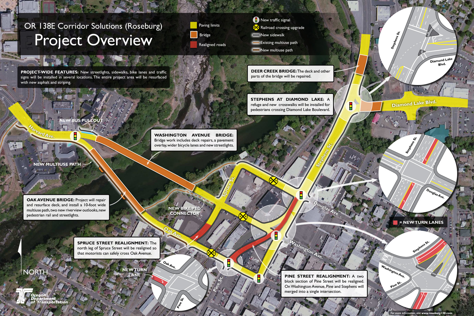

Project Goal: This multimodal project will promote economic development, safety and community livability in downtown Roseburg by improving the flow of traffic along the Oregon 138E corridor and adding features that benefit tourists, bicyclists, pedestrians and the disabled.
Project Elements
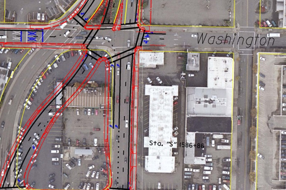
- Consolidate the north end of the downtown couplet, where Pine and Stephens meet Washington, into a single intersection by realigning Pine Street;
- Improve the turning radius at the Pine and Stephens intersections with Douglas, Washington and Oak;
- Reconfigure the travel lanes on Stephens and Oak to reduce the need for unnecessary lane changes;
- Increase capacity by constructing dual turn lanes from northbound and southbound Stephens onto Washington;
- Construct new turn lanes at other locations in the project area;
- Realign Spruce Street at Oak Avenue so the north leg of Spruce leads directly into the south leg;
- Upgrade six sets of traffic signals in the downtown area and introduce new features that discourage red-light running;
- Replace old traffic signs and add overhead directional signage throughout the project limits;
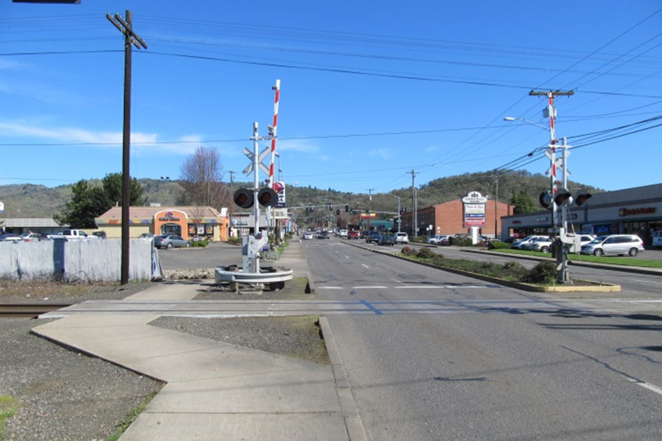
- Upgrade the rail crossings on Douglas, Washington and Oak Avenue;
- Install a multiuse path that along Harvard and Oak Avenue that connects the fairgrounds path with the downtown area;
- Promote connectivity by expanding the bike and pedestrian network onto Spruce Street and Douglas Avenue, connecting it with the paved path to Gaddis Park;
- Improve or add sidewalks throughout project limits;
- Add pedestrian refuges at the Stephens-Diamond Lake Boulevard intersection;
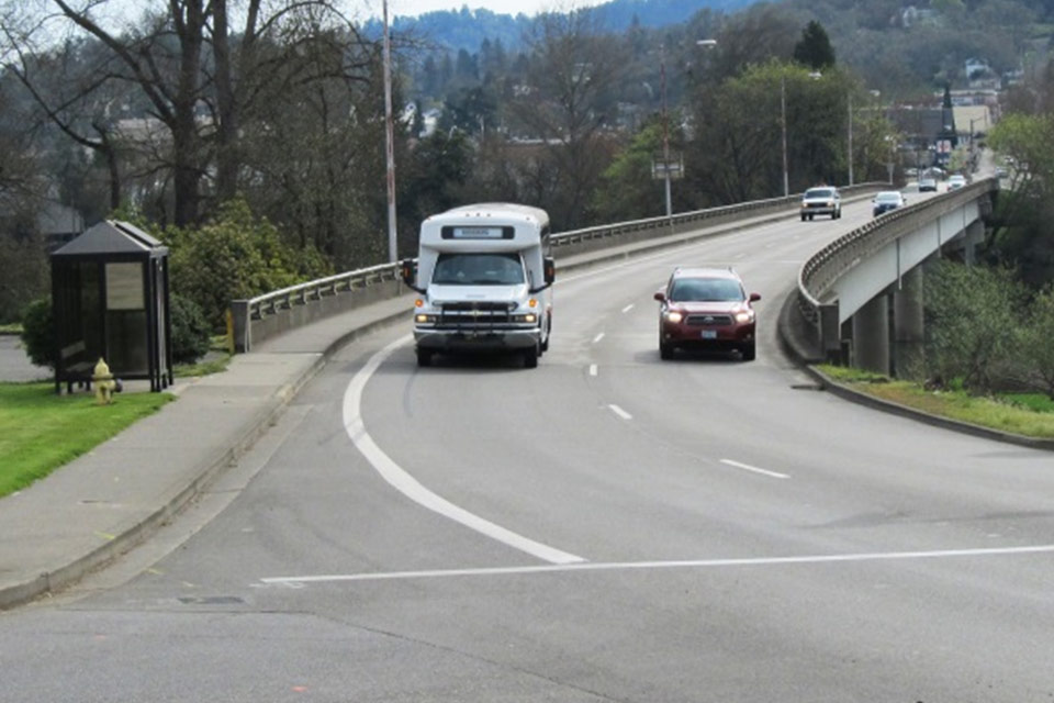
- Construct a bus pullout at the west end of the Washington Avenue bridge;
- Replace streetlights throughout the project area, and install new lighting along Riverside Park, between the Oak and Washington Avenue Bridges;
- Install several decorative features that complement the city’s streetscape, such as bridge rail, old-fashioned lampposts, riverview outlooks and bridge monuments;
- Resurface the Oak and Washington Avenue Bridges and the Deer Creek Bridge on Stephens;
- Repair or replace drainage throughout the work zone;
- Grind and repave the entire project area for the first time in 40 years.
Find out more about this project's road and traffic features, bike-ped improvements, crash reduction efforts and "Enhancement" features.
Construction
Unless the contractor changes the staging plan, construction will begin in July 2015 at the northeast corner of the project area, near the Stephens and Diamond Lake Boulevard intersection, and will gradually move west toward I-5. All construction is scheduled to be completed by fall 2016.
In general, all roads will remain at least partly open at all times. There may be a few nighttime detours when workers are resurfacing the bridges or paving an intersection. ODOT will notify the public before these impacts occur. At other times, motorists should expect single-lane closures, congestion and delays at peak travel times. ODOT encourages motorists to plan ahead, give yourself extra travel time and use alternate routes to avoid congestion.
Find out more about construction and traffic impacts.
Where do you want to go?
Project Overview - Project highlights.
Problems and Solutions - Why is ODOT doing this project?
Construction and Traffic Impacts - How road work will affect you.
Crash Reduction Features - How this project will help improve safety.
Bicycle and Pedestrian Features - Getting around by foot, bicycle or wheelchair.
Enhancement Features - Improving the downtown experience for everyone.
Stay Informed - Get the latest project information and updates.


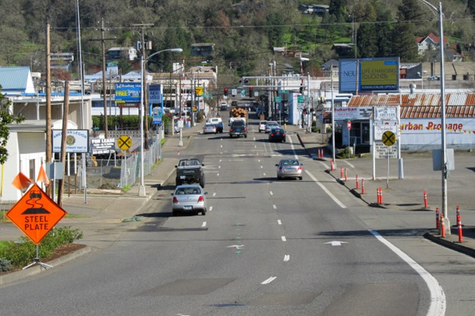
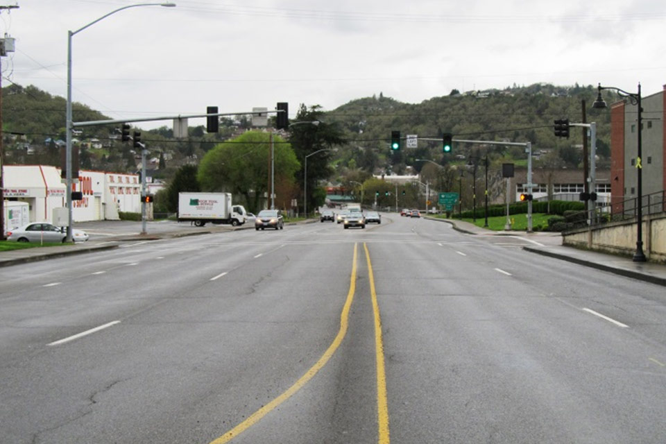
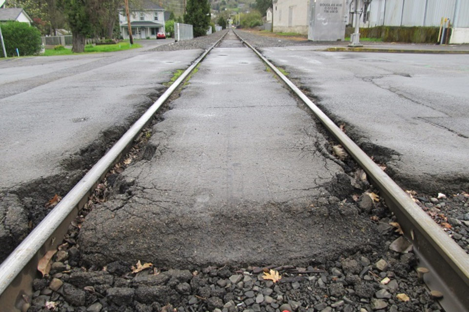
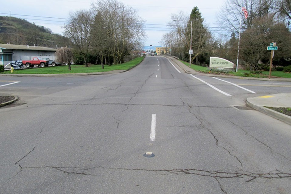
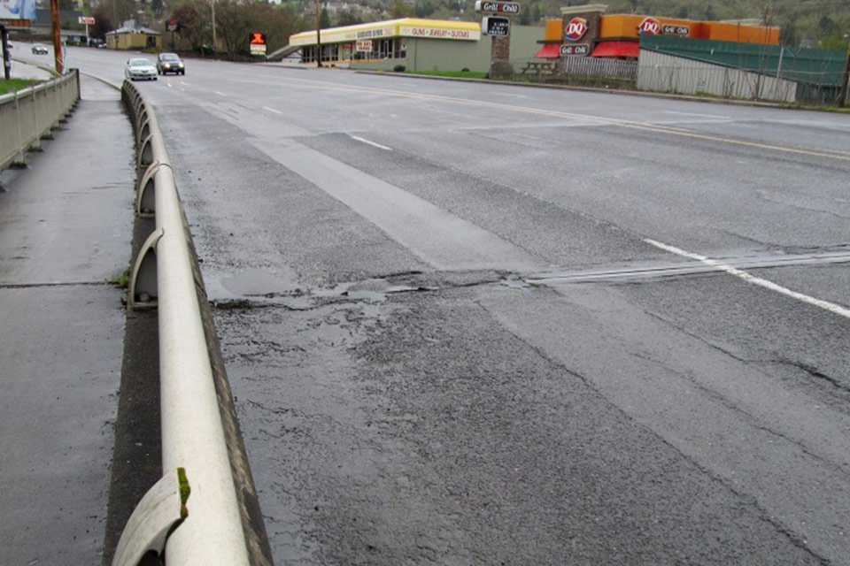


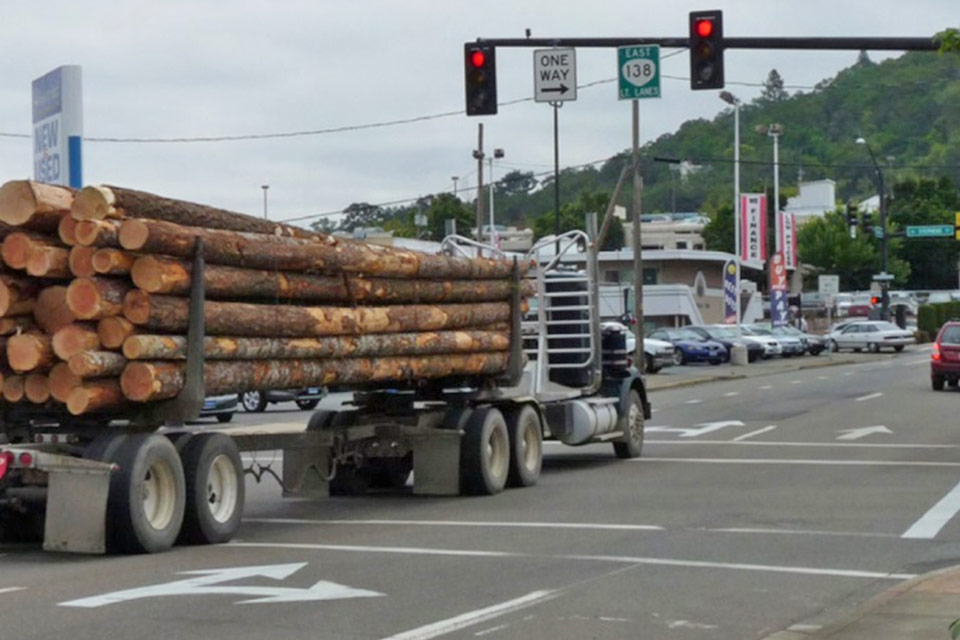
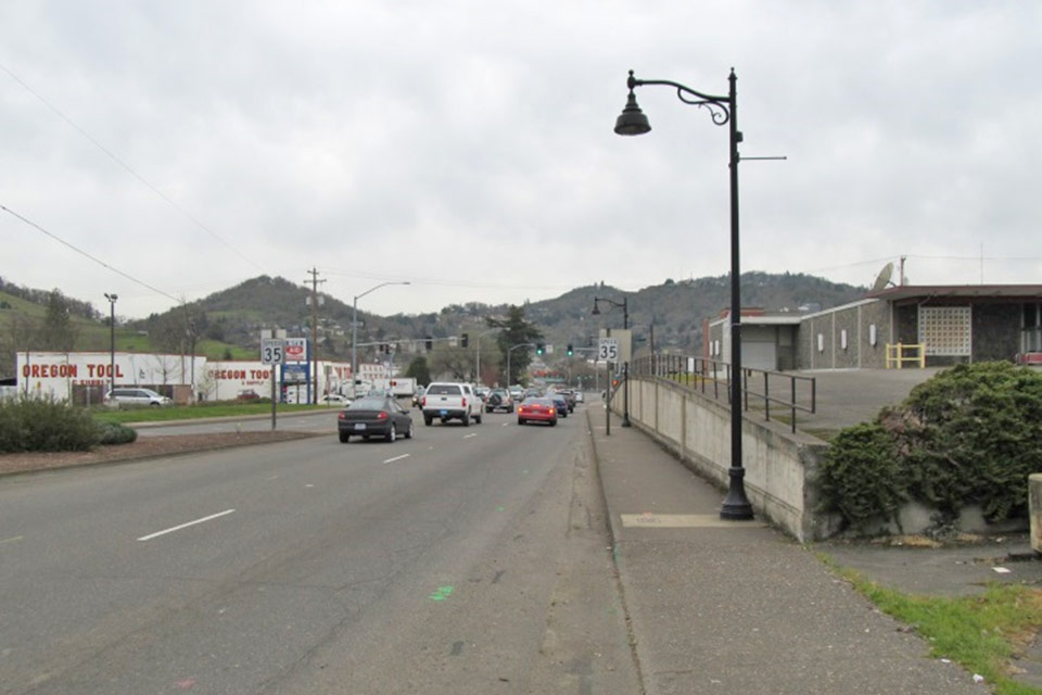
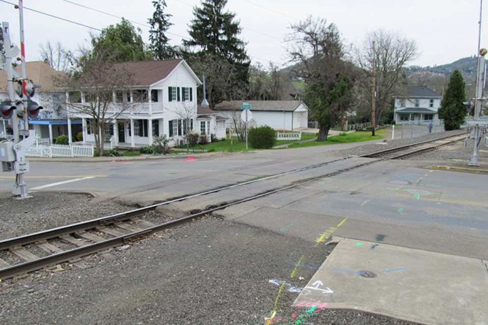
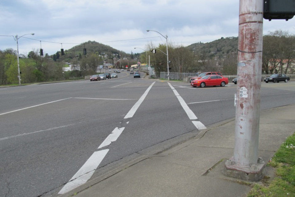
Some of the pavement along Highway 138 in downtown Roseburg dates back to the 1970s. On the state highway system, asphalt is usually repaved every 10 to 20 years, so it’s rare to find an area where the blacktop is so old. And it shows. The section of Washington Avenue near the railroad tracks is cracked and rutted from 40 years of wear and tear.
Paving this area is long overdue, but it can be expensive to resurface roads. In recent years, similar downtown paving projects in Bandon, Coos Bay, North Bend and Reedsport have cost millions of dollars. Even if the OR 138E Corridor Solutions project did nothing but grind and pave all of the existing roadway from curb to curb, it would still be an expensive project.
Problems with the system
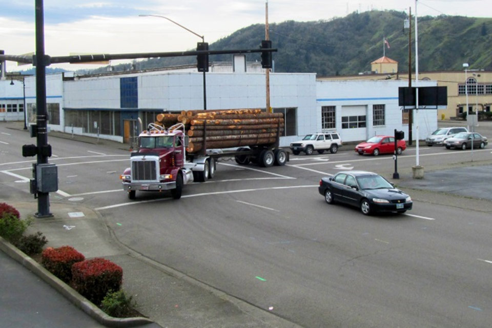
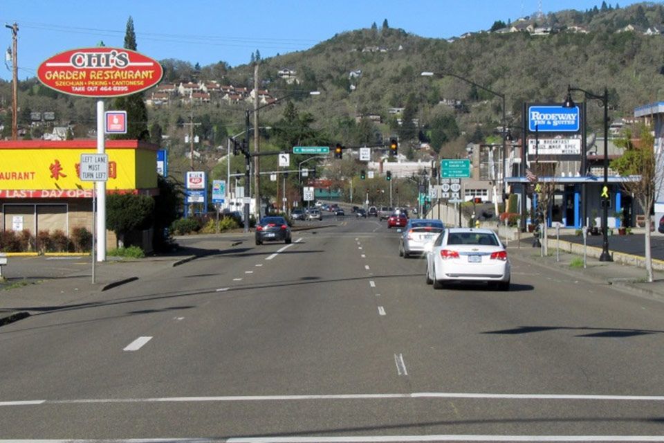
Roseburg has changed a lot in the last 40 years, but the downtown transportation system is still stuck in the 1970s. Traffic often backs up, roads can be difficult to navigate, and there are problems with capacity and turning movements. Many downtown crashes are related to red-light runners and drivers making abrupt lane changes. There are gaps in the bike-ped network, making it difficult for elderly pedestrians, kids on bikes and veterans in wheelchairs to get around.
Proposed solutions
We now have an opportunity to address these problems. The OR 138E Corridor Solutions will make several improvements to the local transportation system. Some of the biggest include:
- Pine Street realignment: A two-block section of Pine Street will be realigned between Douglas and Oak Avenue, and the Pine and Stephens intersections on Washington will be combined into one. This will improve safety and the flow of traffic by eliminating one unnecessary traffic signal from the system.
- Spruce Street realignment: Roseburg drivers frequently use side roads to get around congested intersections, and one of the most popular is Spruce Street. This project will realign the north end of Spruce so that it flows directly into the south end at the Oak Avenue intersection. This will improve safety and the flow of traffic.
- Dual turn lanes: To improve capacity and reduce congestion, dual turn lanes will be built on Stephens for both northbound and southbound traffic turning onto Washington.
- Turn lanes onto Douglas: At the request of the City of Roseburg, this project will build a northbound and southbound turn lane from Stephens onto Douglas Avenue. This will make it easier for drivers to go to the Douglas County Courthouse and downtown businesses.
- Right onto Pine: A new right-turn only lane will be installed from Oak Avenue onto Pine Street. The intersection at Oak and Pine is one of the most dangerous in Roseburg, and the new turn lane will help improve safety and the flow of traffic.
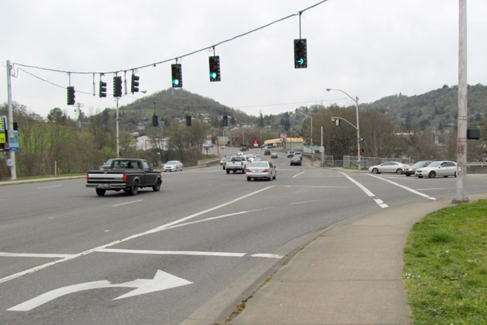
- Preventing “lane trap”: Motorists often make abrupt and dangerous lane changes when they find themselves trapped in the wrong lane. To help drivers get in the correct lane, the travel lanes on Stephens and Oak will be adjusted and new directional signage will be installed.
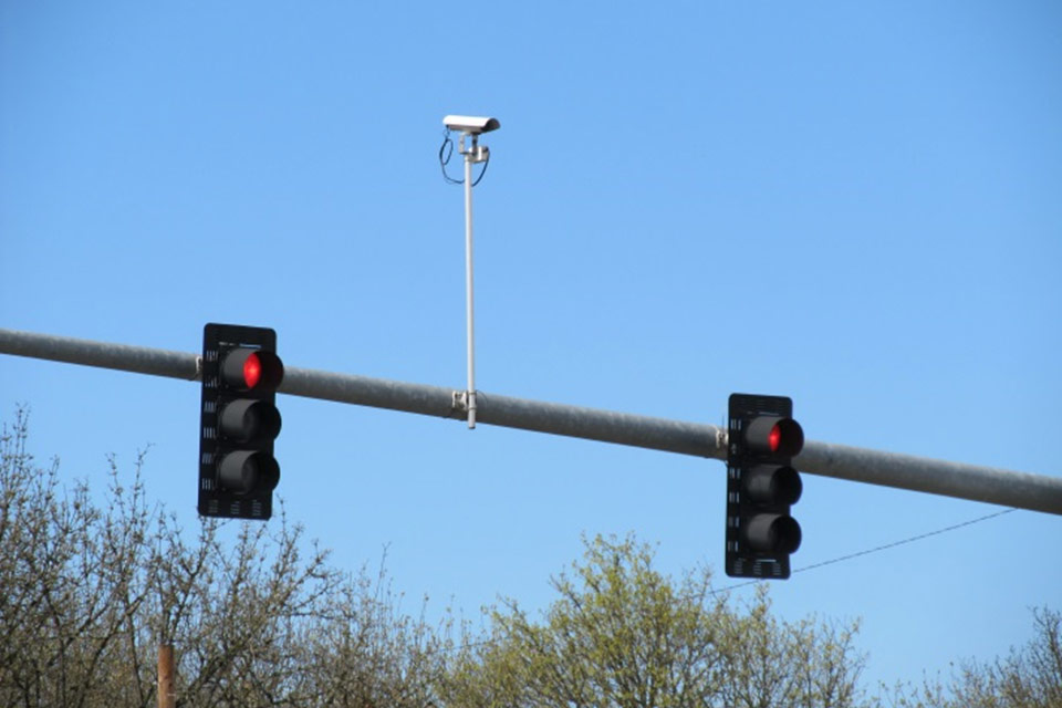
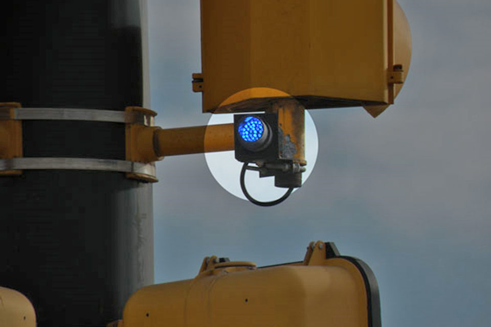
- Traffic signals: Six sets of traffic signals in the downtown area will be upgraded. The wire spans at the Diamond Lake-Stephens intersection will be replaced with poles that have mast arms, which are more stable in windy conditions. The signals will be equipped with camera detectors, which are usually more reliable than pavement sensors. Some of the new downtown traffic signals will be equipped with “tattle-tale” devices that make it easier for police officers to identify red-light runners.
- New signs: Old and damaged traffic signs will be replaced. This project will install new overhead directional signs that will help motorists navigate the downtown area.
- Bus pullout: A pullout will be constructed at the west end of the Washington Avenue Bridge, allowing both lanes of traffic to keep moving off the bridge when UTrans buses are stopped.
- Bridge repairs: The Deer Creek Bridge on Stephens will receive several repairs, and the bumpy deck will be resurfaced. The Washington Avenue Bridge will also be resurfaced and the bike lane will be widened.
Bike-ped improvements: The project also includes several important improvements to the local bike-ped network. A new multiuse path will be built from Harvard Avenue to Spruce Street, connecting the fairgrounds multiuse path with the downtown area. On Oak Avenue Bridge, the path will be 10 feet wide, providing plenty of room for pedestrians, bicyclists and wheelchair users. New streetlights will be installed on the bridge and elsewhere in the project area, helping to improve safety. New bicycle lanes will be added throughout the project area. Old and damaged sidewalks will be replaced, and the new railroad crossings on Douglas, Washington and Oak will feature new wrap-around sidewalks.
Enhance improvements: Working with the City of Roseburg, ODOT plans to make several improvements that will benefit the greater community and local businesses, making downtown Roseburg a more attractive place for people to visit and for locals to rediscover. Some of these, such as the turn lanes from Stephens onto Douglas, the bus pullout at the end of the Washington Avenue Bridge and the multiuse path have already been mentioned. At the request of the City of Roseburg, the multiuse path will feature decorative rail, old-fashioned streetlamps and two riverview overlooks on the Oak Avenue Bridge, allowing pedestrians to pause and enjoy the scenery. The project will also install two decorative monuments at the west end of the Oak and Washington Avenue bridges. Similar monuments can be found on bridges throughout Oregon.
Where do you want to go?
Project Overview - Project highlights.
Problems and Solutions - Why is ODOT doing this project?
Construction and Traffic Impacts - How road work will affect you.
Crash Reduction Features - How this project will help improve safety.
Bicycle and Pedestrian Features - Getting around by foot, bicycle or wheelchair.
Enhancement Features - Improving the downtown experience for everyone.
Stay Informed - Get the latest project information and updates.
Staging Map

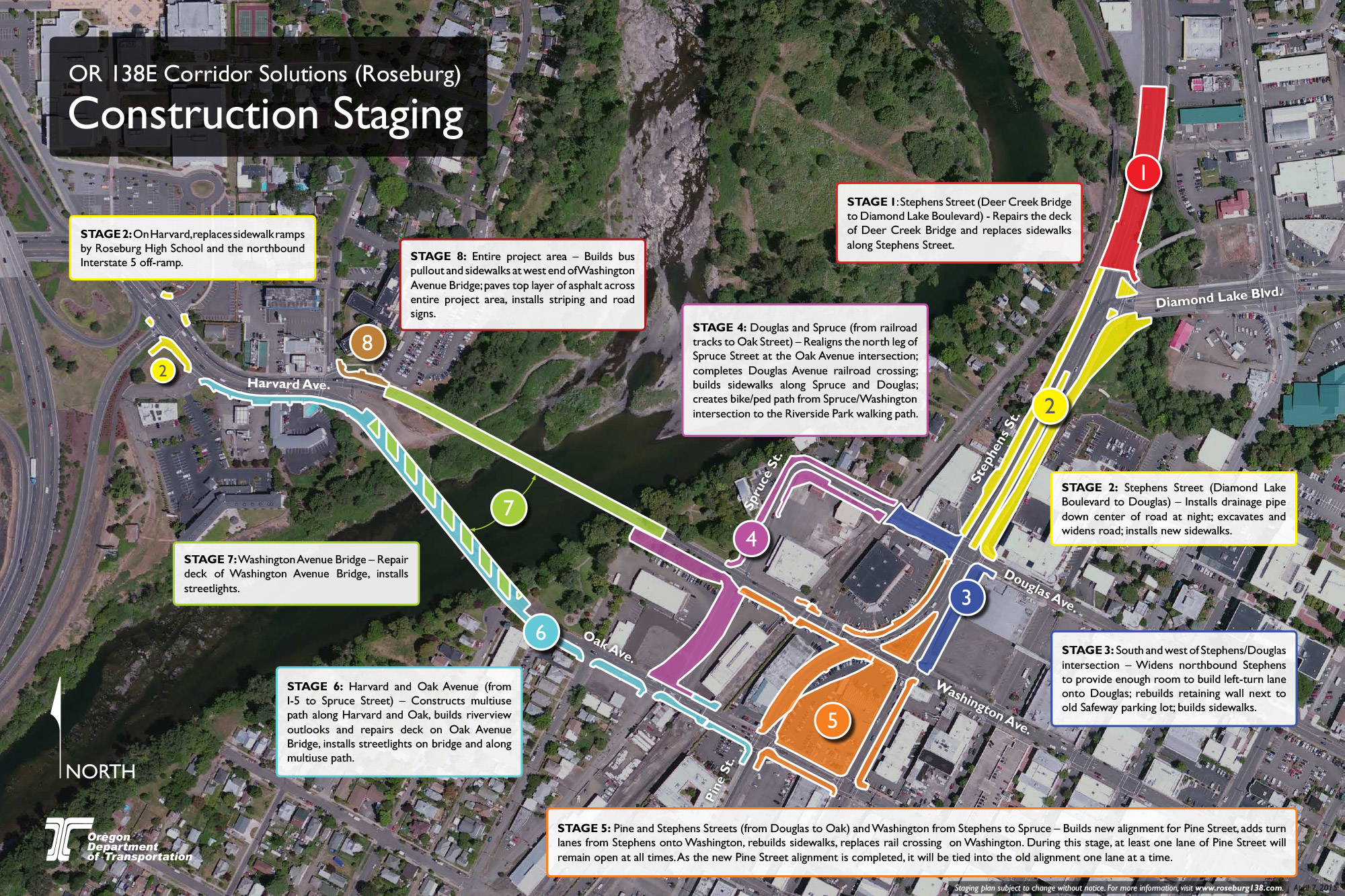
The OR138E Corridor Solutions project will begin in July 2015 and continue for approximately 14 months. Most construction will take place on the roads and bridges between the Stephens/Diamond Lake Boulevard intersection and Interstate 5. The project will realign parts of two roads, replace sidewalks, build turn lanes, add a multiuse path, repair three bridges, add streetlights and make several other transportation improvements.
On any given day, more than 20,000 vehicles pass through this part of downtown Roseburg. With so many cars on the road, it is impossible to build a project of this size without affecting traffic. ODOT understands how important it is to keep traffic moving through the work zone, and we are doing everything we can to keep impacts to a minimum.
During project development, ODOT organized a staging plan that would allow a contractor to build the project in a way that would keep traffic moving.
Each contractor brings their own unique experience and ideas to a project, and they often suggest changes to the original staging plan. Most are small changes. Although it’s possible for a contractor to create an entirely new staging plan, they usually stick close to the original plan because construction is sequenced so that certain tasks must be completed before others can begin. So while some details may change, the overall contours of the original staging plan will likely remain the same.
Prior to construction, some utility work will be scheduled. The City of Roseburg will relocate and replace water mains that are in conflict with the project.
The OR138E Corridor Solutions project bids in May 2015, and construction is not expected to begin until after Graffiti Weekend (July 8-12). We do not have a detailed timeline for when each stage will take place or how long it will need, and some stages may overlap. But construction will likely follow the sequence outlined below:
Stage 1: Stephens Street (Deer Creek Bridge to Diamond Lake Boulevard) – Repair the deck of Deer Creek Bridge and replace sidewalks along Stephens Street.
Stage 2: Stephens Street (Diamond Lake Boulevard to Douglas) – Install drainage pipe down center of road at night; excavate and widen road; install new sidewalks. On Harvard, replace sidewalk ramps by Roseburg High School and the northbound Interstate 5 off-ramp.
Stage 3: South and west of Stephens/Douglas intersection – Widens northbound Stephens to provide enough room to build left-turn lane onto Douglas; rebuilds retaining wall next to old Safeway parking lot; builds sidewalks.
Stage 4: Douglas and Spruce (from railroad tracks to Oak Avenue) – Realigns the north leg of Spruce Street at the Oak Avenue intersection; completes Douglas Avenue railroad crossing; builds sidewalks along Spruce and Douglas; creates bike/ped path from Spruce/Washington intersection to the Riverside Park walking path.
Stage 5: Pine and Stephens Streets (from Douglas to Oak) and Washington from Stephens to Spruce – Builds new alignment for Pine Street, adds turn lanes from Stephens onto Washington, rebuilds sidewalks, replaces rail crossing on Washington. During this stage, at least one lane of Pine Street will remain open at all times. As the new Pine Street alignment is completed, it will be tied into the old alignment one lane at a time.
Stage 6: Harvard and Oak Avenue (from I-5 to Spruce Street) – Constructs multiuse path along Harvard and Oak, builds riverview outlooks and repairs deck on Oak Avenue Bridge, installs streetlights on bridge and along multiuse path.
Stage 7: Washington Avenue Bridge – Repairs deck of Washington Avenue Bridge, installs streetlights.
Stage 8: Entire project area – Builds bus pullout and sidewalks at west end of Washington Avenue Bridge; paves top layer of asphalt across entire project area, installs striping and road signs.
In general, most work will take place during the day when there is more light and it is safer. Some work that could have a high impact on local traffic, such as bridge construction or connecting the new Pine Street alignment to Washington and Oak Avenue, will likely be scheduled at night.
Aside from a few nights, no detours are planned. At most times, traffic impacts will be limited to single-lane closures (both day and night), which may cause congestion and delays at peak travel times for a few days. When this congestion takes place, we expect most local drivers will seek out side roads and take alternate routes. As a result, people who live or own businesses along side streets can expect to see increased traffic from time to time.
Since most sidewalks will be replaced at some point during construction, there will be impacts to pedestrians. At most times, however, at least one side of the street will be passable and pedestrians should watch for construction and walking detour signs.
Likewise, there will be impacts to bicyclists. At most times, we encourage bikers to use alternate routes and side roads. However, when construction is taking place on the Oak or Washington Avenue bridges, bicyclists may either need to walk their bikes or ride in the travel lanes.
Downtown residents and businesses should expect daytime and nighttime noise consistent with road work.
Where do you want to go?
Project Overview - Project highlights.
Problems and Solutions - Why is ODOT doing this project?
Construction and Traffic Impacts - How road work will affect you.
Crash Reduction Features - How this project will help improve safety.
Bicycle and Pedestrian Features - Getting around by foot, bicycle or wheelchair.
Enhancement Features - Improving the downtown experience for everyone.
Stay Informed - Get the latest project information and updates.


In 2012, ODOT conducted a road safety audit to gain a better understanding of the traffic patterns, needs and operational problems along the OR138E corridor in downtown Roseburg. The audit focused on the area of OR 138E (Oak, Washington and Stephens) between Spruce Street and Washington Avenue. Based on ODOT’s Safety Priority Index System, this segment was identified for further analysis because it fell within the top five percent of all segments in the state.
The audit considered all reported crashes in this area during a five-year period, from January 2007 to December 2011 (crashes only need to be reported when the damage exceeds $1,500).
The overwhelming majority or reported crashes, 155 out of 189, occurred at intersections, with red-light running being identified as the main cause. Other crashes at intersections involved turning movements and rear-end collisions. Another 18 crashes took place in straight areas and were a result of sideswipes, which often happens when drivers are changing lanes. A handful of other crashes involved fixed objects and pedestrians.
From this data, the audit identified three safety issues that could to be addressed:
- Reducing red-light running
- Improving turning radiuses and visibility at intersections
- Eliminating “lane trap” and reducing the need to change lanes.
To address red-light running issues, the project will include modifications or replacement of traffic signals, which will make them more visible to drivers. The new signals will use camera detection, which typically perform better than pavement sensors in identifying motorcycles and bicycles. Also, “tattle-tale” beacons will be installed on some of the downtown traffic signals, allowing police officers to identify red-light runners from several different vantage points. Tattle-tale lights have only recently been introduced to Oregon, but they are in widespread use elsewhere, including Daly City, California.
The project will modify intersections to make it easier to turn and to improve visibility for all drivers. New or additional turn lanes will be constructed at several locations within the project area, and additional overhead directional signage will be installed.
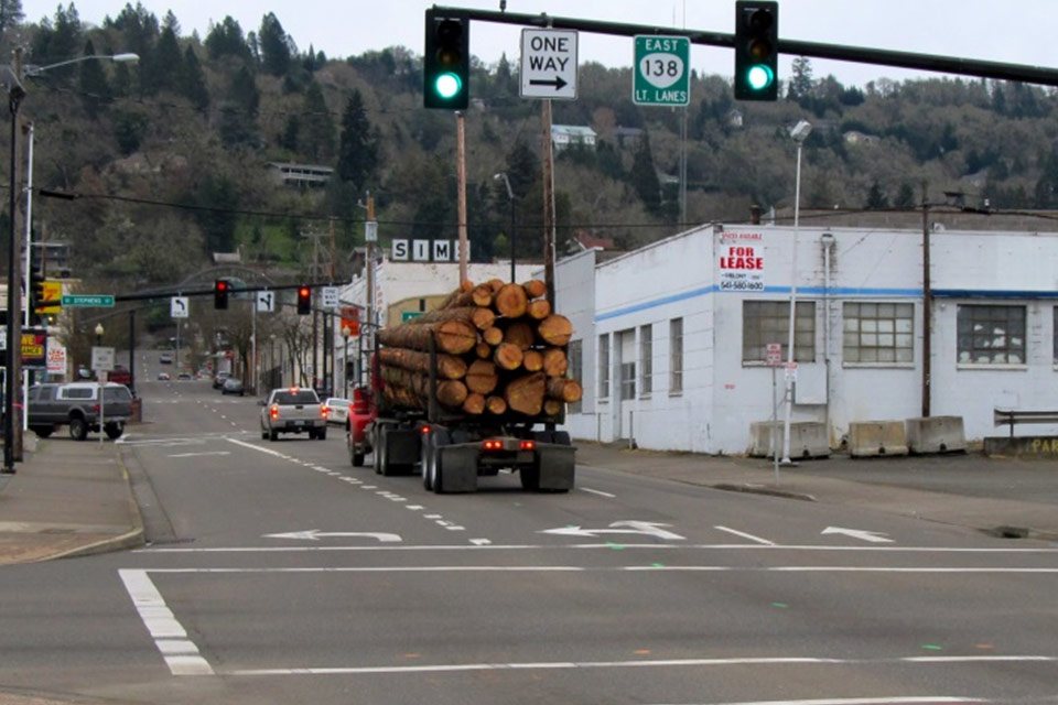
The lane trap phenomenon leads to much of the sideswiping that occurs in the downtown area. Vehicles heading from Diamond Lake Boulevard to I-5 are currently guided into the left and middle lanes of southbound Stephens, but they will need to get into the right lane to turn onto Washington Avenue and reach I-5. Once they realize they are trapped in the wrong lane, drivers may make an abrupt lane change and sideswipe another vehicle. This project will reconfigure the lanes on Stephens and add directional signage and corresponding striping so that drivers can get from Diamond Lake Boulevard to I-5 with fewer lane changes.
Where do you want to go?
Project Overview - Project highlights.
Problems and Solutions - Why is ODOT doing this project?
Construction and Traffic Impacts - How road work will affect you.
Crash Reduction Features - How this project will help improve safety.
Bicycle and Pedestrian Features - Getting around by foot, bicycle or wheelchair.
Enhancement Features - Improving the downtown experience for everyone.
Stay Informed - Get the latest project information and updates.
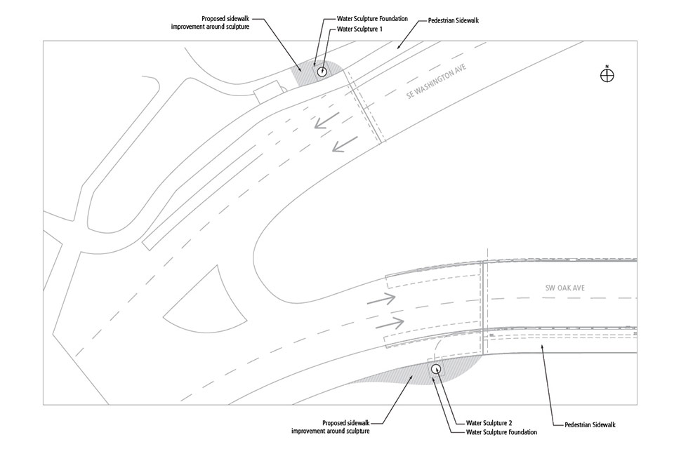


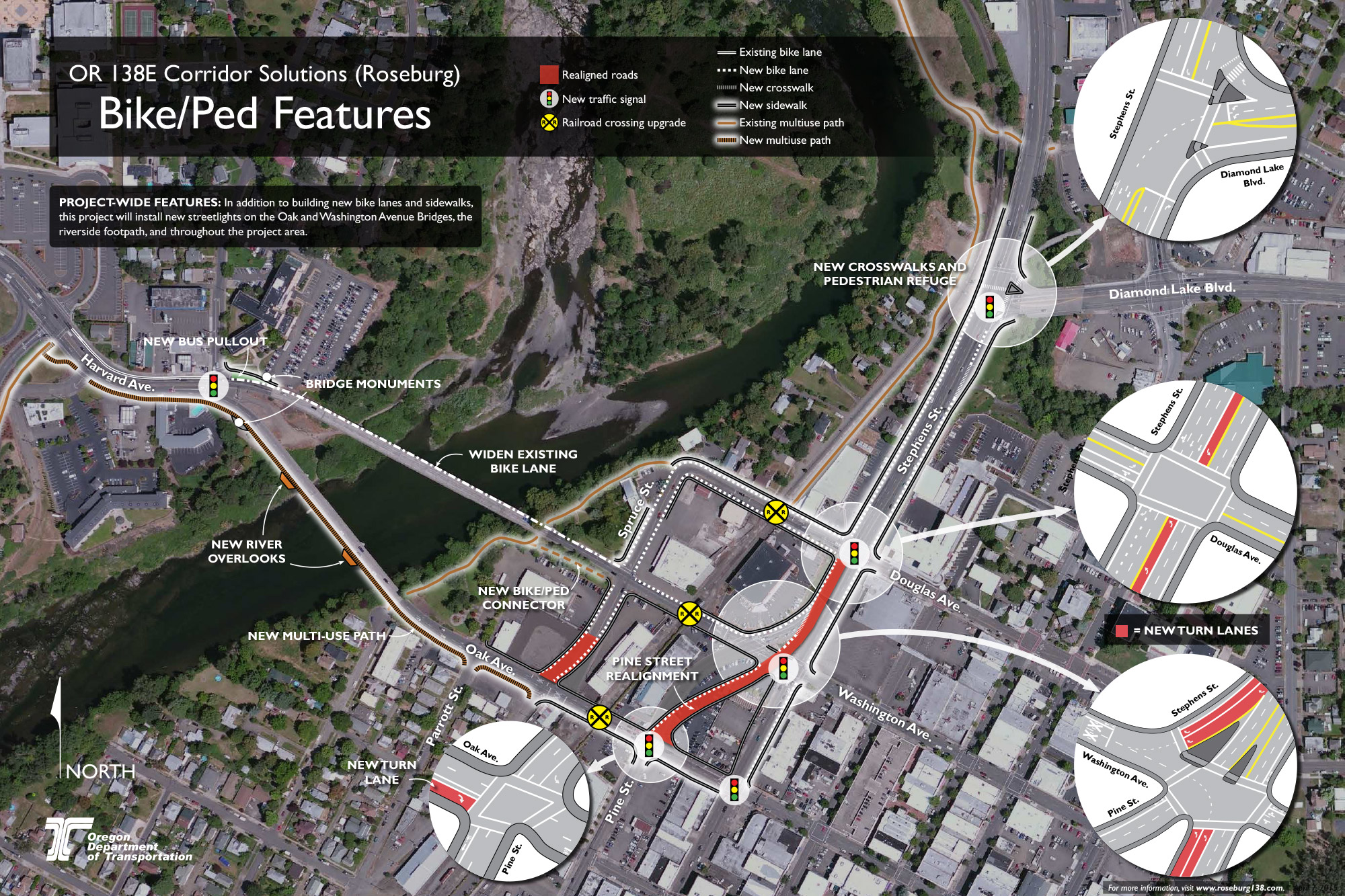
Bicycle and pedestrian features map (pdf, 1.2mb).
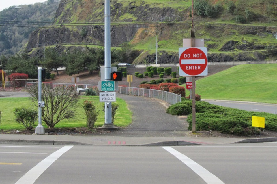
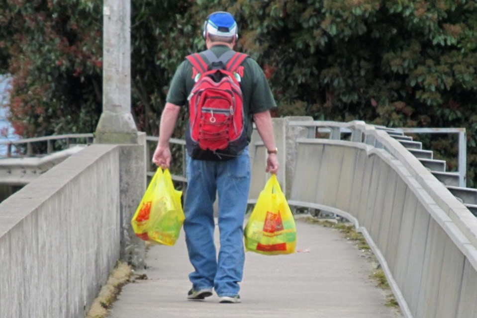
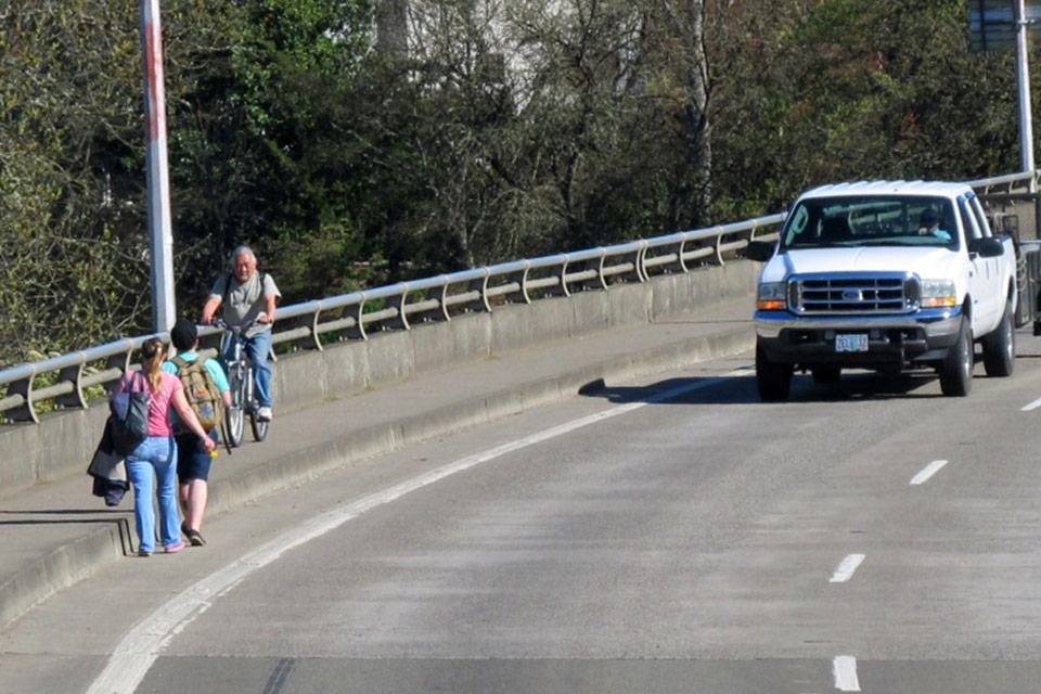
The OR 138E Corridor Solutions project offers several features that will make it easier for pedestrians and bicycle riders to travel safely through the downtown area.
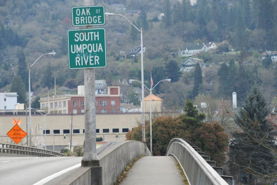
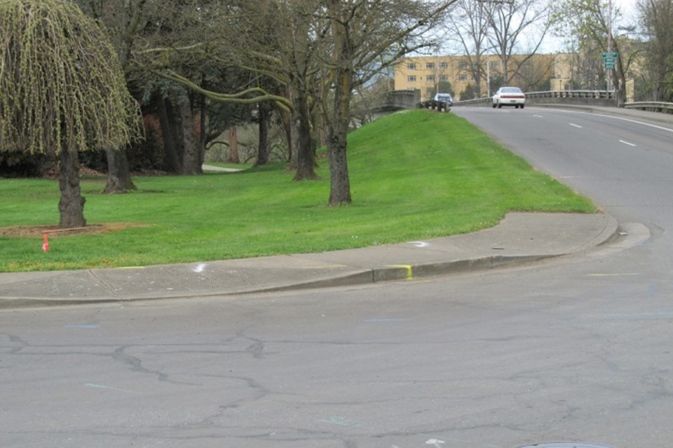
- Multiuse path: There are currently several bicycle and pedestrian paths in the Roseburg area. This project will create a 10-foot wide multiuse path that connects the Fairgrounds path with downtown Roseburg. The new segment begins on Harvard Avenue near the northbound Interstate 5 off-ramp, continues west across the Oak Avenue Bridge and extends to Spruce Street. From there, bicyclists can continue east on Oak or turn left on Spruce, which will take them toward Highway 138 or along the south Umpqua River to Gaddis Park. A short connector path will be built near the intersection of Washington and Spruce, linking the Spruce bike lanes with the Riverside Park multiuse path.
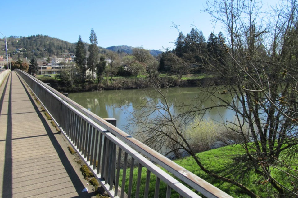
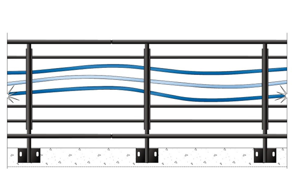
- Oak Avenue Bridge: As part of the new multiuse path, the existing walkway on Oak Avenue Bridge will be widened to 10 feet and will include two riverview overlooks. New pedestrian bridge rail will be installed and the streetlights on the bridge will be replaced. Decorative monuments will be installed at the west end of the Oak and Washington Avenue bridges.
- Washington Avenue Bridge: The westbound bike lanes on the Washington Avenue Bridge will be widened to better accommodate bicycles. The streetlights on the bridge will also be replaced.
- New bike lanes: This project will create new bicycle lanes on Spruce Street, Douglas Avenue and Stephens Street.
- Railroad crossings: The railroad crossings on Douglas, Washington and Oak Avenue will be upgraded, providing a smooth riding surface for bicycles and motor vehicles. New sidewalks will be installed around the crossings, which will benefit pedestrians and wheelchair users.
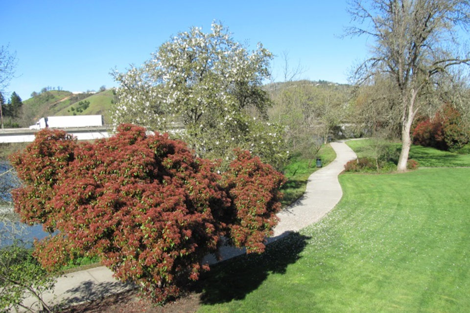
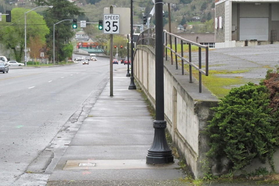
- Streetlights: To improve safety, new lighting will be provided throughout the project area, including the waterfront walking path between the Oak and Washington Avenue Bridges.
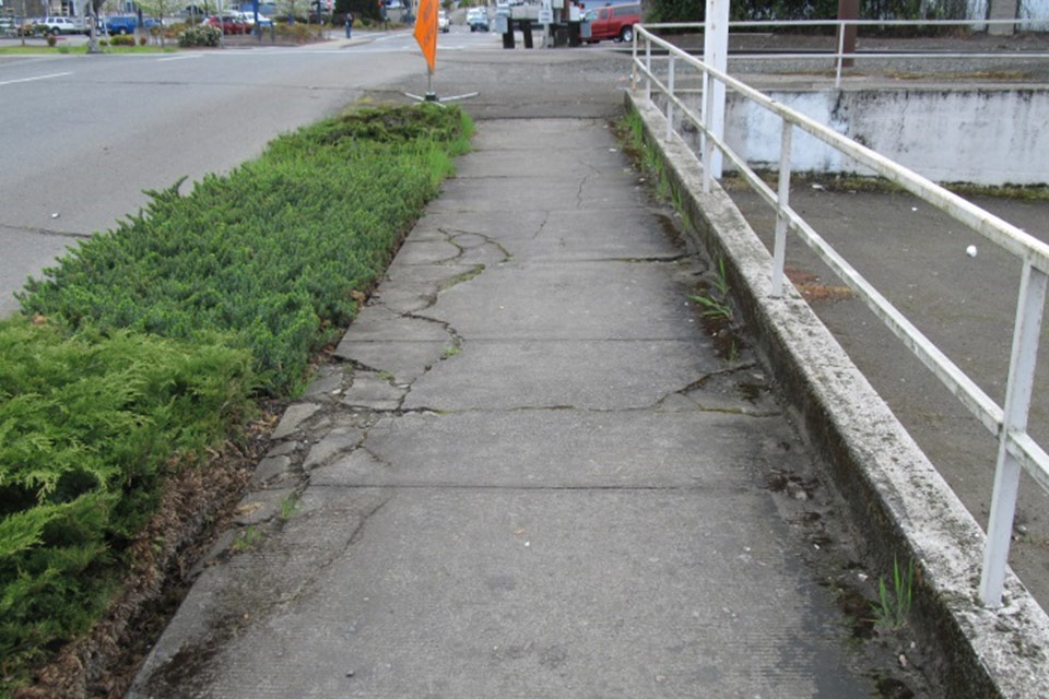
- Sidewalks: Old and damaged sidewalks and ADA ramps will be replaced throughout the project area, and new sidewalks will be built on Spruce and Douglas.
- Crosswalks: The Stephens Street crosswalk at Diamond Lake Boulevard is one of the longest in Oregon, which can make it difficult to safely navigate for elderly pedestrians and wheelchair users. This project will separate the crosswalk into three segments, and will include two pedestrian refuges.
- Signs: In addition to new directional and traffic signs on Stephens, Oak and Washington, this project will add wayfinding signs for bicyclists and pedestrians in several locations.
- Bus pullout: A bus pullout will be constructed at the west end of the Washington Avenue Bridge, making it safer for bus users to wait and get on and off the buses without impeding the flow of traffic.
Where do you want to go?
Project Overview - Project highlights.
Problems and Solutions - Why is ODOT doing this project?
Construction and Traffic Impacts - How road work will affect you.
Crash Reduction Features - How this project will help improve safety.
Bicycle and Pedestrian Features - Getting around by foot, bicycle or wheelchair.
Enhancement Features - Improving the downtown experience for everyone.
Stay Informed - Get the latest project information and updates.
The main goal of the OR 138E Corridor Solutions project is to improve safety and the flow of traffic through downtown Roseburg. But at the request of the City of Roseburg, ODOT is also including several features aimed at making the downtown area a more enjoyable place to visit and a more profitable place to do business.
Over the past several years, the City of Roseburg and ODOT have built multiuse paths in several areas of Roseburg with the goal of eventually connecting them into a broader bicycle and pedestrian network. As part of the OR 138E Corridor Solutions project, a multiuse path will be built along Harvard and Oak Avenue, connecting the Fairgrounds path with the downtown area and the paved path that leads to Gaddis Park. When the new multiuse path is complete, people in Green will be able to walk, run or ride their bikes to downtown Roseburg and destinations beyond.
Besides the health benefits of having a bike-ped network in place, there are economic benefits as well. Each year, more people plan bicycle vacations. Cycle Oregon attracts hundreds of riders on their annual tours of the state. Having a growing and well-maintained bike-ped network in Roseburg opens up more tourism opportunities, which is why the City of Roseburg and many local businesses support these efforts.
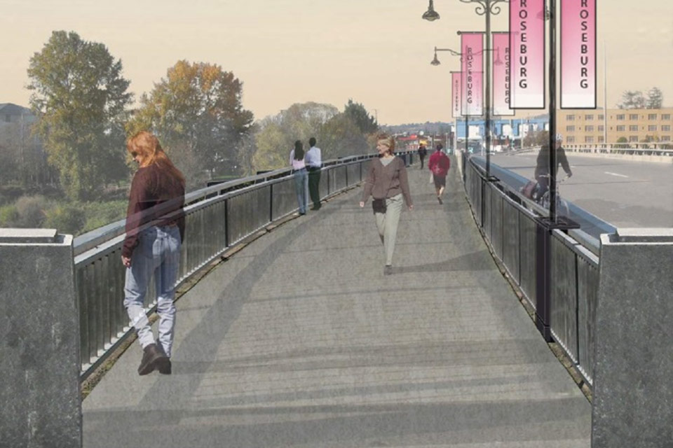
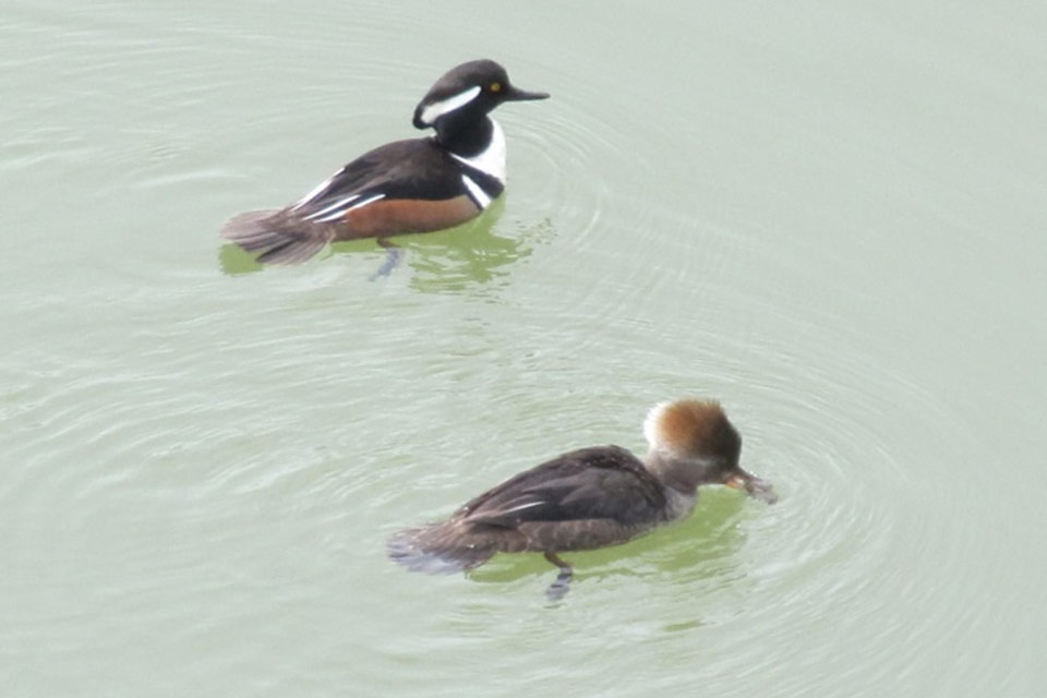
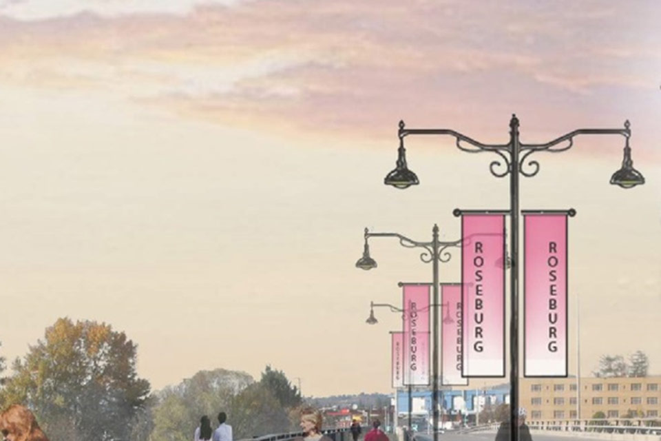
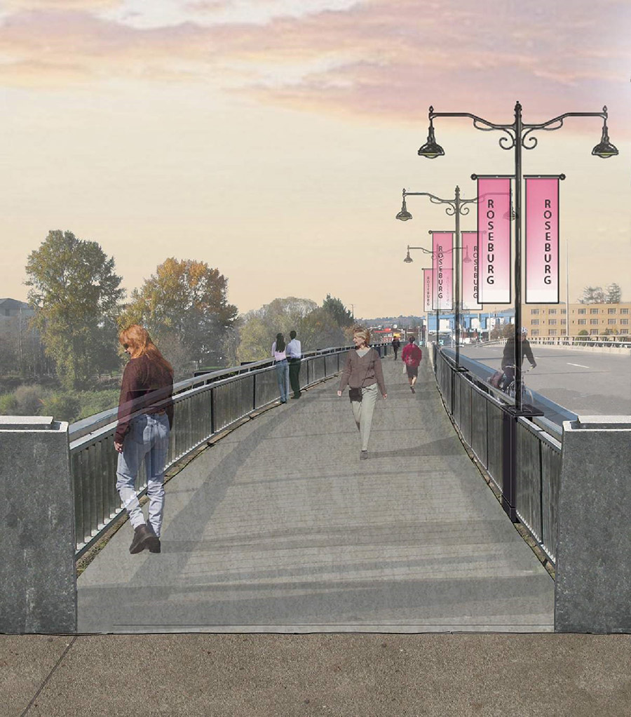
While the multiuse path leads visitors to the heart of Roseburg, the renovated Oak Avenue Bridge will function as the city’s new welcome mat. The walking path on the bridge will be widened to 10 feet and will feature decorative rail and traditional lampposts that are designed to complement the city’s new streetscape improvements. Two riverview outlooks will be built on the bridge, allowing visitors to pause and enjoy the natural scenery. At the west end of the bridge, two monuments built by Oregon artists will welcome visitors to the land of Umpqua.
The City of Roseburg has also requested road and traffic improvements that will benefit the downtown community. A new bus pullout will be constructed at the west end of the Washington Avenue Bridge, allowing both lanes coming off the bridge to keep moving when the bus pulls over. And on Stephens Street, new turn lanes at Douglas Avenue will give motorists another option to reach the county courthouse and downtown businesses.
Many of these enhance features also have an important safety component. The new multiuse path will help keep bicycles and motor vehicles separated, improving safety for both. New pedestrian lighting will be installed throughout the project area and along the Riverside Park footpath. Although the lampposts will be decorative, the illumination they provide will serve an important safety function. And while the bus pullout on Washington Avenue will keep traffic moving off the bridge, it will also lower the risk of rear-end crashes.
The last major addition to the downtown transportation system was the construction of the Oak Avenue Bridge in 1970. The OR 138 Corridor Solutions project, along with the city’s Oak and Washington Avenue improvements, will give everyone an opportunity to rediscover downtown Roseburg.
Where do you want to go?
Project Overview - Project highlights.
Problems and Solutions - Why is ODOT doing this project?
Construction and Traffic Impacts - How road work will affect you.
Crash Reduction Features - How this project will help improve safety.
Bicycle and Pedestrian Features - Getting around by foot, bicycle or wheelchair.
Enhancement Features - Improving the downtown experience for everyone.
Stay Informed - Get the latest project information and updates.
The best way to avoid traffic delays is to find out what’s going on and plan ahead. We understand there are a lot of ways people get information and stay connected. Here are a few options for getting the latest project news, construction updates and traffic information.
- Email updates: ODOT will provide project updates once or twice a month during construction, unless more frequent messages are necessary. These messages will include information about the progress of construction and upcoming traffic impacts. To receive these updates, please visit our Subscriber Preferences page.
- Project website: Find out more about this project at www.roseburg138.com.
- TripCheck: Learn about road conditions in Roseburg and throughout Oregon by visiting www.tripcheck.com or dialing 511.
- Social media: You can follow us on Twitter and Facebook @OregonDOT. Note: these are statewide services and will include information about construction and road conditions throughout Oregon.
- Local media: We will be sending news releases and weekly updates to the Roseburg media. Just pick up a paper, go to your favorite news website, or turn on the TV or radio.
- Smartphone apps: Although ODOT doesn’t endorse any product, several apps provide real-time traffic information. Two of the more popular are Inrix and Waze. Check the reviews online to see if these apps are for you. And when you’re driving, please keep your eyes on the road.
- Give us a call: Sometimes the easiest way to get an answer is to pick up the phone. For more information, please call 541-957-3601 or 541-957-3500.
We’d like to hear from you…
If you have a comment, question or suggestion, please contact:
Dan Latham
ODOT Public Affairs
3500 NW Stewart Parkway
Roseburg, OR 97470
Email: Dan.Latham@odot.state.or.us
Phone: 541-957-3601
Where do you want to go?
Project Overview - Project highlights.
Problems and Solutions - Why is ODOT doing this project?
Construction and Traffic Impacts - How road work will affect you.
Crash Reduction Features - How this project will help improve safety.
Bicycle and Pedestrian Features - Getting around by foot, bicycle or wheelchair.
Enhancement Features - Improving the downtown experience for everyone.
Stay Informed - Get the latest project information and updates.
Oregon.gov
- State Directories
- Agencies A to Z
- Oregon Administrative Rules
- Oregon Revised Statutes
- About Oregon.gov
Oregon.gov Links
PDF File Accessibility
Adobe Reader is required to view PDF files. Click the "Get Adobe Reader" image to get a free download of the reader from Adobe.
About this site
This web site was developed by JLA Public Involvement and is not hosted by the Oregon Department of Transportation, though we adhere to the same accessibility guidelines. If you have any problems with the information on this page, please contact technical support, (503) 235-5881 for assistance.
