
Stations
Go directly to a station using the buttons below, or at the top of the screen to move through the stations in order. You can review and provide feedback on any or all of the areas that interest you. You do not have to visit every page or answer every question.
Please provide your comments by Friday, December 11th.
Click or tap “Get Started” above or use the links below to skip to specific information.

= Page includes questions or opportunities for comment.
Image gallery contents:
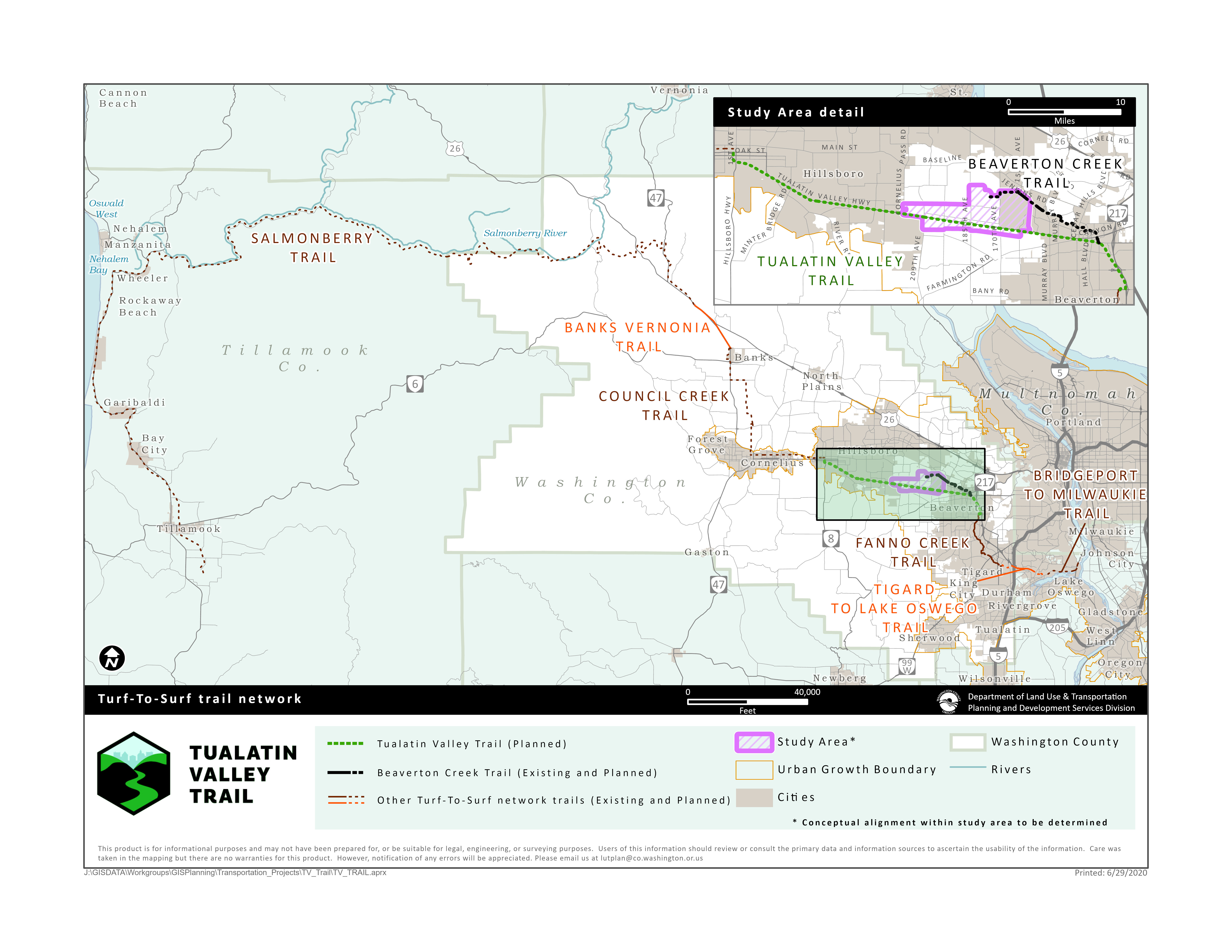
Turf to Surf Area Map
TV Trail will be a part of a network of trails that connect the Portland-Metro area to the Oregon Coast.
Turf to Surf Area Map
TV Trail will be a part of a network of trails that connect the Portland-Metro area to the Oregon Coast.

A new trail would offer...
- An alternative to TV Highway that feels safe to walk and bike – whether for fun and fitness or getting to work or school, running errands, or catching a bus or MAX train.
- A connection to other regional trails.
Project goals
The community has long expressed a desire for safe and comfortable options for traveling the TV Highway corridor to reach nearby destinations without the use of a car and increased access to physical activity and recreation. This project will determine the feasibility of creating a low-stress option to travel through Aloha by walking, biking, and more.
The project team is considering many things as they evaluate each corridor option, including goals, objectives, and evaluation criteria. The goals and objectives were developed with direction from policymakers, the project management team, and community input. View the full project goals, objectives, and evaluation criteria.
Question
- Safety Not ranked.
- Connectivity Not ranked.
- Health and Livability Not ranked.
- Coordination Not ranked.
- Equity Not ranked.
Feasibility is also one of the project goals. It is not included in this goal ranking exercise as only feasible options will be carried forward. The feasibility goal and evaluation criteria are being used to develop the concepts and balance impacts and costs with the other project goals.
Image gallery contents:
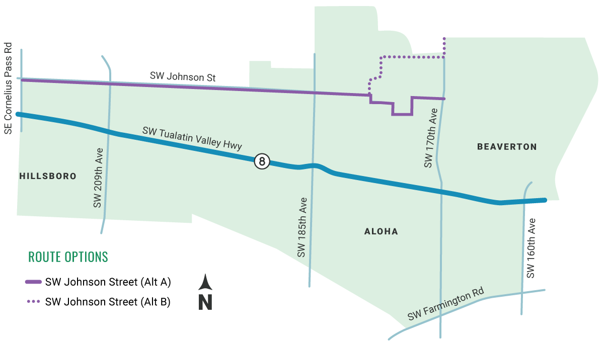
tv-trail/sw-johnson-street-alt-a-b-
tv-trail/sw-johnson-street-alt-a-b-


Question

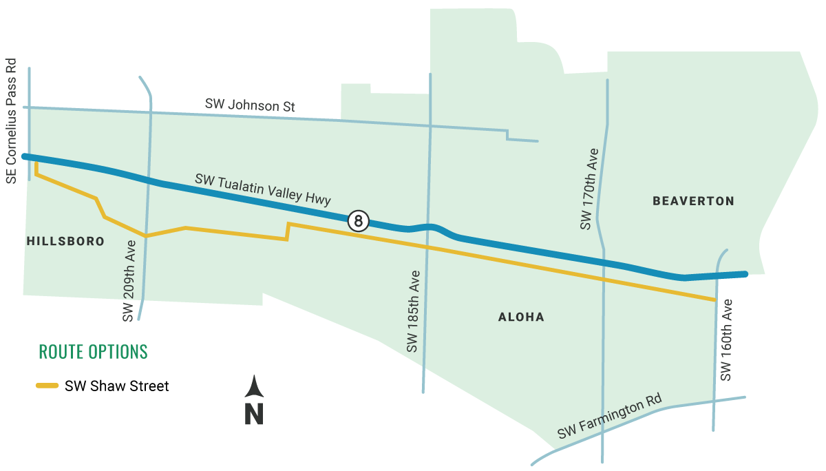


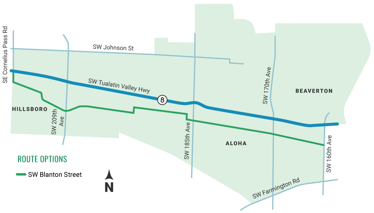

Image gallery contents:
tv-trail/or8-map-all
tv-trail/or8-map-all


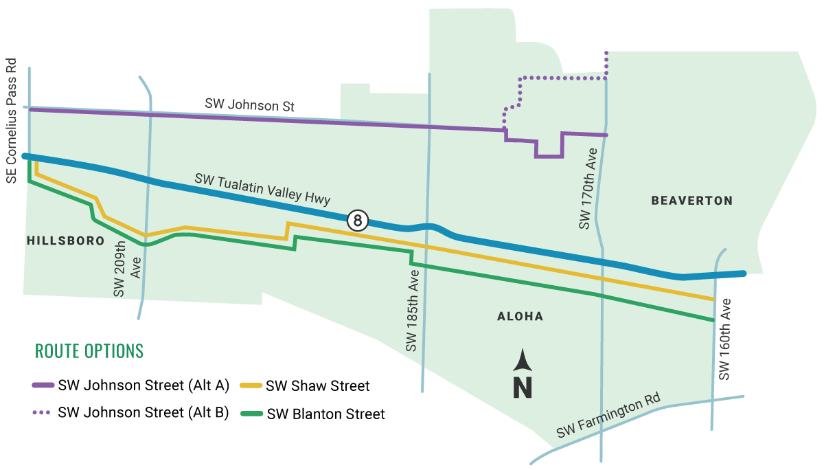
Two of the corridors are beginning to stand out as the best options – SW Shaw Street and SW Blanton Street.
SW Shaw Street street stands out because it scored the best on the evaluation criteria. We also heard that SW Blanton Street provides the best connections to community destinations including community parks and schools. Now we need you to help us decide.
Question
Instructions
Click the "Add Comment" button above the map to place a marker on the map. Then, provide a name for your destination.
Image gallery contents:
regional-trail-on-one-side
complete-street


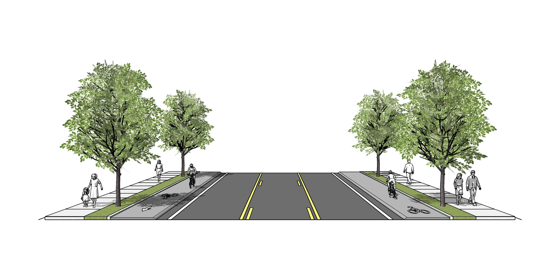
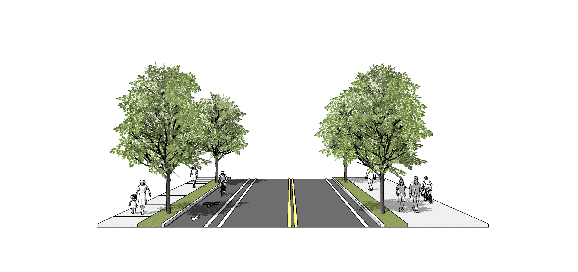
As you look through the following two cross sections, consider which one will best meet the community’s needs.
While these are the primary cross sections we are considering for TV Trail, we are also considering cross sections that will accommodate narrow sections of the corridor and street parking. These cross sections are a work in progress and are subject to change.
Cross Section A
Regional Trail on One Side
Cross Section B

Complete Street
Question
Timeline
With your feedback in mind, we will begin work on a Preferred Alignment and Conceptual Design. A draft Concept Plan will be available for review in Spring 2021.
Stay Involved! Sign-up for project updates.
Email Sign-up
Demographics Questions (Optional)
We're asking these questions to help us evaluate the effectiveness of our outreach activities. Answering these questions is completely optional.
.The option to review and submit answers will appear after you answer at least one question.
