Visit the pages on this site using the buttons below or click "Get Started" above to move through the information in order.

= Page includes questions or opportunities for comment.
Attention Safari Browser Users
Some users of the Safari browser on iOS have reported receiving a "Misdirected" error after submitting comments. If you receive this error, please know that your comments have been successfully received. We are working to address this issue. Please contact us at tech@jla.us.com if you have any questions


Project Purpose
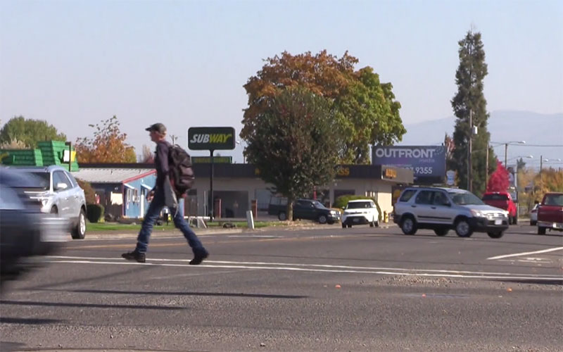
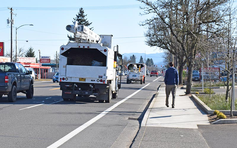
The purpose of the Main Street Safety Project: Planning Phase is to select infrastructure solutions that will make Main Street safer for people walking, biking, driving, and taking transit.
The selected safety improvements will provide for the movement of goods and people, support the economic viability of the corridor, accommodate current bus service and future transit solutions, and complement traffic safety education and enforcement.
What We've Heard
We have heard from the community that balancing safety, traffic mobility, and business needs on Main Street is very important, so the project team has developed and analyzed various elements that can be combined to create a comprehensive safety solution for Main Street. These elements aim for positive outcomes for each of the Project Goals:
- Safety – Increase the safety of Main Street for all users
- Business Community – Support the viability of existing and future businesses
- Mobility – Ensure people and goods travel efficiently and reliably through the corridor
- Transportation Choices – Create a multimodal environment that connects people and destinations
- Vital Community – Support the vitality of the community and its vision for Main Street
- Feasibility – Develop a plan with a clear and achievable approach to implementation
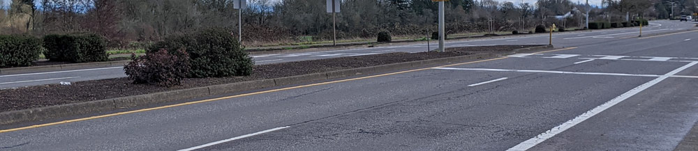
Project Area
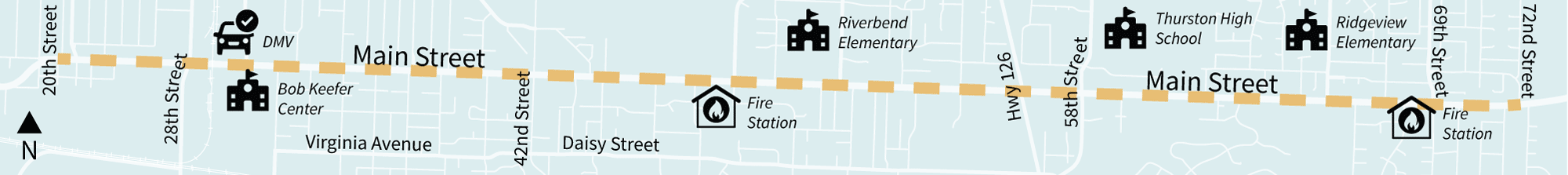
Click to enlarge.
About Scoring
To address the safety problem on Main Street, individual elements, such as intersection or corridor-wide improvements, are being considered. As you advance through each element page you will find a description of the element and the options being considered for that element, information about the benefits and constraints of each element option, and have an opportunity to provide feedback on each element.
The final set of improvements will balance all of the Project Goals to create a comprehensive safety solution for Main Street. A final set of improvements may include a combination of these elements along one or more segments on the corridor.
Scoring Key
![]() Strongly Supports
Strongly Supports
![]() Moderately Supports
Moderately Supports
![]() No Signifcant Change
No Signifcant Change
![]() Moderately Conflicts
Moderately Conflicts
![]() Strongly Conflicts
Strongly Conflicts
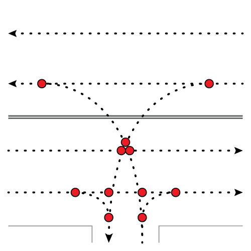
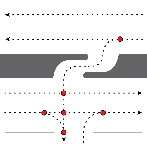
Examples of how raised medians could be implemented on Main Street:
Maximizing
Safety
Add raised medians with openings at major intersections only. More medians along Main Street would have the greatest impact on improving safety but would also decrease the accessibility to and from local streets, requiring some out of direction travel compared to existing conditions (taking approximately 60-120 seconds more to reach a destination, on average).
Balancing Safety
and Access
Add raised medians with openings at major intersections and other local streets. This would better balance the need to improve safety with accessibility on Main Street, reducing the amount of out of direction travel while still providing signifcant safety benefits (taking approximately 30-60 seconds more to reach a destination, on average).
Limited
Medians
Add raised medians only at locations with the most severe safety concerns. This provides the most accessibility on Main Street with limited out of direction travel (taking approximately 10-30 seconds more to reach a destination, on average). However, the amount of safety benefits that limited medians would have on Main Street may be minor, as crashes occur along the entire street.
Element Ratings (hover or tap on icons to learn more)
| Goals and Example Evaluation Criteria | Maximize Safety | Balance Safety and Access | Limited Medians |
|---|---|---|---|
| Safety (!) Potential to reduce crashes and vehicle speeds. | |||
| Business Community (!) Change in travel times to access businesses, availability of truck routes, and potential impacts on business signing. | |||
| Mobility (!) Delay at intersections and travel time through Main Street. | |||
| Transportation Choices (!) Frequency of crossings for people walking and biking, and the comfort of the walking and biking infrastructure. | |||
| Vital Community (!) Potential for streetscape improvements, such as landscaping, and the directness of routes between neighborhoods and Main Street destinations and services. | |||
| Feasibility (!) Degree to which recommendations can be implemented due to cost and right-of-way impacts, and the benefit-cost of safety-focused improvements. |
![]() = Strongly Supports
= Strongly Supports ![]() = Moderately Supports
= Moderately Supports ![]() = No Significant Change
= No Significant Change ![]() = Moderately Conflicts
= Moderately Conflicts ![]() = Strongly Conflicts
= Strongly Conflicts
The safety elements above have been scored using the criteria described in Technical Memorandum #11: Solutions Evaluation Criteria. Scores are not intended to determine a single option, but rather to help inform the conversation about which safety solutions work best for Main Street. Options might score differently if used together with other elements, but are shown here without consideration for how they may be combined.
Questions
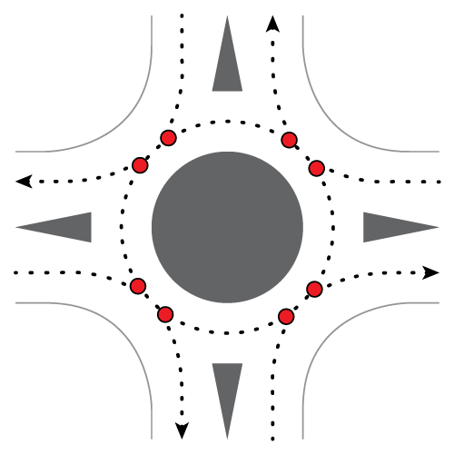
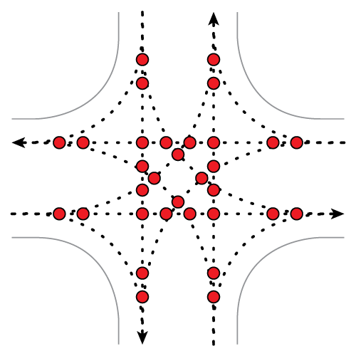
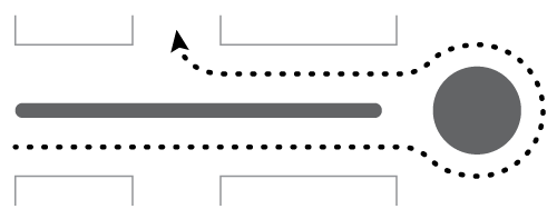
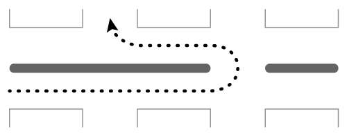
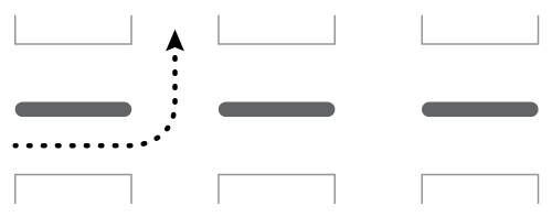
Examples of how intersection controls could be implemented on Main Street:
Roundabouts
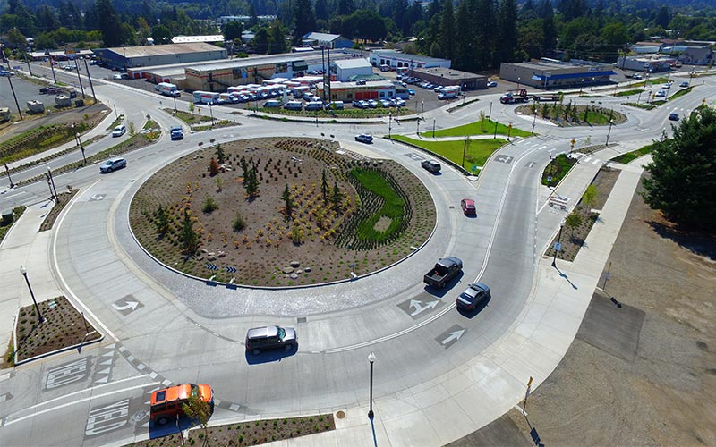
Multi-lane roundabout at Franklin Boulevard.
By encouraging drivers to slow down and reducing the number of conflict points at an intersection, roundabouts significantly reduce fatal and severe injury crashes, such as head-on and right-angle crashes. They would lessen traffic congestion on Main Street and allow freight vehicles to make U-turns. While they may be more expensive and may take up more space than signalized intersections currently do, roundabouts can decrease public and private costs by lowering crash and maintenance costs over time.
Signalized Intersections
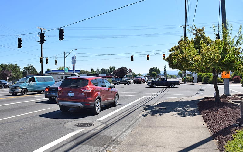
Signalized intersection at 42nd Street.
Retaining signalized intersections would not improve safety. Signalized intersections would likely require and include minor modifications, such as more lanes added in specific locations to accommodate increased traffic over the next 20 years, widening at the street near the corners to accommodate U-turns, and some signal timing changes. Freight vehicles would be unable to make U-turns at signalized intersections and would need to reroute using the local street network, which has limited connectivity in some areas. The construction cost may be lower than building a roundabout, but would require higher maintenance costs.
Element Ratings (hover or tap on icons to learn more)
| Goals and Example Evaluation Criteria | Roundabouts | Traffic Signals |
|---|---|---|
| Safety (!) Potential to reduce crashes and vehicle speeds. | ||
| Business Community (!) Change in travel times to access businesses, availability of truck routes, and potential impacts on business signing. | ||
| Mobility (!) Delay at intersections and travel time through Main Street. | ||
| Transportation Choices (!) Frequency of crossings for people walking and biking, and the comfort of the walking and biking infrastructure. | ||
| Vital Community (!) Potential for streetscape improvements, such as landscaping, and the directness of routes between neighborhoods and Main Street destinations and services. | ||
| Feasibility (!) Degree to which recommendations can be implemented due to cost and right-of-way impacts, and the benefit-cost of safety-focused improvements. |
![]() = Strongly Supports
= Strongly Supports ![]() = Moderately Supports
= Moderately Supports ![]() = No Significant Change
= No Significant Change ![]() = Moderately Conflicts
= Moderately Conflicts ![]() = Strongly Conflicts
= Strongly Conflicts
The safety elements above have been scored using the criteria described in Technical Memorandum #11: Solutions Evaluation Criteria. Scores are not intended to determine a single option, but rather to help inform the conversation about which safety solutions work best for Main Street. Options might score differently if used together with other elements, but are shown here without consideration for how they may be combined.
Questions
Examples of how bicycle infrastructure could be implemented on Main Street:
Conventional Bike Lane (6')
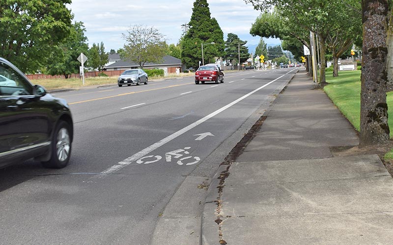
Conventional bike lanes establish part of the street for exclusive use by bicyclists through striping, signage, and pavement markings. A conventional bike lane has a small footprint, making it easy to implement, but it does not improve safety or comfort for people biking on Main Street.
Buffered Bike Lane (7'-10')
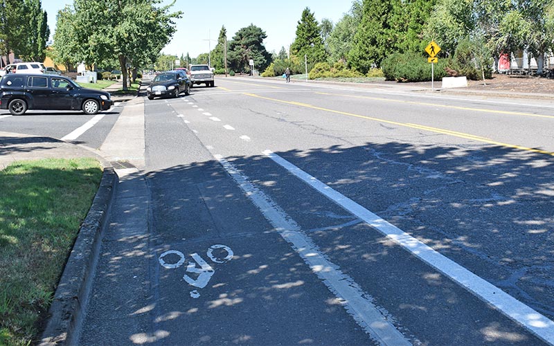
A buffered bike lane has a painted buffer to provide more space between people biking and people driving. It increases the comfort of people biking and still has a relatively small footprint.
At-grade Separated Bike Lane
(9'-12')
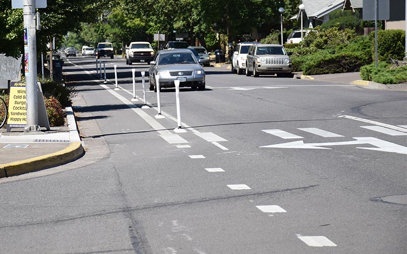
A separated bike lane goes beyond a buffered bike lane to increase the safety and comfort of bicyclists by physically separating them from motor vehicle traffic with vertical delineators, such as flexible plastic posts. An at-grade separated bike lane would be difficult to implement for long stretches of Main Street due to the number of driveways, mailboxes, transit stops and cross streets that would require breaks in separation. However, vertical separation could still be included in select locations.
Raised Cycle Track
(11'-15')
A raised cycle track provides a separated bike lane that is raised from the street level (either at the level of the sidewalk or slightly lower) and could include a landscaped buffer. It would provide a lot of separation between people driving and people biking to significantly improve safety and comfort but would require more space than other options for the bicycle infrastructure types on Main Street. It would be difficult to implement in areas where there are numerous driveways and intersections, such as the Main Street corridor.
Element Ratings (hover or tap on icons to learn more)
| Goals and Example Evaluation Criteria | Conventional Bike Lane (6') | Buffered Bike Lane (7'-10') | At-Grade Separated Bike Lane (9'-12') | Raised Cycle Track (11'-15') |
|---|---|---|---|---|
| Safety (!) Potential to reduce crashes and vehicle speeds. | ||||
| Business Community (!) Change in travel times to access businesses, availability of truck routes, and potential impacts on business signing. | ||||
| Mobility (!) Delay at intersections and travel time through Main Street. | ||||
| Transportation Choices (!) Frequency of crossings for people walking and biking, and the comfort of the walking and biking infrastructure. | ||||
| Vital Community (!) Potential for streetscape improvements, such as landscaping, and the directness of routes between neighborhoods and Main Street destinations and services. | ||||
| Feasibility (!) Degree to which recommendations can be implemented due to cost and right-of-way impacts, and the benefit-cost of safety-focused improvements. |
![]() = Strongly Supports
= Strongly Supports ![]() = Moderately Supports
= Moderately Supports ![]() = No Significant Change
= No Significant Change ![]() = Moderately Conflicts
= Moderately Conflicts ![]() = Strongly Conflicts
= Strongly Conflicts
The safety elements above have been scored using the criteria described in Technical Memorandum #11: Solutions Evaluation Criteria. Scores are not intended to determine a single option, but rather to help inform the conversation about which safety solutions work best for Main Street. Options might score differently if used together with other elements, but are shown here without consideration for how they may be combined.
Questions
With the understanding that some types of improvements may not be possible in all locations, how would you prioritize the following types of bicycle infrastructure?
- Conventional bike lanes Not ranked.
- Buffered bike lanes Not ranked.
- At-grade separated bike lanes Not ranked.
- Raised cycle tracks Not ranked.
Examples of how pedestrian facilities could be implemented on Main Street:
Curb-Tight
Sidewalk
Curb-tight 6-8 ft sidewalk with no obstructions
Source: City of Springfield
Sidewalk with
Landscaped Buffer
Landscaped buffer between street and sidewalk
Source: City of Springfield
Element Ratings (hover or tap on icons to learn more)
| Goals and Example Evaluation Criteria | Curb-tight Sidewalk (6’-8’) | Sidewalk (6’-8’) with landscaped buffer (5’+) |
|---|---|---|
| Safety (!) Potential to reduce crashes and vehicle speeds. | ||
| Business Community (!) Change in travel times to access businesses, availability of truck routes, and potential impacts on business signing. | ||
| Mobility (!) Delay at intersections and travel time through Main Street. | ||
| Transportation Choices (!) Frequency of crossings for people walking and biking, and the comfort of the walking and biking infrastructure. | ||
| Vital Community (!) Potential for streetscape improvements, such as landscaping, and the directness of routes between neighborhoods and Main Street destinations and services. | ||
| Feasibility (!) Degree to which recommendations can be implemented due to cost and right-of-way impacts and the benefit-cost of safety-focused improvements. |
![]() = Strongly Supports
= Strongly Supports ![]() = Moderately Supports
= Moderately Supports ![]() = No Signifcant Change
= No Signifcant Change ![]() = Moderately Conflicts
= Moderately Conflicts ![]() = Strongly Conflicts
= Strongly Conflicts
The safety elements above have been scored using the criteria described in Technical Memorandum #11: Solutions Evaluation Criteria. Scores are not intended to determine a single option, but rather to help inform the conversation about which safety solutions work best for Main Street. Options might score differently if used together with other elements, but are shown here without consideration for how they may be combined.
Questions
Based on community feedback and technical analysis for transit along Main Street, the Main Street Governance Team removed EmX (bus rapid transit) from further study in July 2019 and moved forward with Enhanced Corridor as the transit mode to analyze further in coordination with the Main Street Safety Project. Enhanced Corridor includes features to improve reliability, reduce transit travel times, and increase passenger comfort, such as bus queue jumps or roundabouts, stop enhancements and amenities, and adjustments to stop locations. The details for the transit enhancements will be determined after the Main Street Facility Plan is adopted and a transit project moves into Phase 3: Project Design.
To learn more about the Main-McVay Transit Study, visit http://ourmainstreetspringfield.org/main-mcvay-transit-improvement-study/.
Current transit service changes may occur outside of the Main-McVay Transit Study. To learn more and view current bus schedules, visit https://www.ltd.org/service-changes/.
Stay Involved
- Check our website (mainstreetsafety.org) and sign up for email updates.
- Watch for a series of upcoming meetings for residents, business owners, and property owners (posted on our website).
- Contact our team for more information:
Molly Markarian, City of Springfield
info@ourmainstreetspringfield.org, 541-726-4611
Target Schedule
Implementation of selected solutions will likely occur in phases over time. Some parts of the corridor may not be affected by construction for at least several years after the Main Street Facility Plan is adopted.
Final Questions
(All questions are optional.)
Tell Us About You
Demographic Information
By answering the optional questions below, you can help us know whether we reached a representative cross-section of the community.
