View the information on this site using the buttons below or click "Get Started" above to move through the content in order.


= Page includes questions or opportunities for comment.
Why update the plan?
The City’s existing Transportation System Plan was adopted in 2005. It needs to be updated to reflect the transportation needs of our community today and into the future.
In 2016, 619 acres were added to Woodburn’s Urban Growth Boundary (UGB). It will be important for the updated plan to consider our expanding community and changing transportation patterns.
Work So Far
In 2018, we spent some time analyzing the existing conditions and future growth trends in order to project what our community would be like if we didn’t invest in transportation improvements as well as think about some possible solutions to address these needs. We are ready to share these future projections and solutions with you now. Let us know what investments you think make the most sense moving forward or if we should consider something different.
Project Outcomes
What will the plan do?
- Develop an updated TSP that provides a safe, efficient, and well-connected transportation network for all transportation modes (biking, walking, rolling, motor vehicles, rail, transit, truck freight) based on existing and planned land uses.
- Identify transportation projects, policies and programs that will accommodate Woodburn’s population over the next 20 years, including opportunities to provide transportation facilities and services to the expanded Urban Growth Boundary areas and new urban reserve areas.
- Determine funding opportunities for new and future transportation projects.
- Update the existing project list to meet current and future transportation needs.
- Build on existing adopted plans and planning efforts.
- Identify strategies to create safe environments for children walking and biking to school, such as the Oregon Safe Routes to School Program.
Potential Projects
Environmental Impact Engineering Challenge Consistency with Land Use
Relative Cost Preliminary Preferred Solution
Street Connectivity Improvements | ||||||
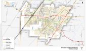
| South Arterial | Construct the Southern Arterial from Evergreen Road to OR 99E (2 lanes) | !EIY | !ECY | !LUY | $$$ | !X |
| Evergreen Road | Extend south to Parr Road | !EIY | !ECY | !LUY | $$ | !X |
| Stacy Allison Drive | Extend south to Parr Road | !EIY | !ECY | !LUY | $$$ | !X |
| Brown Street | Extend south to the South Arterial | !EIY | !ECY | !LUY | $$ | !X |
| Woodland Avenue | Extend west to Butteville Road through future development | !EIY | !ECY | !LUY | $$ | !X |
| Ben Brown Lane from Settlemier Avenue to Elans Way | Re-designate Ben Brown Lane as an Access Street | !EIN | !ECN | !LUN | $ | !X |
| Ben Brown Lane | Extend Ben Brown Lane to Evergreen Road as an Access Street as part of future residential development | !EIY | !ECY | !LUY | $$ | !X |
Capacity-based Improvements | ||||||
| OR 219 from Butteville Road to Woodland Avenue | Widen roadway to include two lanes in each direction and a two-way left-turn lane | !EIY | !ECY | !LUY | $$ | !X |
| OR 214 from Cascade Drive to OR 99E | Widen roadway to include two lanes in each direction and a two-way left-turn lane | !EIY | !ECY | !LUY | $$$ | !X |
| OR 99E from Young Street to south UGB | Widen roadway to provide a continuous two-way left-turn lane and wider shoulders (in conjunction with pedestrian and bicycle facility improvements) | !EIY | !ECY | !LUY | $$ | !X |
| Parr Road | Upgrade to service collector urban standards | !EIY | !ECY | !LUY | $$ | !X |
| Butteville Road, south of OR 219 | Upgrade to minor arterial urban standards | !EIY | !ECY | !LUY | $$$ | !X |
| Brown Street | Upgrade to service collector urban standards | !EIY | !ECY | !LUY | $$ | !X |
| OR 214/I-5 Southbound Ramp Intersection | Signal retiming | !EIN | !ECY | !LUN | $ | !X |
| Establish alternative mobility standards | !EIN | !ECN | !LUN | $ | ||
| OR 214/I-5 Northbound Ramp Intersection | Signal retiming | !EIN | !ECY | !LUN | $ | !X |
| Establish alternative mobility standards | !EIN | !ECN | !LUN | $ | !X | |
| OR 214/Evergreen Road Intersection | Signal retiming | !EIN | !ECY | !LUN | $ | !X |
| OR 214/Oregon Way/Country Club Road Intersection | Signal retiming | !EIN | !ECY | !LUN | $ | !X |
| OR 214/Front Street Ramp Intersection | Install a traffic signal | !EIY | !ECY | !LUY | $$ | !X |
| OR 214/Park Street Intersection | Install a traffic signal | !EIY | !ECY | !LUY | $$ | !X |
| OR 214/OR 211/OR 99E Intersection | Reconfigure southbound approach to have two turn-lanes and the east leg to have two receiving lanes, including signal retiming | !EIY | !ECY | !LUY | $$ | !X |
| Parr Road/Settlemier Avenue Intersection | Install a traffic signal | !EIY | !ECY | !LUY | $$ | !X |
| OR 99E/Hardcastle Avenue Intersection | Reconfigure the westbound approach to incorporate one left-turn lane and one thru-right turn lane | !EIY | !ECY | !LUY | $$ | !X |
| Reconfigure the westbound approach to incorporate one left-turn lane and one thru-right turn lane and install a separate right-turn lane on the southbound approach, including signal retiming | !EIY | !ECY | !LUY | $$ | ||
| OR 99E/Lincoln Street Intersection | Reconfigure the eastbound approach to incorporate one left-turn lane and one thru-right turn lane | !EIY | !ECY | !LUY | $$ | !X |
| Reconfigure the eastbound approach to incorporate one left-turn lane and one thru-right turn lane and install a separate right-turn lane on the southbound approach, including signal retiming | !EIY | !ECY | !LUY | $$ | ||
| OR 99E/Young Street Intersection | Install a third westbound lane to provide separate left, thru, and right turn lanes. Implement protected-permissive left-turn phasing on the eastbound and westbound approaches. | !EIY | !ECY | !LUY | $ | !X |
| OR 99E/Cleveland Street Intersection | Install a traffic signal, including OR 99E coordination | !EIN | !ECY | !LUY | $ | !X |
Safety Improvements | ||||||
| Butteville Road/Parr Road | Rebuild intersection due to grades on approaches | !EIY | !ECY | !LUY | $$ | !X |
| Southern OR 219/Butteville Road | Realign OR 219 to improve intersection(s) with Butteville Road | !EIY | !ECY | !LUY | $$ | !X |
| Enhanced traffic control (traffic signal, roundabout, or other appropriate geometric enhancements) | !EIY | !ECY | !LUY | $$ | !X | |
| Northern OR 214/Butteville Road Intersection | Enhanced traffic control (traffic signal, roundabout, or other appropriate geometric enhancements) | !EIY | !ECY | !LUY | $$ | !X |
| OR 99E | Update roadway lighting to meet ODOT roadway lighting standards | !EIY | !ECY | !LUY | $ | !X |
| OR 99E access between Young Street and Cleveland Street | Restrict certain turning movements | !EIN | !ECY | !LUY | $ | |
| Close street accesses and potential lot consolidation | !EIN | !ECY | !LUY | $$ | !X | |
| Front Street/Lincoln Street Intersection | Enhanced signs and pavement markings (e.g. stop signs, warning signs, and/or beacons) | !EIN | !ECN | !LUY | $ | !X |
| Front Street/Young Street/Garfield Street Intersection | Evaluate the intersection layout, signing, and striping in correlation to the railroad tracks. Provide clarification for westbound drivers trying to proceed through the intersection | !EIY | !ECY | !LUY | $ | !X |
| OR 99E/Tomlin Avenue | Restrict the southbound left-turn movement | !EIN | !ECN | !LUY | $ | |
| Evaluate the intersection layout, signing, and striping, including any sight distance constraints | !EIY | !ECY | !LUY | $ | !X | |
| City-wide | Evaluate traffic safety along OR 99E, OR 219/OR214, Front Street, Evergreen Road, and other key corridors to identify appropriate countermeasures | !EIN | !ECY | !LUY | $ | !X |
Questions
Potential Projects
Environmental Impact Engineering Challenge Consistency with Land Use
Relative Cost Preliminary Preferred Solution
Major Arterials | ||||||
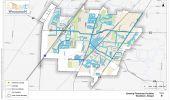
| OR 219 from Butteville Road to Woodland Avenue | Install new sidewalks | !EIN | !ECN | !LUY | $$ | !X |
| Install new sidewalks with landscaping | !EIY | !ECY | !LUY | $$$ | ||
| OR 99E from northern UGB to Lincoln Street | Evaluate light levels and install street lighting | !EIN | !ECN | !LUY | $ | |
| OR 99E from Lincoln Street to southern City Boundary | Install new sidewalks | !EIN | !ECN | !LUY | $$ | !X |
| Install new sidewalks with landscaping | !EIY | !ECY | !LUY | $$$ | ||
| OR 99E from southern City Boundary to southern UGB | Install new sidewalks | !EIN | !ECN | !LUY | $$ | !X |
| Install new sidewalks with landscaping | !EIY | !ECY | !LUY | $$$ | ||
Minor Arterials | ||||||
| Butteville Road/OR 219 from northern UGB to southern UGB | Install new sidewalks | !EIN | !ECN | !LUY | $ | !X |
| Install new sidewalks with landscaping | !EIN | !ECN | !LUY | $$ | ||
| Evergreen Road | Fill in the gaps | !EIN | !ECN | !LUY | $$ | !X |
| Boones Ferry Road from northern UGB to Hazelnut Drive | Install new sidewalks on one side | !EIN | !ECN | !LUY | $ | !X |
| Settlemier Avenue from Oak Street to Parr Road | Install new sidewalks on one side | !EIN | !ECN | !LUY | $ | !X |
| Boones Ferry Road from Parr Road to southern UGB | Install new sidewalks | !EIN | !ECN | !LUY | $ | !X |
| Front Street from northern UGB to Hazelnut Drive | Install new sidewalks on one side | !EIN | !ECN | !LUY | $ | !X |
| Young Street | Fill in the gaps | !EIN | !ECN | !LUY | $ | !X |
| OR 211 | Install new sidewalks | !EIN | !ECN | !LUY | $$ | !X |
| Install new sidewalks with landscaping | !EIY | !ECY | !LUY | $$$ | ||
Service Collectors | ||||||
| Hayes Street | Fill in the gaps | !EIN | !ECN | !LUY | $$ | !X |
| Parr Road | Install new sidewalks | !EIN | !ECN | !LUY | $$ | !X |
| Install new sidewalks with landscaping | !EIY | !ECY | !LUY | $$$ | ||
| Lincoln Street | Fill in the gaps | !EIN | !ECN | !LUY | $$ | !X |
| Industrial Avenue | Install new sidewalks | !EIN | !ECN | !LUY | $ | !X |
| Progress Way | Install new sidewalks | !EIN | !ECN | !LUY | $$ | !X |
| Hardcastle Avenue | Fill in the gaps | !EIN | !ECN | !LUY | $$ | !X |
| Brown Street | Fill in the gaps | !EIN | !ECN | !LUY | $$ | !X |
| Cooley Road | Fill in the gaps | !EIN | !ECN | !LUY | $$ | !X |
| Evaluate light levels and install street lighting | !EIN | !ECN | !LUY | $ | ||
Access Streets | ||||||
| Woodland Avenue from Jory Street to Arney Road | Install new sidewalks on one side | !EIN | !ECN | !LUY | $ | !X |
| Stubb Road | Install new sidewalks | !EIN | !ECN | !LUY | $ | !X |
| Oregon Way from Country Club Road to OR 214 | Install new sidewalks | !EIN | !ECN | !LUY | $$ | !X |
| Hazelnut Drive from Graystone Drive to Front Street | Fill in the gaps | !EIN | !ECN | !LUY | $$ | !X |
| Gatch Street | Fill in the gaps | !EIN | !ECN | !LUY | $ | !X |
| Park Avenue from Hardcastle Avenue to Lincoln Street | Install new sidewalks on one side | !EIN | !ECN | !LUY | $ | !X |
Local Streets | ||||||
| Willow Avenue from McNaught Road to OR 219 | Install new sidewalks on one side | !EIY | !ECN | !LUY | $ | !X |
| Install new sidewalks on both sides | !EIY | !ECY | !LUY | $$ | ||
| Cascade Drive | Install new sidewalks | !EIN | !ECN | !LUY | $ | !X |
| Leasure Street | Install new sidewalks on one side | !EIY | !ECN | !LUY | $ | !X |
| Install new sidewalks on both sides | !EIY | !ECY | !LUY | $$ | ||
| Church Street from Leasure Street to Settlemier Avenue | Install new sidewalks on one side | !EIY | !ECN | !LUY | $ | !X |
| Install new sidewalks on both sides | !EIY | !ECY | !LUY | $$ | ||
| Garfield Street from Smith Drive to Settlemier Avenue | Install new sidewalks on one side | !EIY | !ECN | !LUY | $ | |
| Install new sidewalks on both sides | !EIY | !ECY | !LUY | $$ | !X | |
| Smith Drive from Hayes Street to Garfield Street | Install new sidewalks on one side | !EIN | !ECN | !LUY | $ | !X |
| Install new sidewalks on both sides | !EIN | !ECY | !LUY | $$ | ||
| Ben Brown Lane | Fill in the gaps | !EIY | !ECN | !LUY | $ | !X |
| Oak Street | Install new sidewalks on one side | !EIY | !ECN | !LUY | $ | !X |
| Ogle Street | Install new sidewalks on one side | !EIY | !ECN | !LUY | $ | |
| Install new sidewalks on both sides | !EIY | !ECY | !LUY | $$ | !X | |
| Stark Street | Install new sidewalks on one side | !EIY | !ECN | !LUY | $ | |
| Install new sidewalks on both sides | !EIY | !ECY | !LUY | $$ | !X | |
Intersections | ||||||
| Front Street/Young Street | Construct ADA-complaint ramps and sidewalks on the east leg of the intersection | !EIN | !ECY | !LUY | $ | !X |
| Front Street/Lincoln Street | Construct ADA-complaint ramps and sidewalks on the east leg of the intersection | !EIN | !ECY | !LUY | $ | !X |
| Cascade Drive/Hayes Street | Install an enhanced pedestrian crossing | !EIN | !ECN | !LUY | $ | !X |
| Park Avenue/Legion Park Driveway | Install an enhanced pedestrian crossing | !EIN | !ECN | !LUY | $ | !X |
| Hazelnut Drive/Broadmoor Place Accessway | Install an enhanced pedestrian crossing | !EIN | !ECN | !LUY | $ | !X |
| OR 99E from OR 214 to Young Street | Install enhanced pedestrian crossings along OR 99E at every major intersection between OR 214 and Young Street | !EIN | !ECN | !LUY | $$ | !X |
| OR 99E | Install countdown pedestrian timers and construct ADA enhancements at all signalized intersections along OR 99E | !EIN | !ECY | !LUY | $ | !X |
| OR 99E from Arlington Street to Nelson Lane | Install curb extensions along OR 99E at every major intersection between Arlington Street and Nelson Lane (up to 15 locations). Potential locations include:
| !EIN | !ECY | !LUY | $$ | !X |
Multi-Use Pathways | ||||||
| Butteville Road/OR 219 from northern UGB to southern UGB | Widen roadway and install widen shoulders | !EIY | !ECY | !LUY | $$ | |
| Mill Creek corridor | Construct the Mill Creek Greenway | !EIY | !ECY | !LUY | $$$ | !X |
| Mill Creek corridor | Mill Creek Greenway – Northern tributary | !EIY | !ECY | !LUY | $$$ | !X |
| Mill Creek corridor | Mill Creek Greenway – Western tributary | !EIY | !ECY | !LUY | $$$ | !X |
| Mill Creek corridor | Evergreen Road extension south to planned Mill Creek Greenway | !EIY | !ECY | !LUY | $$$ | !X |
| Mill Creek corridor | North-south connection on Hardcastle Avenue and Lincoln Street west of Washington Elementary School | !EIY | !ECY | !LUY | $$$ | !X |
| Mill Creek corridor | Extend Mill Creek corridor off-street pathway to Belle Passi Road | !EIY | !ECY | !LUY | $$$ | !X |
Off-street Improvements | ||||||
| June Way Accessway to OR 99E (near the Audrey Way intersection) | Accessway | !EIY | !ECY | !LUY | $$ | !X |
| Johnson Street Accessway to OR 99E | Accessway | !EIY | !ECY | !LUY | $$ | !X |
| Elm Street Accessway to OR 99E | Accessway | !EIY | !ECY | !LUY | $$ | !X |
| Wilson Street Accessway to OR 99E | Accessway | !EIY | !ECY | !LUY | $$ | !X |
| Hawley Street Accessway to OR 99E | Accessway (possibly part of future street extension) | !EIY | !ECY | !LUY | $$ | !X |
| A Street Accessway to Cleveland Street | Accessway | !EIY | !ECY | !LUY | $ | !X |
| Mill Creek Greenway crossing at Young Street | At-grade mid-block crossing treatment | !EIY | !ECY | !LUY | $ | !X |
| Mill Creek Greenway crossing at Hazelnut Drive | At-grade mid-block crossing treatment | !EIY | !ECY | !LUY | $ | !X |
| Mill Creek Greenway crossing at Bulldog Drive - East | At-grade mid-block crossing treatment | !EIY | !ECY | !LUY | $ | !X |
| Mill Creek Greenway crossing at OR 214 | At-grade mid-block crossing treatment | !EIY | !ECY | !LUY | $ | !X |
| Mill Creek Greenway crossing at Hardcastle Avenue | At-grade mid-block crossing treatment | !EIY | !ECY | !LUY | $ | !X |
| Mill Creek Greenway crossing at Lincoln Street | At-grade mid-block crossing treatment | !EIY | !ECY | !LUY | $ | !X |
| Mill Creek Greenway crossing at Cleveland Street and railroad tracks | At-grade mid-block crossing treatment | !EIY | !ECY | !LUY | $ | !X |
| Mill Creek Greenway crossing at Ben Brown Lane | At-grade mid-block crossing treatment | !EIY | !ECY | !LUY | $ | !X |
| Mill Creek Greenway crossing at Settlemier Avenue | At-grade mid-block crossing treatment | !EIY | !ECY | !LUY | $ | !X |
| Mill Creek Greenway crossing at Parr Road | At-grade mid-block crossing treatment | !EIY | !ECY | !LUY | $ | !X |
| Mill Creek Greenway crossing at Front Street and railroad tracks | At-grade mid-block crossing treatment | !EIY | !ECY | !LUY | $ | !X |
| Mill Creek Greenway crossing at Bulldog Drive - West | At-grade mid-block crossing treatment | !EIY | !ECY | !LUY | $ | !X |
| Mill Creek Greenway crossing at Meridian Drive | At-grade mid-block crossing treatment | !EIY | !ECY | !LUY | $ | !X |
| Mill Creek Greenway crossing at Boones Ferry Road | At-grade mid-block crossing treatment | !EIY | !ECY | !LUY | $ | !X |
Questions
Potential Projects
Environmental Impact Engineering Challenge Consistency with Land Use
Relative Cost Preliminary Preferred Solution
Major Arterials | ||||||
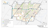
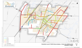
| OR 219/OR 214 from Willow Avenue to Progress Way | Widen roadway and widen bike lanes | !EIY | !ECY | !LUY | $$ | !X |
| Widen roadway and install buffered bike lanes | !EIY | !ECY | !LUY | $$$ | ||
| OR 219 from Butteville Road to Willow Avenue | Widen roadway and install bike lanes | !EIY | !ECY | !LUY | $$ | !X |
| Widen roadway and install buffered bike lanes | !EIY | !ECY | !LUY | $$$ | ||
| OR 214 from Progress Way to OR 99E | Widen roadway and install bike lanes | !EIY | !ECY | !LUY | $$ | !X |
| Widen roadway and install buffered bike lanes | !EIY | !ECY | !LUY | $$$ | ||
| OR 99E from northern UGB to Lincoln Street | Widen roadway and widen bike lanes | !EIY | !ECY | !LUY | $$ | !X |
| Widen roadway and install buffered bike lanes | !EIY | !ECY | !LUY | $$$ | ||
| OR 99E from Lincoln Street to southern City Boundary | Widen roadway and install bike lanes | !EIY | !ECY | !LUY | $$ | !X |
| Widen roadway and install buffered bike lanes | !EIY | !ECY | !LUY | $$$ | ||
| OR 99E from southern City Boundary to southern UGB | Install shared lane markings and signs | !EIN | !ECN | !LUY | $ | |
| Widen roadway and install bike lanes | ||||||
| Widen roadway and install buffered bike lanes | !EIY | !ECY | !LUY | $$$ | !X | |
Minor Arterials | ||||||
| OR 219 from western UGB to Butteville Road | Widen roadway and install bike lanes | !EIY | !ECY | !LUY | $$ | !X |
| Widen roadway and install buffered bike lanes | !EIY | !ECY | !LUY | $$$ | ||
| Butteville Road/OR 219 from northern UGB to southern UGB | Widen roadway and install bike lanes | !EIY | !ECY | !LUY | $$ | !X |
| Widen roadway and install buffered bike lanes | !EIY | !ECY | !LUY | $$$ | ||
| Evergreen Road from OR 214 to Hayes Street | Reduce lane width and install bike lanes | !EIN | !ECN | !LUY | $ | |
| Widen roadway and install bike lanes | !EIY | !ECY | !LUY | $$ | !X | |
| Boones Ferry Road from northern UGB to Hazelnut Drive | Perform an engineering study to consider reduction of the posted speed limit | !EIN | !ECN | !LUY | $ | |
| Install shared lane markings and signs | !EIN | !ECN | !LUY | $ | ||
| Widen roadway and install bike lanes | !EIY | !ECY | !LUY | $$ | !X | |
| Widen roadway and install buffered bike lanes | !EIY | !ECY | !LUY | $$$ | ||
| Boones Ferry Road/Settlemier Avenue from Hazelnut Drive to Harrison Street | Perform an engineering study to consider reduction of the posted speed limit | !EIN | !ECN | !LUY | $ | !X |
| Reduce lane width and widen bike lanes | !EIN | !ECN | !LUY | $ | ||
| Widen roadway and widen bike lanes | !EIY | !ECY | !LUY | $$ | ||
| Widen roadway and install buffered bike lanes | !EIY | !ECY | !LUY | $$$ | ||
| Settlemier Avenue from Harrison Street to railroad tracks | Install shared lane markings and signs | !EIN | !ECN | !LUY | $ | !X |
| Boones Ferry Road from Dahlia Street to southern UGB | Perform an engineering study to consider reduction of the posted speed limit | !EIN | !ECN | !LUY | $ | |
| Reduce lane width and install bike lanes | !EIN | !ECN | !LUY | $ | ||
| Widen roadway and install bike lanes | !EIY | !ECY | !LUY | $$ | !X | |
| Widen roadway and install buffered bike lanes | !EIY | !ECY | !LUY | $$$ | ||
| Front Street | Perform an engineering study to consider reduction of the posted speed limit | !EIN | !ECN | !LUY | $ | |
| Reduce lane width and install bike lanes | !EIN | !ECN | !LUY | $ | ||
| Widen roadway and install bike lanes | !EIY | !ECY | !LUY | $$ | !X | |
| Widen roadway and install buffered bike lanes | !EIY | !ECY | !LUY | $$$ | ||
| Garfield Street from 3rd Street to Front Street | Widen roadway and install bike lanes | !EIY | !ECY | !LUY | $$ | !X |
| Garfield Street from Smith Drive to 3rd Street | Install shared lane markings and signs | !EIN | !ECN | !LUY | $ | !X |
| Young Street | Perform an engineering study to consider reduction of the posted speed limit | !EIN | !ECN | !LUY | $ | !X |
| Widen roadway and install bike lanes | !EIY | !ECY | !LUY | $$ | ||
| Widen roadway and install buffered bike lanes | !EIY | !ECY | !LUY | $$$ | ||
| OR 211 | Perform an engineering study to consider reduction of the posted speed limit | !EIN | !ECN | !LUY | $ | |
| Reduce lane width and install bike lanes | !EIN | !ECN | !LUY | $ | ||
| Widen roadway and install bike lanes | !EIY | !ECY | !LUY | $$ | ||
| Widen roadway and install buffered bike lanes | !EIY | !ECY | !LUY | $$$ | ||
Service Collectors | ||||||
| Arney Road from Robin Avenue to OR 219 | Install shared lane markings and signs | !EIN | !ECN | !LUY | $ | !X |
| Stacy Allison Way from Evergreen Road to Center Street | Reduce lane width and install bike lanes | !EIN | !ECN | !LUY | $ | |
| Widen roadway and install bike lanes | !EIY | !ECY | !LUY | $$ | ||
| Enhance the parallel route of Harvard Drive from Stacy Allison Way to Evergreen Road. Install buffered bike lanes on both sides of the roadway | !EIY | !ECY | !LUY | $$ | !X | |
| Hayes Street from Harvard Drive to Cascade Drive | Reduce lane width and install bike lanes | !EIN | !ECN | !LUY | $ | !X |
| Hayes Street from Cascade Drive to Settlemier Avenue | Reduce lane width and install bike lanes | !EIN | !ECN | !LUY | $ | |
| Widen roadway and install bike lanes | !EIY | !ECY | !LUY | $$ | !X | |
| Parr Road from western UGB to western City Boundary | Reduce lane width and install bike lanes | !EIN | !ECN | !LUY | $ | |
| Widen roadway and install bike lanes | !EIY | !ECY | !LUY | $$ | !X | |
| Lincoln Street | Install shared lane markings and signs | !EIN | !ECN | !LUY | $ | !X |
| Cleveland Street | Install shared lane markings and signs | !EIN | !ECN | !LUY | $ | !X |
| Hardcastle Avenue | Install shared lane markings and signs | !EIN | !ECN | !LUY | $ | !X |
| Widen roadway and install bike lanes | !EIY | !ECY | !LUY | $$ | ||
| Brown Street | Install shared lane markings and signs | !EIN | !ECN | !LUY | $ | !X |
| Widen roadway and install bike lanes | !EIY | !ECY | !LUY | $$ | ||
| Cooley Road from OR 211 to Aubrey Way | Widen roadway and install bike lanes | !EIY | !ECY | !LUY | $$ | !X |
| Perform an engineering study to consider reduction of the posted speed limit | !EIN | !ECN | !LUY | $ | ||
| Cooley Road from Aubrey Way to Hardcastle Avenue | Install bike lane striping | !EIN | !ECN | !LUY | $ | !X |
| Perform an engineering study to consider reduction of the posted speed limit | !EIN | !ECN | !LUY | $ | ||
Access Streets | ||||||
| Stubb Road | Install shared lane markings and signs | !EIN | !ECN | !LUY | $ | !X |
| Astor Way | Install shared lane markings and signs | !EIN | !ECN | !LUY | $ | !X |
| Tukwila Drive from Boones Ferry Road to Hazelnut Drive | Install shared lane markings and signs | !EIN | !ECN | !LUY | $ | !X |
| 5th Street | Install shared lane markings and signs | !EIN | !ECN | !LUY | $ | !X |
| Gatch Street | Install shared lane markings and signs | !EIN | !ECN | !LUY | $ | !X |
| Park Avenue | Install shared lane markings and signs | !EIN | !ECN | !LUY | $ | !X |
Local Streets | ||||||
| Evergreen Road from Country Club Court to OR 214 | Install shared lane markings and signs | !EIN | !ECN | !LUY | $ | !X |
| Country Club Road from Evergreen Road to Astor Way | Install shared lane markings and signs | !EIN | !ECN | !LUY | $ | !X |
| Cascade Drive | Install shared lane markings and signs | !EIN | !ECN | !LUY | $ | !X |
| Smith Drive from Hayes Street to Garfield Street | Install shared lane markings and signs | !EIN | !ECN | !LUY | $ | !X |
| Meridian Drive | Install shared lane markings and signs | !EIN | !ECN | !LUY | $ | !X |
Questions
Potential Projects
Environmental Impact Engineering Challenge Consistency with Land Use
Relative Cost Preliminary Preferred Solution
Service Enhancements | ||||||
| Woodburn Fixed Route | Increase frequency to 30 minutes | !EIN | !ECN | !LUY | $$ | !X |
| Woodburn Fixed Route | Provide Saturday service | !EIN | !ECN | !LUY | $ | !X |
| Woodburn Fixed Route | Provide Sunday service | !EIN | !ECN | !LUY | $ | !X |
| Woodburn Fixed Route | Convert existing route to two-way operations | !EIN | !ECN | !LUY | $$ | |
| Separate route into two routes with one-way operations | !EIN | !ECN | !LUY | $$ | ||
| Separate route into two routes with two-way operations | !EIN | !ECN | !LUY | $$ | !X | |
| Add a new fixed route in City center (30-minute frequency to major local destinations) | !EIN | !ECN | !LUY | $ | ||
| Restructure "long" loop, expanded to serve the neighborhood in southeast Woodburn | !EIN | !ECN | !LUY | $ | ||
| Parr Road corridor via an extension of Evergreen Road | New or re-routed service (as growth occurs) | !EIN | !ECN | !LUY | $ | !X |
| Crosby Road corridor | New or re-routed service (as growth occurs) | !EIN | !ECN | !LUY | $ | |
| Butteville Road corridor | New or re-routed service (as growth occurs) | !EIN | !ECN | !LUY | $ | !X |
| Employment center southwest of I-5/OR 214 interchange | New or re-routed service (as growth occurs) | !EIN | !ECN | !LUY | $ | !X |
| Woodburn Industrial Park along the Progress Way and Industrial Avenue corridors | New or re-routed service (as growth occurs) | !EIN | !ECN | !LUY | $ | !X |
| Gateway subarea | New or re-routed service. Refocus local and regional transit service in the Gateway subarea (between Front Street and Mill Creek) to support a mixed-use district | !EIN | !ECN | !LUY | $ | !X |
| Woodburn Company Stores | Establish a free shuttle between the Woodburn Company Stores and Downtown Woodburn, hourly during peak shopping and entertainment hours | !EIN | !ECN | !LUY | $ | !X |
| City-wide | Peak-only employer shuttle | !EIN | !ECN | !LUY | $$ | |
Intercity Service Enhancements | ||||||
| City-wide | Coordinate transfers between the different agency services in Woodburn | !EIN | !ECN | !LUY | $ | !X |
| Woodburn | Provide a stop in Woodburn for SMART Route 1X | !EIN | !ECN | !LUY | $ | !X |
| Woodburn to Salem | Provide service to downtown Salem (and east to State offices): Incorporate a stop at the planned Park & Ride for the SMART express route between Wilsonville and Salem | !EIN | !ECY | !LUY | $$$ | !X |
| Woodburn to Portland | Provide service to Portland - connect to TriMet via the Tualatin Park-and-Ride, directly into downtown Portland, to the Westside Express Service (southern terminus at Wilsonville SMART Central), or the MAX Orange Line light rail service. | !EIN | !ECY | !LUY | $$$ | |
| Woodburn to Hubbard | Provide a new demand-responsive service to Hubbard one day per week | !EIN | !ECY | !LUY | $$ | |
| Woodburn to Wilsonville | Provide service to WES station in Wilsonville | !EIN | !ECN | !LUY | $$ | |
Stop Enhancements | ||||||
| City-wide | Post static bus route information at bus stops | !EIN | !ECN | !LUY | $ | !X |
| Stop 755016: Walmart | New shelter | !EIN | !ECN | !LUY | $ | !X |
| Stop 20419: Garfield Street | New shelter | !EIN | !ECN | !LUY | $ | !X |
Other Transit Solutions | ||||||
| City-wide | Investigate transferring the paratransit system to a local social service agency | !EIN | !ECN | !LUY | $ | !X |
Questions
Potential Projects
Environmental Impact Engineering Challenge Consistency with Land Use
Relative Cost Preliminary Preferred Solution
Access Management | ||||||
| City-wide | Develop city-wide access spacing standards according to a roadway's functional classification | !EIN | !ECN | !LUY | $ | !X |
| City-wide | Investigate and implement opportunities to provide alternative access to nonstate facilities when reasonable access can occur (consistent with the State's Division 51 access management standards) | !EIN | !ECN | !LUY | $ | !X |
| City-wide | Through development, right-of-way dedications should be provided to facilitate the future planned transportation system in the vicinity of the proposed development | !EIN | !ECN | !LUY | $$ | !X |
| City-wide | Through development, half-street improvements (sidewalks, curb and gutter, bicycle lanes/paths, and/or travel lanes) should be provided along all site frontages that do not have full buildout improvements in place at the time of development | !EIN | !ECN | !LUY | $ | !X |
| City-wide | Define a variance process for when the standard cannot be met | !EIN | !ECN | !LUY | $ | !X |
| City-wide | Establish an approach for access consolidation over time to move in the direction of the standards at each opportunity (see above). Cross-over easements should be provided on all compatible parcels (topography, access, and land use) to facilitate future access between adjacent parcels and inter-parcel circulation. | !EIN | !ECN | !LUY | $ | !X |
| City-wide | Consider opportunities to restrict certain turning movements at accesses (such as a right in-right out access) | !EIN | !ECN | !LUY | $ | !X |
Transportation Systems Management and Operations (TSMO) | ||||||
| City-wide | Lead or provide support of potential TSM and TDM strategies | !EIN | !ECN | !LUY | $ | !X |
| City-wide | Identify opportunities for collaborative marketing with local business owners and operators, developers, and transit service providers | !EIN | !ECN | !LUY | $ | !X |
| City-wide | Update the Woodburn Development Ordinance to limit and/or allow for flexible parking requirements | !EIN | !ECN | !LUY | $ | !X |
| City-wide | Develop access management standards that reflect functional classification of the roadway | !EIN | !ECN | !LUY | $ | !X |
| City-wide | Implement truck signal priority at all signalized intersections along OR 214 and OR 99E | !EIN | !ECY | !LUY | $ | !X |
| City-wide | Promote regional carpool/vanpool program | !EIN | !ECN | !LUY | $ | !X |
| City-wide | Provide transit fare subsidies | !EIN | !ECN | !LUY | $ | !X |
| City-wide | Establish carpool matching programs for ride-sharing | !EIN | !ECN | !LUY | $ | !X |
| City-wide | Establish carpool parking programs | !EIN | !ECN | !LUY | $ | !X |
| City-wide | Schedule shift changes to occur outside of peak travel periods | !EIN | !ECN | !LUY | $ | !X |
| City-wide | Allow employees to work at home one day a week | !EIN | !ECN | !LUY | $ | !X |
| City-wide | Establish neighborhood commercial and mixed-use nodes within the City | !EIN | !ECN | !LUY | $ | !X |
| OR 99E | Work with ODOT to develop and implement a Traffic Management Plan for the OR 99E corridor that responds to increased congestion resulting from incidents on I-5 and regional events | !EIN | !ECY | !LUY | $ | !X |
Intermodal Projects | ||||||
| City-wide | Provide wayfinding to bike routes, multi-use paths, trails (as constructed), parks, schools, and other essential destinations | !EIN | !ECN | !LUY | $ | !X |
| City-wide | Provide bike racks at bus stops | !EIN | !ECN | !LUY | $ | !X |
Rail Projects | ||||||
| Front Street | Establish a downtown Amtrak passenger rail stop along Front Street in downtown Woodburn, potentially as a public-private partnership at the "Y" property adjacent to Locomotive Park | !EIY | !ECY | !LUY | $$ | !X |
| Front Street and Cleveland Street | Investigate the opportunity to remove private grade railroad crossings by providing alternative access to parcels as development and redevelopment occurs | !EIY | !ECY | !LUY | $ | !X |
| Butteville Road, north of OR 219 | Explore a passenger rail stop if commuter rail is extended between Wilsonville and Beaverton down to Salem | !EIY | !ECY | !LUY | $$$ | |
Questions
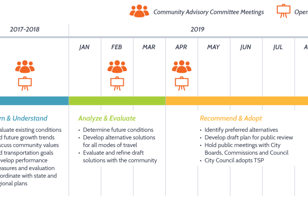
Project Schedule
Stay involved
- Learn more at WoodburnTSP.org
- Sign up for email updates below.
Final questions
Before you leave, be sure to submit any comments you've provided.

