This site may be easier to use if viewed in the "landscape" orientation.
 

Welcome to the Tualatin Valley Trail
Online Open House!

Washington County is considering three options for a new regional trail that will connect Aloha to neighboring communities and run parallel to TV Highway (Oregon 8). We need your help to determine which option best serves the community!

Note: This open house is closed for new comments.

    Stations

    Go directly to a station using the buttons below, or at the top of the screen to move through the stations in order. You can review and provide feedback on any or all of the areas that interest you. You do not have to visit every page or answer every question.

    Please provide your comments by Friday, December 11th.

    Click or tap “Get Started” above or use the links below to skip to specific information.

    1
    Learn about the purpose of the trail. 
    2
    Review each of the three Tualatin Valley Trail options, also referred to as "corridors." 
    3
    Use an interactive map to share where you would travel to with the TV Trail. 
    4
    Learn about the cross sections we're considering and get a sense for what the trail could look like. 
    5
    Learn what happens next and sign up for updates. 

    = Page includes questions or opportunities for comment.
    Washington County Logo

    What is the TV Trail?

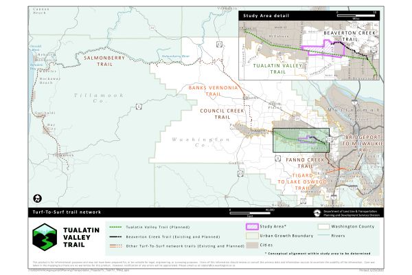
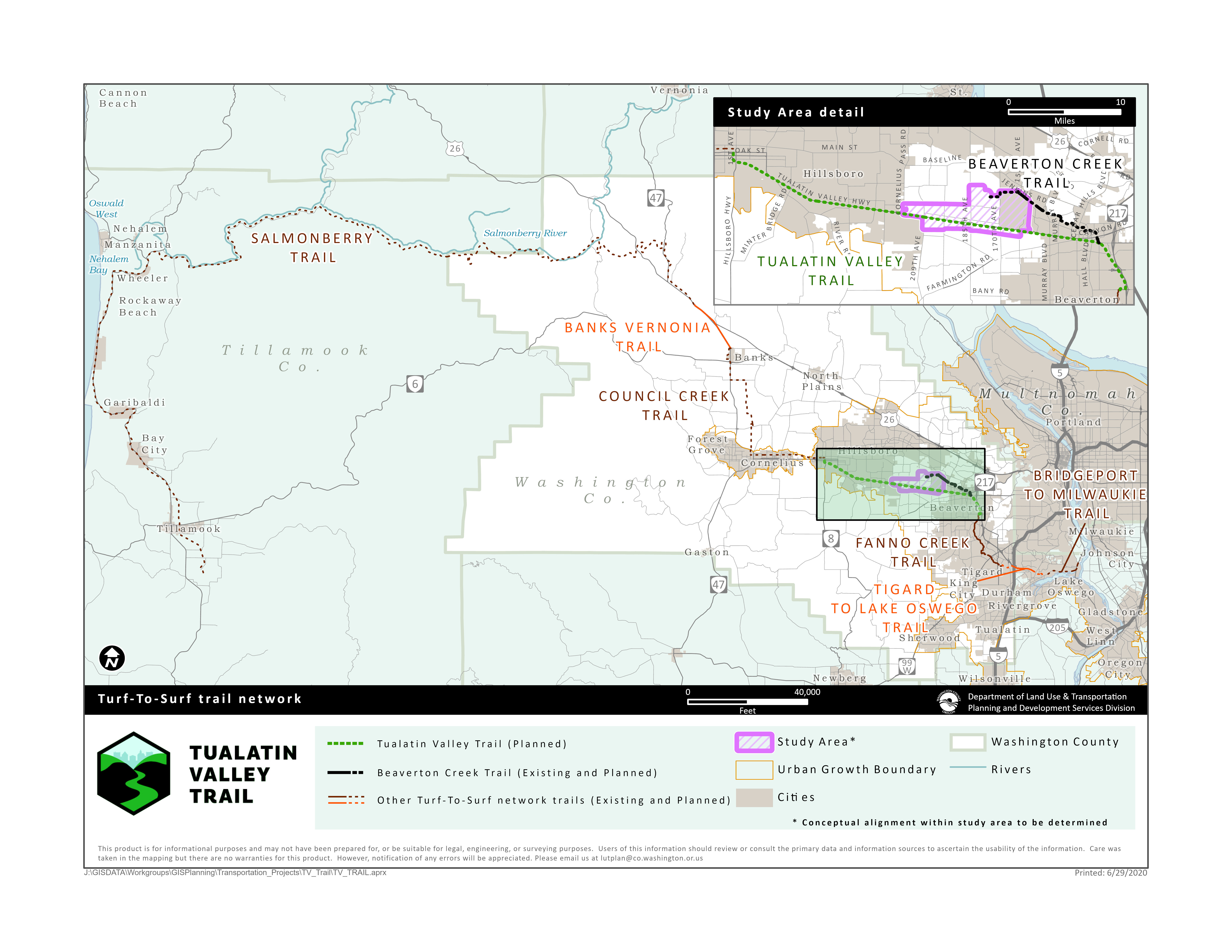
    Washington County is moving forward with plans for a Tualatin Valley (TV) Trail, which will run parallel to TV Highway (Oregon 8). It will connect Beaverton, Aloha, and Hillsboro for biking, walking, and more. The TV Trail will be an important part of the future Turf-to-Surf Trail, which will connect the Portland region with the Oregon Coast.

    Image gallery contents:

    Turf to Surf Area Map

    TV Trail will be a part of a network of trails that connect the Portland-Metro area to the Oregon Coast.

    Turf to Surf Area Map

    TV Trail will be a part of a network of trails that connect the Portland-Metro area to the Oregon Coast.

    A new trail would offer...

    • An alternative to TV Highway that feels safe to walk and bike – whether for fun and fitness or getting to work or school, running errands, or catching a bus or MAX train.
    • A connection to other regional trails.

    Project goals

    The community has long expressed a desire for safe and comfortable options for traveling the TV Highway corridor to reach nearby destinations without the use of a car and increased access to physical activity and recreation. This project will determine the feasibility of creating a low-stress option to travel through Aloha by walking, biking, and more.

    The project team is considering many things as they evaluate each corridor option, including goals, objectives, and evaluation criteria. The goals and objectives were developed with direction from policymakers, the project management team, and community input. View the full project goals, objectives, and evaluation criteria.


    Question

    The project goals are listed below. How would you rank them in order of importance?
    Click and drag the options listed below into this box, then arrange by priority.
    • Safety Not ranked.
    • Connectivity Not ranked.
    • Health and Livability Not ranked.
    • Coordination Not ranked.
    • Equity Not ranked.

    Feasibility is also one of the project goals. It is not included in this goal ranking exercise as only feasible options will be carried forward. The feasibility goal and evaluation criteria are being used to develop the concepts and balance impacts and costs with the other project goals.

    33% Complete

    Trail Options

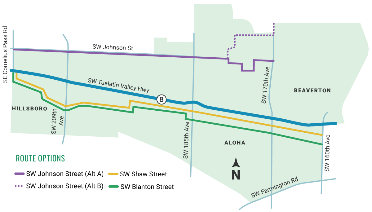
    Review each of the three Tualatin Valley Trail options, also referred to as "corridors," then answer the questions at the bottom of the page. 

    The project also considered Alexander Street and TV Highway as options, but they were eliminated because of their noise and traffic levels (TV Highway) and for not being continuous and not connecting with the regional trail system (Alexander Street).


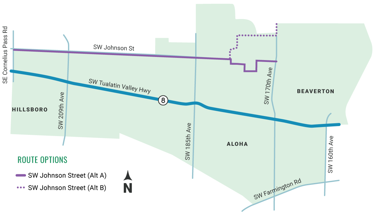
    SW Johnson Street

    The SW Johnson Street corridor is the northernmost of the three options. SW Johnson Street more directly aligns with the Beaverton Creek Trail and connects to the Reedville Trail and Reedville Elementary School. However, it is located further away from TV Highway than the Blanton and Shaw corridors.

    Watch the video to experience the corridor as a bicyclist. While you watch it, pay attention to how it might feel as someone walking and riding a bike, where it takes you, and potential conflicts like intersections and driveways.

    Image gallery contents:

    tv-trail/sw-johnson-street-alt-a-b-

    tv-trail/sw-johnson-street-alt-a-b-

    tv-trail/sw-johnson-street-alt-a-b-

    Question

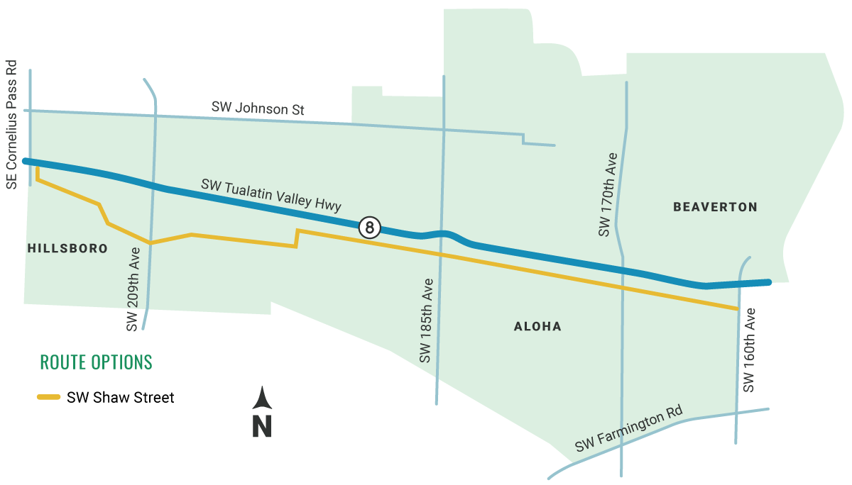
    SW Shaw Street

    The SW Shaw Street corridor is the closest option to TV Highway and the vision for the TV Trail. SW Shaw Street offers an alternative to TV Highway, connects to more businesses, the Aloha Town Center, and Intel, and has the fewest driveway conflicts. However, challenges exist at key crossings due to the proximity of railroad crossings and traffic signals along TV Highway.

    Watch the video to experience the corridor as a bicyclist. While you watch it, pay attention to how it might feel as someone walking and riding a bike, where it takes you, and potential conflicts like intersections and driveways.

    Image gallery contents:

    tv-trail/or8-map-shawstreet

    tv-trail/or8-map-shawstreet

    tv-trail/or8-map-shawstreet

    Question

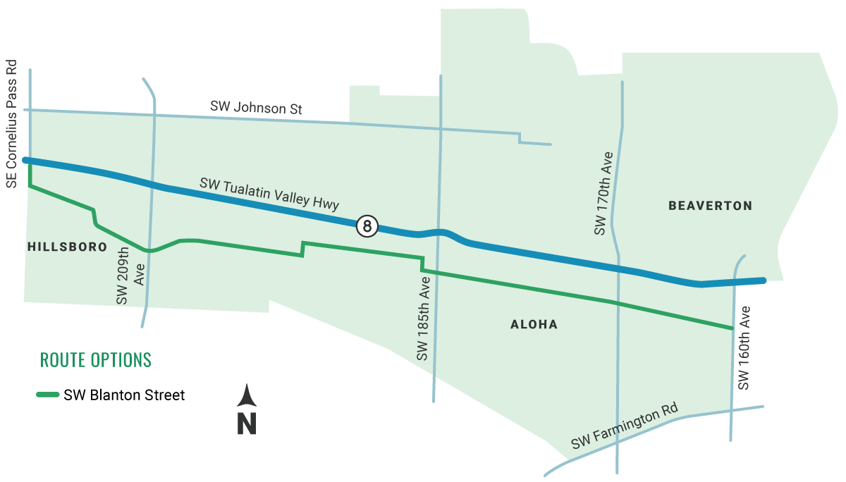
    SW Blanton Street

    The SW Blanton Street corridor is the southern-most of the three options. This corridor connects to five schools, including The International School of Beaverton and Kinnaman Elementary. It also runs along Arnold Park, Barsotti Park and several businesses including Intel.

    Watch the video to experience the corridor as it is today. While you watch it, pay attention to how it might feel as someone walking and riding a bike, where it takes you, and potential conflicts like intersections and driveways.

    Image gallery contents:

    tv-trail/sw-blanton-street-

    tv-trail/sw-blanton-street-

    tv-trail/sw-blanton-street-

    Question

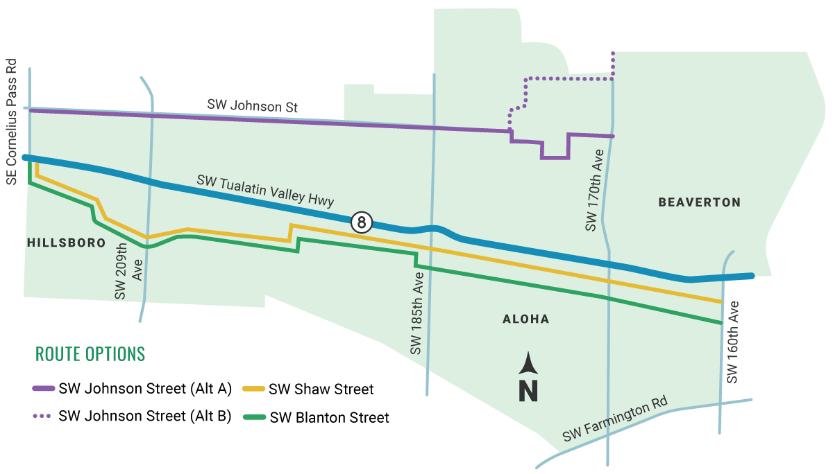
    Help us decide which route is right for TV Trail.

    The project team is considering many things as they work towards identifying a preferred corridor, including connections to community destinations, traffic conditions, number of driveways, intersections, and available public right-of-way.

    We also want to know what you think!

    Image gallery contents:

    tv-trail/or8-map-all

    tv-trail/or8-map-all
    tv-trail/or8-map-all

    Two of the corridors are beginning to stand out as the best options – SW Shaw Street and SW Blanton Street. 

    SW Shaw Street street stands out because it scored the best on the evaluation criteria. We also heard that SW Blanton Street provides the best connections to community destinations including community parks and schools. Now we need you to help us decide.


    Question

    Which corridor do you think would be the best fit for the TV Trail?
    Click and drag the options listed below into this box, then arrange by priority.
    • SW Johnson Street with Alt A Not ranked.
    • SW Johnson Street with Alt B Not ranked.
    • SW Blanton Street Not ranked.
    • SW Shaw Street Not ranked.

    50% Complete

    Destinations Map

    If the TV Trail existed, what places would it help you get to? Use the map to identify places you like to go to in Aloha.

    Instructions

    Click the "Add Comment" button above the map to place a marker on the map. Then, provide a name for your destination.

    67% Complete

    Cross Sections

    Learn about the cross sections we're considering for TV Trail.

    Image gallery contents:

    regional-trail-on-one-side

    complete-street

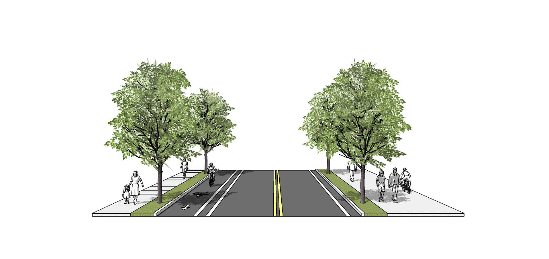
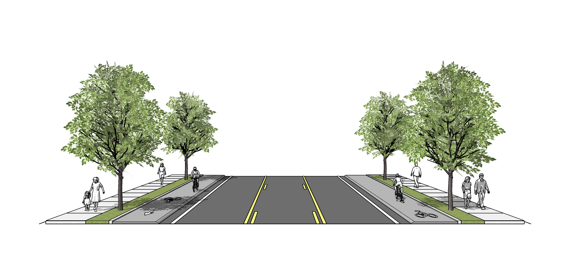
    As you look through the following two cross sections, consider which one will best meet the community’s needs.

    While these are the primary cross sections we are considering for TV Trail, we are also considering cross sections that will accommodate narrow sections of the corridor and street parking. These cross sections are a work in progress and are subject to change. 

    Cross Section A

    regional-trail-on-one-side

    Regional Trail on One Side

    Cross Section B

    complete-street

    Complete Street


    Question

    Which of these cross sections do you think will be the most welcoming for all trail users? (Check one.)
    83% Complete

    Next Steps

    Thank you for participating!

    Timeline

    With your feedback in mind, we will begin work on a Preferred Alignment and Conceptual Design. A draft Concept Plan will be available for review in Spring 2021.

    Stay Involved! Sign-up for project updates. 

    Email Sign-up

    Demographics Questions (Optional)

    We're asking these questions to help us evaluate the effectiveness of our outreach activities. Answering these questions is completely optional.

    .

    What is your age? (Check one.)
    Within the broad categories below, where do you place your racial or ethnic identity? (Check all that apply.)
    How do you identify your gender? (Check one.)
    Which of the following best represents the annual income of your household before taxes? (Check one.)
    Which of the following best describes your current employment status? (Check one.)
    Do you live with a disability? (Check all that apply.)
    What language or dialect is used most in your home? (Check one.)
    What is your education experience? (Check one.)
    Do you rent or own your home? (Check one.)
    Including yourself, how many people live in your household? (Check one.)
    Do you have access to a vehicle? (Check one.)

    The option to review and submit answers will appear after you answer at least one question.

    100% Complete