
Online Open House Stations
In this open house there are a series of stations where you can learn about the project. Go directly to a station using the buttons below, or at the top of the screen to move through the stations in order. A comment form is located at the end.

= Page includes questions or opportunities for comment.
Image gallery contents:
Plan Area
Schedule
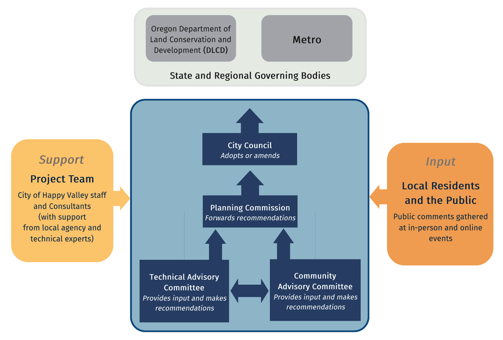
Decision-Making Process


Why are we doing this?
- The PV/NC Plan area is within the urban growth boundary. As such, urban comprehensive plan and zoning designations are required by state law.
- There are many benefits to a comprehensive plan: developing strategies to reduce congestion and create safer roads; diverse housing options; preservation of natural areas; a riverfront that people can use and enjoy; and a well-planned system of parks and trails.
- In addition, the above benefits often translate into more marketable properties and opportunities for economic development and job creation.
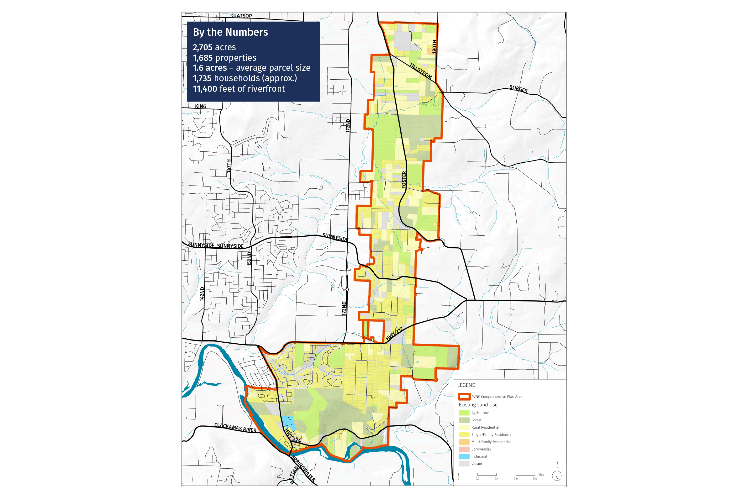
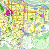
Plan Area
The plan area is shown in the map. The area is a natural extension of the City Happy Valley and the East Happy Valley Comprehensive Plan (EHVCP). The PV/NC Plan area includes:
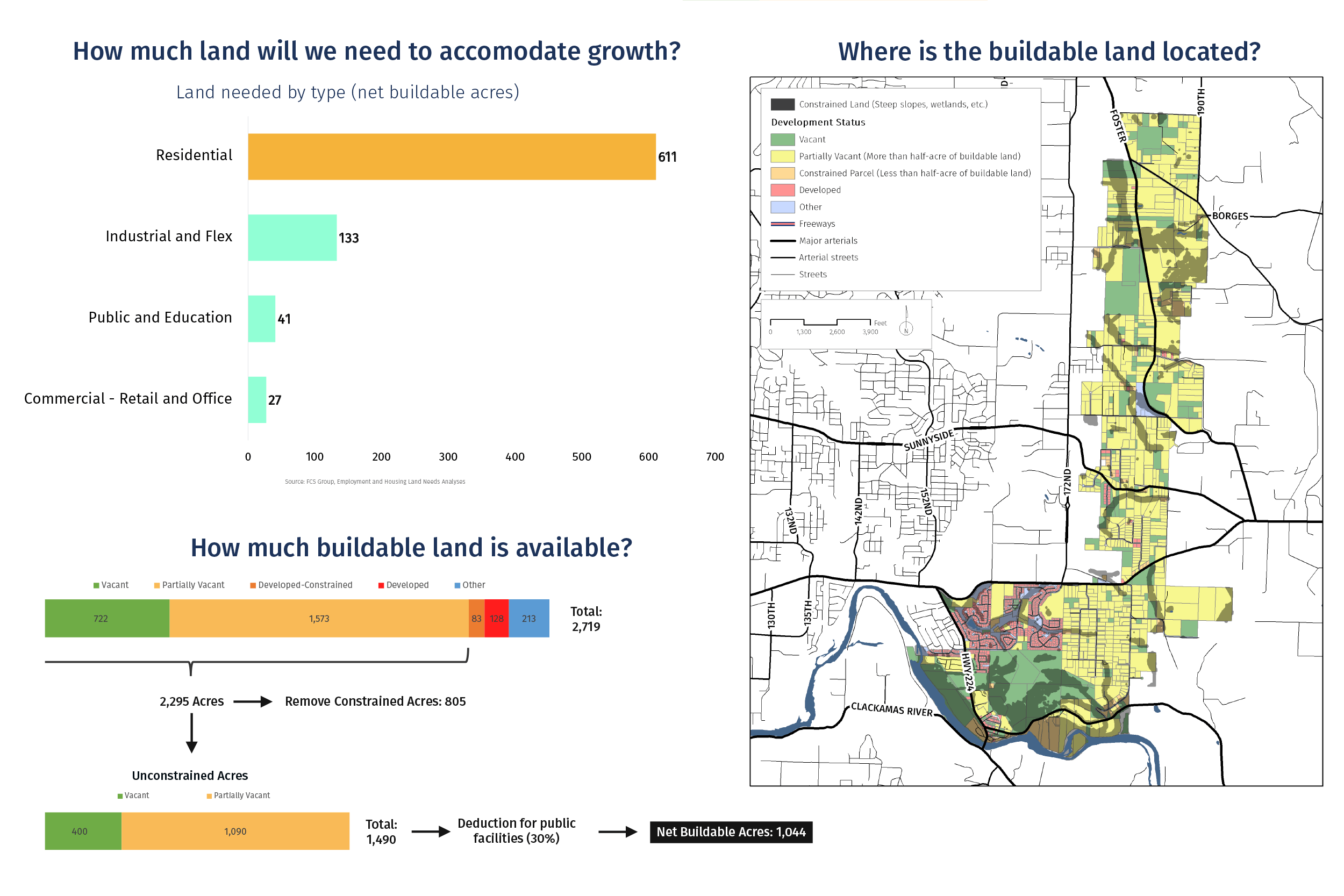
- 2,705 acres
- 1,685 properties
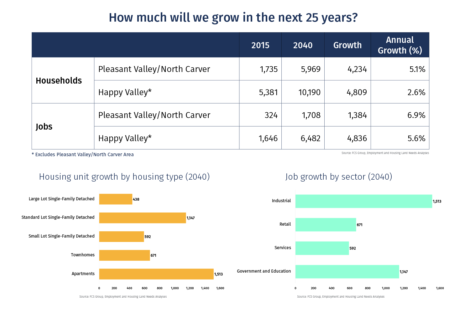
- 3,390 residents
- 1,735 households (approx.)
- 11,400 feet of riverfront
- 1 elementary school
- 1.4 acres of public parks
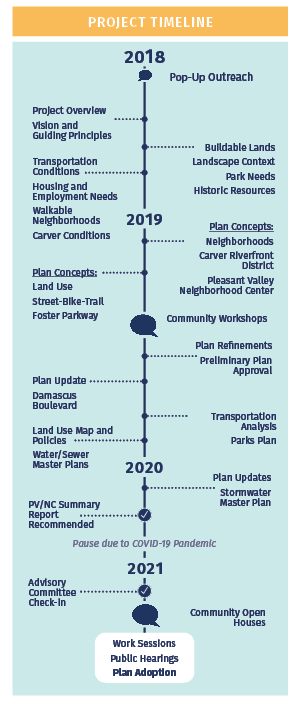
Project Schedule
- The project originally kicked off in the summer of 2018 and, was divided into three major areas:1) Research and Learning 2) Development of the Vision and Plan Concepts, and 3) City Plan and Code Amendments. It was guided by a 13-member Community Advisory Committee (CAC), which met 13 times over a two-year period.
- The latest Summary Report was published in August 2021.
- The final plan is scheduled to be adopted by the City Council in the spring of 2022.
For more information, visit the project webpage.


"The Pleasant Valley/North Carver area is an integral part of the growing Happy Valley community, and a natural extension of East Happy Valley. The area is comprised of a network of walkable neighborhoods, vibrant mixed-use centers, and thriving employment areas. The natural beauty of the landscape is embraced, the ecological health of the area is preserved and enhanced through environmental stewardship, and nature is made part of every neighborhood. The Carver riverfront has been transformed to include great public access and unique destinations. The area is supported by a resilient and safe network of streets, transit service, infrastructure, high-quality schools, and attractive parks and trails."
Promote a Sense of Community.
All development is planned and designed to create a strong identity and sense of community in Pleasant Valley and North Carver.
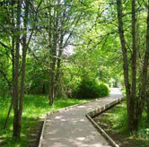
Preserve and Celebrate Nature.
Nature is protected, celebrated, and integrated into the community. Stream and habitat corridors are preserved and enhanced to ensure they can provide critical ecological functions. People can experience nature up-close through a network of parks and trails. People can appreciate nature from afar, in everyday situations, though views of rolling hills and forested buttes.
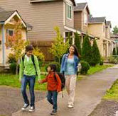
Form Walkable, Welcoming Neighborhoods.
Neighborhoods are more than a collection of housing. Neighborhoods feel and function like villages: welcoming communities that make room for people of all ages, abilities, and life experiences. Within each neighborhood, housing options include family-sized homes, compact cottages, and livable townhomes and apartments where appropriate. Streets and blocks are designed for walking and local shops and services are within walking distance.
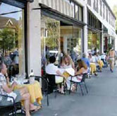
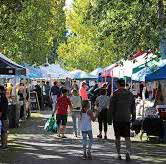
Create Vibrant, Mixed-Use Centers.
People gather in town centers to shop, play, and celebrate as a community. Mixed-use buildings allow people to live in these centers, ensuring that streets are alive with activity both during the day and in the evenings. The centers are destinations because they are built around special places, such as the waterfront of the Clackamas River or the confluence of important streets.
Craft Distinctive Places.
People perceive the communities in the plan area as distinctive places. Homes and buildings are designed to be varied and interesting. Gateways into the area and individual neighborhoods are marked with distinctive public art or monuments. Unique features are designed into corridors and centers to reinforce a sense of place.
Attract Local Jobs and Businesses.
Residents have opportunities to live and work in the same community. Local jobs are available to people with a range of backgrounds and skills, and all pay a living wage. Businesses are attracted by unique advantages of locating in the area and reinforce the development of industry clusters.
Design a Resilient, Connected Transportation System.
A robust network of streets and transit routes allow people to move efficiently in, out, and across the area. Streets are designed to both manage traffic flow and encourage walking, biking, and riding transit. Transportation infrastructure is built prior to or concurrent with development.
Ensure Regional Fit.
The plan area is integrated with the regional transportation system, land use patterns, and public facilities network. The plan area is viewed both as a distinct, individual place and a part of a larger system of neighboring cities and rural areas.

Plan for Fiscal Health.
The plan can be implemented because it addresses fiscal realities. Service providers—including transportation, sewer, water, stormwater, parks, schools, and parks—can build infrastructure to support development because funding mechanisms are aligned with needs and costs.
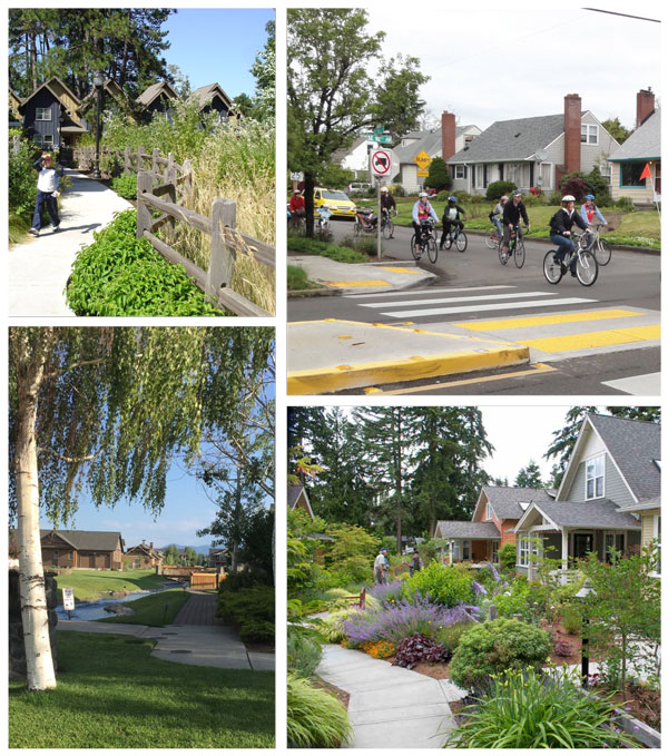
Image gallery contents:
Walkable Neighborhoods
Precedent Example #1
Sunnyside Village (Happy Valley, OR)
Precedent Example #2
Northwest Crossing (Bend, OR)


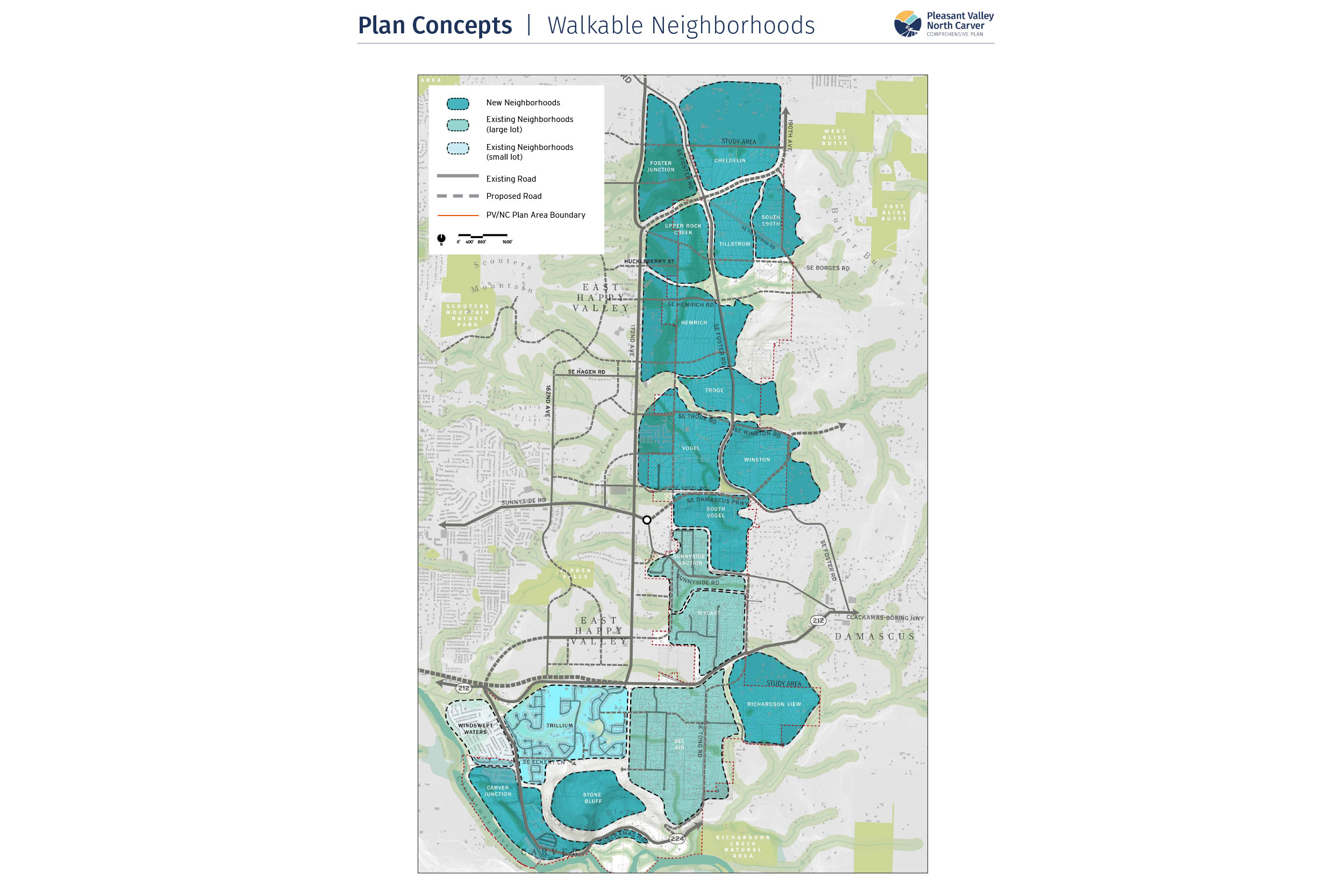
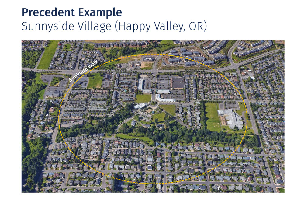
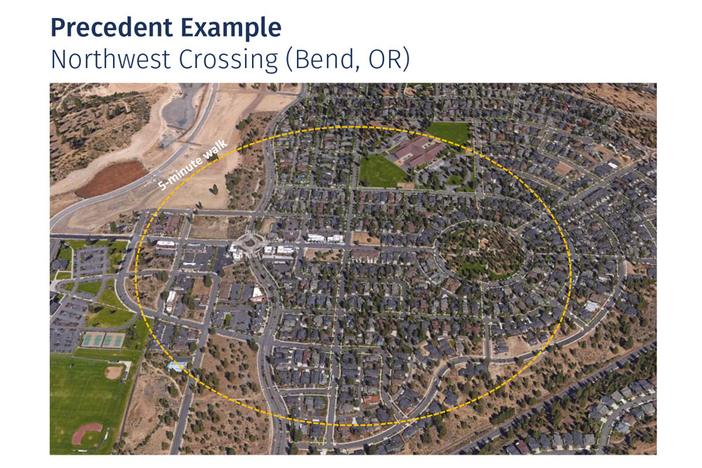


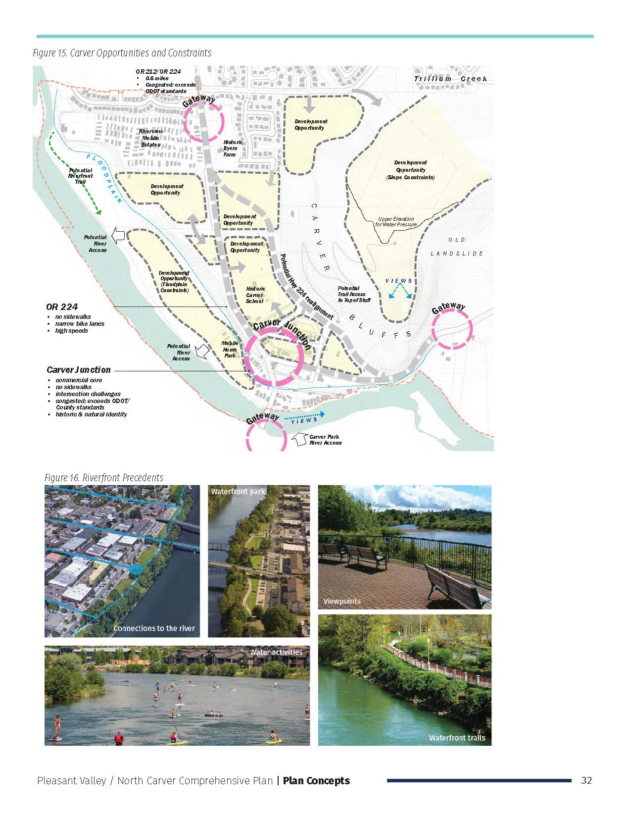
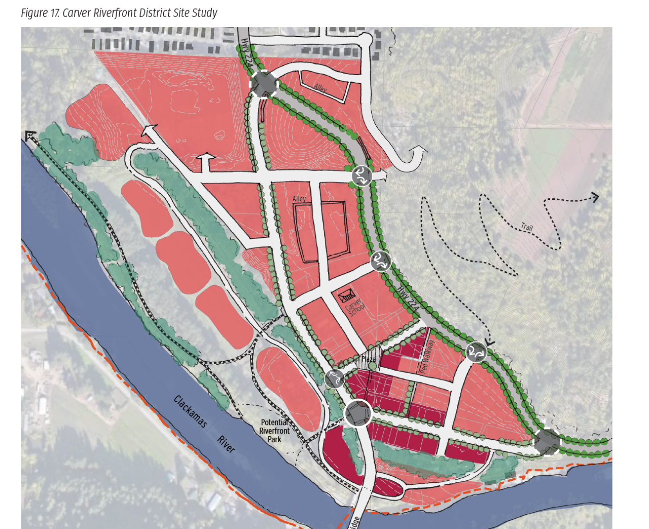
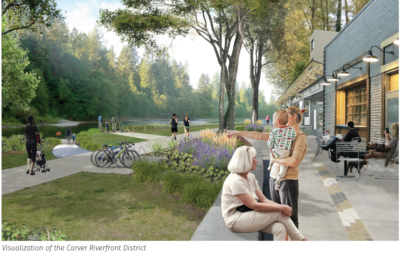


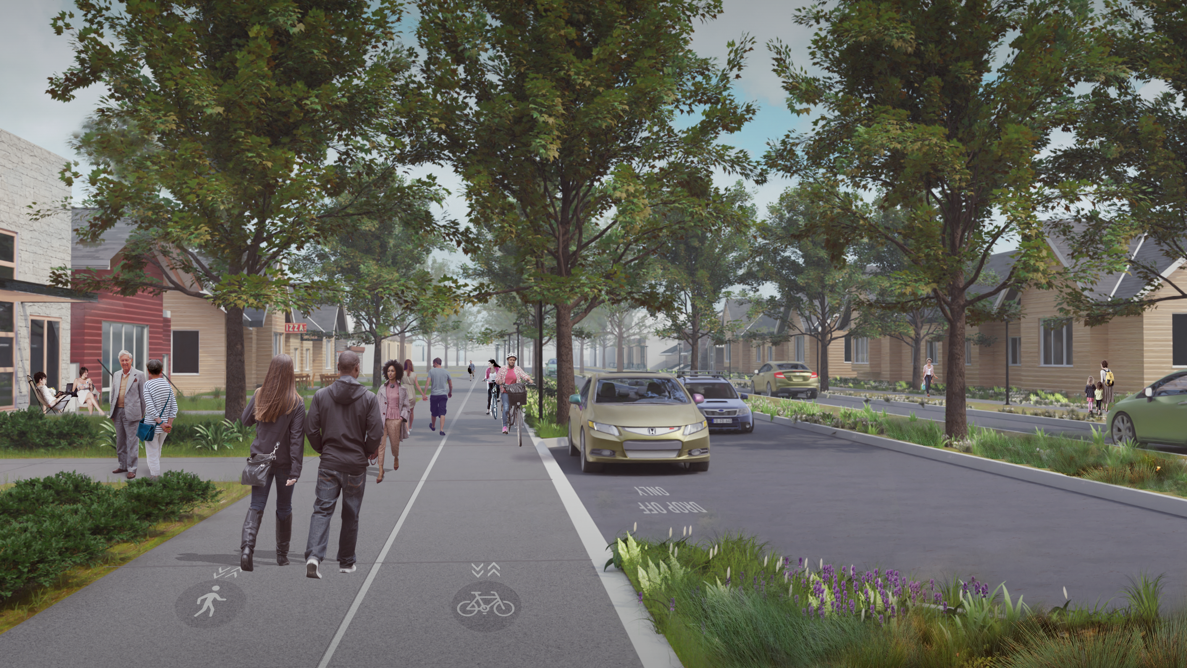
Image gallery contents:
pvnc-comp-plan/OOH2/parks-concept
pvnc-comp-plan/OOH2/parks-concept

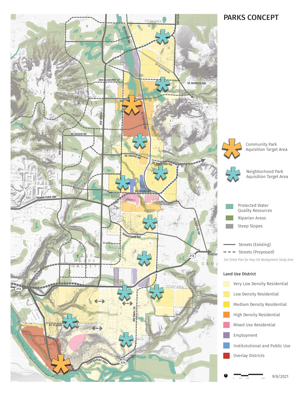
The PV/NC Parks Concept designates two potential community parks. The northern community park will be located near the Pleasant Valley Neighborhood Center, to take advantage of the area’s flat land, planned mixed use and higher density development, and transportation options. The southern community park will be a new riverfront park in the Carver Riverfront District, capitalizing on the unique and scenic qualities of the Clackamas River and Carver area.
The Parks Concept also includes eleven neighborhood parks. These parks are primarily “walk-to and bike-to” facilities serving the planned neighborhoods around them.
Image gallery contents:
pvnc-comp-plan/OOH2/pvnc-land-use-new-zoning-designations-reboot-larger-0-
pvnc-comp-plan/OOH2/pvnc-land-use-new-zoning-designations-reboot-larger-0-

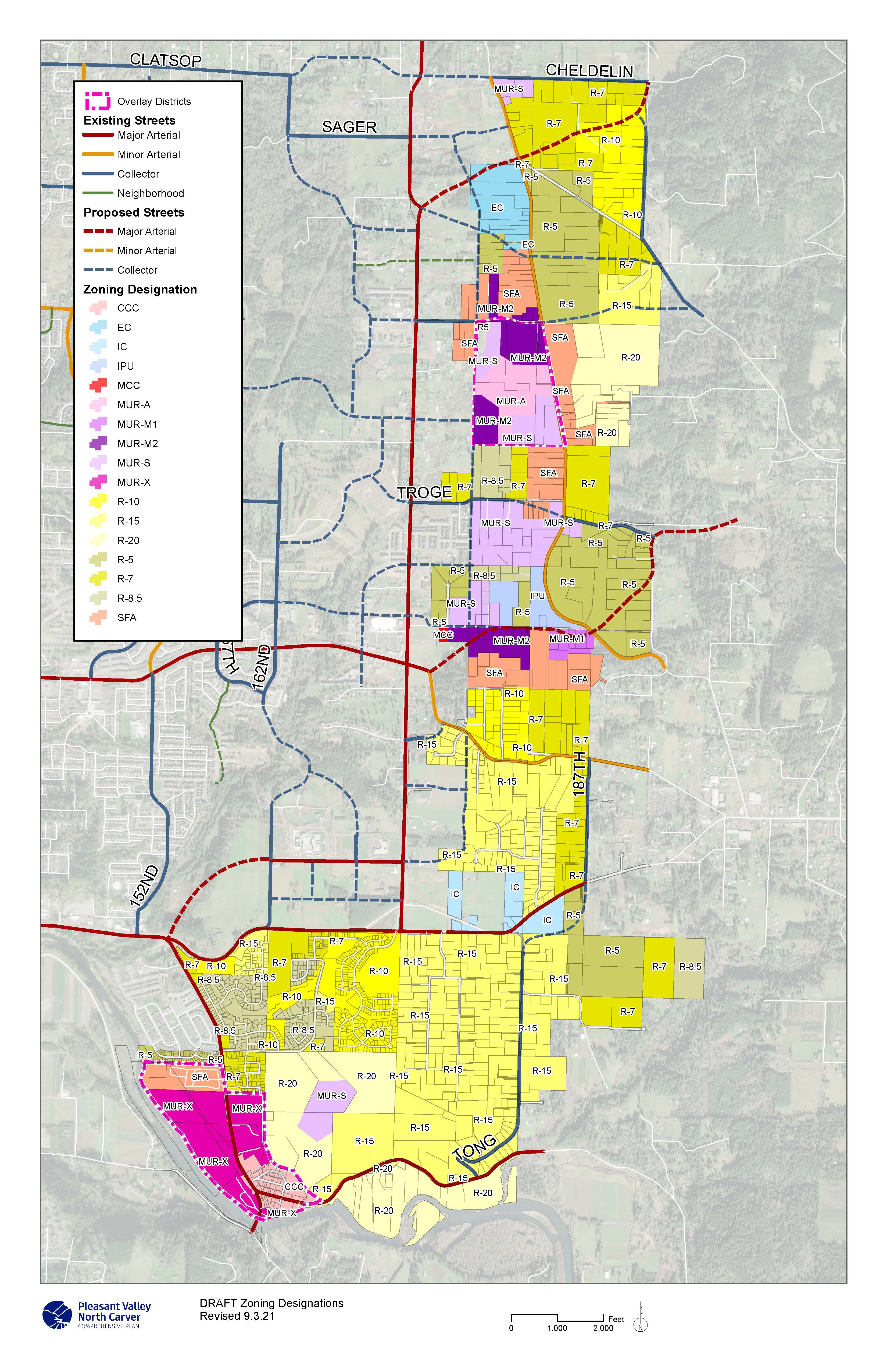
Residential Zones
- R-20: Residential – 20,000 sq. ft. per dwelling
- R-15, R-10, R-8.5, R-7, R-5: Residential – (Example: R-7 is 7,000 sq. ft. per dwelling)
- MUR-S: Mixed Use Residential – Single-Family (minimum 6 du/acre)
- SFA: Single-Family Attached Residential – (10-15 du/acre)
- MUR-A: Mixed Use Residential – Attached (10-15 du/acre)
- MUR-M1: Mixed Use Residential (15-24 du/acre)
- MUR-M2: Mixed Use Residential (25-34 du/acre)
- MUR-X: Mixed Use Residential Mixed Buildings (24 du/acre average in Carver Riverfront District)
Employment Zones
- MCC: Mixed Commercial Center
- EC: Employment Center
- IC: Industrial Campus
- MUC: Mixed Use Commercial Center
- MUE: Mixed Use Employment
- IPU: Institutional and Public Use District
- CCC: Community Commercial Center
In addition to the zones listed above, two new overlay zones are proposed:
- Pleasant Valley Neighborhood Center Overlay District. This overlay will apply to the land in the southwest quadrant of the intersection of Foster Road and Hemrich Road.
- Carver Riverfront Overlay District. This overlay will apply to land within the unincorporated community of Carver.
Image gallery contents:
Schedule
Schedule

