This site may be easier to use if viewed in the "landscape" orientation.
 

Welcome to the Pleasant Valley/North Carver Comprehensive Plan online workshop!

The City of Happy Valley is embarking on a plan that will guide the future of the Pleasant Valley/North Carver area. We’d like your input on what that future will look like. We’re planning for neighborhoods, commercial centers, streets, trails, parks, schools, and other elements of a complete community.

You will be presented with three pages of background information, then asked to respond to several questions about the recommended plan concepts. Survey questions will be available through May 12.

Let's get started!

Comments are no longer being accepted through this site, though you can submit feedback through the project webpage.

Prize Drawing Results

Congratulations to the four gift certificate winners, who will each receive a $20 gift certificate to Jim and Patty’s Coffee or Fat Cupcake: L.H, T.B, H.F and F.S.

Workshop Stations

In this open house there are a series of stations where you can learn about the project and provide input. Go directly to a station using the buttons below, or at the top of the screen to move through the stations in order.

1
Learn about the project purpose, plan area, and schedule. 
2
Get familiar with what we’ve learned so far about the plan area. 
3
Review the "big ideas" that will shape the plan. 
4
Learn about and provide feedback on specific ideas for neighborhoods, mixed use centers, and employment areas. 
5
Learn about and provide feedback on specific ideas for streets, trails, and bikeways. 
6
Get information on what happens next in the process. 

= Page includes questions or opportunities for comment.

Overview

The City of Happy Valley is embarking on a plan that will guide the future of the Pleasant Valley/North Carver area.The Comprehensive Plan will establish an integrated land use and transportation plan for the area, update citywide plans to ensure future provision of public services and faciliate urban development in the area.

Comprehensive Plan Overview Video: 2 min 37 sec

Why are we doing this?

  • The Pleasant Valley/North Carver (PV/NC) area is within the urban growth boundary. As such, urban comprehensive plan and zoning designations are required by state law.
  • There are many benefits to a comprehensive plan: developing strategies to reduce congestion and create safer roads; diverse housing options; preservation of natural areas; a riverfront that people can use and enjoy; and a well-planned system of parks and trails.
  • In addition, the above benefits often translate into more marketable homes and opportunities for economic development and job creation.

Plan Area

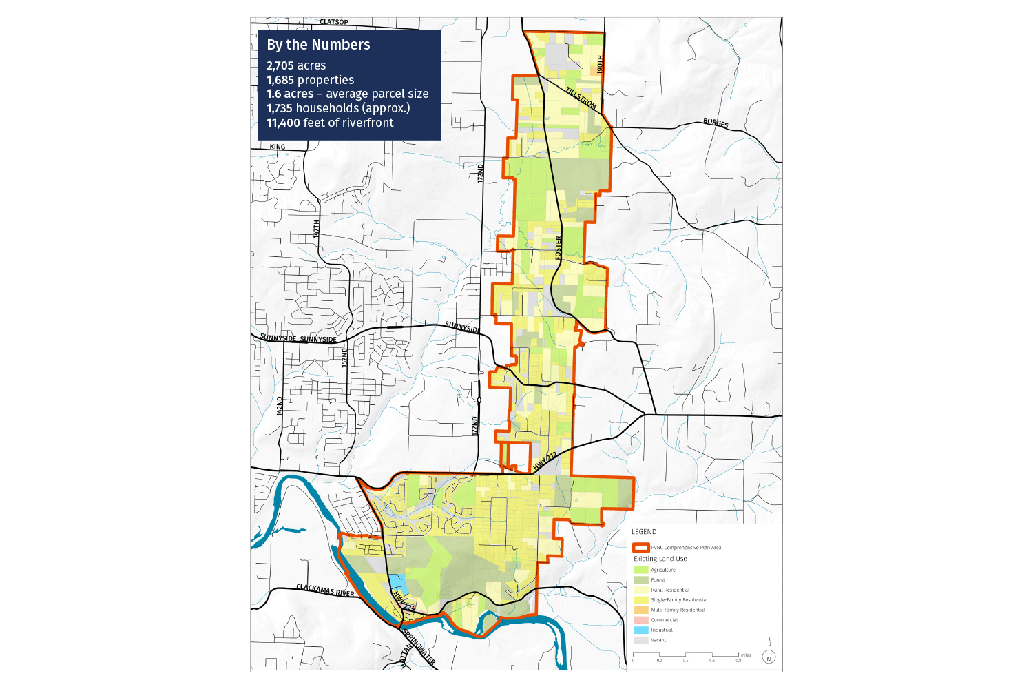
The plan area is shown in the map. The area is a natural extension of the City Happy Valley and East Happy Valley. The plan area includes:

  • 2,705 acres
  • 1,685 properties
  • 1,735 households (approx.)
  • 11,400 feet of riverfront

Project Schedule

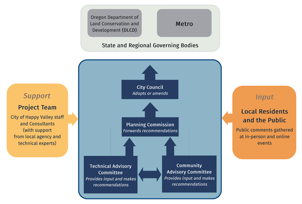
  • The project kicked off in summer of 2018 and is divided into three phases. It is being guided by a 13-member Community Advisory Committee.
  • This workshop focuses on draft “Plan Concepts”. Following this workshop, a draft plan will be prepared. The draft plan will be made available for review by the community throughout the fall and winter of 2019/2020.
  • The final plan is scheduled to be adopted by the City Council in the spring of 2020.

For more information, visit the project webpage.

The Plan Area Today

Get familiar with what we’ve learned so far about the plan area by clicking through the tabs below.


Context and Landscape

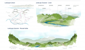
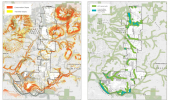
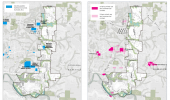
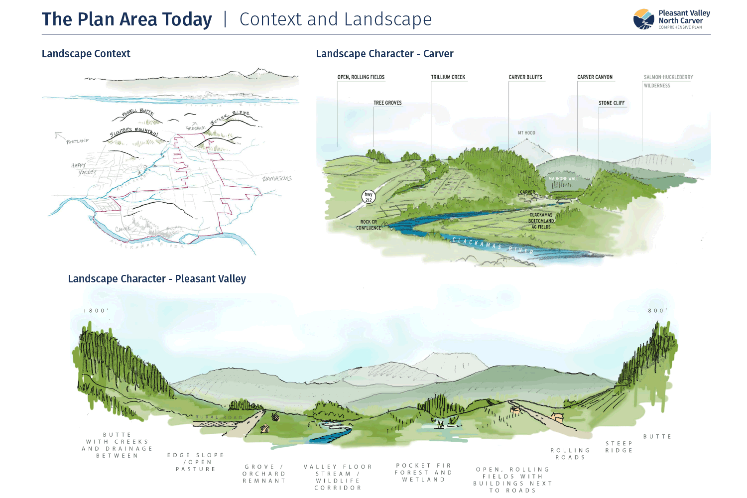
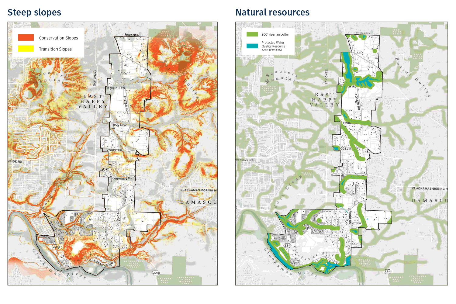
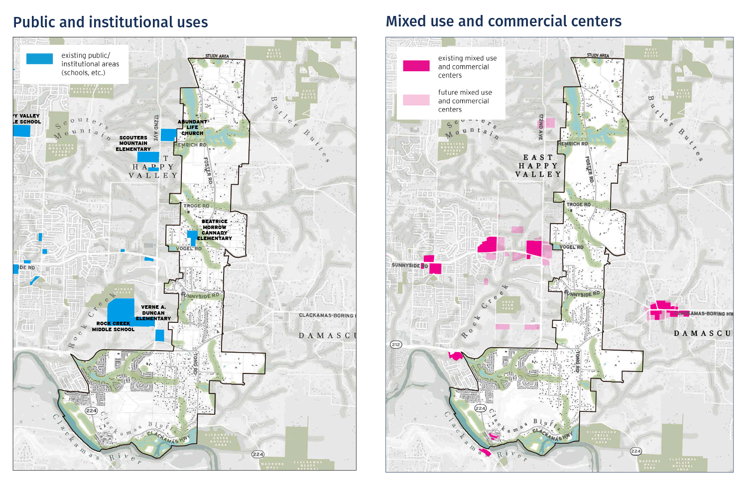
These maps illustrate the beautiful landscape that defines the area, and is an asset to the plan. Similarly, the existing commercial centers and public uses are key community gathering areas – the start of new ones that will emerge in the plan.

Transportation

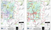
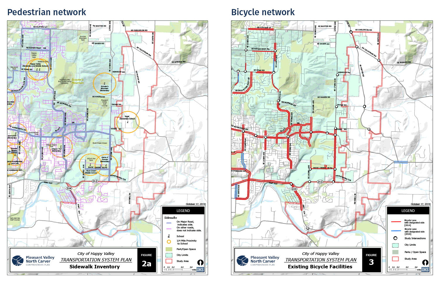
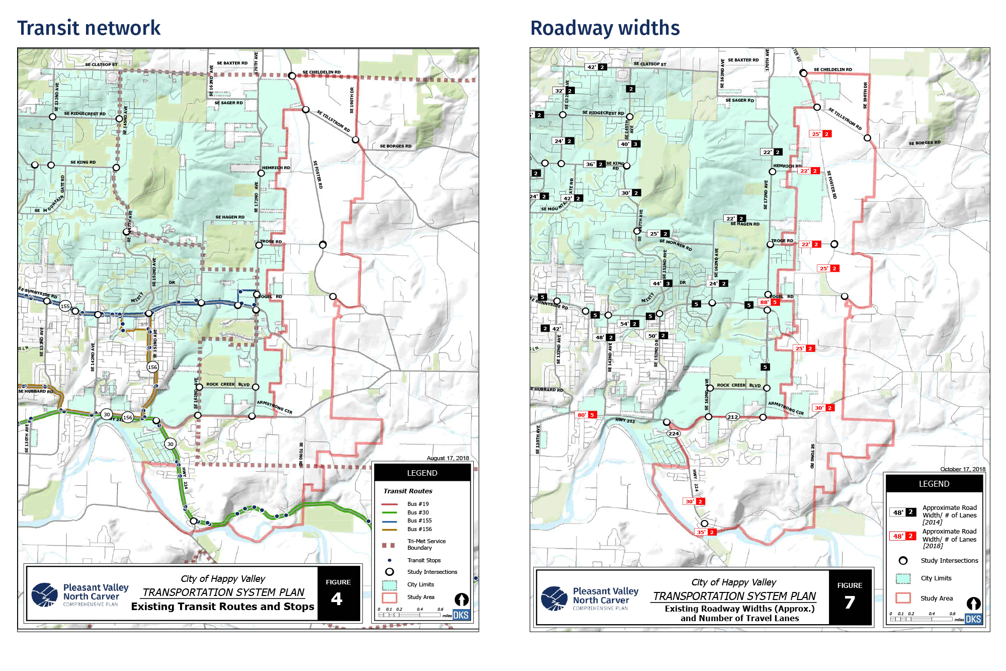
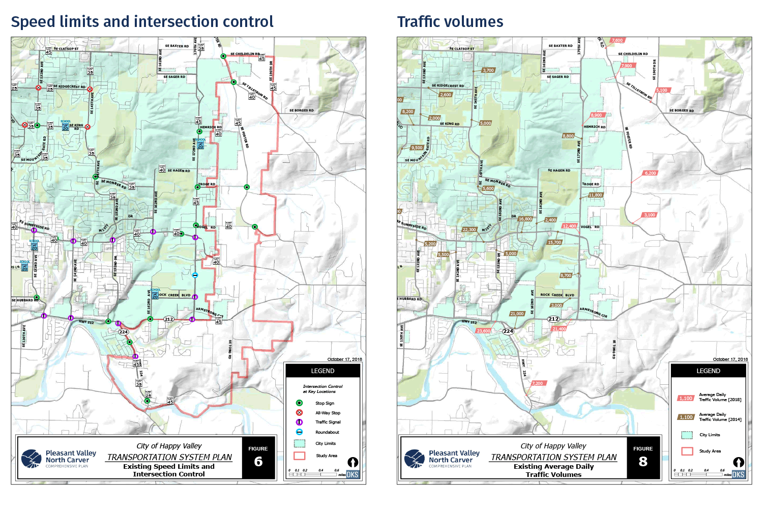
  • Several major roads move people through the area. Most other roads directly serve local development, and many are unpaved or lack sidewalks.
  • This limited network makes it difficult to travel on foot or bike, but there are opportunities to extend and improve streets. There is also an opportunity to extend bus transit from the east.
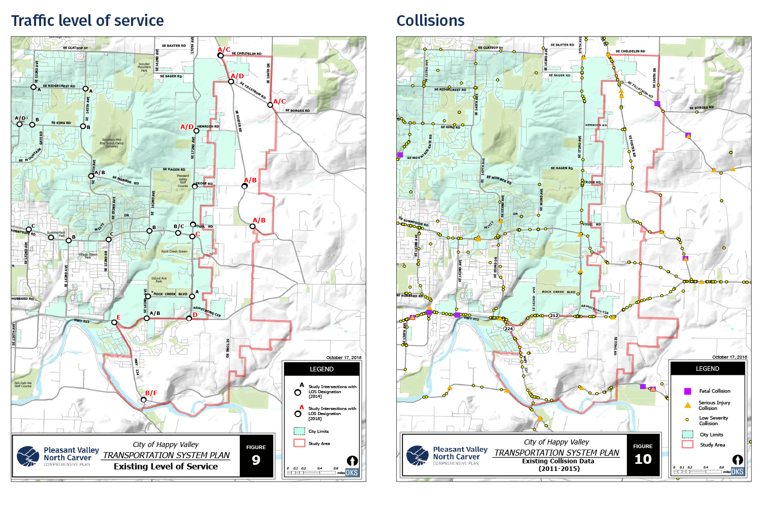
  • Traffic volumes are highest on Highway 212, Highway 224, 172nd Avenue, and Foster Road. There are pinch points at some intersections, such as the Highway 212/224 junction and Foster Road/Tillstrom Road.
  • Traffic collisions are higher near some intersections, such as Foster Road/Tillstrom Road and Highway 224/Market Road.

Parks

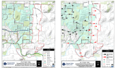
There are few existing, developed parks in the plan area. Based on standards set in the citywide parks plan, there will be a need for one larger community park (20-40 acres) and 8-11 smaller neighborhood parks (1.5-5 acres). The community park should include multiple sport fields. The neighborhood parks should be located to serve all households within a ½ mile. The map shows existing parks and general locations for new parks.

Parks

Parks

There are few existing, developed parks in the plan area. Based on standards set in the citywide parks plan, there will be a need for one larger community park (20-40 acres) and 8-11 smaller neighborhood parks (1.5-5 acres). The community park should include multiple sport fields. The neighborhood parks should be located to serve all households within a ½ mile. The map shows existing parks and general locations for new parks.

Parks

Land Needs and Supply

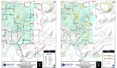
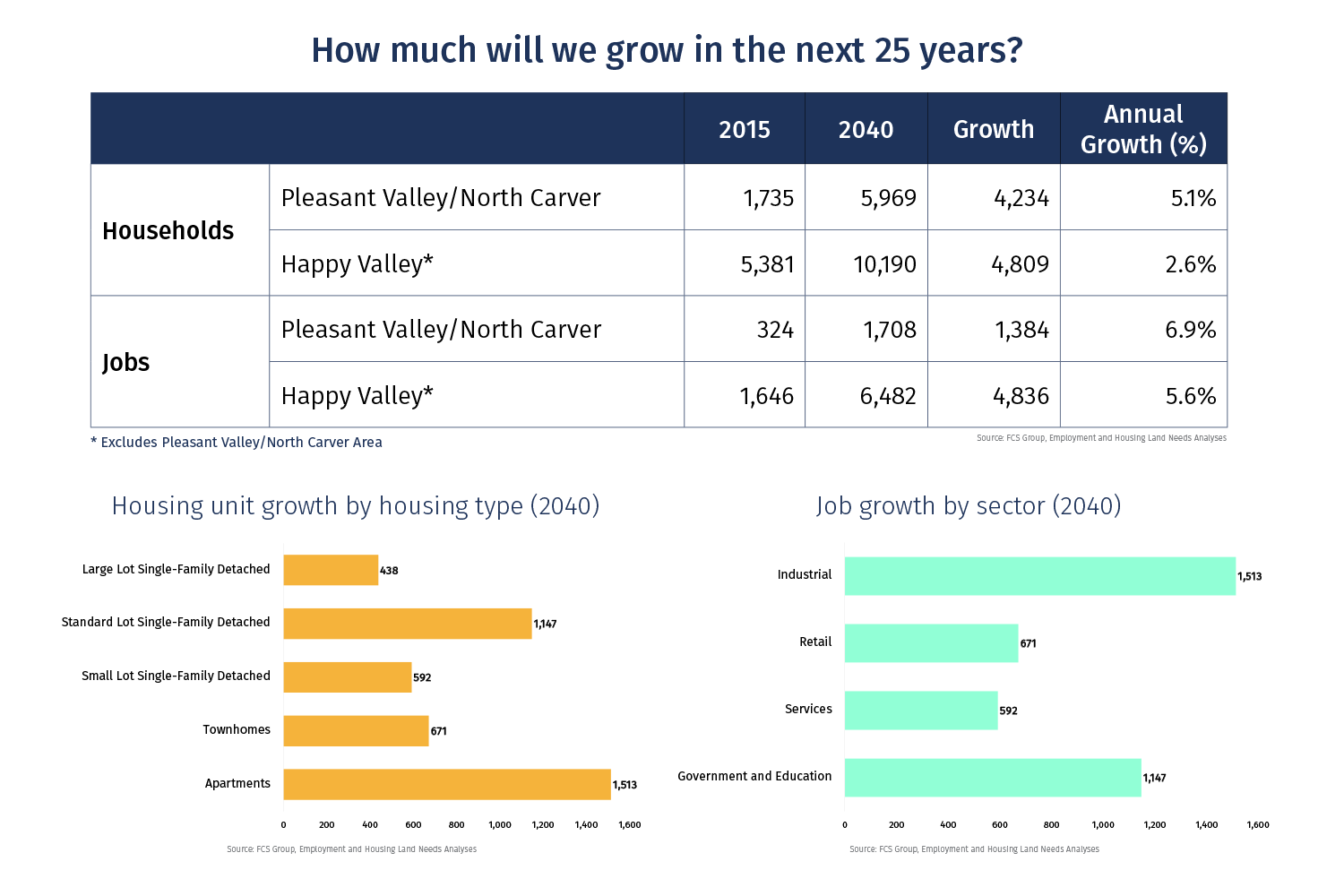
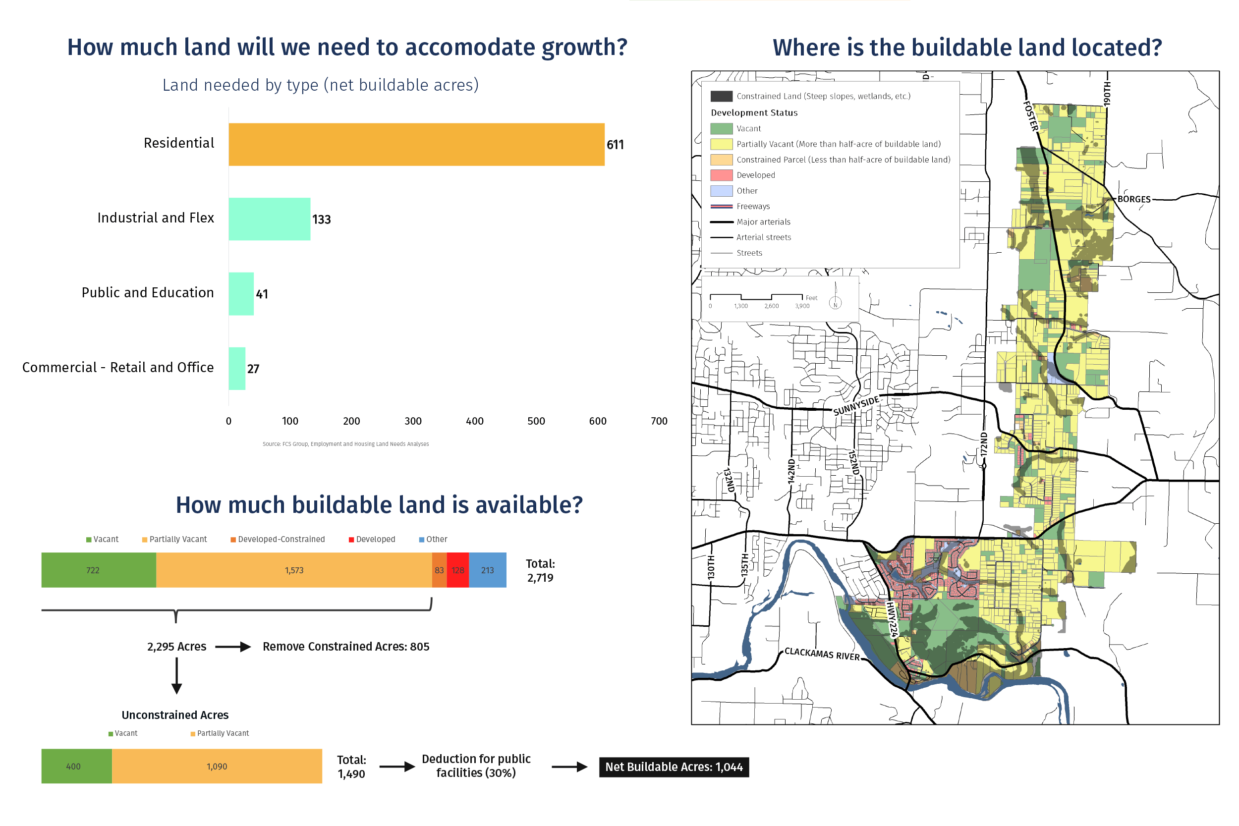
  • By 2040, about 4,200 new households and 1,300 new jobs are projected to locate in the area.
  • A range of housing types will be needed, including apartments, townhomes, and various types of single-family detached housing.
  • New jobs will also be diverse. More industrial and office jobs are expected in the future, while retail and service jobs will continue to be important.
  • There is an need for about 600 acres of land for residential uses and about 200 acres of land for commercial and employment uses.
  • Fortunately, there is enough land in the plan area to meet these needs. There is about 1,000 acres of buildable land in the plan area.
43% Complete

Vision and Guiding Principles

The project advisory committees worked with the project team to draft a vision statement. The vision statement articulates the key ideas and values that will shape the plan and express the type of community that should be developed over time. The guiding principles spell out the key ideas and values behind the vision. The principles are also a set of criteria to apply to ensure the plan and future development remain consistent with the vision.


Vision Statement

"The Pleasant Valley/North Carver area is an integral part of the growing Happy Valley community, and a natural extension of East Happy Valley. The area is comprised of a network of walkable neighborhoods, vibrant mixed-use centers, and thriving employment areas. The natural beauty of the landscape is embraced, the ecological health of the area is preserved and enhanced through environmental stewardship, and nature is made part of every neighborhood. The Carver riverfront has been transformed to include great public access and unique destinations. The area is supported by a resilient and safe network of streets, transit service, infrastructure, high-quality schools, and attractive parks and trails."

Guiding Principles

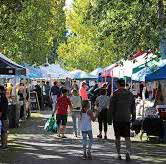
Photo: Farmer's market

Promote a Sense of Community.

All development is planned and designed to create a strong identity and sense of community in Pleasant Valley and North Carver.
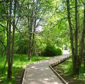
Photo: Pathway through trees

Preserve and Celebrate Nature.

Nature is protected, celebrated, and integrated into the community. Stream and habitat corridors are preserved and enhanced to ensure they can provide critical ecological functions. People can experience nature up-close through a network of parks and trails. People can appreciate nature from afar, in everyday situations, though views of rolling hills and forested buttes.
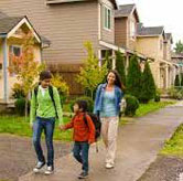
Photo: Sidewalk and pedestrians

Form Walkable, Welcoming Neighborhoods.

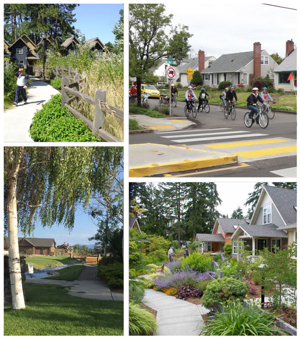
Neighborhoods are more than a collection of housing. Neighborhoods feel and function like villages: welcoming communities that make room for people of all ages, abilities, and life experiences. Within each neighborhood, housing options include family-sized homes, compact cottages, and livable townhomes and apartments where appropriate. Streets and blocks are designed for walking and local shops and services are within walking distance.
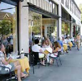
Photo: Sidewalk cafe

Create Vibrant, Mixed-Use Centers.

People gather in town centers to shop, play, and celebrate as a community. Mixed-use buildings allow people to live in these centers, ensuring that streets are alive with activity both during the day and in the evenings. The centers are destinations because they are built around special places, such as the waterfront of the Clackamas River or the confluence of important streets.
Photo: Ornamental light-fixture

Craft Distinctive Places.

People perceive the communities in the plan area as distinctive places. Homes and buildings are designed to be varied and interesting. Gateways into the area and individual neighborhoods are marked with distinctive public art or monuments. Unique features are designed into corridors and centers to reinforce a sense of place.
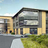
Photo: Employment center

Attract Local Jobs and Businesses.

Residents have opportunities to live and work in the same community. Local jobs are available to people with a range of backgrounds and skills, and all pay a living wage. Businesses are attracted by unique advantages of locating in the area and reinforce the development of industry clusters.
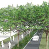
Photo: Roadway cross-section

Design a Resilient, Connected Transportation System.

A robust network of streets and transit routes allow people to move efficiently in, out, and across the area. Streets are designed to both manage traffic flow and encourage walking, biking, and riding transit. Transportation infrastructure is built prior to or concurrent with development.
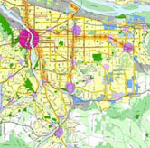
Map: Metro area

Ensure Regional Fit.

The plan area is integrated with the regional transportation system, land use patterns, and public facilities network. The plan area is viewed both as a distinct, individual place and a part of a larger system of neighboring cities and rural areas.

Image: Line chart

Plan for Fiscal Health.

The plan can be implemented because it addresses fiscal realities. Service providers—including transportation, sewer, water, stormwater, parks, schools, and parks—can build infrastructure to support development because funding mechanisms are aligned with needs and costs.

Walkable Neighborhoods

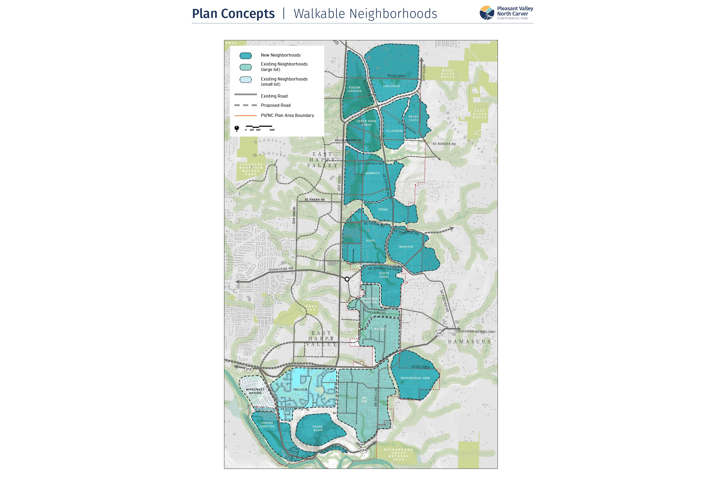
A central idea of the vision statement is to create walkable neighborhoods. Walkable neighborhoods are distinct places, bounded by physical features that act as “edges”, and are organized to integrate natural areas. Walkable neighborhoods provide easy access to green spaces, schools, and commercial centers.

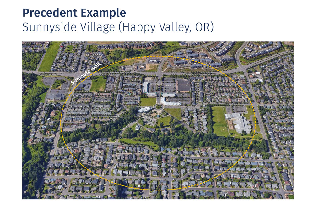
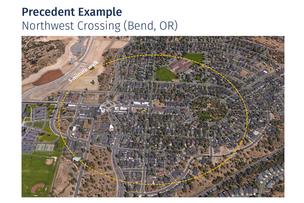
The walkable neighborhoods map applies these principles to the plan area. The scale of a neighborhood is based on the idea that it should take about 5 minutes to walk from center to edge. Natural features—slopes, steams, and habitat areas—shape their boundaries. Major streets may also represent boundaries. The neighborhoods have been given “place names” to make them easier to identify.


Questions

57% Complete

Land Use Plan Concepts

Learn about and provide feedback on specific ideas for neighborhoods, mixed use centers, and employment areas.

Please respond to the questions at the end of each section.


Pleasant Valley Downtown District

Downtown districts are places where people gather to shop, eat, play, and celebrate as a community. They are walkable and pedestrian-friendly places.

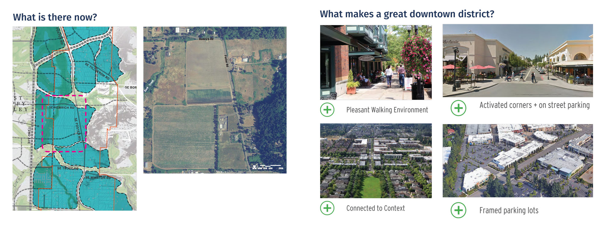
The area near the intersection of SE Hemrich Road and SE Foster Road is a strong candidate for a downtown district to serve the Pleasant Valley area. The location is in the heart of the area and served by two major streets. The land is relatively flat and does not contain stream corridors or habitat areas.

Two conceptual plans have been developed for a downtown district. Both concepts envision a commercial core near the intersection, with a retail “Main Street” acting as a gathering place and lively street.

  • Concept A envisions the Main Street oriented to SE Foster Road, which terminates in a small neighborhood park.
  • Concept B envisions the Main Street oriented to SE Hemrich Road, with a neighborhood park tucked next to Rock Creek.

Downtown district: map of what is there now, and photos of pleasant walking environments, activated corners, connectedness to context, and framed parking lots.

Plan concepts: A - Main Street oriented to Foster; B - Main Street oriented to Hemrich.


Questions

What is your level of support for the draft Pleasant Valley Downtown District, Concept A?

(Check one.)

What is your level of support for the draft Pleasant Valley Downtown District, Concept B?

(Check one.)

North Carver Waterfront District

The Clackamas River and the historic Carver junction is a special place. The beauty of the Clackamas River and surrounding buttes and the historic significance of this junction combine to create a unique sense of place.

The North Carver waterfront is envisioned to develop into a destination that both encourages new development and preserves the natural and historic features that make it unique. Carver could become a regional amenity, with a large waterfront park, trails, restaurants that face the river, and a historic core with retail shops and a public space. Apartments and townhomes would contribute to lively streets and provide an opportunity many people to live near these amenities.

Two concepts have been developed for a North Carver Waterfront District. Both concepts include the land uses and amenities noted above

  • Concept A assumes that Highway 224 remains in its currently alignment, which runs between the waterfront area and the large, developable properties at the foot of the butte.
  • Concept B assumes that Highway 224 could be realigned to run along the foot of the butte. This would lower traffic volumes on the street along the current highway alignment, creating a more pedestrian-friendly environment. This concept will be more difficult to implement then Concept A.

Photos of example waterfront areas.

North Carver Waterfront options: A - Exsiting location of Highway 224; B - Highway 224 realignment.


Questions

What is your level of support for the draft North Carver Waterfront District, Concept A?

(Check one.)

What is your level of support for the draft North Carver Waterfront District, Concept B?

(Check one.)

Land Use and Neighborhoods

A central element of the plan is a land use map. A set of ten land use districts have been created in order to describe the types of land uses that would be envisioned in various locations. The land use districts are based on existing policies and standards of the City of Happy Valley Comprehensive Plan and Development Code. The characteristics of each land use district is summarized in the table below.

The conceptual land use map is an initial “first cut” at shaping land uses to fit the plan area, considering the vision, topography, natural resources, existing development, transportation, and other factors. The map was designed to address the following goals and needs:

  1. Create walkable neighborhoods. The land use districts are shaped to the neighborhood areas, reinforcing the elements that help create the identity of each neighborhood.
  2. Meet projected land needs for housing and jobs. The land use map allocates enough land to meet the projected land needs.
  3. Place higher densities near mixed use centers. Higher density residential areas are located near mixed use centers. This pattern supports walkability and healthy commercial districts.
  4. Place lower densities in constrained areas. Residential densities are lower in areas that have steep slopes, natural resources, or are further from mixed use centers.
  5. Create transitions to existing neighborhoods. Transitions are provided from higher density areas to existing, lower density areas. Within these existing neighborhoods, new development will largely be infill on a lot-by-lot basis.

Land Use District

Zone(s)

Density Range

(Click to enlarge.)

Very Low Density Residential (VLDR)

R-20, R-15

2-3 units/ac

Low Density Residential (LDR)

R-10, R-8.5, R-7

3-5 units/ac

Medium Density Residential (MDR)

R-5, MUR-S

6-9 units/ac

High Density Residential Attached (HDR)

SFA, MUR-A

10-15 units/ac

Mixed Use Residential – Multi-Family (MUR)

MUR M1-M2, MUR-X

15-30 units/ac

Community Commercial Center (CCC)

CCC

10-15 units/ac

Mixed Commercial Center (MCC)

MCC

15-30 units/ac

Employment (EMP)

EC, IC

N/A

Institutional and Public Use (IPU)

IPU

N/A


Questions

What is your level of support for the draft Land Use and Neighborhoods concept?

(Check one.)

Employment Areas

Employment areas are important because they enable jobs to locate in the city, can reduce regional traffic, and contribute to the local economy. Employment uses will likely be light industrial, business parks, or professional offices.

The land use map designates about 65 acres of land for employment. Based on growth projections, there is a need for about 100 additional acres of land for employment.

A logical location for employment land is near Highway 212. Highway 212 is planned for improvements as part of the Sunrise Corridor project. However, these areas may be difficult to develop for employment uses, due to existing development, slopes, and streams.

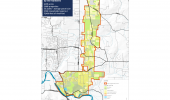
Three potential employment areas are shown with dashed lines on the map. The areas have similar features, but different constraints. Damascus Triangle and Bel Air North are relatively flat and have few streams, but there is more existing development than Richardson View.

We’d like your input on which area(s) are suitable for employment uses.

Employment Areas


Questions

What is your level of support for designating Bel Air North for employment uses?

(Check one.)

What is your level of support for designating Damascus Triangle for employment uses?

(Check one.)

What is your level of support for designating Richardson View for employment uses?

(Check one.)

71% Complete

Transportation Plan Concepts

Learn about and provide feedback on specific ideas for streets, trails, and bikeways.

Please respond to the questions at the end of each section.


Street Network

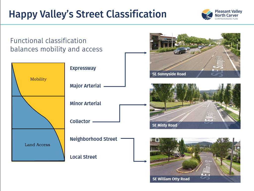
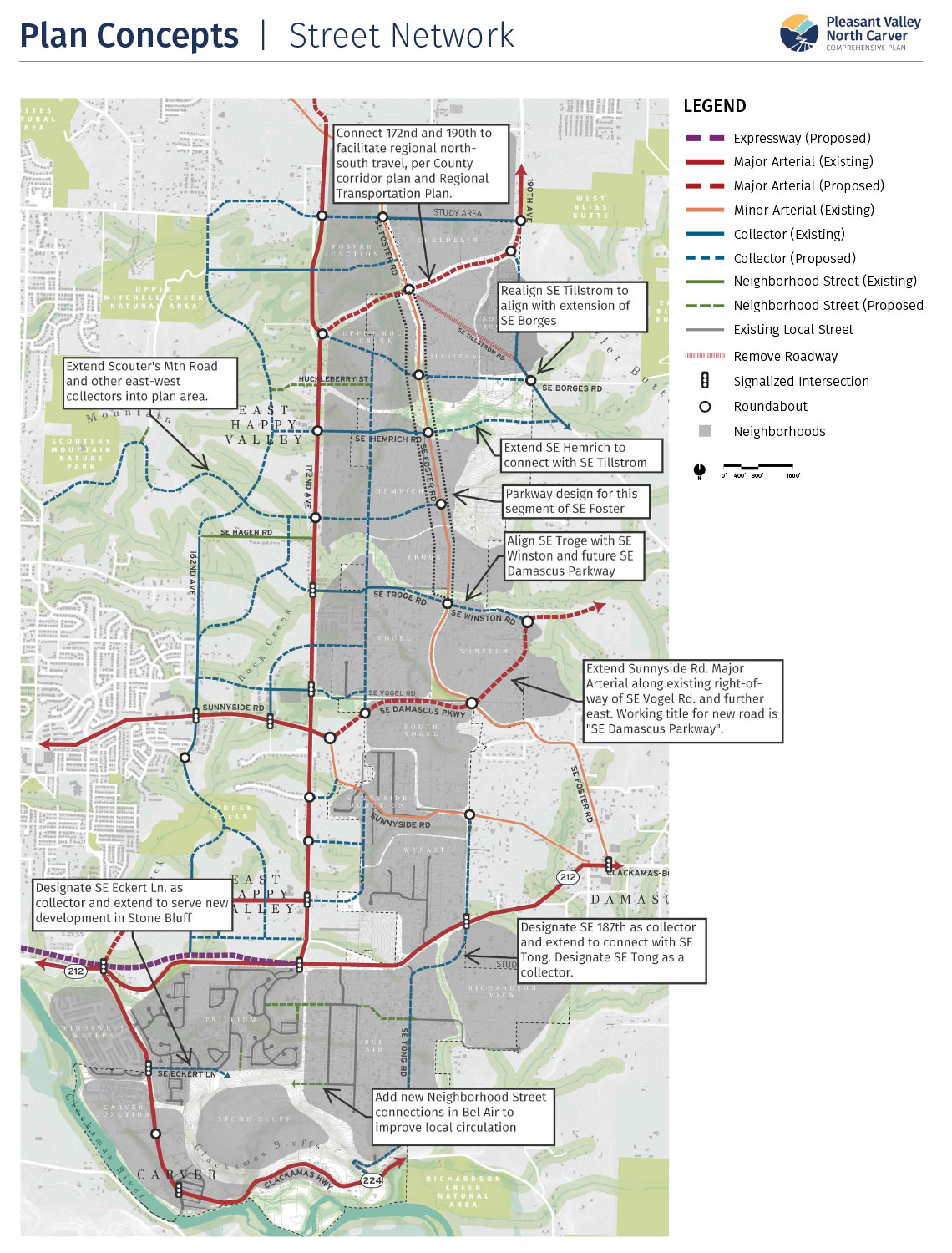
The graphic on this page shows the City’s existing classification of street types. The plan will extend streets, following this classification, to serve the project area to ensure a well-connected street system in the future.

Happy Valley Street Classifications

Map: Plan concepts, street network


Questions

What is your level of support for the draft Street Network concept?

(Check one.)

Trails and Bikeways

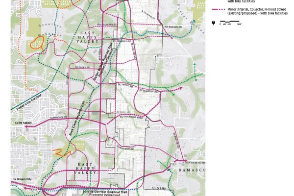
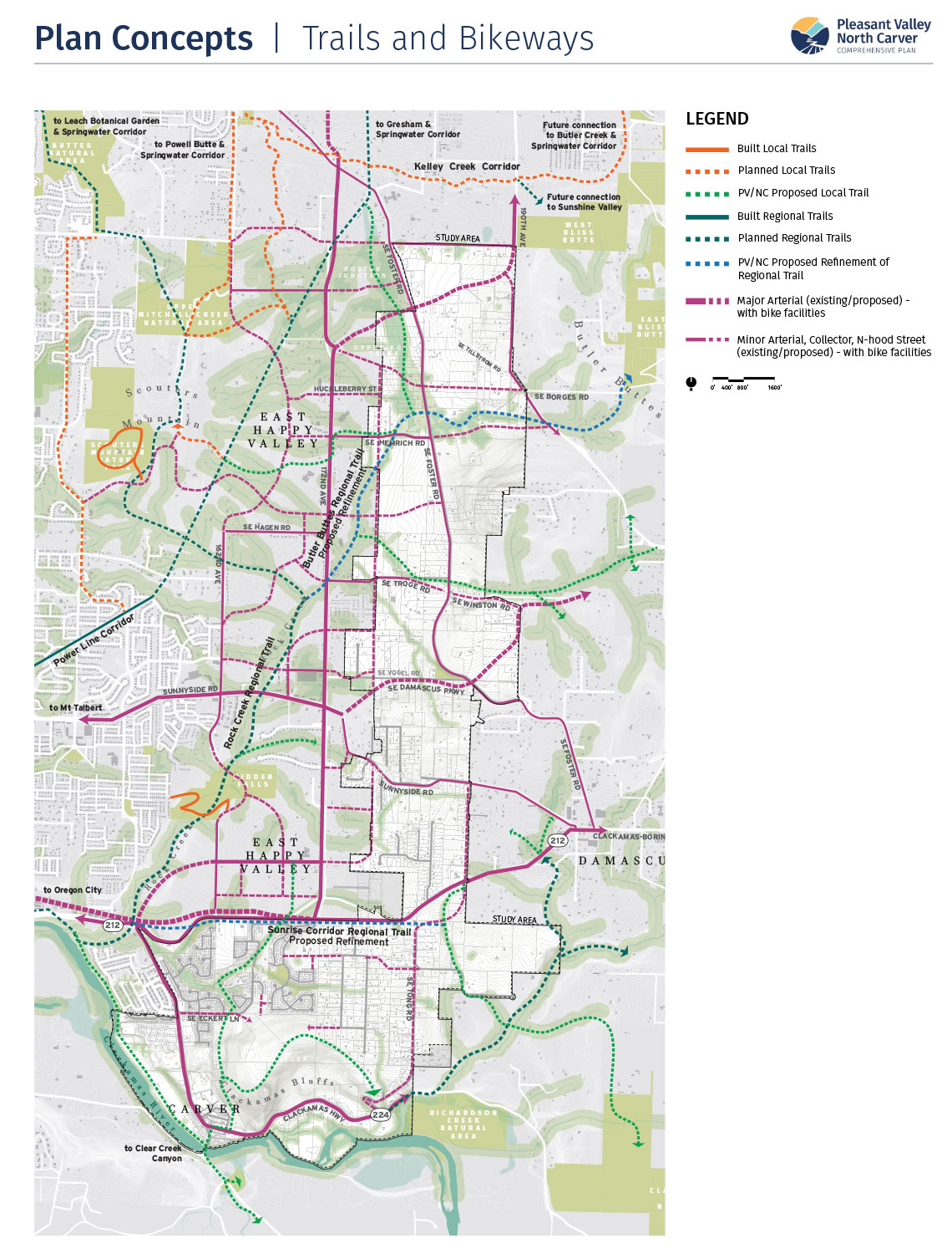
The conceptual trails and bikeways map shows how the plan area could be served by a network of off-street trails and on-street bike facilities.

  • Bikeways are streets that will include dedicated bike facilities (a bike lane, protected bike lane, or path) as they are built or improved in the future.
  • Trails are off-street facilities, paved or soft surface, that provide pedestrian and/or bike routes to connect to key destinations and natural areas. Trails may be part of the regional system or local trails.

Trails and Bikeways


Questions

What is your level of support for the draft Trails and Bikeways concept?

(Check one.)

Foster Road Parkway Design

Foster Road is an important street that runs through the center of the Pleasant Valley area. It has historic significance as a regional “farm to market” road.

A special parkway design is envisioned from roughly SE Cheldelin Road to SE Troge Road. The goals of the parkway are to:

  • Create a unique identity for Foster Road and an attractive gateway into the Pleasant Valley area.
  • Provide a comfortable and safe environment for walking and biking.
  • Deliver safe and reliable mobility for driving.

Two conceptual designs have been developed. Both include a double row of trees that frame the street and sidewalk.

  • Concept A provides bike lanes adjacent to vehicle lanes with a buffer area in between.
  • Concept B provides for a wider, shared bike and pedestrian path on one side of the street.

Foster Parkway Concepts


Questions

What is your level of support for the draft Foster Road Parkway Concept A?

(Check one.)

What is your level of support for the draft Foster Road Parkway Concept B?

(Check one.)

86% Complete

Next Steps

Get information on what happens next in the process. Be sure to submit your comments below.

Enter to Win

Congratulations to the four gift certificate winners, who will each receive a $20 gift certificate to Jim and Patty’s Coffee or Fat Cupcake: L.H, T.B, H.F and F.S.

Schedule

For More Information


Final Questions

How did you hear about this online workshop? (Check all that apply.)
What is your preferred source for receiving information from the City of Happy Valley? (Check all that apply.)

Mailing list (Optional)

Provide the following optional contact information if you would like to be added to the project mailing list.

Demographic Information (Optional)

This information can help us evaluate the effectiveness of our public outreach activities and tell us if we are reaching a representative cross-section of our community. The identity of individuals is kept confidential. The results are reported as totals only, and used solely to help improve future community engagement. Providing this information is voluntary and optional.

What is your age? (Check one.)
What is your gender? (Check one.)
Do you rent or own your home? (Check one.)
What is your annual household income? (Check one.)
What is your ethnicity (or race)? (Check all that apply.)
What is your preferred language? (Check all that apply.)
What is the highest degree or level of school that you have completed? (Check one.)
What is your household size? (Check one.)
100% Complete