Stations
Go directly to a station using the buttons below, or at the top of the screen to move through the stations in order.
= Page includes questions or opportunities for comment.
Image gallery contents:
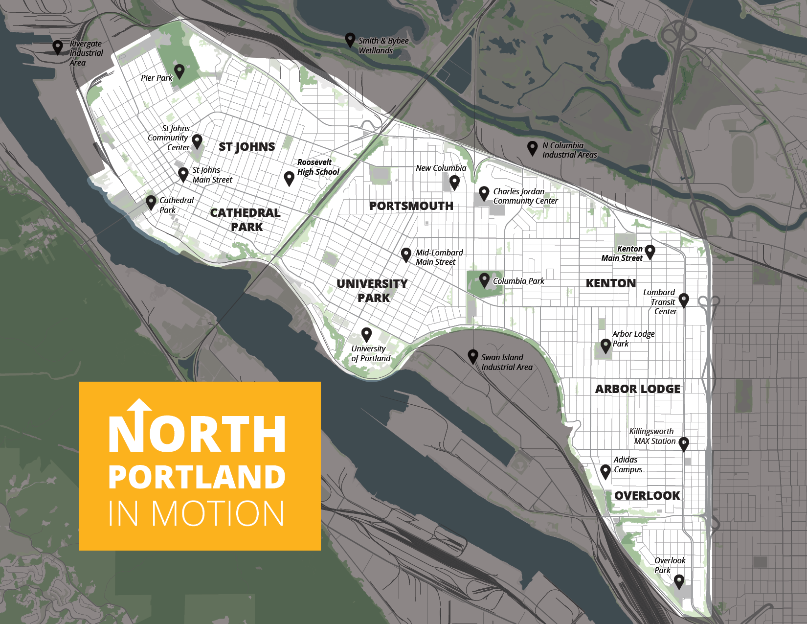
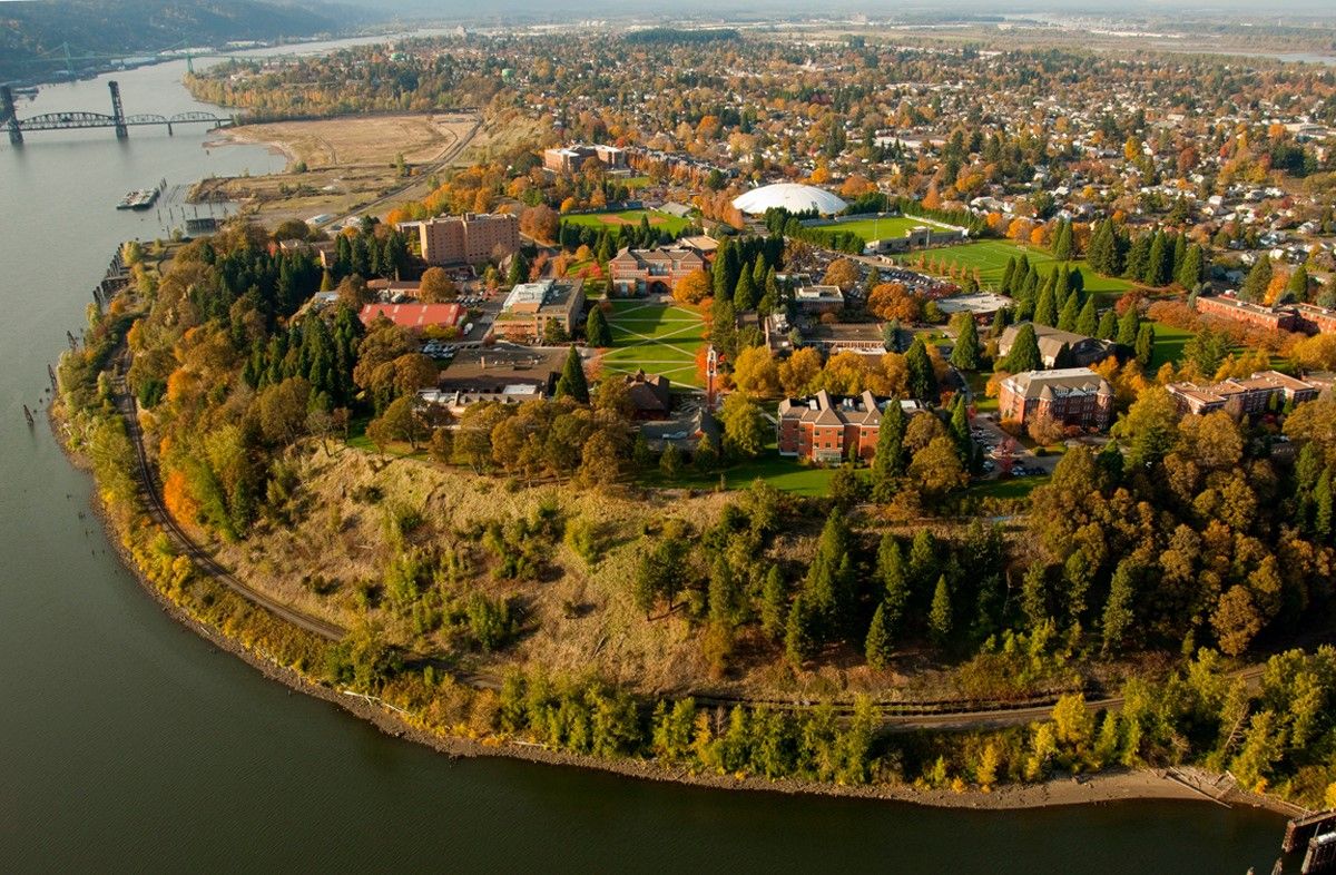
Map of project study area
North Portland in Motion will focus on the residential and commercial areas of North Portland west of Interstate 5.
Map of project study area
North Portland in Motion will focus on the residential and commercial areas of North Portland west of Interstate 5.

Long transit travel times, an incomplete biking network, unpaved streets, sidewalk gaps, and a lack of safe, accessible crossings make it hard for people to get around.
Through this project, PBOT will:
Talk with and seek feedback from North Portlanders to understand their transportation needs and what’s keeping them from reaching important places within – and outside of – North Portland.
Identify projects and programs we can start in the next five to ten years that will improve conditions for walking, biking, and transit.
Build new relationships with community-based organizations that represent the diverse neighborhoods and communities within North Portland.
Equity is a large focus of this project. We've already held two racial equity workshops about how to reach diverse and underserved communities. The resulting Racial Equity Memo shaped these and other public engagement goals:
Elevate voices from North Portland’s diverse communities, especially those who may have not been historically represented.
Intentionally place new, emerging, and disenfranchised community organizations and voices on a level playing field with more traditional community groups.
We understand that North Lombard Street is a vital north Portland corridor. Many safety improvements are now underway and being led by ODOT since the street is owned and maintained by the State. To learn more about the current construction and improvements, visit the project website here.
Find out more about the project and view project documents on the project webpage.
Image gallery contents:
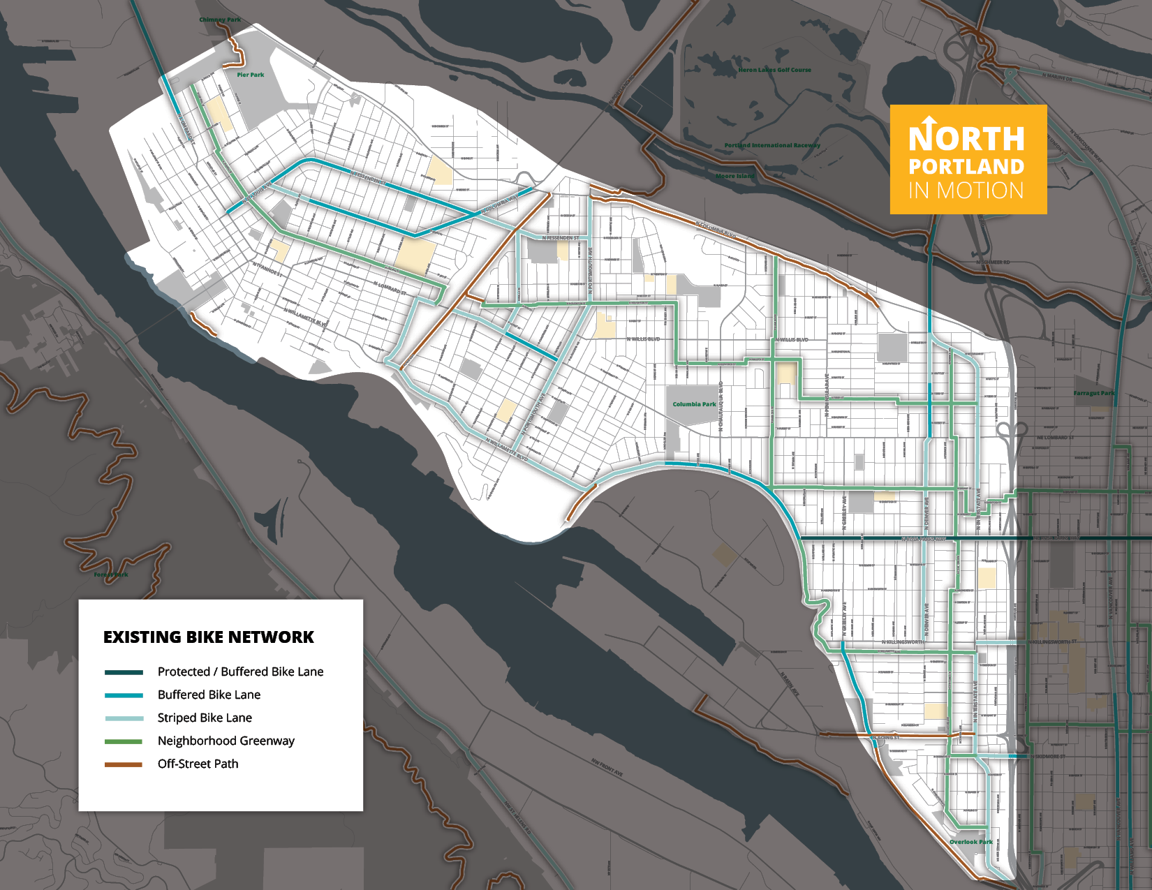
Map of bike network
NoPIM/nopim-ped-network
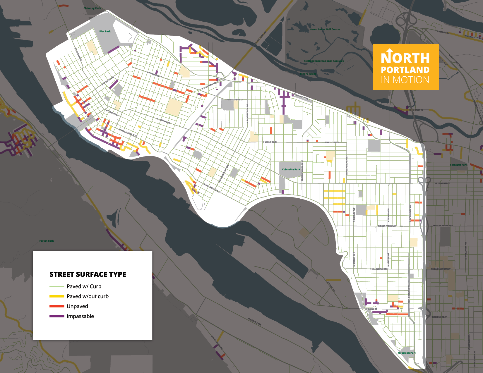
NoPIM/nopim-street-surface
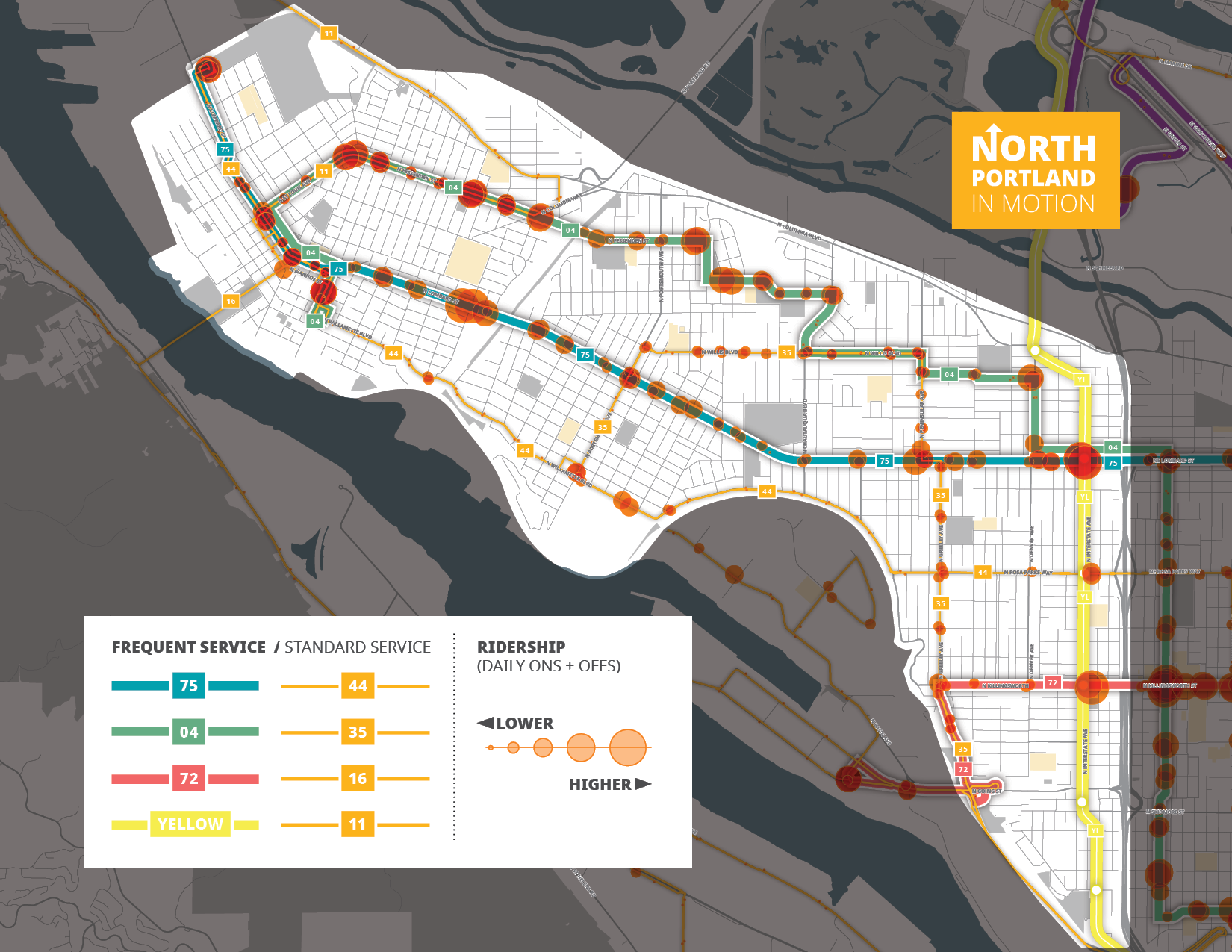
NoPIM/nopim-transit
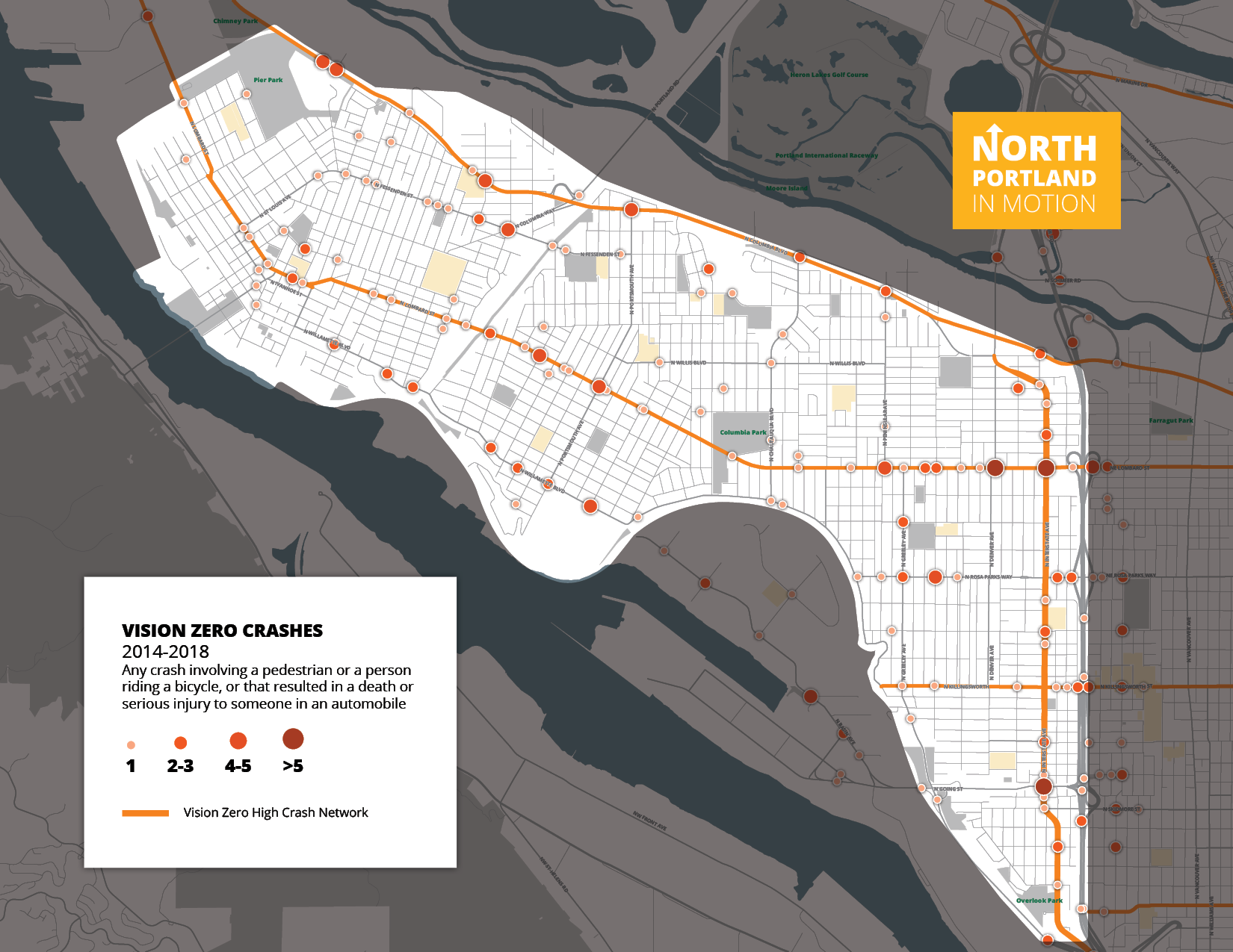
NoPIM/nopim-vision-zero
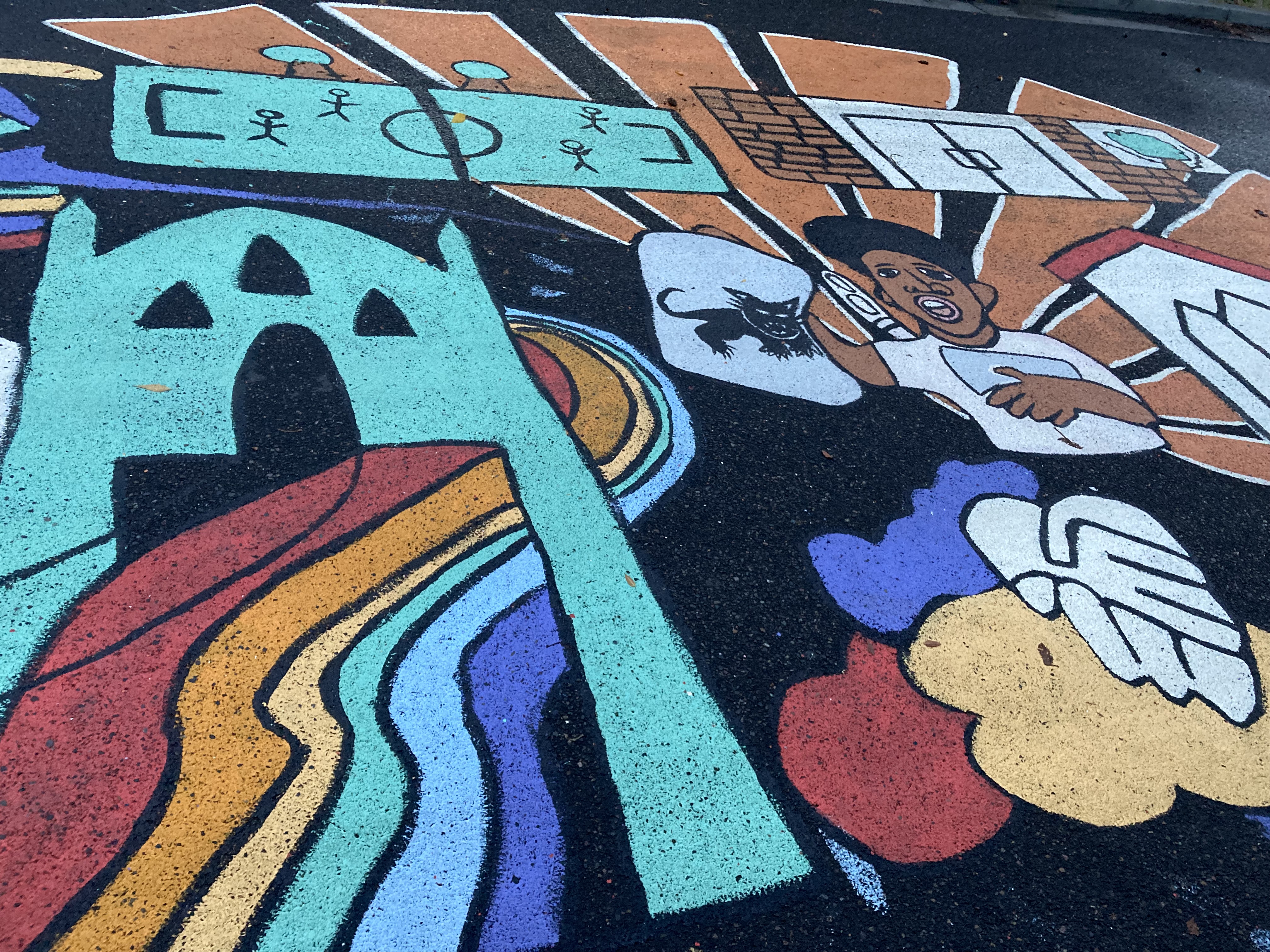
Street Mural


Click the plus sign (+) next to the different types of transportation to learn more!
PBOT documented current sidewalk locations and gaps, and the different types of crossings. North Portlanders said that sidewalk gaps make it hard for them to get where they need to go while walking and rolling. In the survey, people also said they would like more trees and lighting along streets, and signs to help them understand where they are and how to get places.
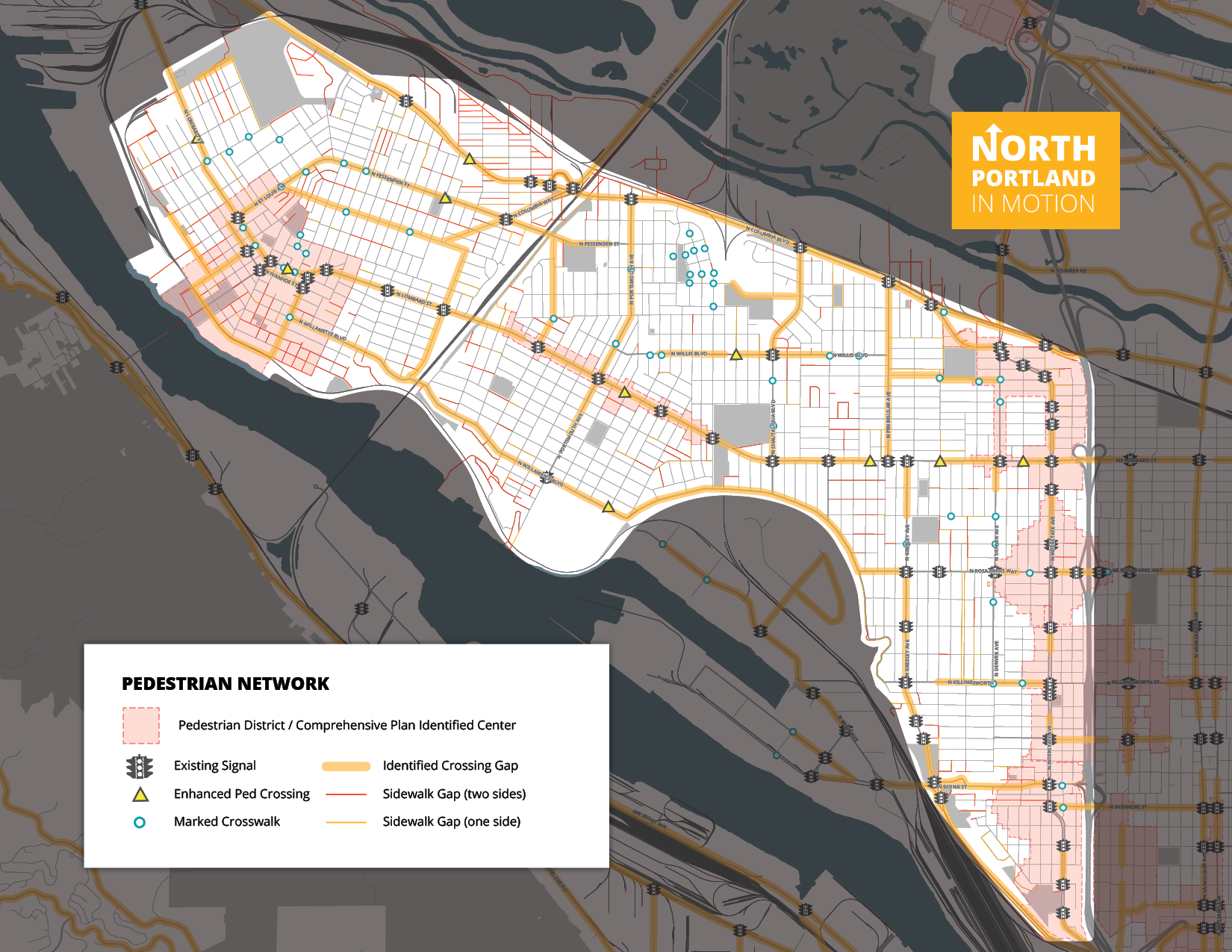
Click on the map to enlarge.
PBOT documented current gaps in the bicycling network and the extent (31.4 miles) of bike paths and bike lanes in North Portland. In the survey, people commented that the network is incomplete, has gaps and does not help people get to important community destinations. People would like new connections, upgraded bike lanes to add more protection, and an expanded and improved neighborhood greenway network.

Click on the map to enlarge.
PBOT found that people used the MAX Transfer and the Lombard Transit Center the most. In the survey, people mentioned long travel times and said buses don’t come to some stops often enough. People would like more reliable buses and faster service, as well as better amenities at bus stops. People would also like to see new or different bus routes for more direct service to important destinations.
Click on the map to enlarge.
PBOT studied the different street surfaces (paved, unpaved, etc.), how wide streets are, and the number of crashes (motor vehicle, walking, and biking). North Lombard Street, North Columbia Boulevard, and North Interstate Avenue are where most crashes occur. People are concerned about high-speed, cut-through traffic in neighborhoods, and would like to see traffic calming measures such as speed bumps. People would like better parking management (especially around high-density housing) and more traffic enforcement that addresses speeding and other reckless, illegal driving. People would like to be able to fulfill basic needs without a car.

Click on the map to enlarge.
Click on the map to enlarge.
People would like to see more public plazas, pop-ups (such as food carts, small shops, and farmer’s market stands), better maintained public areas, and new mobility services (bike/share).

Click on image to enlarge.
Image gallery contents:
Map of household income by neighborhood
Equity map by neighborhood
Map of racial diversity by neighborhood


Click the plus sign (+) next to each category to learn more!
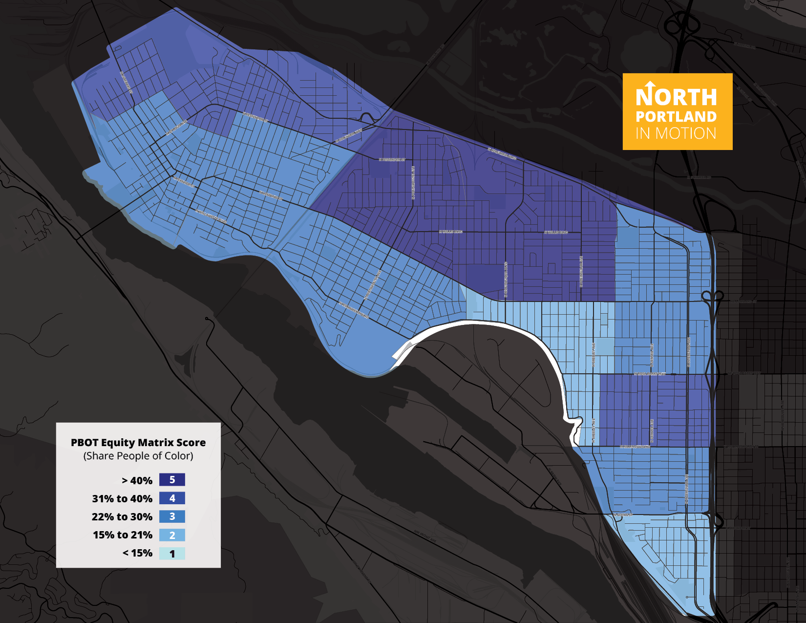
The study area is more racially diverse, with a higher share of Black, Indigenous, and other Residents of Color than Portland as a whole. The Portsmouth neighborhood is the most racially diverse on the peninsula, and one of the most racially diverse areas in Oregon. Less than 50 percent of residents identify as non-Hispanic White. The neighborhoods north of North Lombard Street and in the northern section of St Johns are more racially diverse as well.

Click on the map to enlarge.
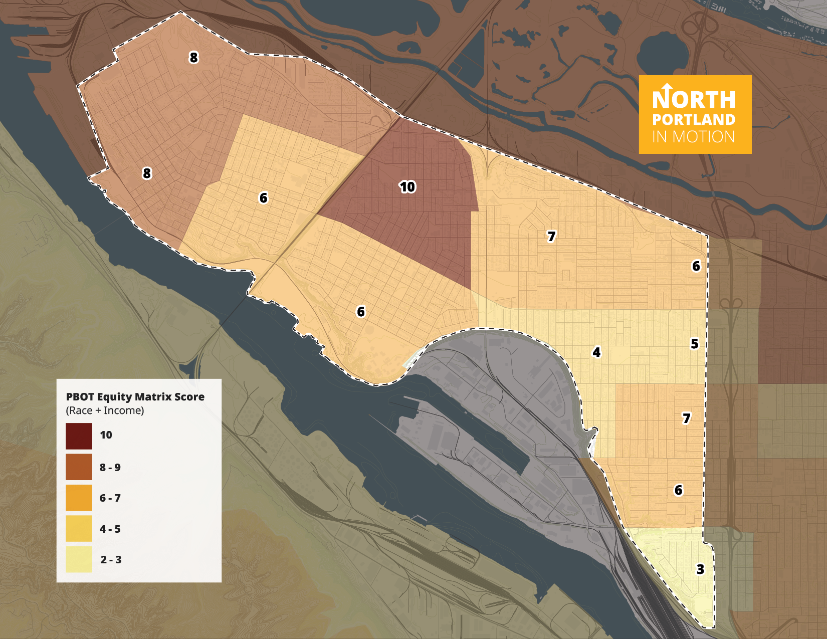
PBOT uses a simple ranking index called an Equity Matrix to help make decisions on projects and programs. This map uses data on race, ethnicity, and income to apply a score to census tracts (numbered areas in the Equity Matrix map below). Within the North Portland Study Area, the Portsmouth neighborhood and the upper section of St Johns have a high score. Both of these areas are home to larger affordable housing developments as well as higher shares of people who identify as a non-white and/or of Hispanic/Latino origin.
Click on the map to enlarge.
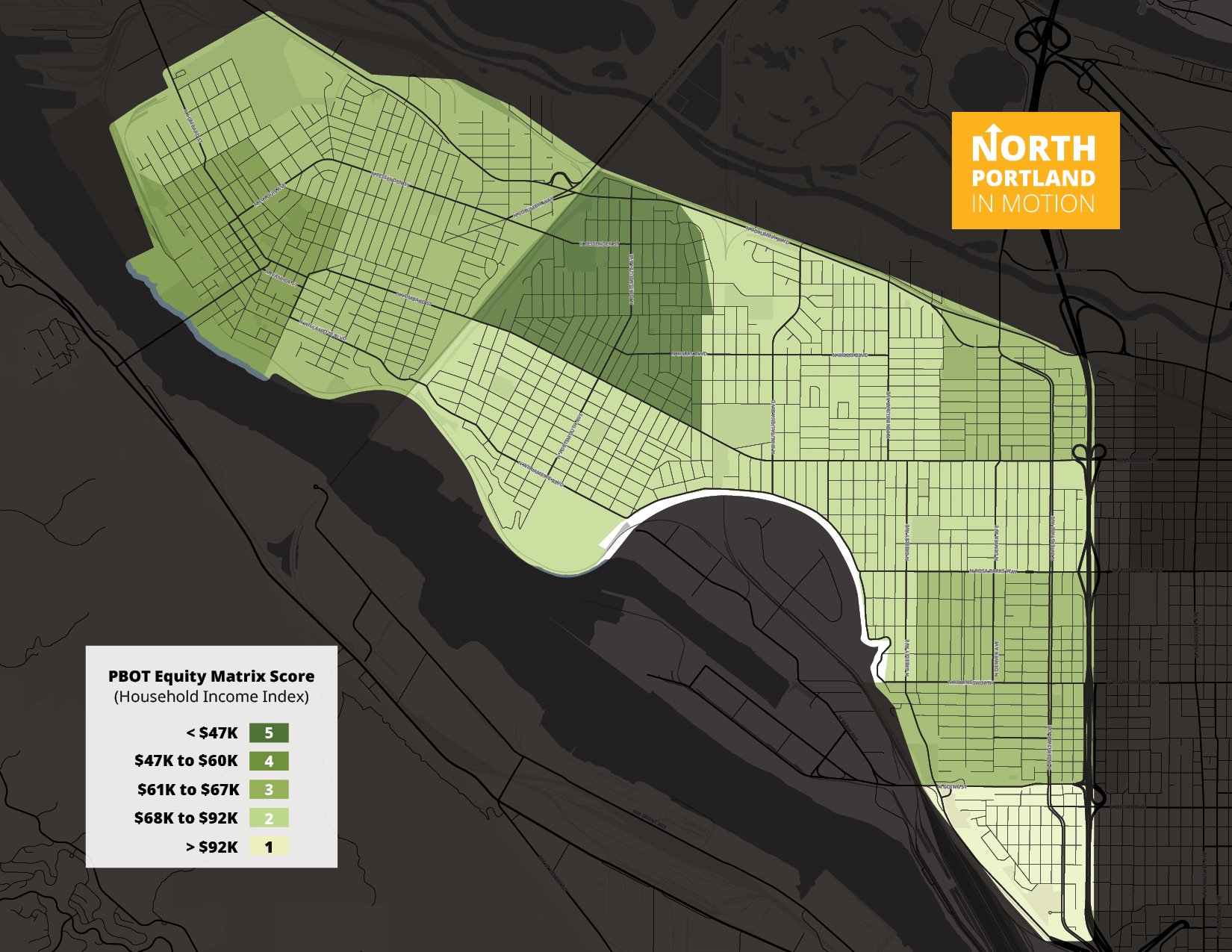
Household incomes in the study area generally are between $60,000 and $80,000 a year. Median household income in the western side of the Portsmouth neighborhood is just over $40,000 a year. This neighborhood is home to New Columbia, the state’s largest affordable housing development. The lower section of the Overlook neighborhood south of North Going Street has a median household income of just over $100,000 a year.

Click on the map to enlarge.
Image gallery contents:
Map of important places in North Portland
Paul Bunyan Statue
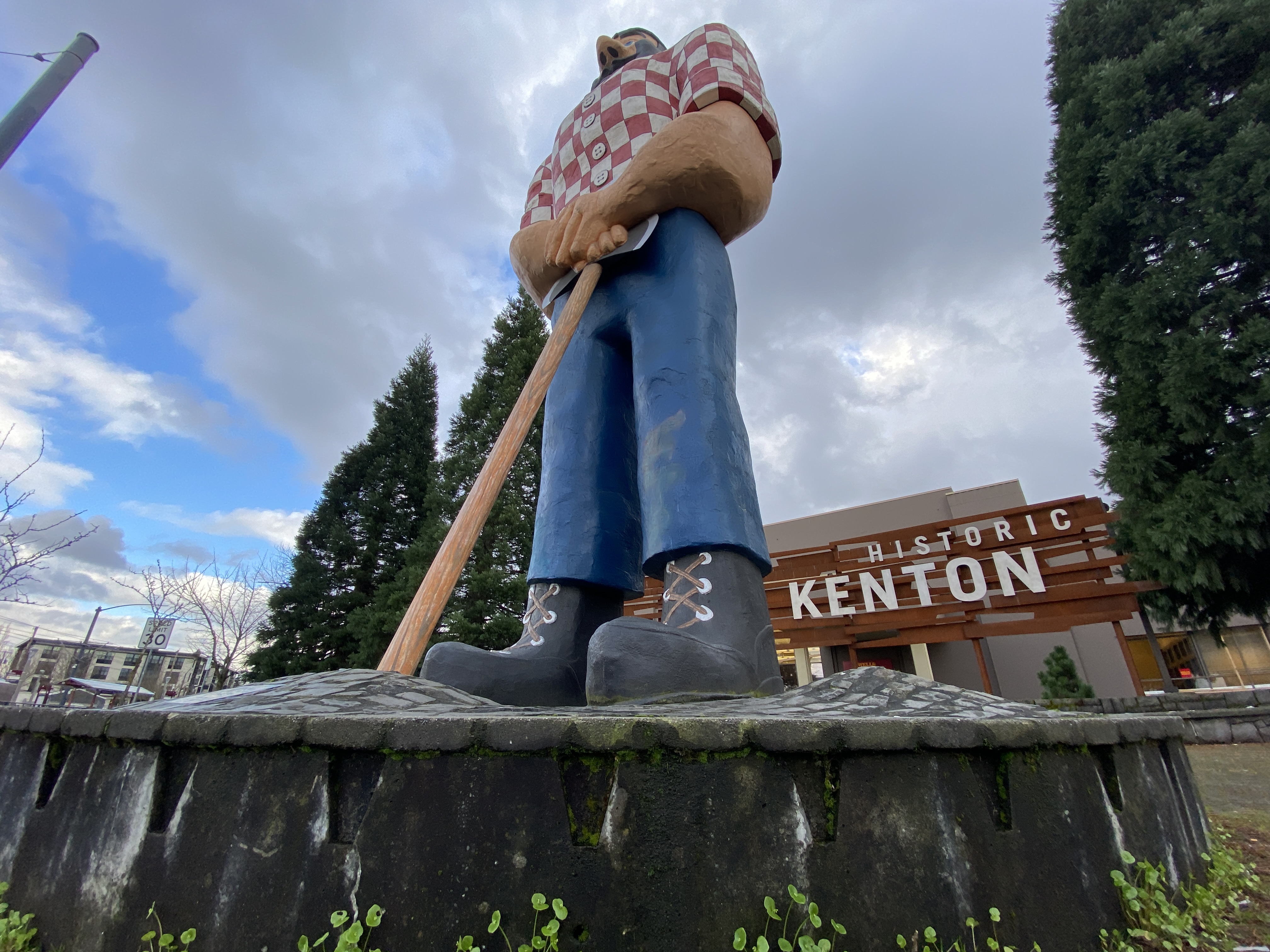
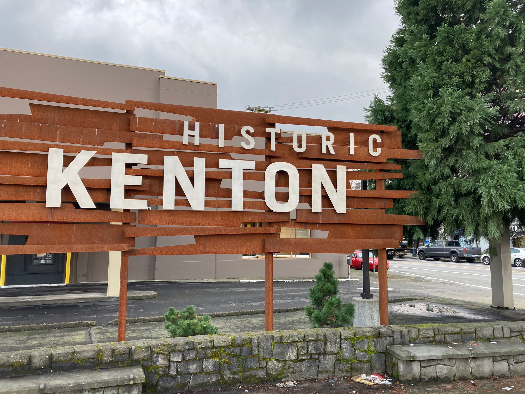
Historic Kenton Sign
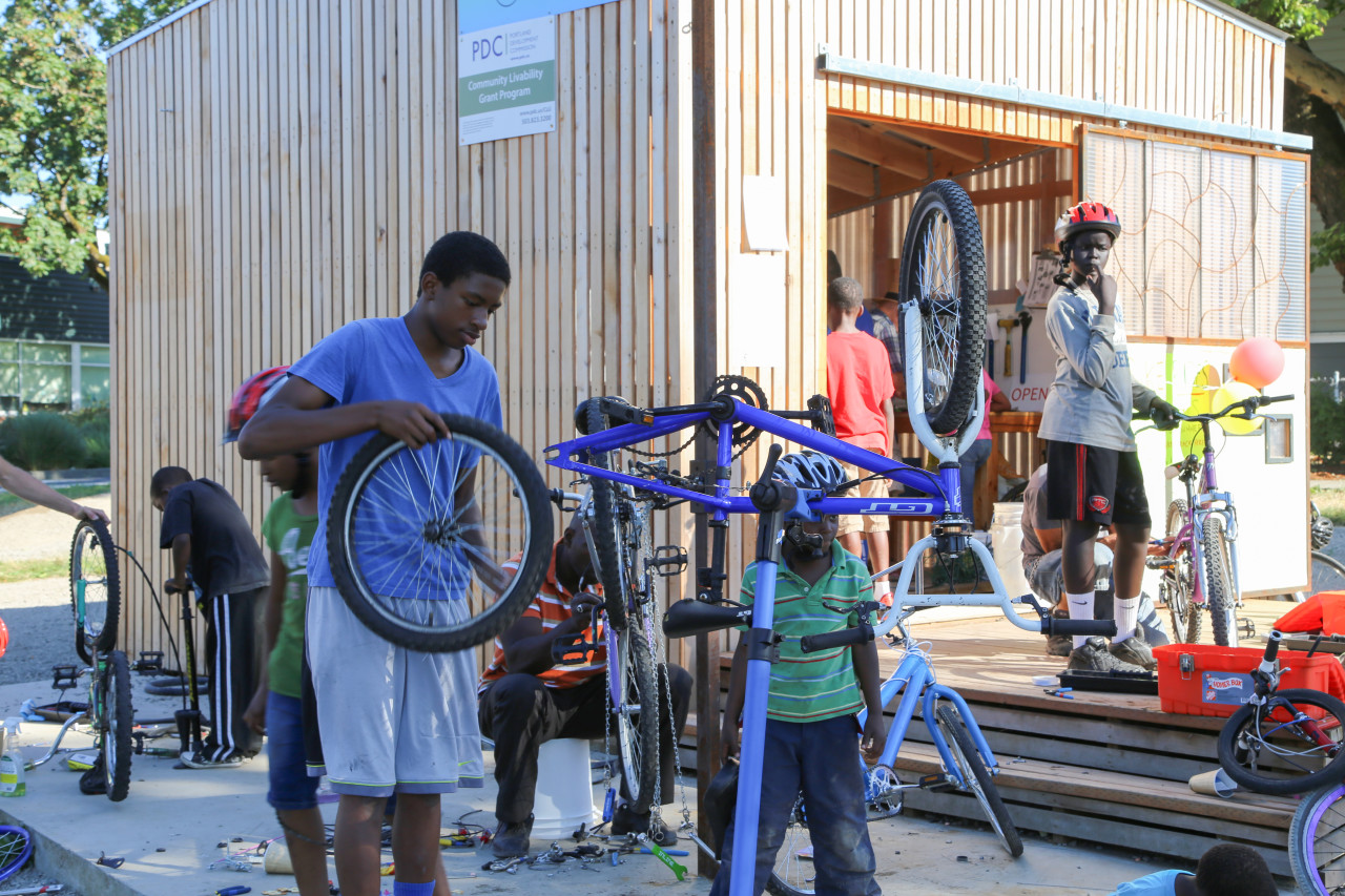
People fixing bikes at New Columbia
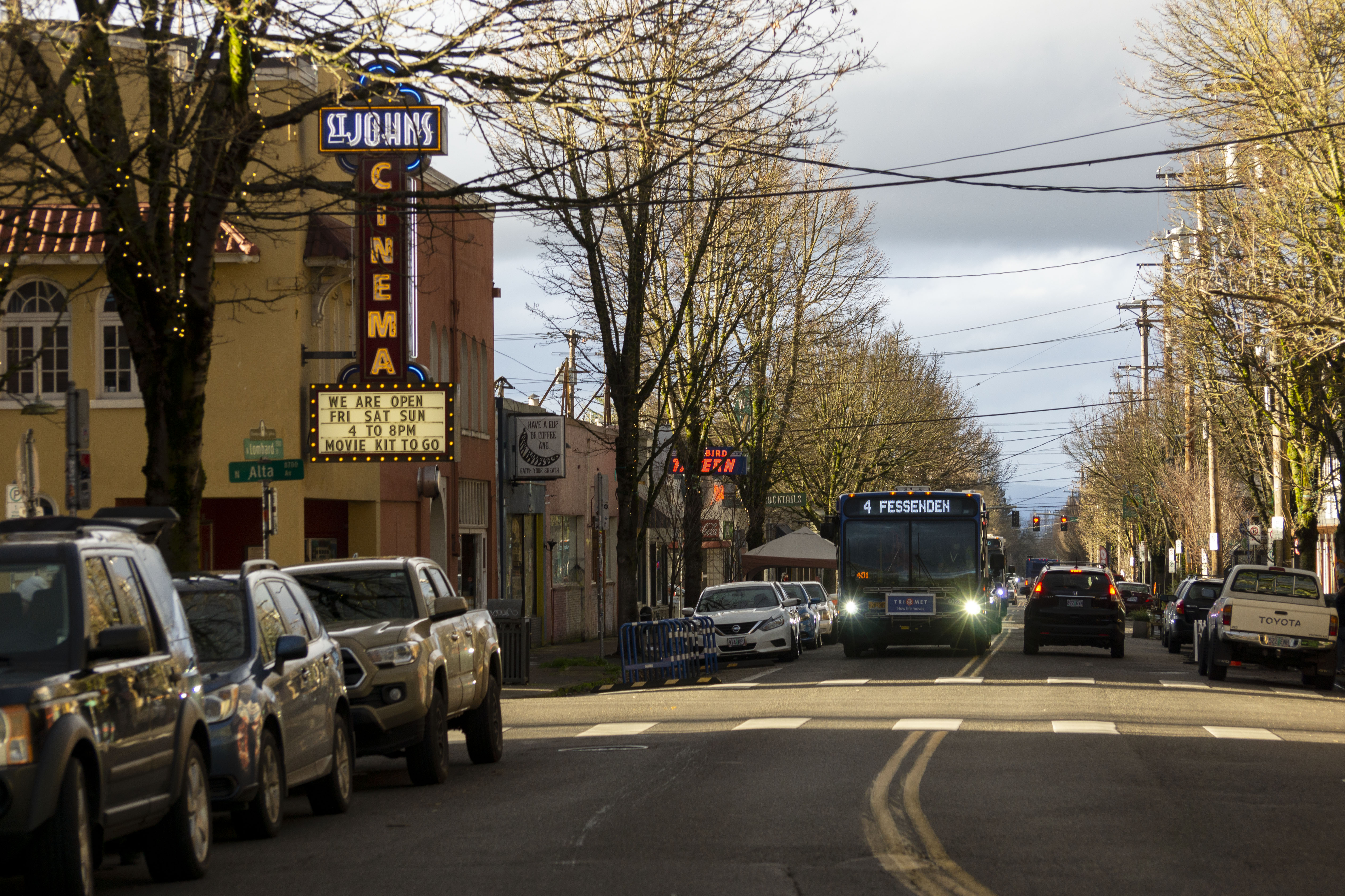
St Johns Cinema - Main Street
University of Portland


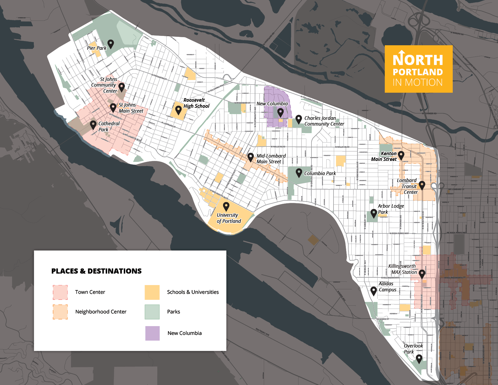


The North Portland in Motion study area is home to seven neighborhoods, each has a unique and strong civic identity. Within these neighborhoods are important places like main streets, schools, parks, and other public spaces.
We've put these places into three categories:
Community, Learning, and Health
Recreation and Nature
Commerce, Activation, and Connection
Take a look at the map to see some of the places we've identified so far.

Click on the map to enlarge.


Click images to enlarge.
Can't see the map? Click here to reload.
If you do not wish to use the map, or if you want to provide general comments about the area, please provide feedback on the "Share your ideas" page.
Image gallery contents:
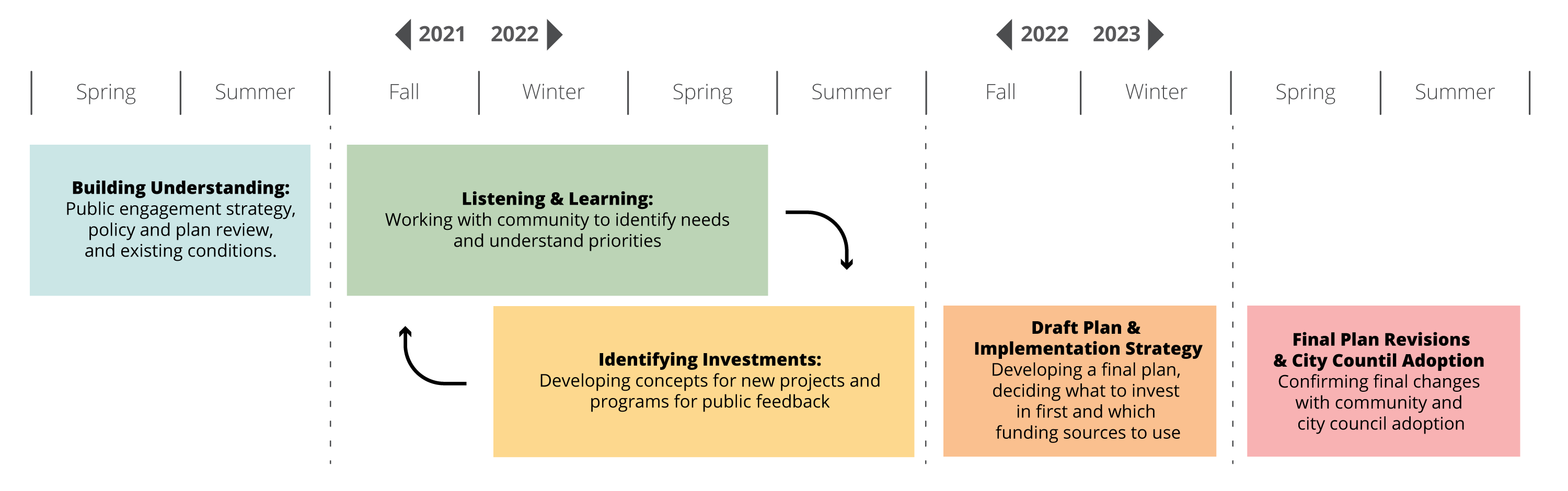
Timeline
Spring/Summer 2021: Building Understanding. Fall 2021 through Summer 2022: Listening and learning, identifying investments. Fall/Winter 2022: Draft Plan and Implementation Strategy. Spring/Summer 2023: Final Plan Revisions and City Council Adoption.
Timeline
Spring/Summer 2021: Building Understanding. Fall 2021 through Summer 2022: Listening and learning, identifying investments. Fall/Winter 2022: Draft Plan and Implementation Strategy. Spring/Summer 2023: Final Plan Revisions and City Council Adoption.

Your feedback will help shape priorities for the North Portland In Motion plan as we draft a list of transportation projects that could be in the final plan.
We’ll share this draft list in Spring 2022 and ask what you think. You can sign up to receive emails about North Portland in Motion by joining our email list.
Click image to enlarge.
The City of Portland ensures meaningful access to City programs, services, and activities to comply with Civil Rights Title VI and ADA Title II laws and reasonably provides: translation, interpretation, modifications, accommodations, alternative formats, auxiliary aids and services. To request these services, contact 311 (or bureau contact 503-823-4416), Relay Service: 711.
