Stations
Go directly to a station using the buttons below, or at the top of the screen to move through the stations in order.
= Page includes questions or opportunities for comment.


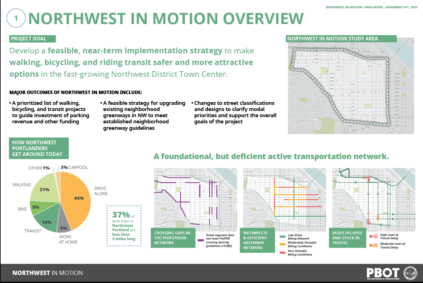

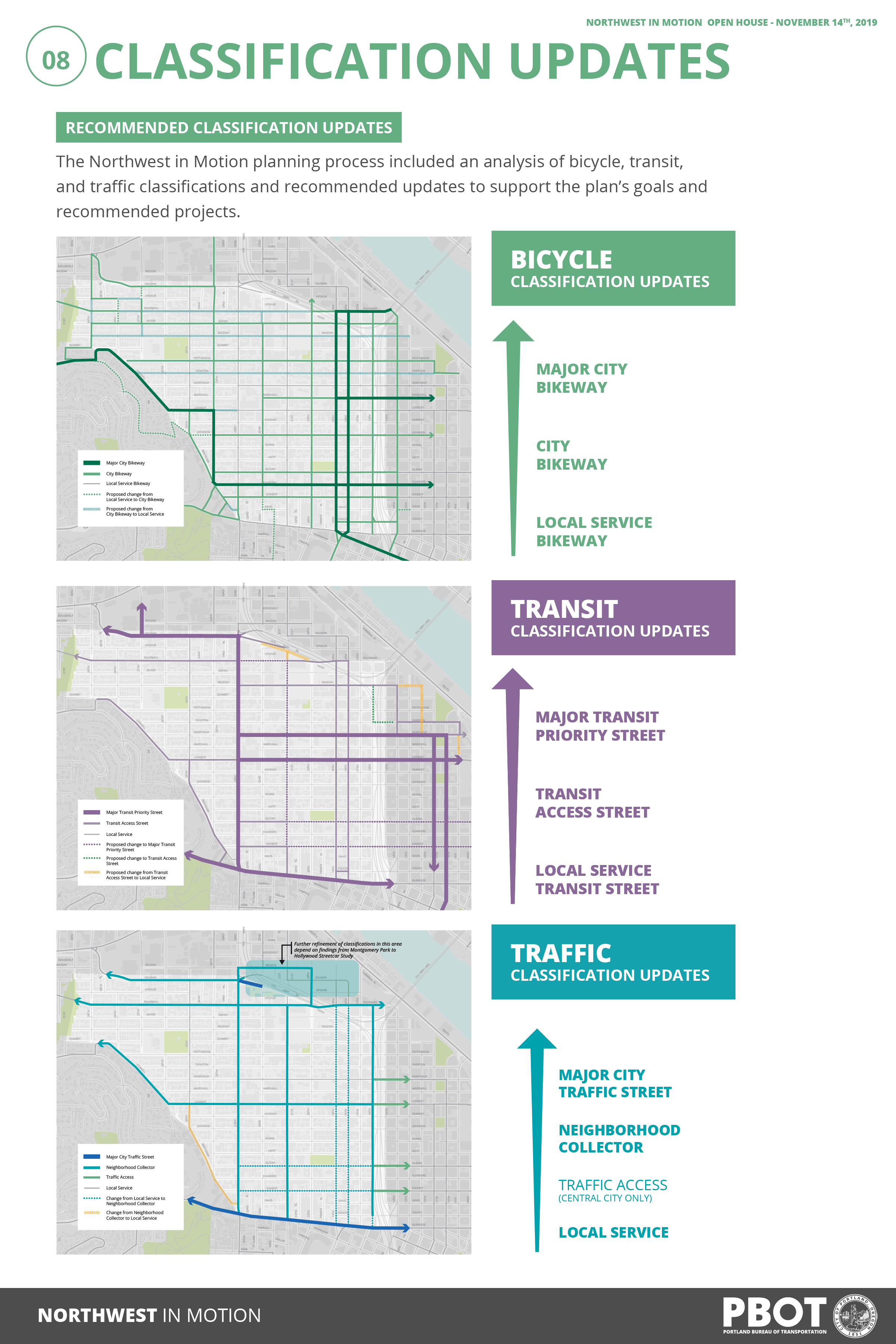
Major outcomes of Northwest in Motion include:
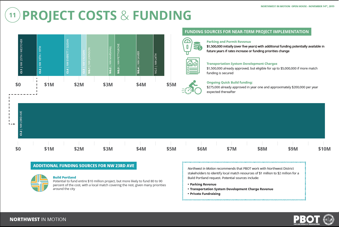
- A prioritized list of walking, bicycling, and transit projects to guide investment of parking revenue and other funding
- A feasible strategy for upgrading existing neighborhood greenways in NW to meet established neighborhood greenway guidelines
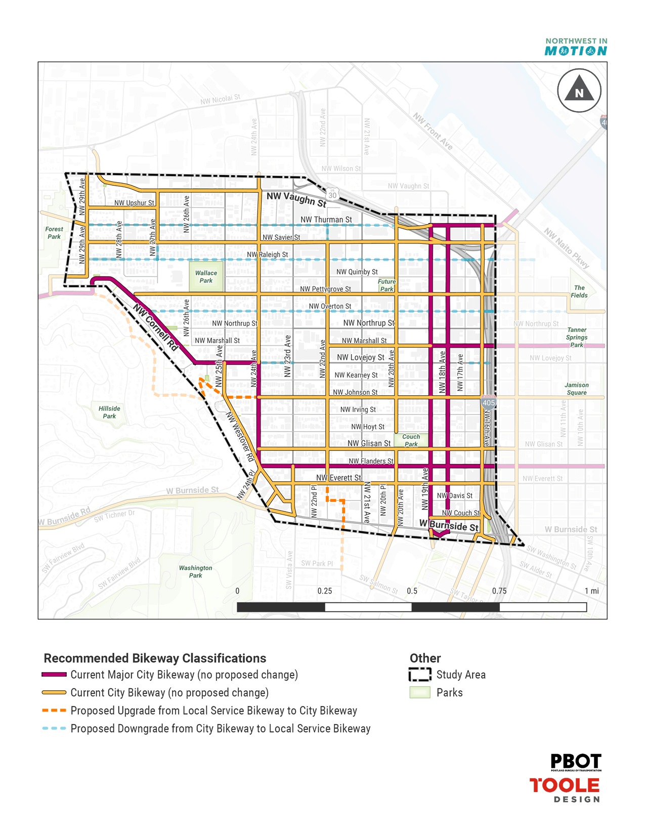
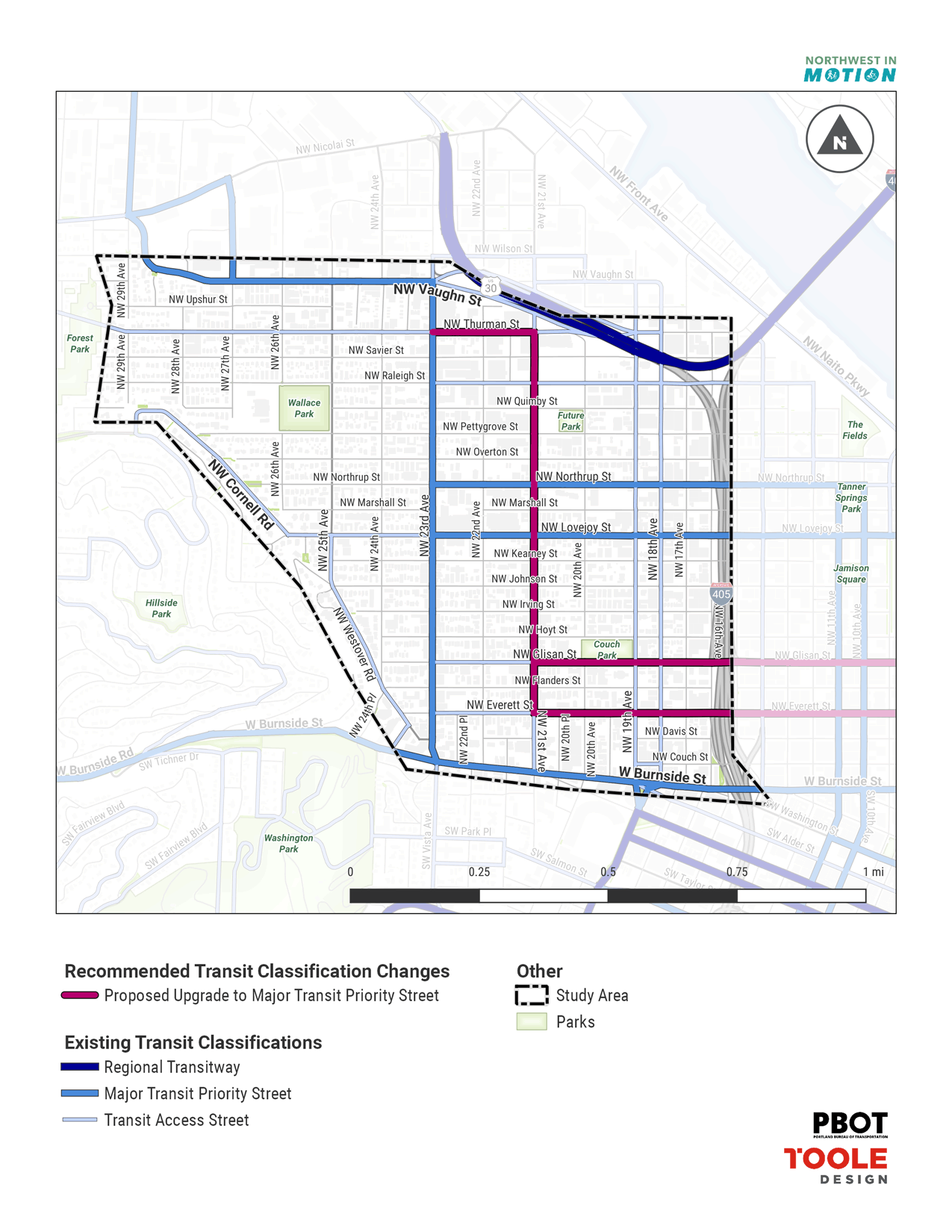
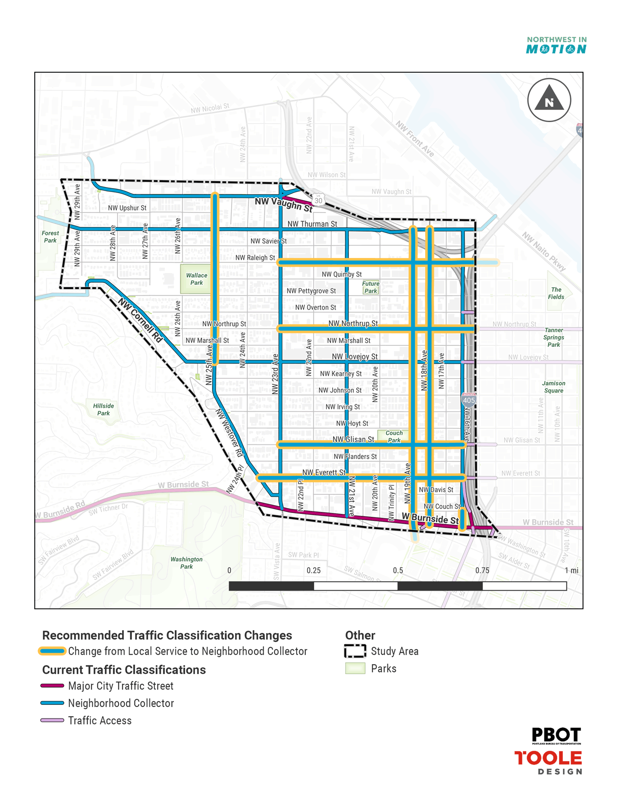
- Changes to street classifications and designs to clarify modal priorities and support the overall goals of the project
Thanks for your help with shaping this plan.
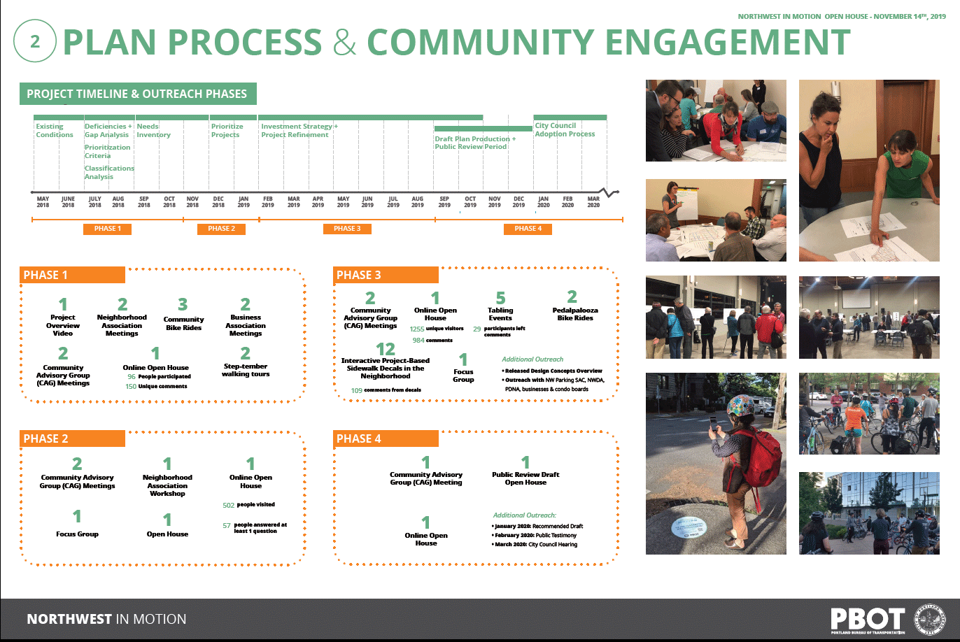
Since May 2018, the project team has engaged thousands of Portlanders who travel within and in and out of the Northwest district. Outreach helped form the list of recommendations and projects included in the current Public Review Draft of the Northwest in Motion Plan. Outreach included the involvement of a Community Advisory Group, multiple public events, bike rides and walks, focus groups, online engagement and more.
Review the displays for more information on:
- Study area map
- The ways people currently travel within Northwest Portland
- Current deficiencies of the network
- Project timeline and outreach phases
- Outreach activities for each phase
Click images to enlarge and zoom.


PLAN BENEFITS
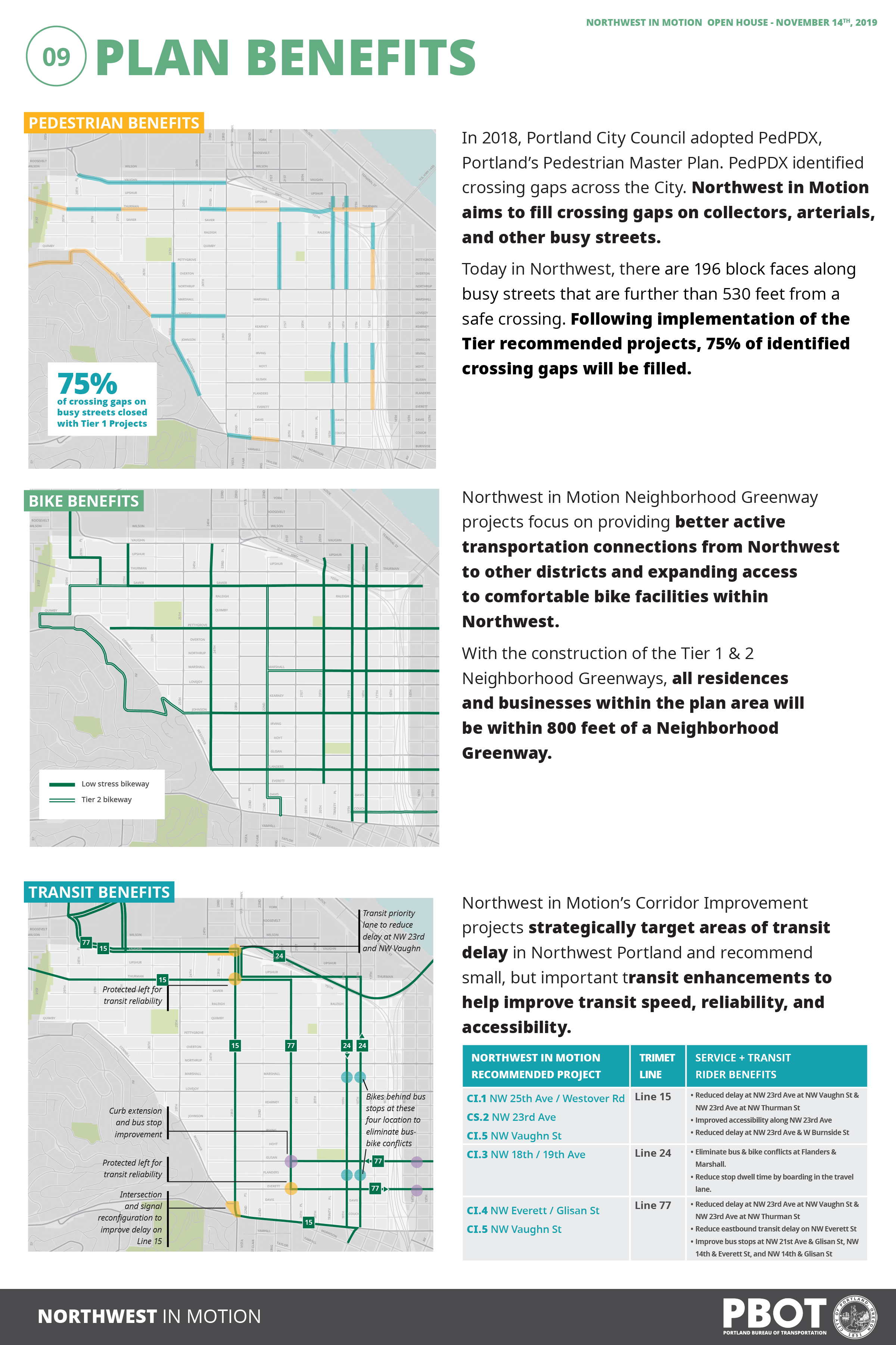
Pedestrian Benefits
In 2018, Portland City Council adopted PedPDX, Portland’s Pedestrian Master Plan. PedPDX identifed crossing gaps across the City. Northwest in Motion aims to fil crossing gaps on collectors, arterials, and other busy streets.
Today in Northwest, there are 196 block faces along busy streets that are further than 530 feet from a safe crossing. Following implementation of the Tier recommended projects, 75% of identifed crossing gaps will be filed.
Bike Benefits
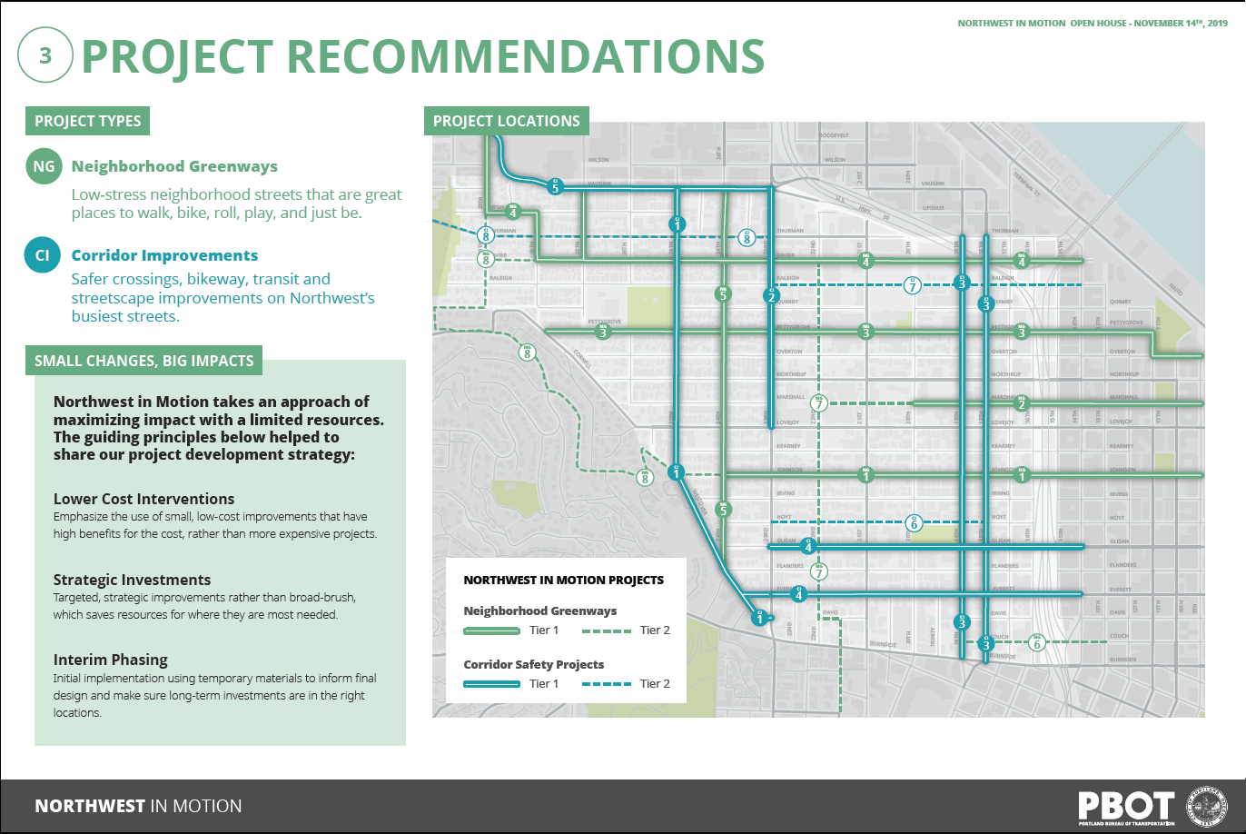
Northwest in Motion Neighborhood Greenway projects focus on providing better active transportation connections from Northwest to other districts and expanding access to comfortable bike facilities within Northwest.
With the construction of the Tier 1 & 2 Neighborhood Greenways, all residences and businesses within the plan area will be within 800 feet of a Neighborhood Greenway.
Transit Benefits
Northwest in Motion’s Corridor Improvement projects strategically target areas of transit delay in Northwest Portland and recommend small, but important transit enhancements to help improve transit speed, reliability, and accessibility.
PLAN IMPACTS
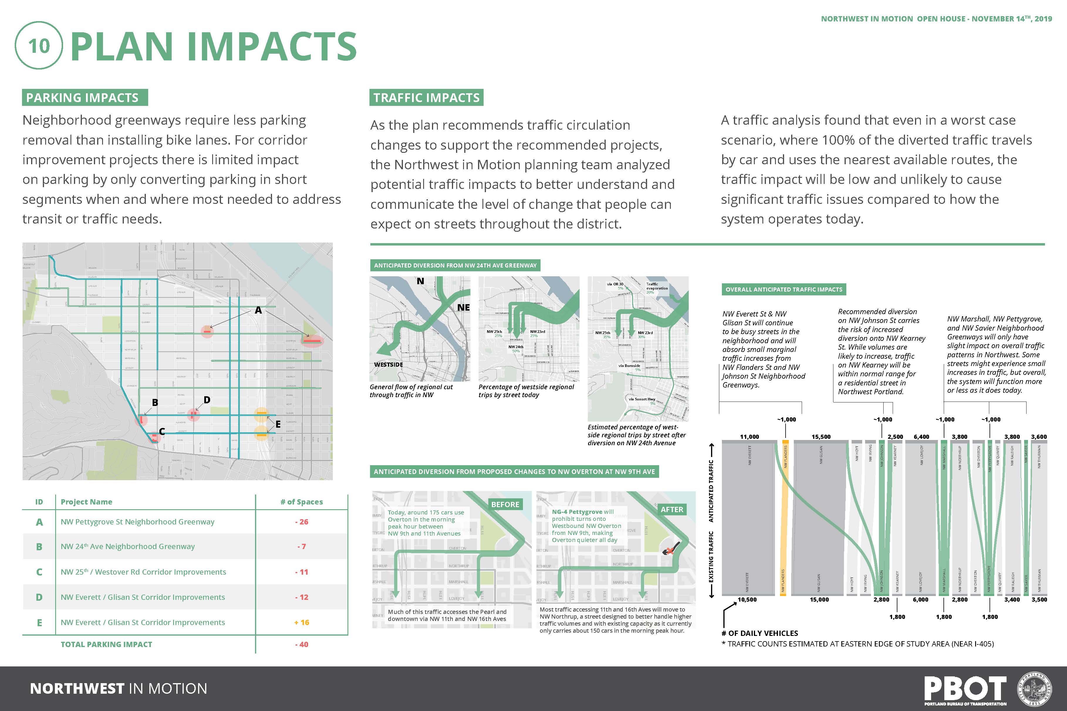
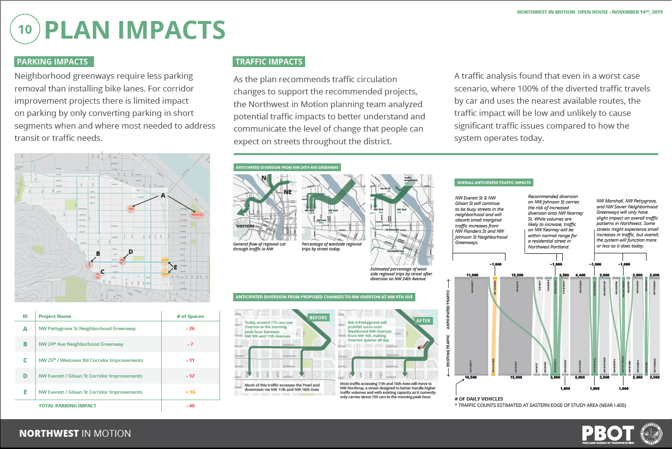
Parking Impacts
Neighborhood greenways require less parking removal than installing bike lanes. For corridor improvement projects there is limited impact on parking by only converting parking in short segments when and where most needed to address transit or traffic needs.
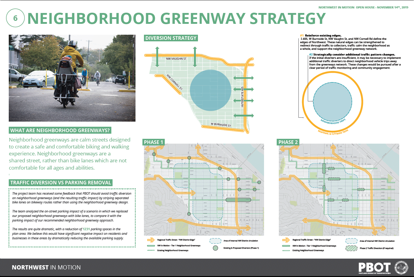
Traffic Impacts
As the plan recommends traffic circulation changes to support the recommended projects, the Northwest in Motion planning team analyzed potential traffic impacts to better understand and communicate the level of change that people can expect on streets throughout the district.
A traffic analysis found that even in a worst case scenario, where 100% of the diverted traffic travel by car and uses the nearest available routes, the traffic impact will be low and unlikely to cause significant traffic issues compared to how the system operates today.
Review displays for more information. Click images to enlarge and zoom.


What happens next?
Your feedback on this Public Review Draft will help the project team make refinements before issuing a Recommended Draft to City Council in early 2020. Please respond to the questions below in the space provided, and be as specific as you can.
Stay Involved
- Review the full Public Review Draft of the Northwest in Motion plan
- Sign up for email updates using the survey on this page.
- Contact us directly: NWinMotion@portlandoregon.gov
- Follow “Portland Bureau of Transportation (PBOT)” on Facebook
- Follow @PBOTinfo on Twitter
Survey Questions
Scroll to respond to the 12 brief questions. Thank you!
The City of Portland complies with all non‐discrimination, Civil Rights laws including Civil Rights Title VI and ADA Title II. To help ensure equal access to City programs, services and activities, the City of Portland will reasonably modify policies/procedures and provide auxiliary aids/services to persons with disabilities. Call 503-823-5185, TTY 503-823-6868 or Oregon Relay Service: 711 with such requests, or visit http://bit.ly/13EWaCg.
