This online open house is now closed to new responses. You can always submit feedback from our website.
At this online open house, you can review proposed transportation solutions and share your top transportation priority projects for walking, biking, driving, freight and public transit improvements. This is an important point for you to weigh in on the project. We will use your answers to these questions to inform the project team as solutions are prioritized to meet Newport’s transportation and transit needs over the next 20 years. We will come back with refined solutions/options during the next outreach event.
Stations
Go directly to a station using the buttons below, or at the top of the screen to move through the stations in order. You can review and provide feedback on any or all of the areas that interest you. You do not have to visit every page or answer every question.

= Page includes questions or opportunities for comment.
Actualización del Plan de Transporte Casa Abierta en línea
Cómo ayudará su opinion: La ciudad de Newport y el Departamento de Transporte de Oregón están actualizando el Plan del Sistema de Transporte (TSP). Este es un plan de largo alcance en el que se basan todas las mejoras futuras en el transporte de la ciudad.
Su opinión a través de este proceso de planificación informará cómo se debe gastar el dinero futuro. Imprima esta encuesta y envíela antes del 13 de diciembre
Image gallery contents:
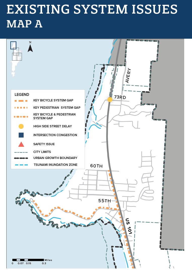
Existing Issues 1/4
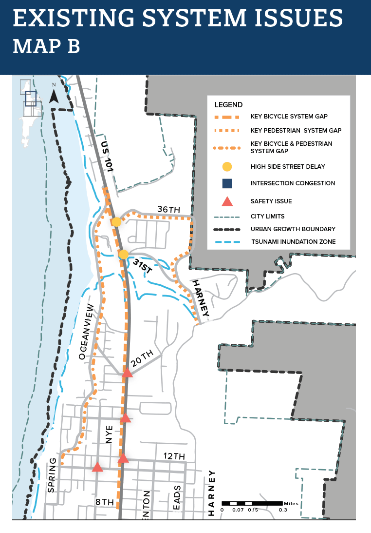
Existing Issues 2/4
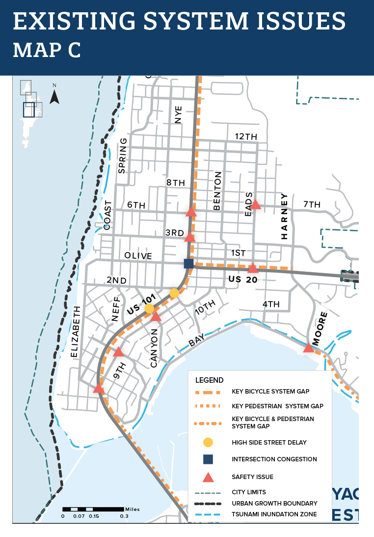
Existing Issues 3/4
Existing Issues 4/4


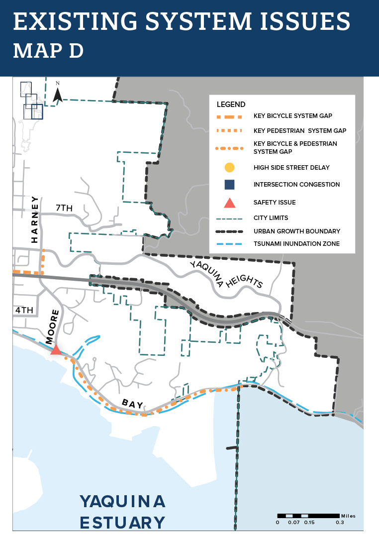

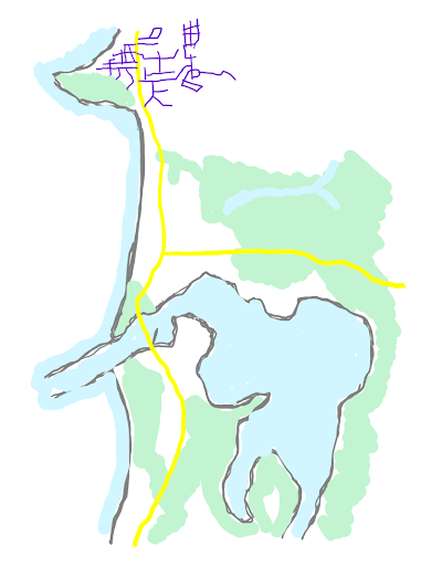
Vision 2040 is a plan completed by the City of Newport that helped gather the community's idea for what Newport should look like in 2040. The Transportation System Plan (TSP) project looked at the transportation related strategies to inform the stakeholder outreach and to determine how best to implement the 2040 strategies.
After completing dozens of stakeholder interviews and collecting comments we found these existing system issues, shown on these maps.
These maps show the current paths, roads, and bike facilities in Newport as well as areas that feel unsafe or are dangerous.
Questions
Image gallery contents:
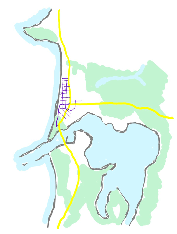
Citywide
Potential parallel routes
Potential parallel routes for pedestrians and bikes
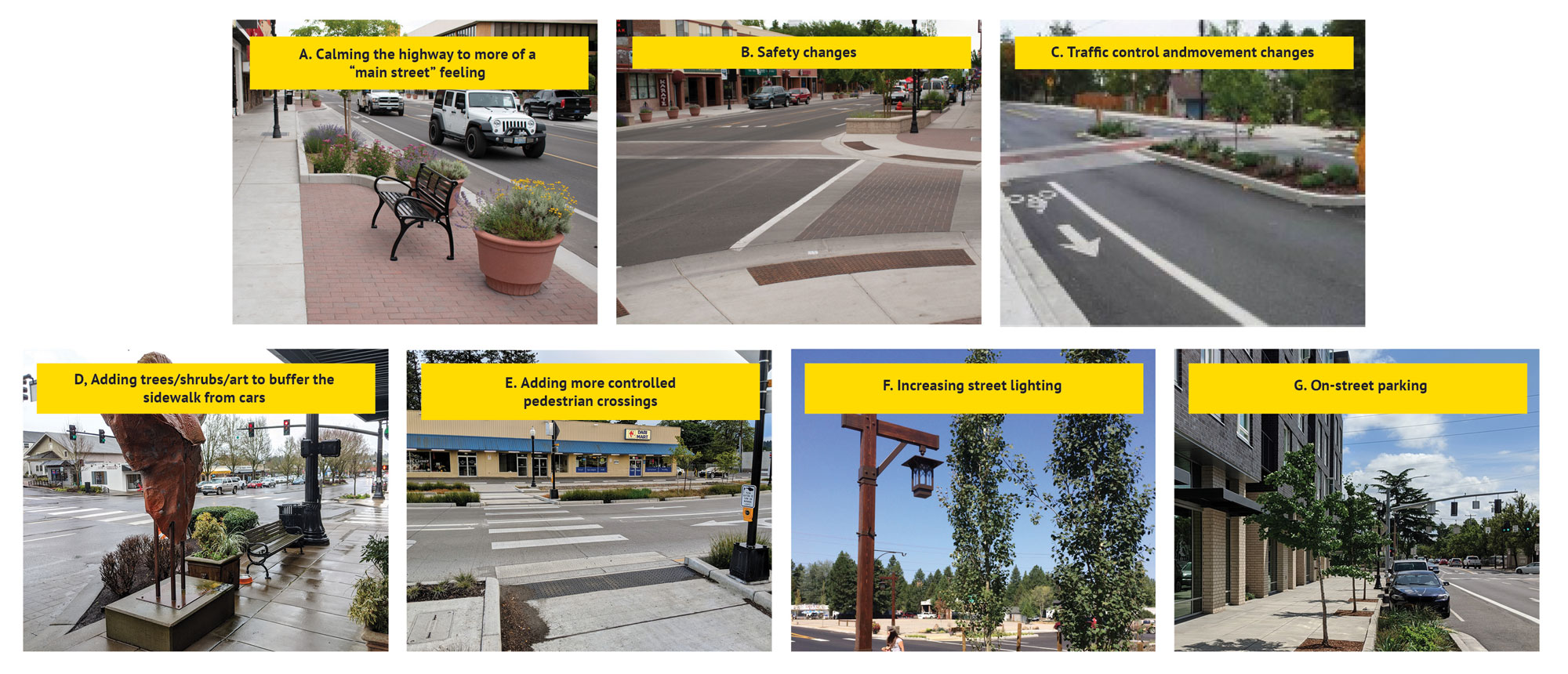
Traffic calming strategies
Newport Local Street Cross Section


Transportation Issues
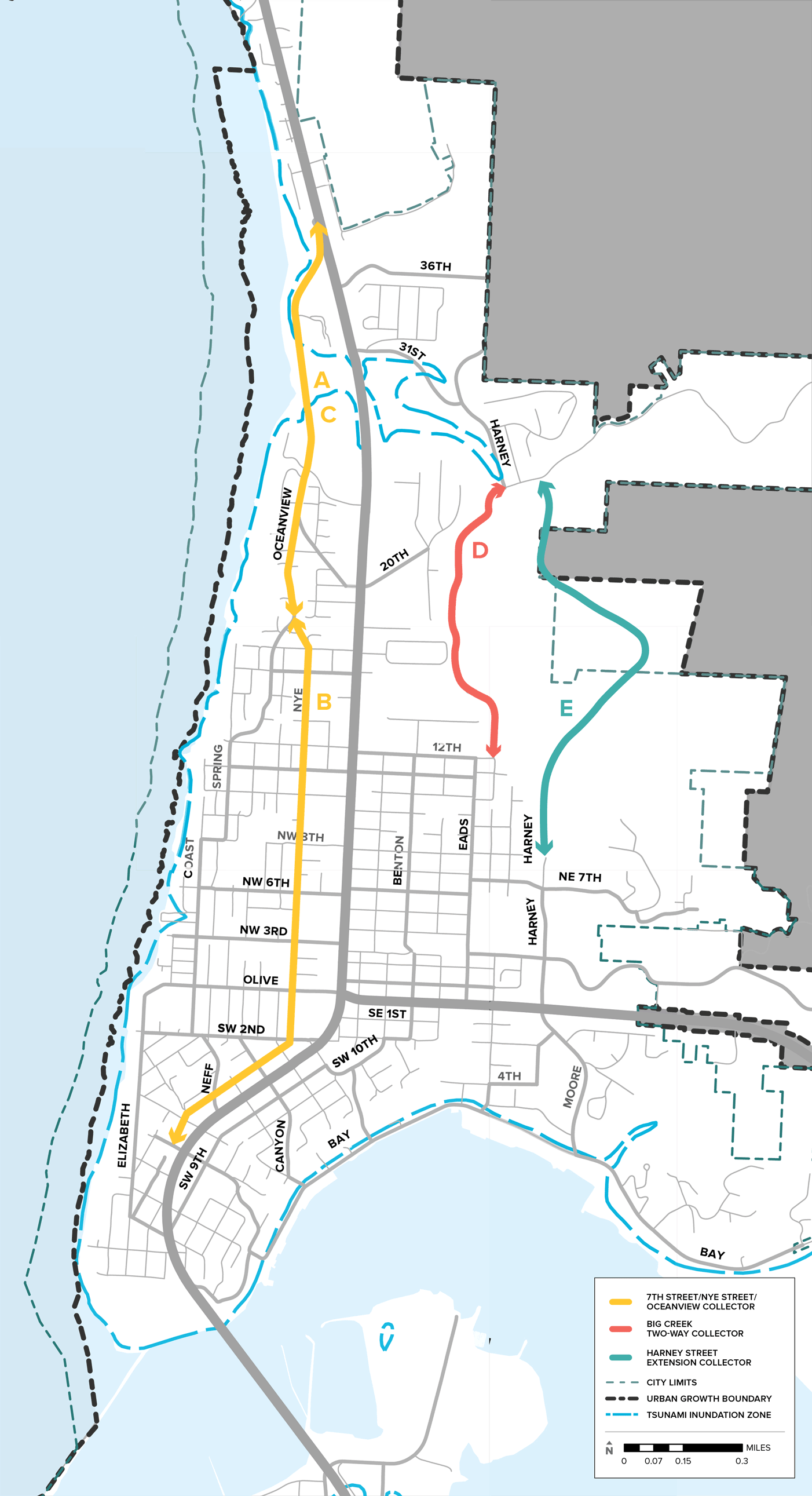
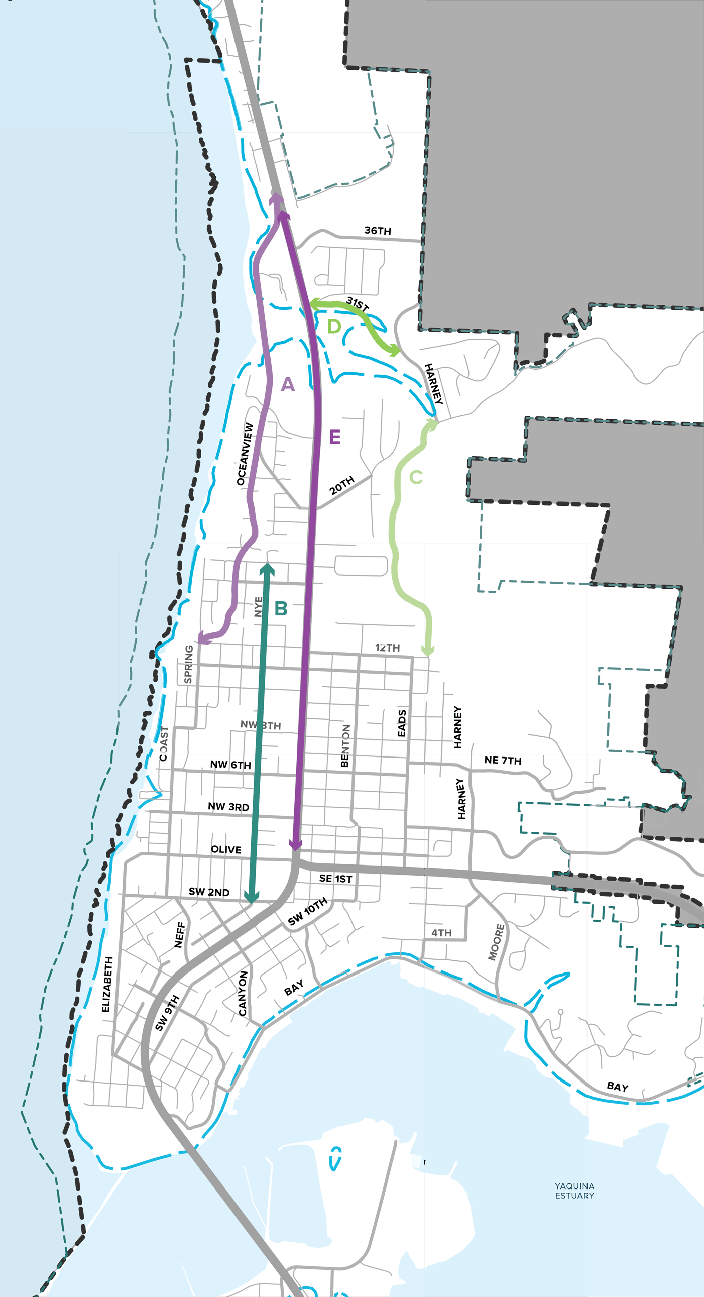
Throughout the early phases of outreach, we heard many concerns about Highway 101 for the future of Newport. Safety and summer tourist traffic were the two most common issues. The technical team would like to know what you think about an idea for a citywide bikeway off Highway 101 and the potential for a street that parallels Highway 101 for local use.
Questions
The technical team has developed a few solutions to these community needs. Tell us what you think!
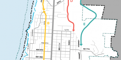
During stakeholder interviews, we heard that the community wants a way to get around town in a car without using Highway 101. Of the three parallel routes to Highway 101 (that we are currently looking into) each currently looks quite different. Which alignment do you think will best serve the local community's future needs?
(Check all that apply.)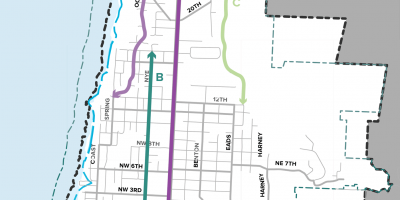
We heard that the community would like a bike network that allows travel on local streets, particularly north/south travel off of Hwy 101. Which local street do you think will best serve the local community's future needs for a north/south bikeway?
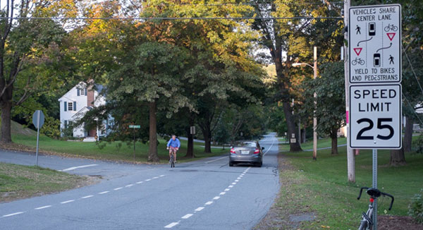
(Check all that apply.)Some of the solutions we are looking at include traffic calming, a technique for keeping people who are walking and biking safer as well as deterring cut-through traffic, but which also reduces vehicle travel speeds and may delay emergency response times.
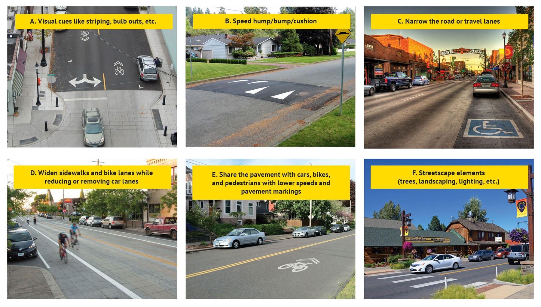
(Click to enlarge.)
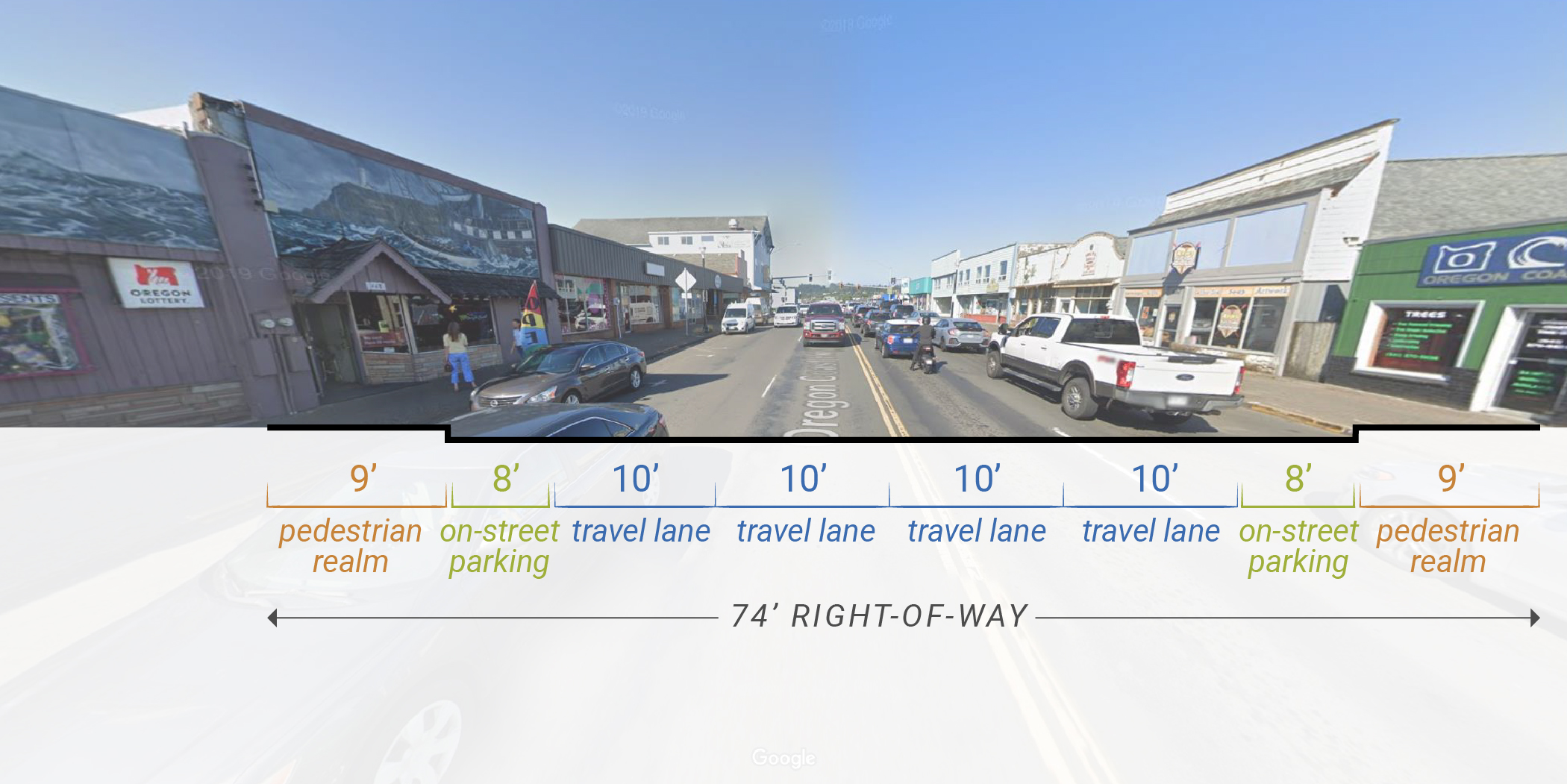
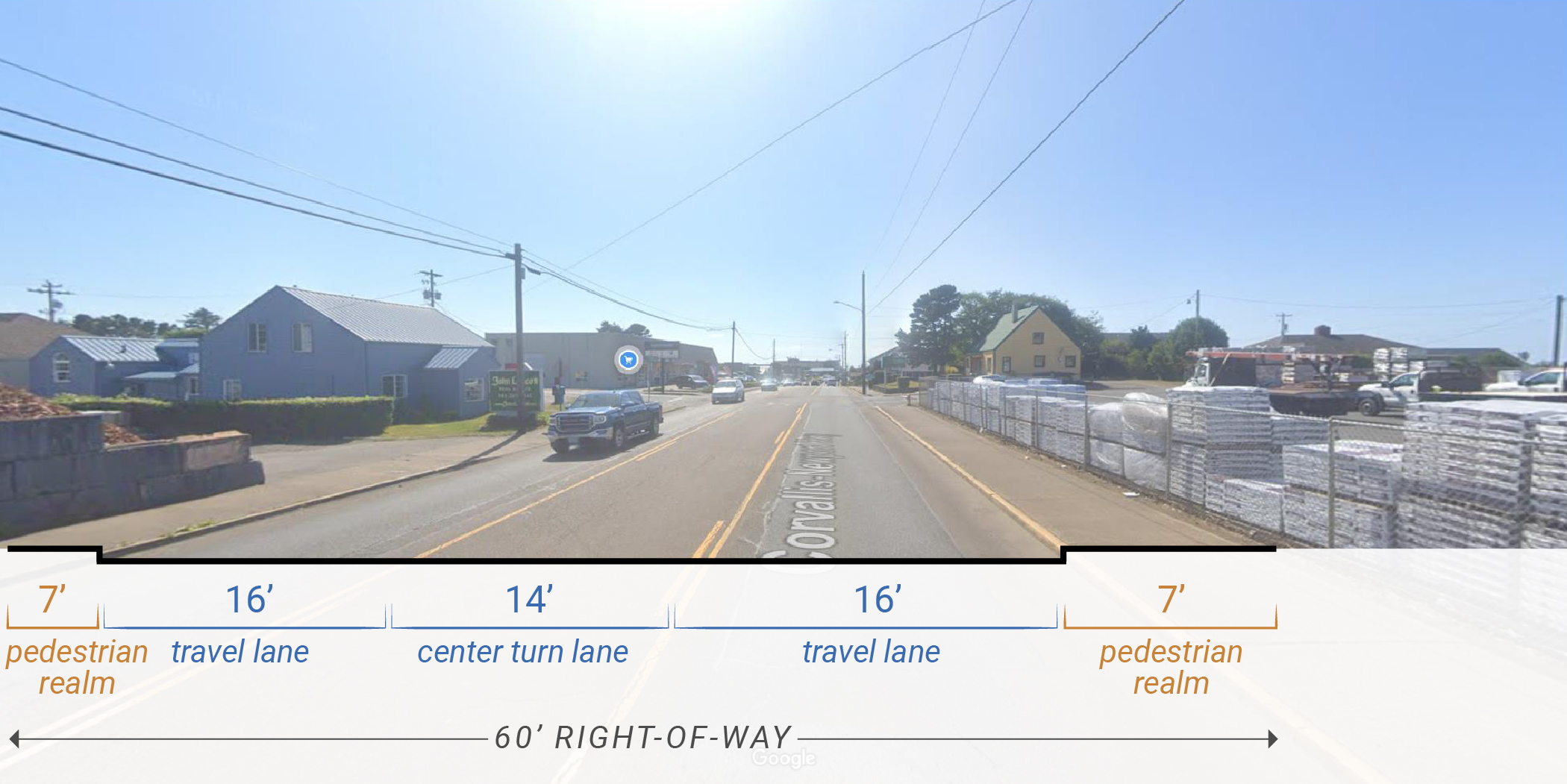
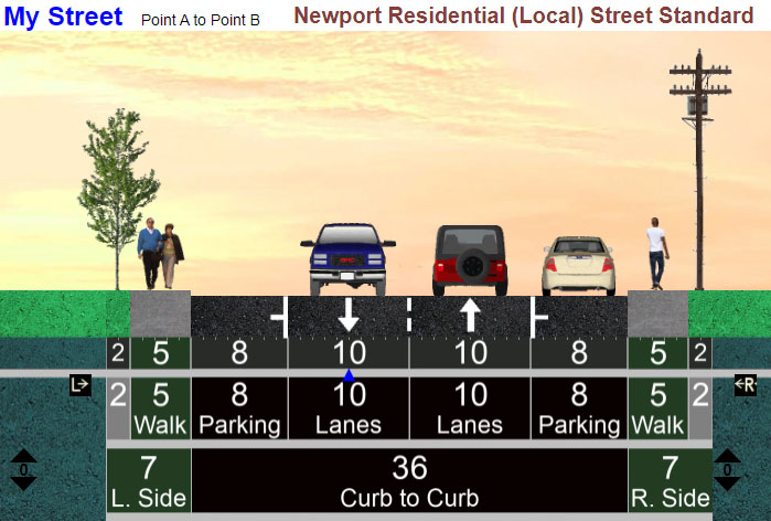 The City sets standards for the types of streets that it wants to see in existing residential neighborhoods/districts. These are illustrated with cross-section drawings. How important is it for you to see existing neighborhoods' roadways expanded to meet the full City standards? (Check one.)
Emerging transportation technologies will shape roads, communities, and daily lives for generations. Vehicles are becoming more connected, automated, shared, and electric. While the timing of when these advances will occur is uncertain, they will have significant impacts on how a community plans, designs, builds, and uses the transportation system. Learn more about emerging transportation technology terms and definitions.
Image gallery contents:
Agate Beach Map
Advisory shoulder example


Transportation Issues
The community has identified the following needs for Agate Beach:
- Inadequate highway access at NE 73rd St. and NE 55th St.
- NW Lighthouse Drive - Summer congestion and limited ped/bike facilities
- Limited parallel routes to downtown
- Summer congestion
- Geologic constraints (areas of unstable soils)

Questions
We have developed a few solutions to these community needs. Tell us what you think!

Example of advisory markings.
These solutions are proposed for "average" Agate Beach roads. Which do you think meets the community's needs for the future?
(Check one.)Image gallery contents:
Commercial Core/Downtown
Possible US 101 Couplet Example
Possible US 20 Couplet Example
Possibe downtown improvements
Existing US 101 cross-section
Existing US 20 cross-section


Transportation Issues
Throughout the early phases of outreach, we heard many concerns about Highway 101 for the future of Newport. Safety and summer tourist traffic were the two most common issues, but we also heard:
Desire for:
- intersection upgrades on Hwy 101 at US 20, Hwy 101 at Hurbert St, and US 20 at Moore Dr
- off highway ped/bike routes
- a transportation system that enhances business redevelopment
Problems with:
- limited access to hospital
- narrow, unsafe on-street parking for US 101
- Yaquina Bay Bridge - vehicle capacity, limited ped/bike capacity, freight weight limits
- People don’t feel safe walking or biking
Questions
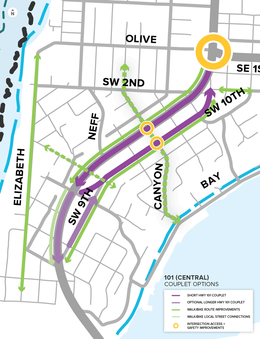
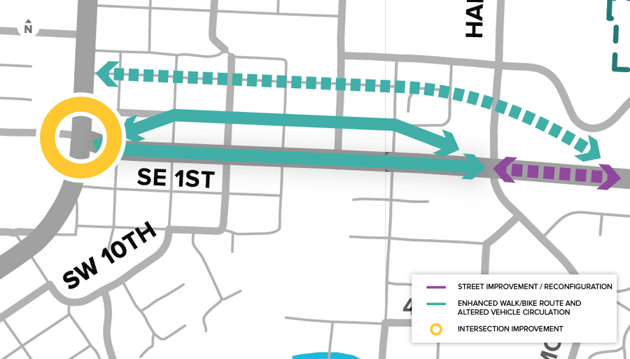
We looked at what could be done to improve Highway 101 and US 20 within their existing alignments and the idea for creating couplets (a pair of streets where you can only travel in one direction, either north or south) for both Highway 101 and US 20 to reduce congestion, increase safety and provide more improvements requested by the community (sidewalks, bike lanes, on street parking, etc.). Tell us what you think!
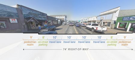 Existing US 101 cross-section.
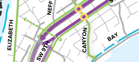 Hwy 101 couplet example: a couplet is a pair of streets where you can only travel in one direction on a street.
Stakeholders we interviewed have suggested ways to improve Hwy 101 in the commercial core (improvements we’ve heard about are listed in the first question). Which solution fits the future community needs the best?
View US 101 potential improvements (cross-sections).
(Check one.)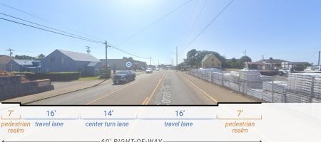 Existing US 20 cross-section.
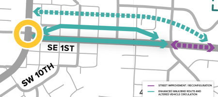 US 20 couplet example: a couplet is a pair of streets where you can only travel in one direction on a street.
Stakeholders we interviewed have suggested ways to improve US 20 (improvements we’ve heard about are listed in the question above). Which solution fits the future community needs the best?
View US 20 potential improvements (cross-sections).
(Check one.)
What improvements would you like to see on US 20?
(Check up to 3.)Image gallery contents:
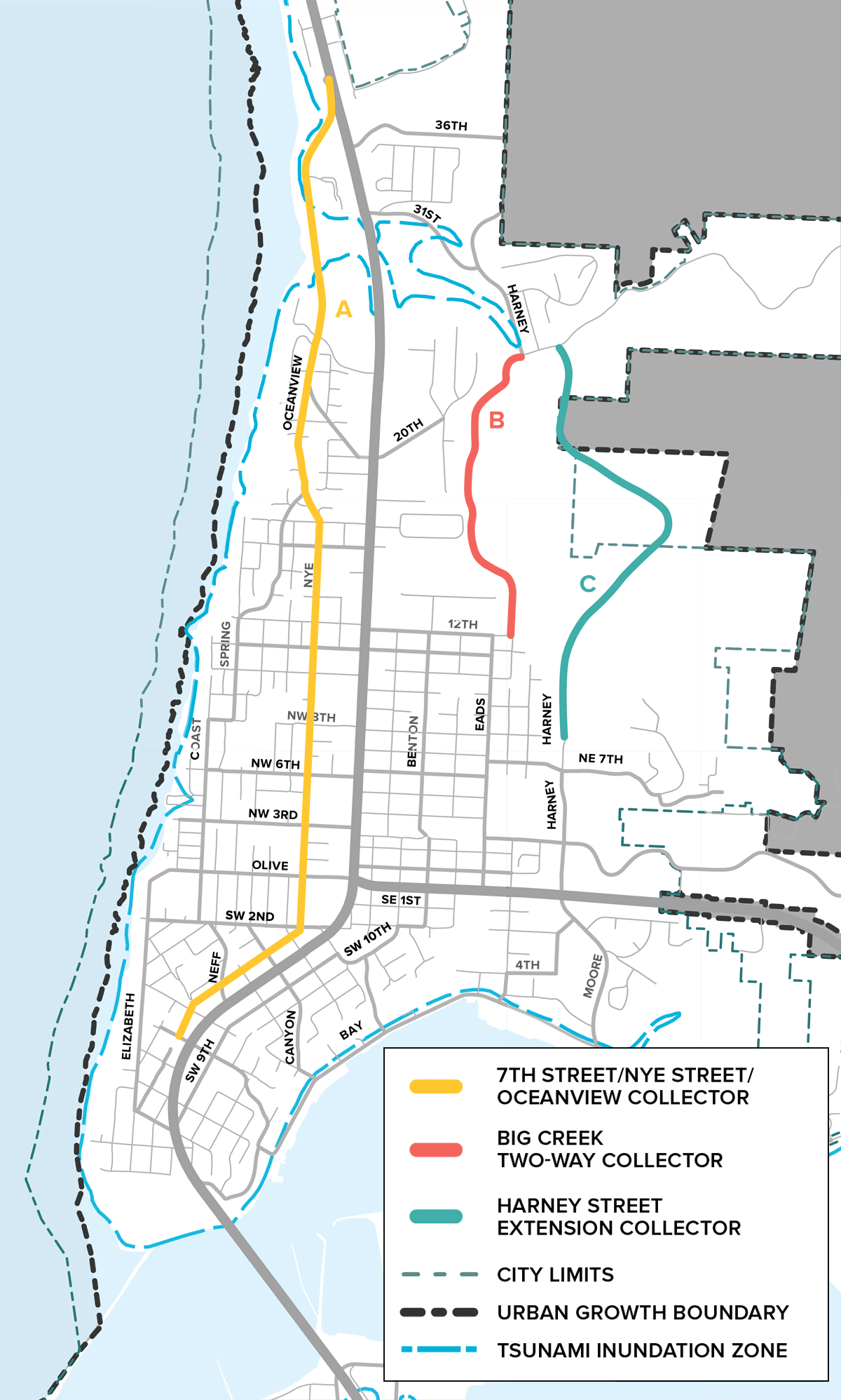
Nye Beach/Bayfront map
Possible parallel routes


Transportation Issues
The community has identified the following needs for the north end of Newport:
- Access upgrades at Hwy 101/NW Oceanview Drive
- Limited parallel routes to Hwy 101 north of 20th Street; alternative routes include Nye Street
- Ped/Bike improvements for NW Oceanview Drive corridor
- Limited parking
- Summer tourist congestion, parking impacts, and speeding
- Minimize conflicts between tourists and waterfront industries in Bayfront
Questions
We have developed a few solutions to these community needs. Tell us what you think!
Image gallery contents:
Yaquina Bay Bridge
Yaquina Bay Bridge

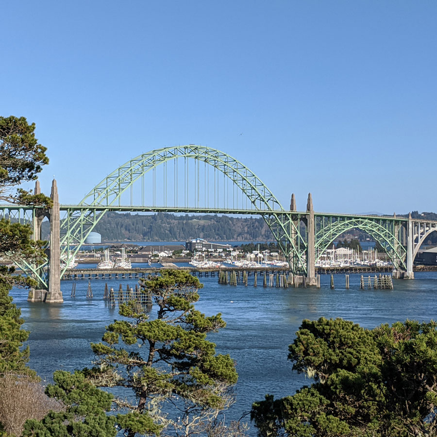
This Yaquina Bay Bridge project will replace the cathodic protection (corrosion protection) on the bridge, repair damaged concrete and provide seismic upgrades to retrofit the bridge started in 2020. This work is necessary to maintain the health of the bridge and increase its lifespan. Learn more at the Yaquina Bay Bridge project website.
The transportation needs for South Beach were assessed in 2012 and priority projects have been built or will soon go under construction. (Learn more about the Hwy 101/32nd Street Signal Relocation Project, which is one of the upcoming projects.)

Questions
Share your thoughts about these elements of the TSP below:
Image gallery contents:
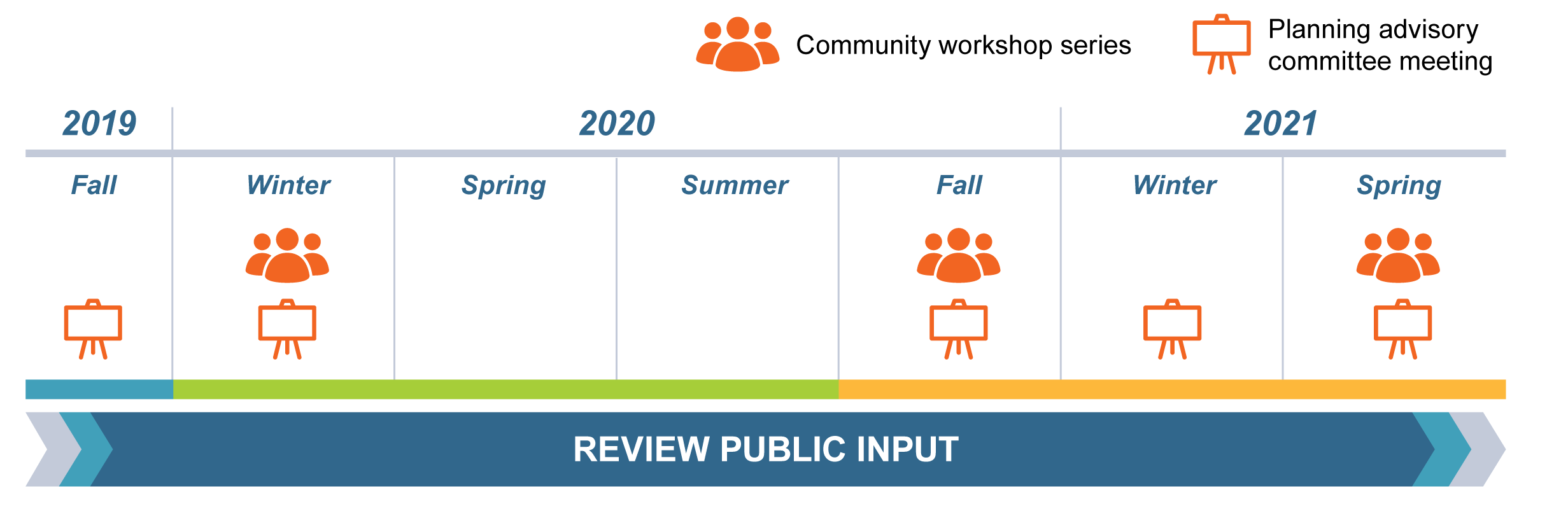
Project Timeline
Project Timeline

Contact us
- Get more information at NewportTSP.org
- If you have questions or comments, please contact
Derrick Tokos AICP
City of Newport Community Development Director
541-574-0626
Timeline

Final Questions
Interested Parties list
Provide your contact information if you would like to be added to the project mailing list.
Please tell us about yourself.
We are requesting the following demographic information to help evaluate the effectiveness of our public outreach activities. Results will be reported as totals. Providing this information is voluntary and optional.
