Stations
This online open house should take about ten minutes. Click or tap "Get Started" above — or use the links below to skip to specific information.
= Page includes questions or opportunities for comment.
What is an RTP?
Lane Council of Governments, which is the Central Lane Metropolitan Planning Organization (CLMPO), is the lead agency responsible for regional transportation planning and distribution of federal transportation dollars for the Central Lane County area. The CLMPO works cooperatively with community members, local governments, and transit providers to set regional priorities for transportation needs.
Every four years, the CLMPO creates a Regional Transportation Plan (RTP), a long-range plan that serves as a blue-print for the region’s long-term transportation projects. The RTP outlines how the region plans to invest in transportation projects and programs in our area. State and federal funding sources require an established plan be in place that identifies transportation needs and proposed investments. This planning effort will fulfill these requirements for the 2020-2045 planning period.
The RTP will guide transportation investments in Eugene, Springfield, and Coburg and build on previous efforts by local partners — including the cities of Eugene and Springfield, along with Coburg and Lane County. It will outline how to proceed with projects and programs that local partners already identified through previous planning activities. These projects and programs include multimodal travel options, climate recovery measures, job growth, environmental stewardship, and social equity.
Where will it apply?
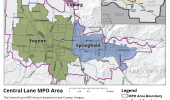
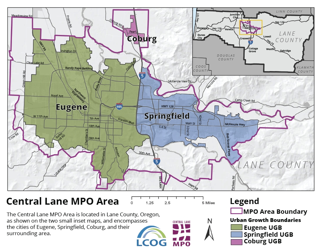
The RTP will apply within the Central Lane MPO boundary, which covers the area within the urban growth boundaries of Eugene, Springfield, and Coburg, and a small area of Lane County adjacent to these urban areas (see map).
What will it accomplish?
- Outline transportation needs, goals, priorities, and opportunities that the community, especially vulnerable and low-income populations, identifies.
- Identify how to increase access to housing and jobs through improved transportation.
- Consider and integrate transportation options and technologies.
- Support climate recovery and reduce transportation-related pollution.
Why do we need your input?
We expect the population in the region to grow by 52,000 people over the next 25 years, requiring expanded transportation options that will serve the community’s changing needs. We need your input to better understand the community’s transportation needs now and into the future so that we can create a transportation system that works for everyone.
How do you travel to work, school, and to run errands? How would you like to travel? What is challenging about our current transportation system (i.e., roads, public transit, bike and walking trails, etc.)?
By participating in this online open house and providing feedback on questions like these, you can help us shape the future transportation system in Eugene, Springfield, and Coburg.
Questions
Cars and Freight*
*Freight is defined as truck and service vehicles that move materials and finished goods.
How would you rate the road network for cars in the Eugene-Springfield area?
(Check one.)How would you rate the road network for moving goods via truck/service vehicles in the Eugene-Springfield area?
(Check one.)Walking and Rolling
How would you rate the on-street walking/rolling network (such as sidewalks and crossings) in the Eugene-Springfield area?
(Check one.)How would you rate the off-street walking/rolling network (such as multi-use paths and trails) in the Eugene-Springfield area?
(Check one.)What are the main barriers to walking in the Eugene-Springfield area?
(Check all that apply.)Biking
How would you rate the on-street biking network (such as bike lanes and bike parking) in the Eugene-Springfield area?
(Check one.)How would you rate the off-street biking network (such as multi-use paths and trails) in the Eugene-Springfield area?
(Check one.)What are the main barriers to biking in the Eugene-Springfield area?
(Check all that apply.)Bus
How would you rate the bus (transit) system in the Eugene-Springfield area?
(Check one.)What are the main barriers to taking transit in the Eugene-Springfield area?
(Check all that apply.)Instructions
On the map, identify where you have transportation concerns, issues, or ideas for improvement.
Timeline
Questions
If you had to pick just one transportation project to fund, what would it be?
(Check one.)You have 36 points to assign and you can assign up to 8 points per category. Use the sliders to assign points to each prioritization option.
| Preserving and maintaining existing roads | 0 |
| Improving existing roads through technology (signal timing, traffic management, etc.) | 0 |
| Transit that comes more often | 0 |
| Transit that goes to more places | 0 |
| Improved bike paths, crossings and systems | 0 |
| Improved pedestrian paths, sidewalks and crosswalks | 0 |
| Shipping goods and materials (train, truck, ships, planes) | 0 |
| Commute trip reduction programs, such as van pools, park and rides, teleworking, etc. | 0 |
| Improved road safety through lighting, speed, design, etc. | 0 |
Total Spent: 0/36
MULTI-MODAL TRANSPORT
When it comes to alternative transportation options, are you very interested, somewhat interested, somewhat uninterested, or not at all interested in the following:
Bike share programs or programs to allow you to try out electric assist bikes.
(Check one.)Programs to encourage the use of electric scooters.
(Check one.)Programs that would make electric vehicles more convenient to use, such as more EV charging stations.
(Check one.)Project Timeline
Timeline
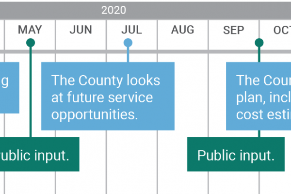
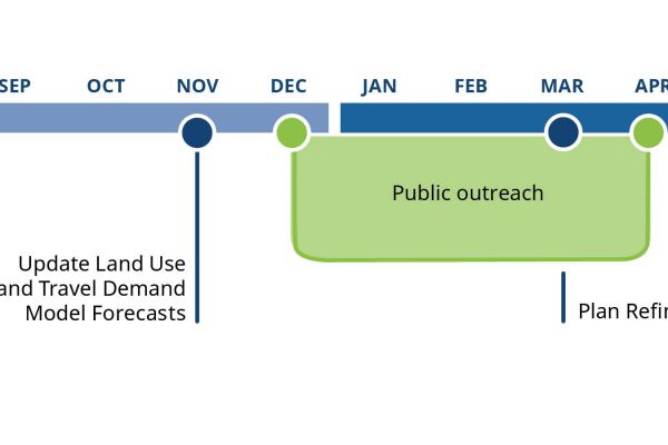
Planning will take about a year and a half. The RTP is expected to be completed and adopted by the Metropolitan Policy Committee (MPC) in September 2021. See the timeline for activities where you can get updates and give further input.
Project Contact Information
For questions or more information, contact Ellen Currier, Transportation Planner with Metropolitan Planning Organization, 541-682-3177, mpo@lcog.org.
Tell us how you use our transportation system today
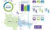
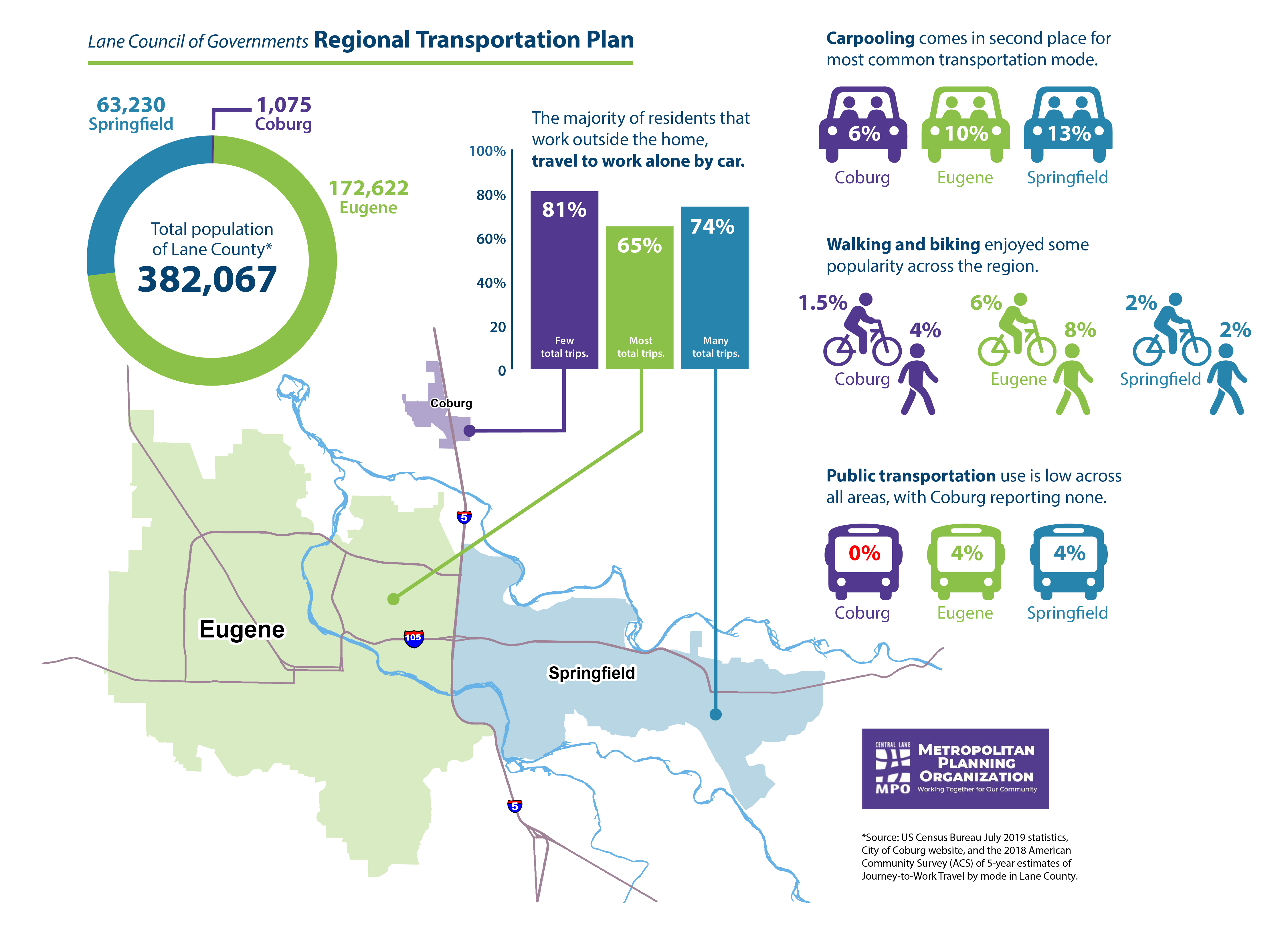
How do you usually get from one place to another?
Driving or riding in a car or other motor vehicle.
(Check one.)Riding a bike.
(Check one.)Walking.
(Check one.)Taking the bus.
(Check one.)Do you or a member of your family travel to and from school on any given day?
(Check one.)If yes, please select the most common travel method(s) that you use.
(Check all that apply.)Interested Parties list
Demographics Questions (Optional)
We're asking these questions to help us evaluate the effectiveness of our outreach activities. Answering these questions is completely optional.

