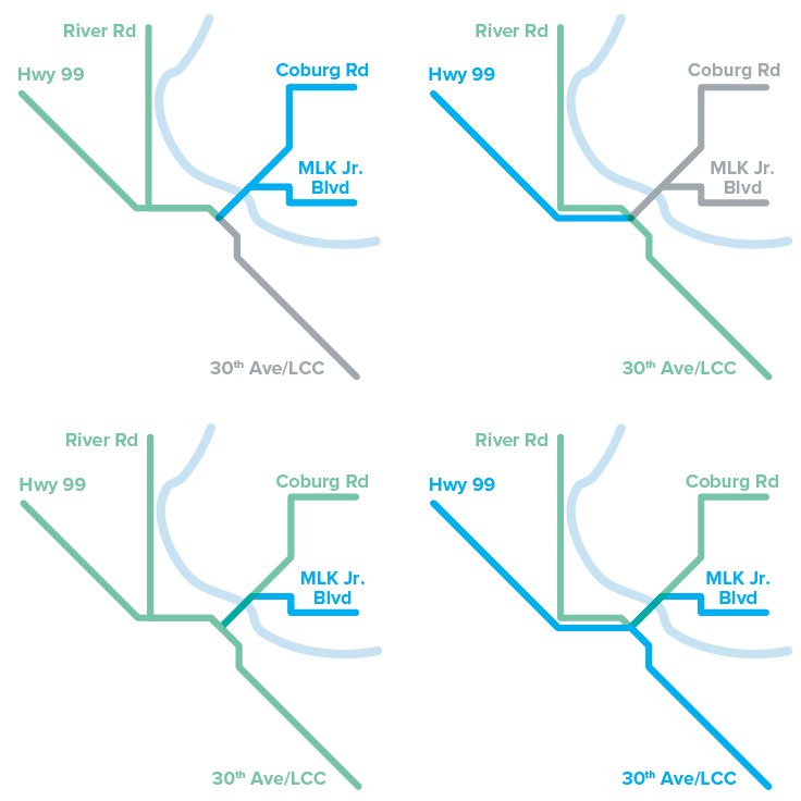
Your feedback from this online open house will help the City of Eugene and Lane Transit District (LTD) prioritize transportation investments in five key corridors over the next 10 years.
Visit the pages on this site using the buttons below or click "Get Started" to move through the information in order.


= Page includes questions or opportunities for comment.
Para información en español
Si usted desea materiales en español, contáctenos en questions@movingahead.com o 541-682-6100.
Interpretación en español estará disponible en la jornada de puertas abiertas (9/24 - 9/27).
How we got here
MovingAhead began in 2015 as a partnership between the City of Eugene, Lane Transit District (LTD), regional agencies, and the Eugene-Springfield community. The purpose of the project was to determine what transportation investments are needed on some of our most important streets.
MovingAhead is about more than just transit: it considers a range of options for getting us where we need to go, whether we ride the bus, bike, drive, use mobility devices, or walk.
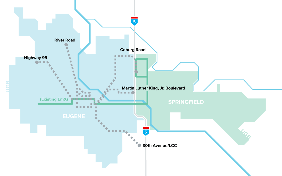
Based on previous community feedback, the MovingAhead team focused on five key corridors and identified the costs and benefits of various transportation investments for each:
- Highway 99
- River Road
- 30th Avenue/LCC
- Coburg Road
- Martin Luther King, Jr. Boulevard
At the conclusion of the project, the Eugene City Council and LTD Board of Directors will select a package of transit, walking, and biking investments across these five corridors that can be funded and built over the next 10 years. This list of prioritized investments will become a powerful tool for implementing local and regional land use, transportation, and community plans.
Alternatives Analysis
The information in this open house describes the findings of the MovingAhead Alternatives Analysis (AA) Report. An Alternatives Analysis is a part of established transportation planning practice that uses in-depth analyses to understand the trade-offs between different options and how they compare on a variety of criteria. It is also an important first step in securing federal funding for local projects.
MovingAhead Goals and Objectives
Goal 1 Improve multimodal transit corridor service +
Improve transit travel time and reliability, minimize transfers, increase ridership, and improve access and safety for people walking, bicycling, and using mobility devices.
Goal 2 Meet current and future transit demand in a cost-effective and sustainable manner +
Control costs while increasing transit capacity to meet demand. Leverage funding opportunities that provide a maximum return on investment. Minimize impacts to the environment.
Goal 3 Support economic development, revitalization, and land use opportunities for the corridor +
Support and coordinate with other planned development and transportation projects and provide high-capacity transit that is consistent with the community vision. Minimize impacts to businesses and industry and improve transit so as to provide benefits to vehicles, freight, and emergency services.
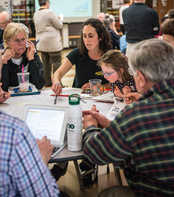
Community involvement for MovingAhead got underway in 2015 with workshops to solicit input that informed the evaluation criteria and explored and identified which corridors should be advanced for further evaluation. Feedback from these workshops, an online open house, and other public comments determined the five corridors and the three levels of investment options that are being considered here.
Questions
How important are the following evaluation criteria to you?
Total Spent: 0/78
Use the sliders to divide up to 78 points between the 12 criteria listed below. You can assign up to 12 points to each. If you run out, you can shift points between categories until you are satisfied with the balance you achieve.
Capital CostCapital cost includes estimated costs for vehicles, design, construction, right of way, and project management. |
0 |
Operating CostThis is the estimated annual cost to operate and maintain the service. This includes paying operators, vehicle maintenance and fuel, as well as administrative and overhead costs. |
0 |
Transit Travel Time SavingsThis measure estimates how long it would take for someone riding the bus to travel from the end of the corridor to the downtown Eugene Transit Station during the afternoon rush hour. |
0 |
Ridership IncreaseAnnual transit ridership as projected for the year 2035 using the regional transportation model. |
0 |
New Bicycle/Pedestrian Access & Safety ImprovementsThis criterion is based on the amount of proposed investment in bicycle and pedestrian improvements in each corridor. |
0 |
Support Development & RedevelopmentThis is an assessment of how well the alternative supports development and redevelopment of property along the corridor as identified in adopted plans. |
0 |
Tree ImpactsThis criterion is based on the number of medium and large trees which may need to be removed. |
0 |
Number/Acreage of AcquisitionsThis criterion is based on the number and total acreage of properties that would potentially need to be purchased. |
0 |
Potential Property DisplacementsThis measure indicates the number of residences or businesses that may be displaced as a result of constructing the project. |
0 |
Parking ImpactsThis criterion considers the amount of on-street and off-street parking that may need to be removed. |
0 |
Existing Jobs & Population ServedThese estimates are based on providing transit that serves people working and living within ¼ mile of the corridor (under the No-Build and Enhanced Corridor Alternatives) and serving people working and living within ½ mile of the corridor (under the EmX Alternative). |
0 |
Investment in Corridors with Disadvantaged PopulationsThis criterion will be used later in the project to compare corridors and will consider the amount of spending in corridors with greater numbers of low-income and minority people. |
0 |
Total Spent: 0/78
No-Build Alternative
No new investments at this time
Under the No-Build option, the City and LTD would only make changes that are already planned as part of other projects. No additional investments would be made as a part of the MovingAhead project. This option is helpful as a reference point to measure the relative benefits, costs, and impacts of the build alternatives.
Enhanced Corridor Alternative
Lower investment option
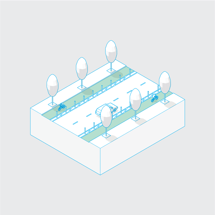
Enhanced Corridor is a new concept for the Eugene-Springfield region and is intended to improve safety, access, and transit service without requiring major capital investments.
Key features include:
- Typically a bus every 15 minutes
- Consolidating the number of transit stops
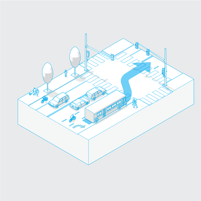
- Transit signal priority and/or queue jumps at intersections
- Enhancing some bus stops
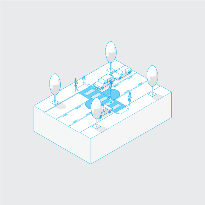
- Improving or building new pedestrian crossings at intersections
- Filling in gaps in the sidewalk network
- Adding accessible sidewalk ramps at intersections
- Improving or building new bicycle facilities
- Streetscape investments such as lighting and landscaping
EmX Alternative
Higher investment option
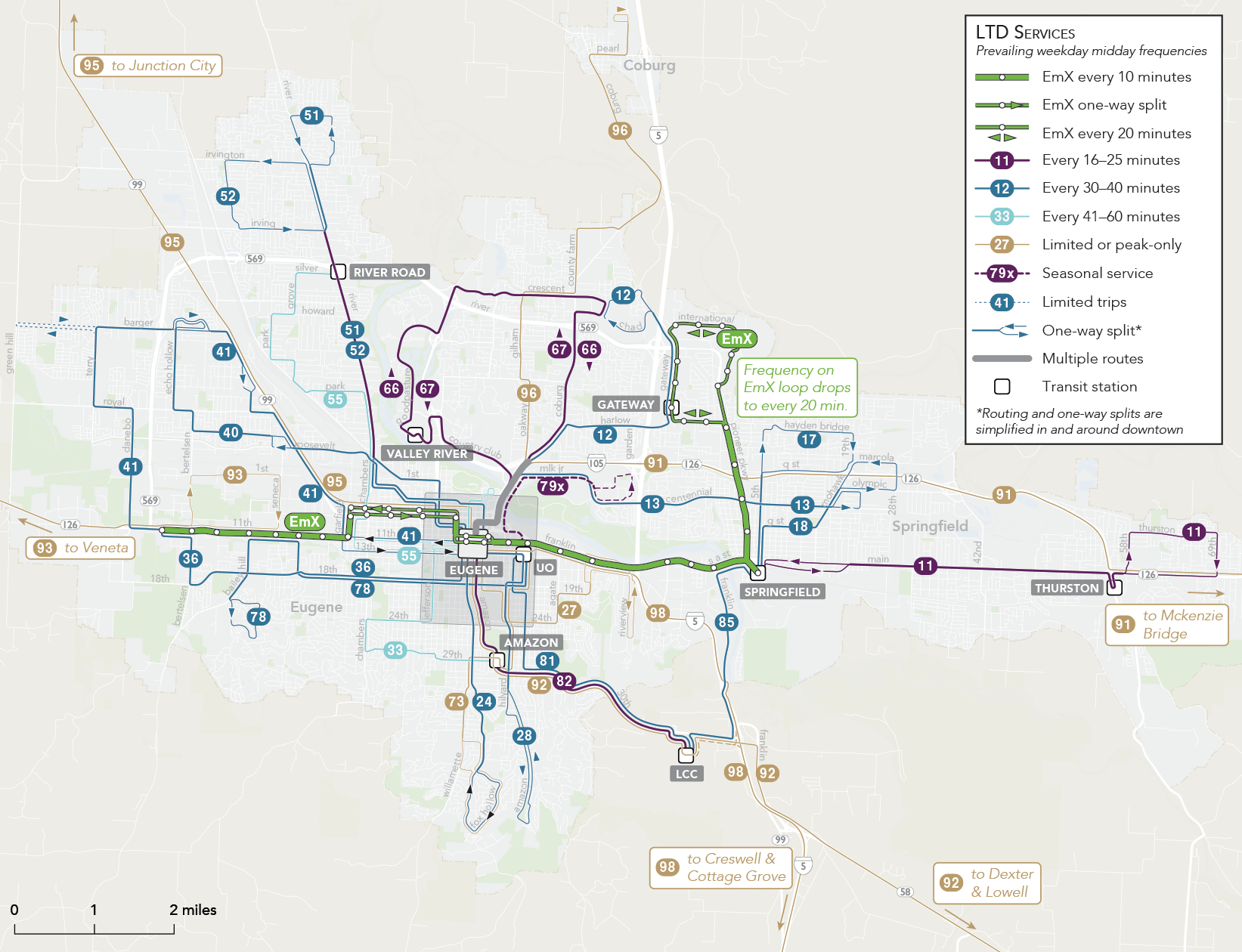
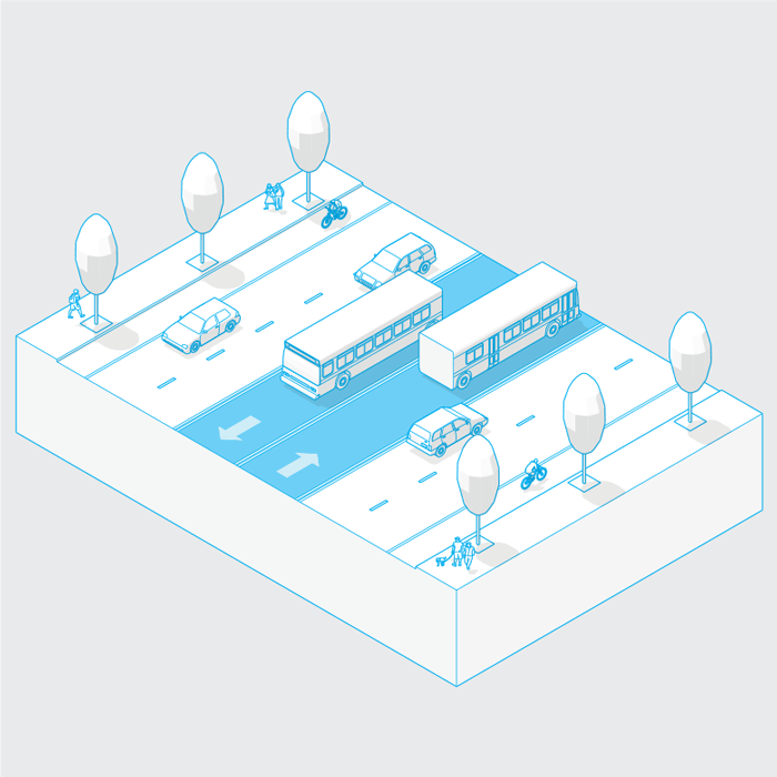
EmX is LTDS’s branded Bus Rapid Transit (BRT) service. The EmX Alternative is intended to develop additional BRT service and connect with the existing EmX system. EmX currently operates between the Gateway area and west Eugene serving downtown Springfield, downtown Eugene, and the University of Oregon.
Key features include:
- Typically a bus every 10 minutes
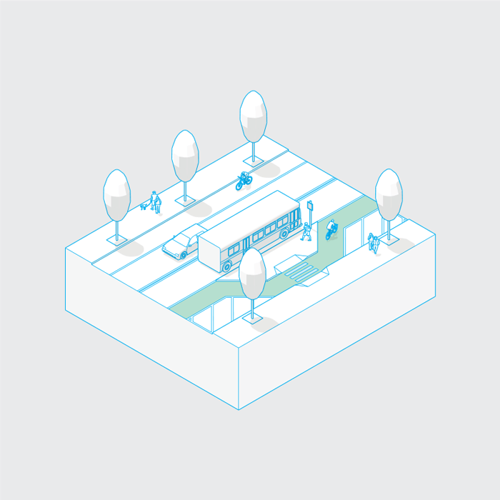
- Bus-only lanes in key locations
- Higher capacity multi-door transit vehicles
- Enhanced stations with raised platforms and other customer amenities
- Off-board fare collection to allow multi-door boarding
- Transit signal priority and/or queue jumps at intersections
- Longer distances between stops
- More frequent and redesigned service to improve cross-town connectivity
- Greater investment in pedestrian, bicycle, sidewalk, and streetscape improvements than with the Enhanced Corridor options
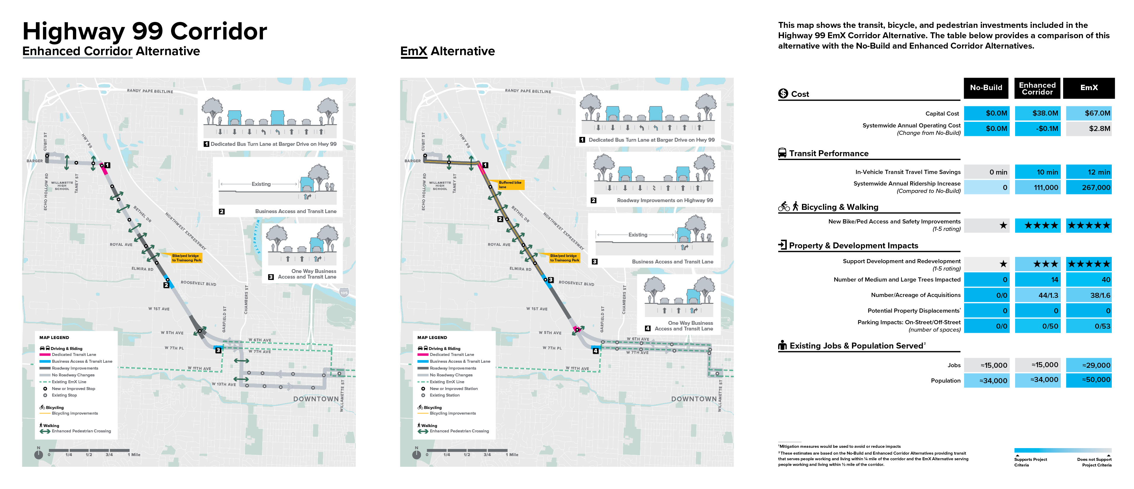
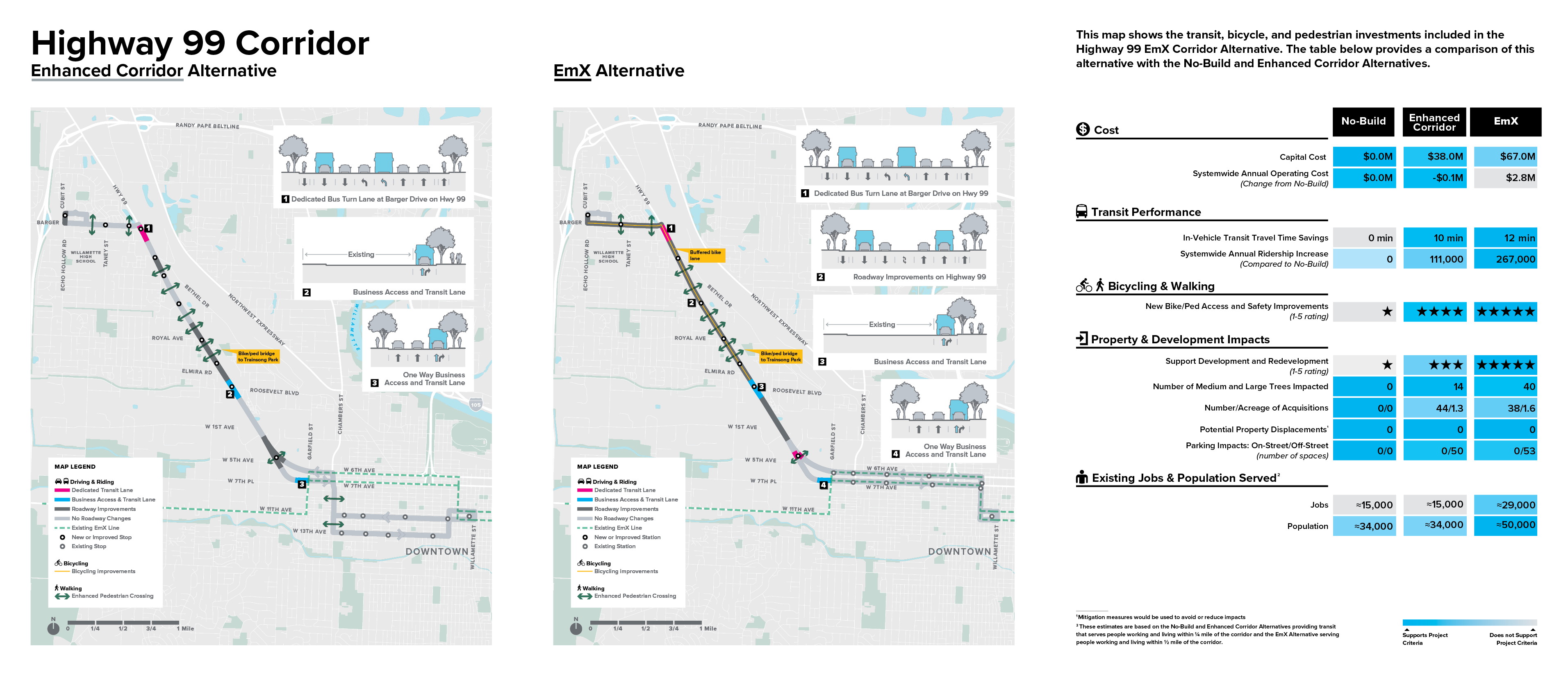
ltd/movingahead/ooh1/corridor-hwy99.png
Overview
Compared to the No-Build Alternative, the Enhanced Corridor and EmX Alternatives significantly decrease transit travel time (by 10 and 12 minutes, respectively) and would increase ridership more than any other corridor (by 111,000 and 267,000 annual trips, respectively). Both build alternatives would provide more frequent transit service.
The No-Build Alternative avoids impacts (including property acquisitions, off-street parking impacts, and potential tree removal) and costs, but does not provide the same level of benefits compared to the Enhanced Corridor and EmX Alternatives.
What We Heard
- Pedestrian and bicycle crossings are presently unsafe, make the environment safer.
- Good Enhanced Corridor candidate because of anticipated long-term changes .
- Railroad yards are a major obstacle - Maxwell Road to Roosevelt Boulevard.
- Bus service is not frequent enough.
- Highway 99 is hard to cross for pedestrian/bikes.
- Lack of bike lanes north of Bethel Drive.
- Opposition to EmX Investments within the boundary of the Jefferson Westside Neighborhood (JWN).
Addressing Community Concerns
Both build alternatives provide new investments in bicycle and pedestrian connectivity and safety, including a bicycle and pedestrian bridge connecting the Trainsong Neighborhood to the Highway 99 Corridor. Both build alternatives would also represent an increase in the frequency of transit service along the Highway 99 Corridor.
To address JWN concerns, the EmX Alternative would be routed along 6th and 7th Street and no infrastructure improvements are proposed along 11th and 13th Street as part of the Enhanced Corridor Alternative.
Questions
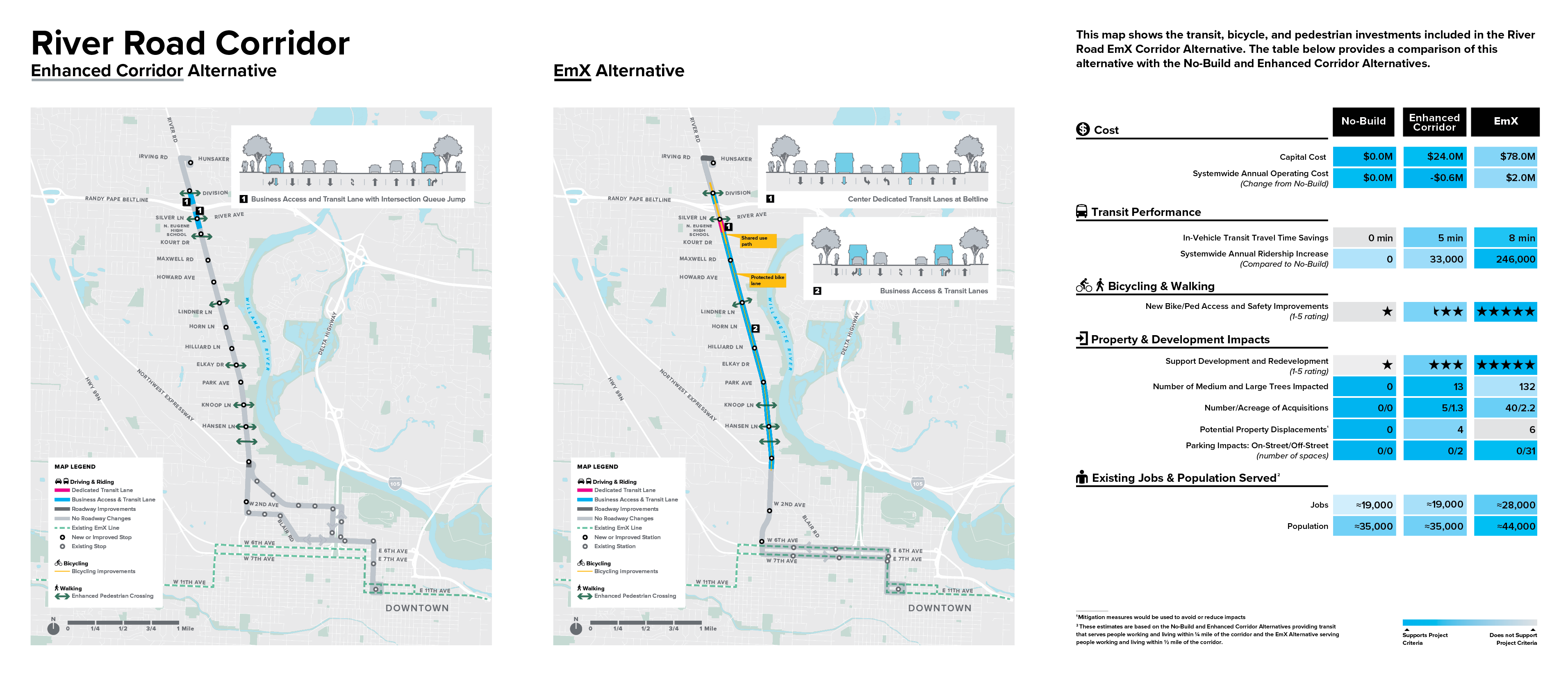
ltd/movingahead/ooh1/corridor-river-road.png
Overview
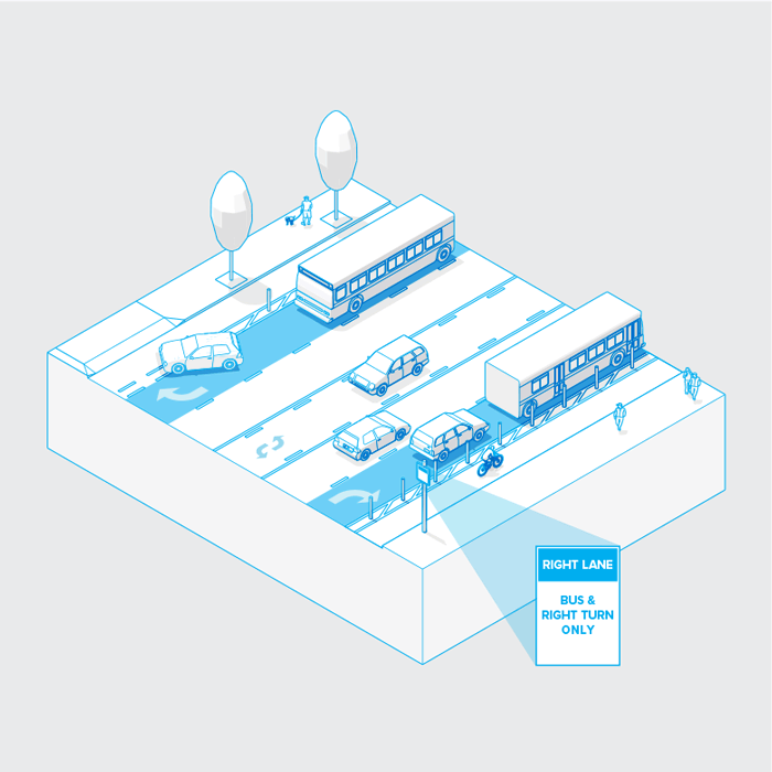
Of the two build alternatives, the EmX Alternative offers the greatest benefit to bicycle and pedestrian connectivity and safety, as well as the most improved transit service frequency because of repurposed travel lanes to Business Access and Transit (BAT) lanes. The Enhanced Corridor Alternative also provides transit benefits and improvement to bicycle and pedestrian facilities, but to a lesser extent than the EmX Alternative, and would result in a smaller increase in transit ridership.
The No-Build Alternative avoids impacts (including property acquisitions, off-street parking impacts, and potential tree removal) and costs, but does not provide the same level of benefits compared to the Enhanced Corridor and EmX Alternatives.
What We Heard
- Dedicated transit and cycling lanes are needed
- Reduce the speed limit on River Road
- Beltline interchange is a particular area of concern
- Consider safety of all road users in design for River Road
- Avoid tree removal with any transit option
- EmX option 2 [Business Access and Transit Lanes] is preferred because of turn lane in the middle
- There are bus stops on both sides of River Road near Briarcli ff but no crosswalks to get across; a crosswalk is critical here
Addressing Community Concerns
The build alternatives would increase transit frequency while providing new investments in bicycle and pedestrian connectivity and safety. Both build alternatives aimed to work within the existing right of way where feasible, to preserve trees along the corridor as much as possible.
Questions
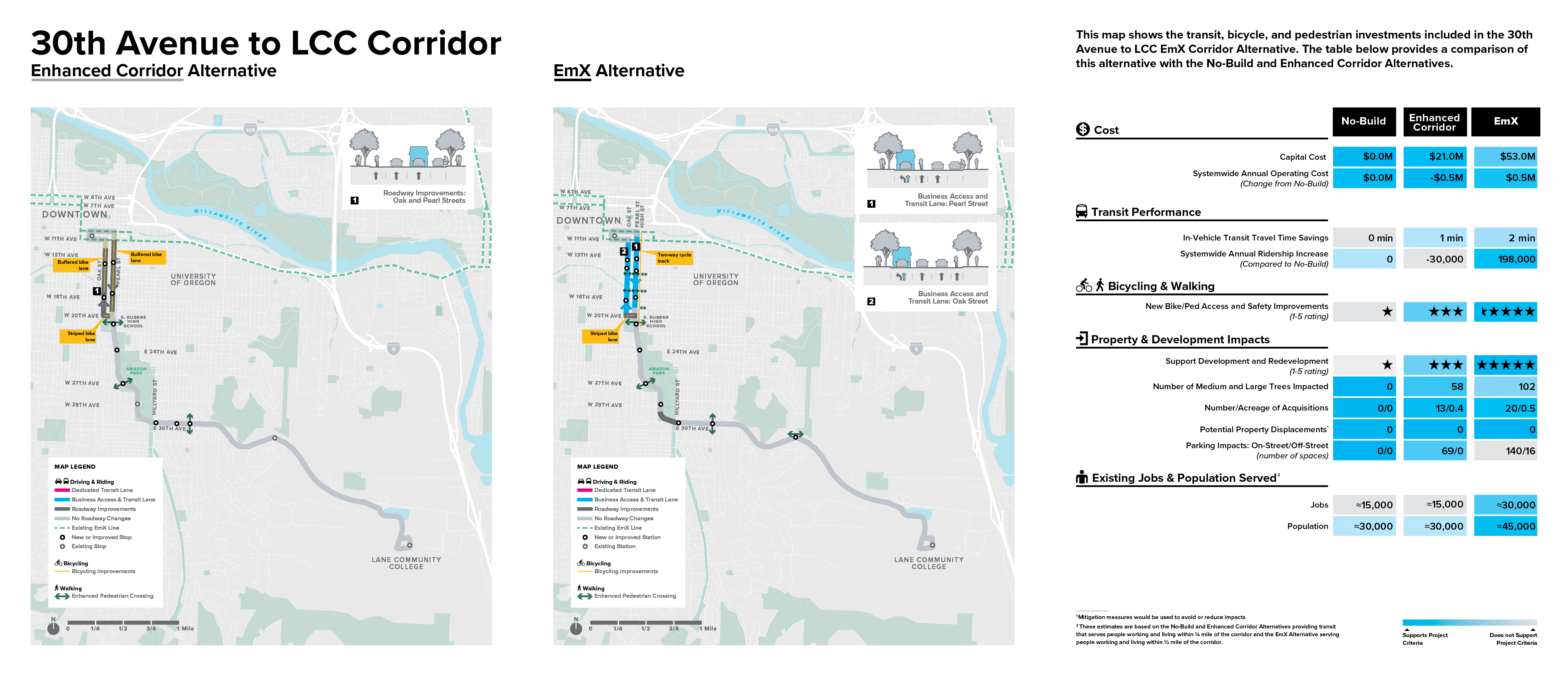
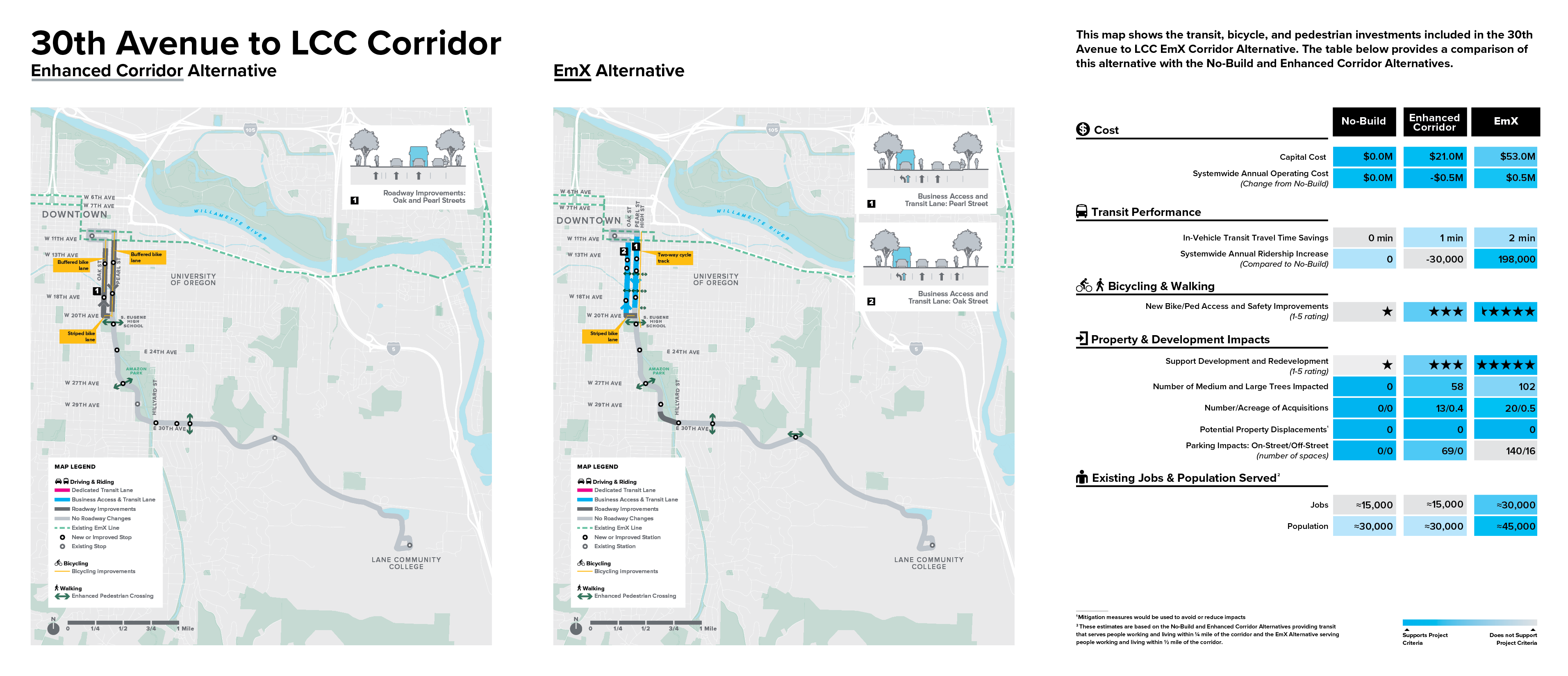
ltd/movingahead/ooh1/corridor-30th-lcc.png
Overview
Of the two build alternatives, the EmX Alternative offers the greatest potential ridership increase as well as the most bicycle and pedestrian connectivity and safety improvements. The Enhanced Corridor Alternative would provide a lower level of bicycle and pedestrian investment, and fewer transit benefits, including a possible reduction in transit ridership due to the elimination of service on Harris Street and a direct transit connection between LCC and the University of Oregon.
The No-Build Alternative, which would retain existing service, avoids impacts (including property acquisitions, off-street and on-street parking impacts, and potential tree removal) and costs, and o ffers transit travel times that are similar to the two build alternatives.
Additionally, ridership for the No-Build Alternative is better than estimated ridership for the Enhanced Corridor Alternative due to the assumed elimination of Route 81 service.
What We Heard
- Needs bigger pedestrian improvements from 30th to LCC campus
- Needs evening and weekend bus service to LCC for attending events and meetings
- Oak and Pearl should be for buses along 30th/LCC and High Street should be a cycle track
- Corridor would complement changes occurring in the South Willamette area
- Crossings along 30th are di fficult
- Need more details about how bicycles will be accommodated
Addressing Community Concerns
The build alternatives both provide new investments in bicycle and pedestrian connectivity and safety. Either of the build alternatives or the No-Build (which retains existing service) could extend service hours in the future.
Questions
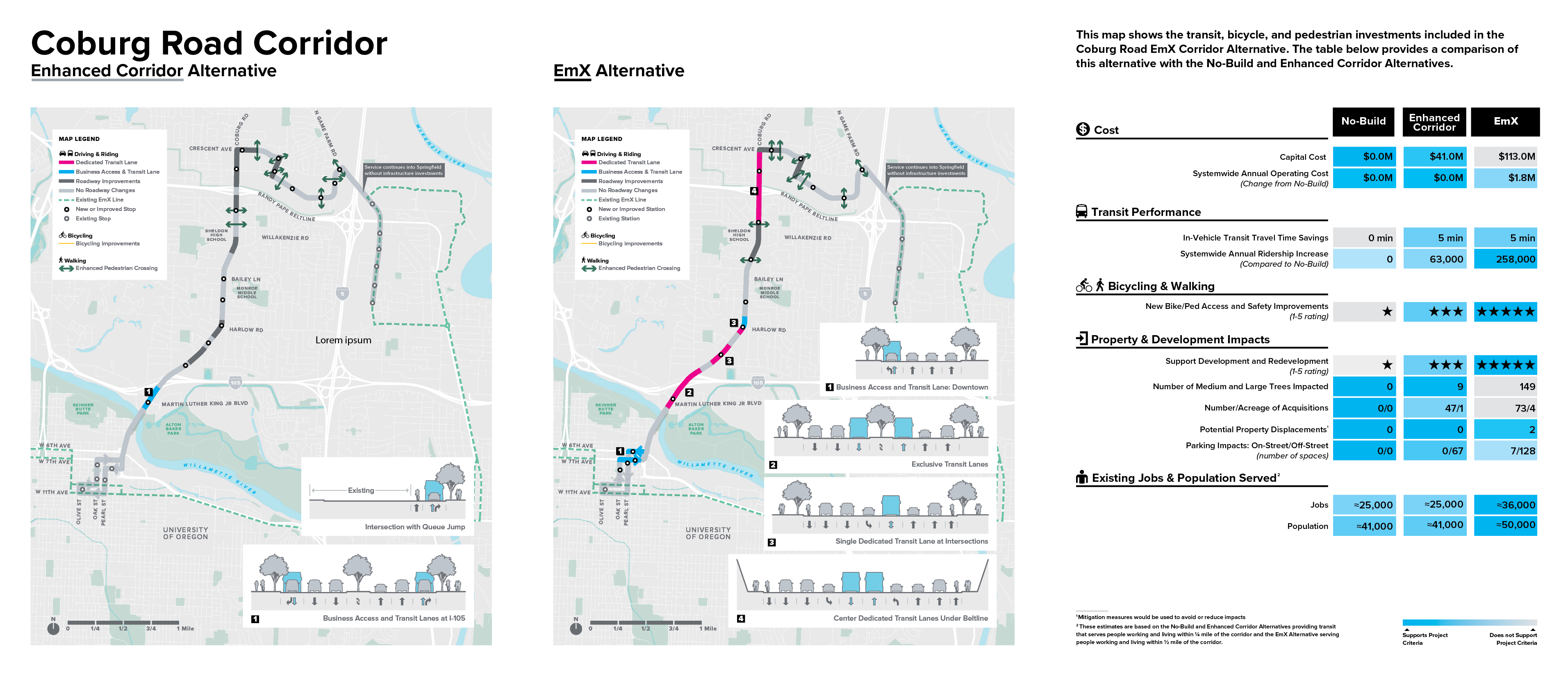
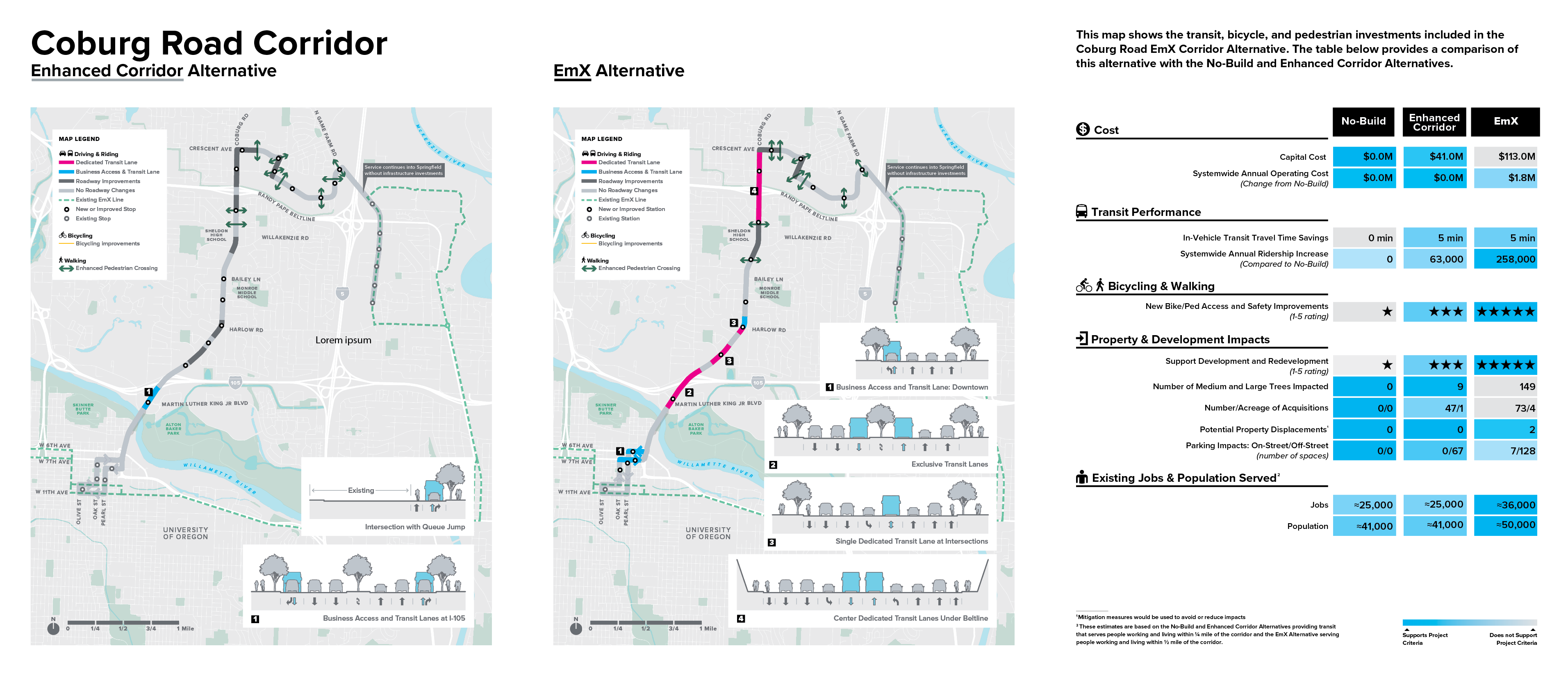
ltd/movingahead/ooh1/corridor-coburg.png
Overview
Although the two build alternatives are rated more favorably than the No-Build Alternative, the EmX Alternative in this corridor has the highest capital cost of all the corridor alternatives considered and would require the most property acquisition. The Enhanced Corridor Alternative has a lower cost, less impact, and an equivalent improvement in transit travel time than the EmX Alternative, but has lower projected ridership.
The No-Build Alternative avoids cost and impacts (including property acquisitions, off -street and onstreet parking impacts, and potential tree removal).
What We Heard
- The VA clinic and all the new development at Crescent and further north have limited bus service and bikeway options.
- Auto access to businesses must be maintained
- Coburg is scary with fast moving tra ffic
- Bicycle and pedestrian crossings are di fficult
- Bicycling facilities separated from tra ffic are important
- The corridor is important for autos, given the nature of development and connection to freeways
Addressing Community Concerns
The build alternatives provide investments in bicycle and pedestrian connectivity and safety, as well as improved transit service and connections to areas north of Beltline. Additionally, questions came up about how business impacts would be minimized. Both build options propose infrastructure investments that stay within the existing right of way as much as possible.
Questions
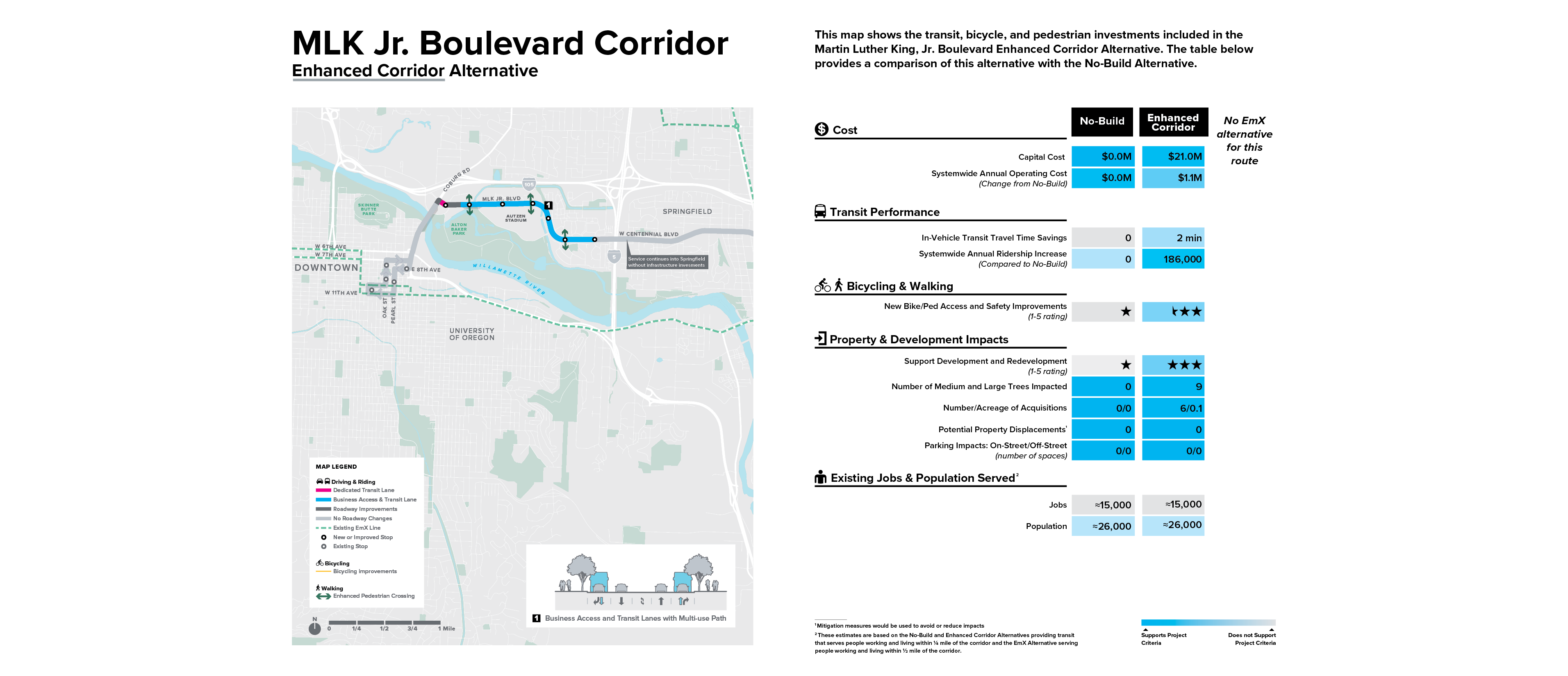
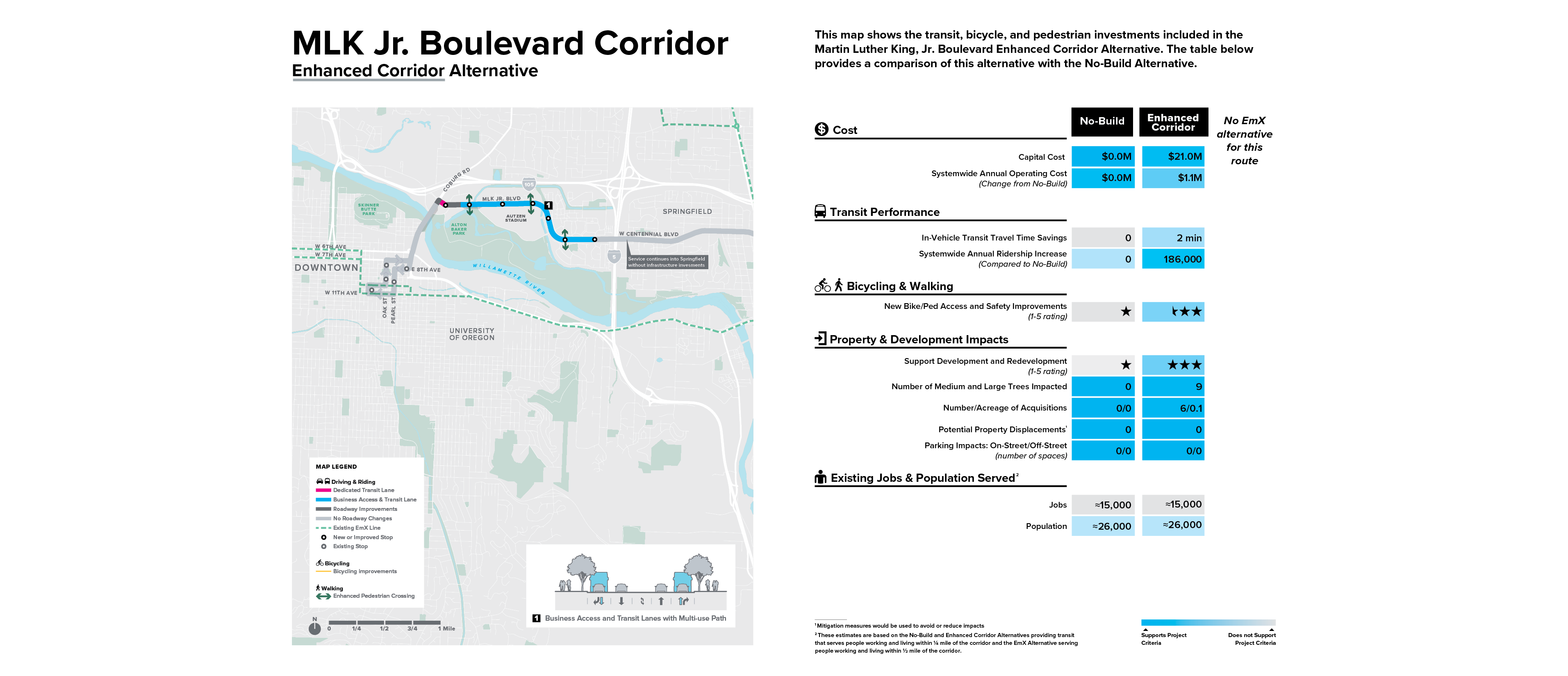
ltd/movingahead/ooh1/corridor-mlk-jr.png
Overview
The Enhanced Corridor Alternative o ffers the greatest potential ridership increase and more benefits to bicycle and pedestrian connectivity and safety, however estimated travel time savings are relatively small compared to the No-Build Alternative. An EmX option was not considered in the MLK, Jr. Boulevard Corridor due to its shorter length and the lower return on investment potential at this time since proposed infrastructure investments currently end at the Eugene/Springfield boundary. There may be opportunities to reconsider EmX on this corridor in the future.
The No-Build Alternative avoids impacts (including property acquisitions, off-street parking impacts, and potential tree removal) and cost.
What We Heard
- Traffic concerns are related to events at Autzen Stadium
- Corridor is an essential connection to student housing, Eugene, and Springfield
- Bicycle and pedestrian improvements are needed
- Do not compromise Alton Baker Park to alleviate Ferry Street Bridge congestion
- MLK without Springfield connection is a waste, connect the corridor to Springfield
Addressing Community Concerns
The build alternative provides investments in a variety of travel options that help address these needs, most notably, the inclusion of BAT lanes to provide transit priority and traffic calming.
Questions
Comment on the Alternatives Analysis
The full text of the Alternatives Analysis Report, Executive Summary, and other supporting materials are available for download from the project website. Printed copies of the report can be obtained by contacting Lane Transit District or the City of Eugene Planning and Development Department or Public Works. Printed copies may also be reviewed at the: City of Eugene Public Library; City of Eugene Planning and Development and Public Works offices; and LTD Administrative Office and Customer Service.
If you have specific comments related to the AA report, please send them in writing to questions@movingahead.org or submit them online via the website comment form at movingahead.org/contact/.
If you need assistance providing comments, such as an interpreter, please call 541-682-6100 (voice) or 7-1-1 (TTY).
Stay involved
Visit the project website (MovingAhead.org) for the latest project information, to sign up for email updates, to learn about upcoming events, and to submit comments.
MovingAhead Timeline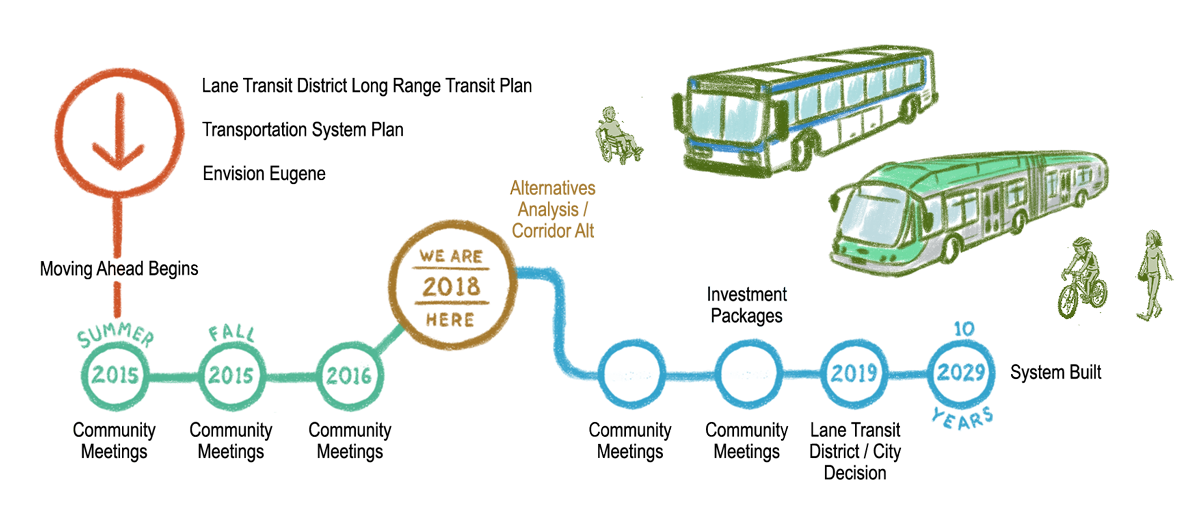
Final Questions
(All questions are optional.)
Demographic Information (Optional)
These questions are optional, but will help the City and LTD know whether this survey has reached a representative cross-section of the community.

