
Stations
In this open house there are a series of stations where you can learn about the project and provide input. Go directly to a station using the buttons below, or at the top of the screen to move through the stations in order.

= Page includes questions or opportunities for comment.


The main objectives of the Plan are to:
- Enhance safe opportunities for walking, biking, and taking transit, in ways that connect people to the destinations they need to reach: schools, employment centers, transit, and other community destinations.
- Ensure that all neighborhoods in Beaverton have options for walking, biking, and transit.
- Reduce climate-changing emissions.
- Create a network of low-stress neighborhood routes to serve all ages and abilities of bicyclists and pedestrians.
- Improve safety for all modes.
- Set up Beaverton transportation projects to be competitive for grants and regional funding opportunities.
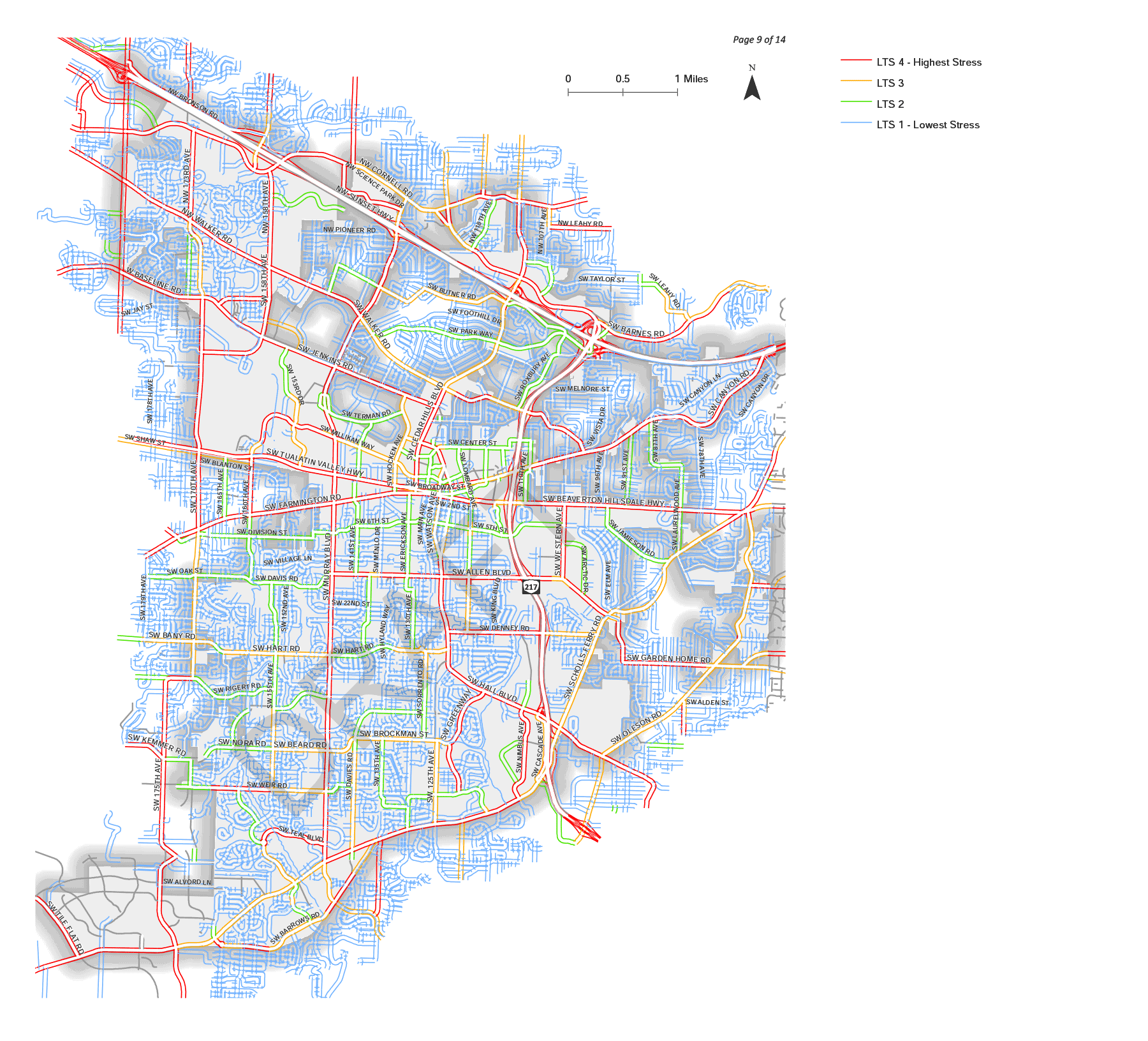
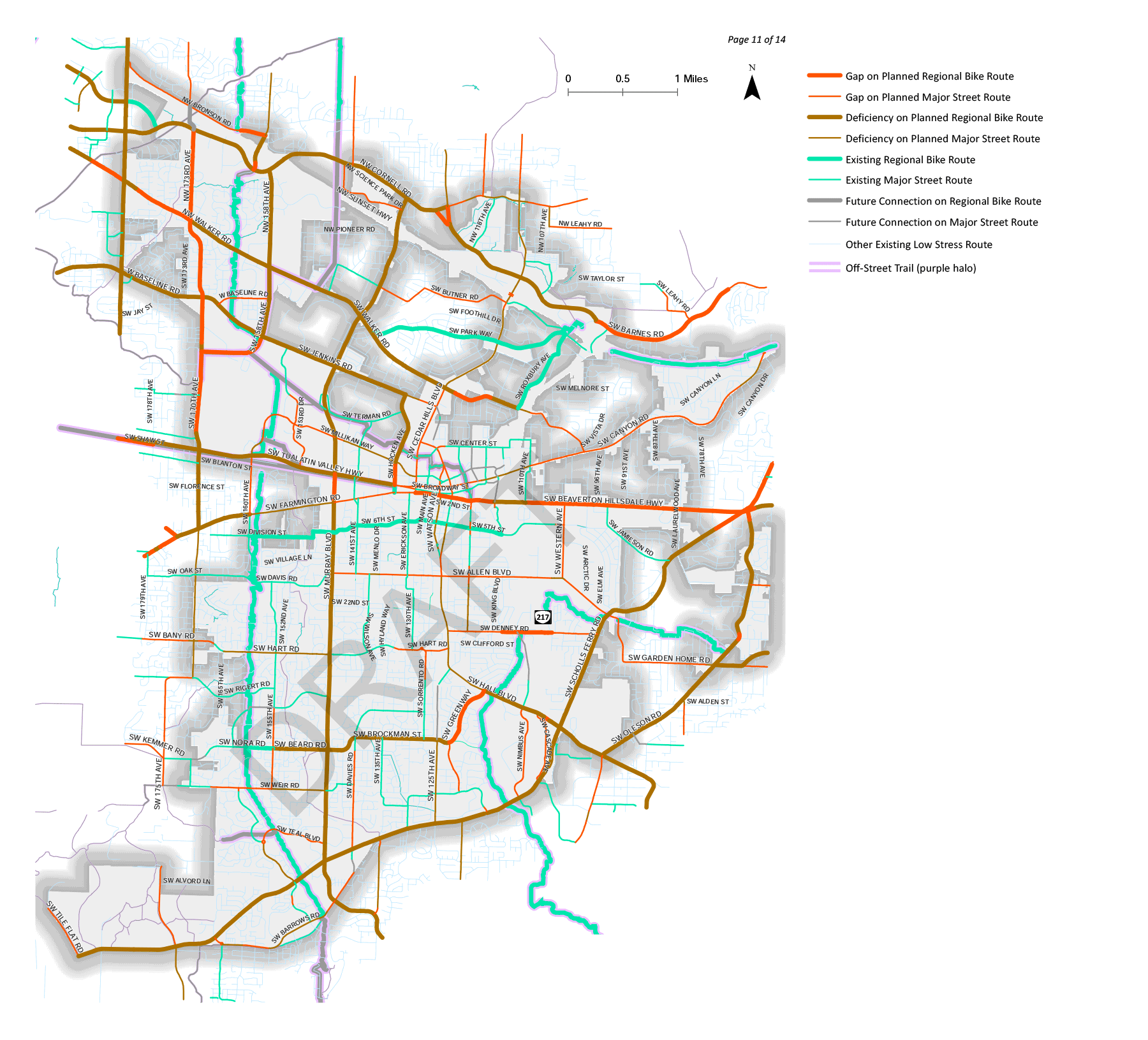
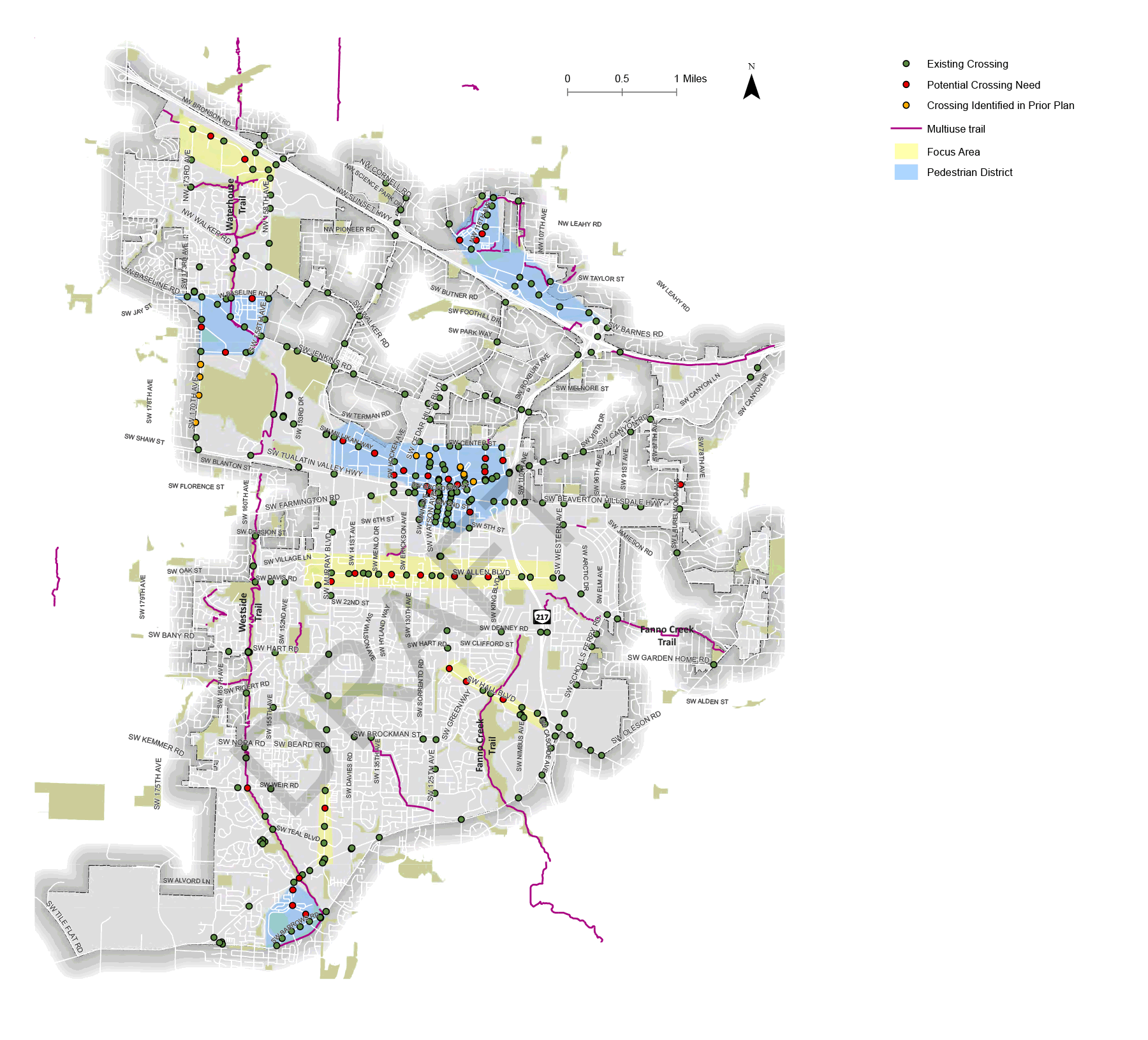
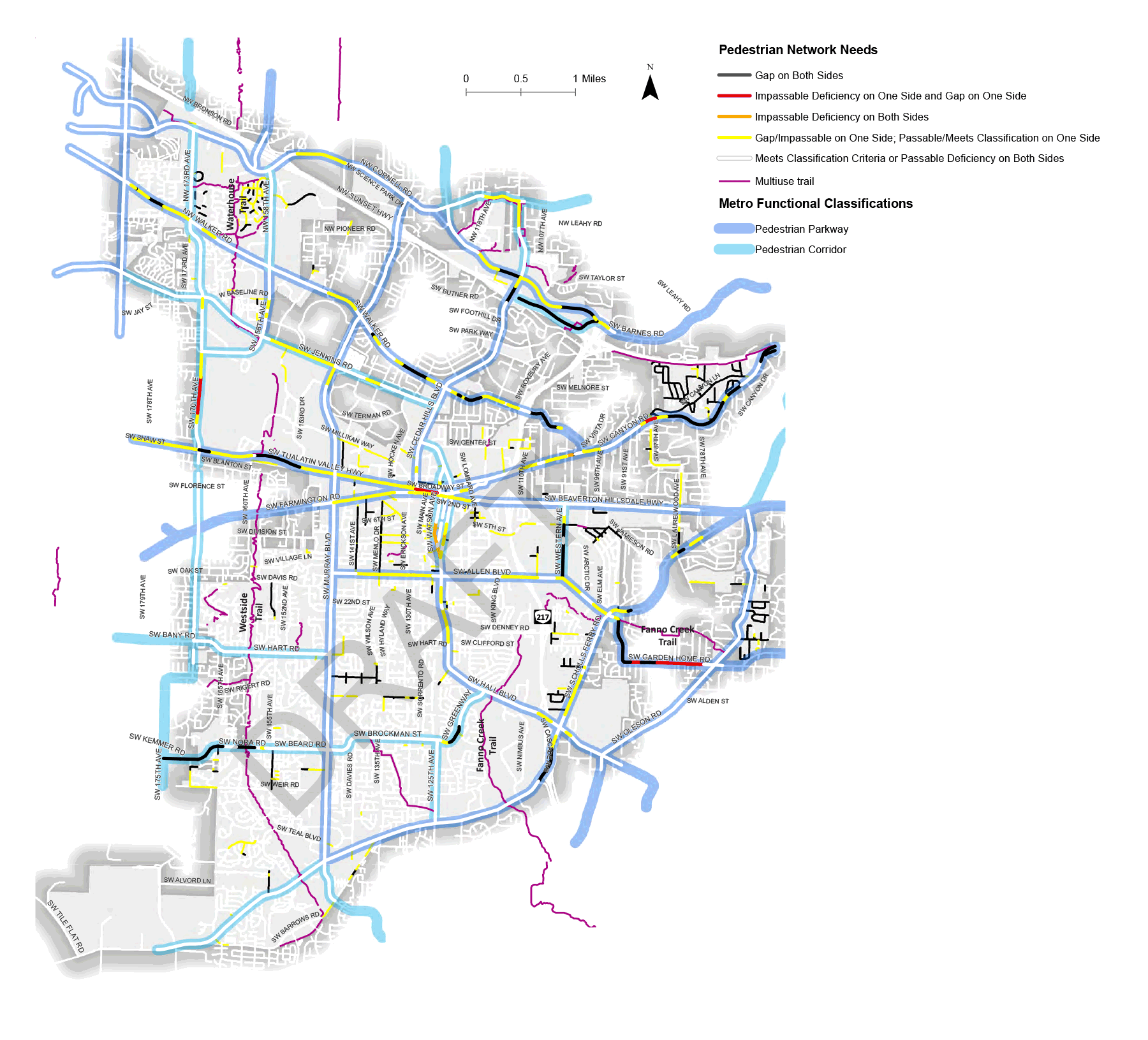
Existing conditions
To better understand existing conditions and current plans, to date, our team has:
- Reviewed other planning efforts in Beaverton.
- Collected feedback from our advisory committees.
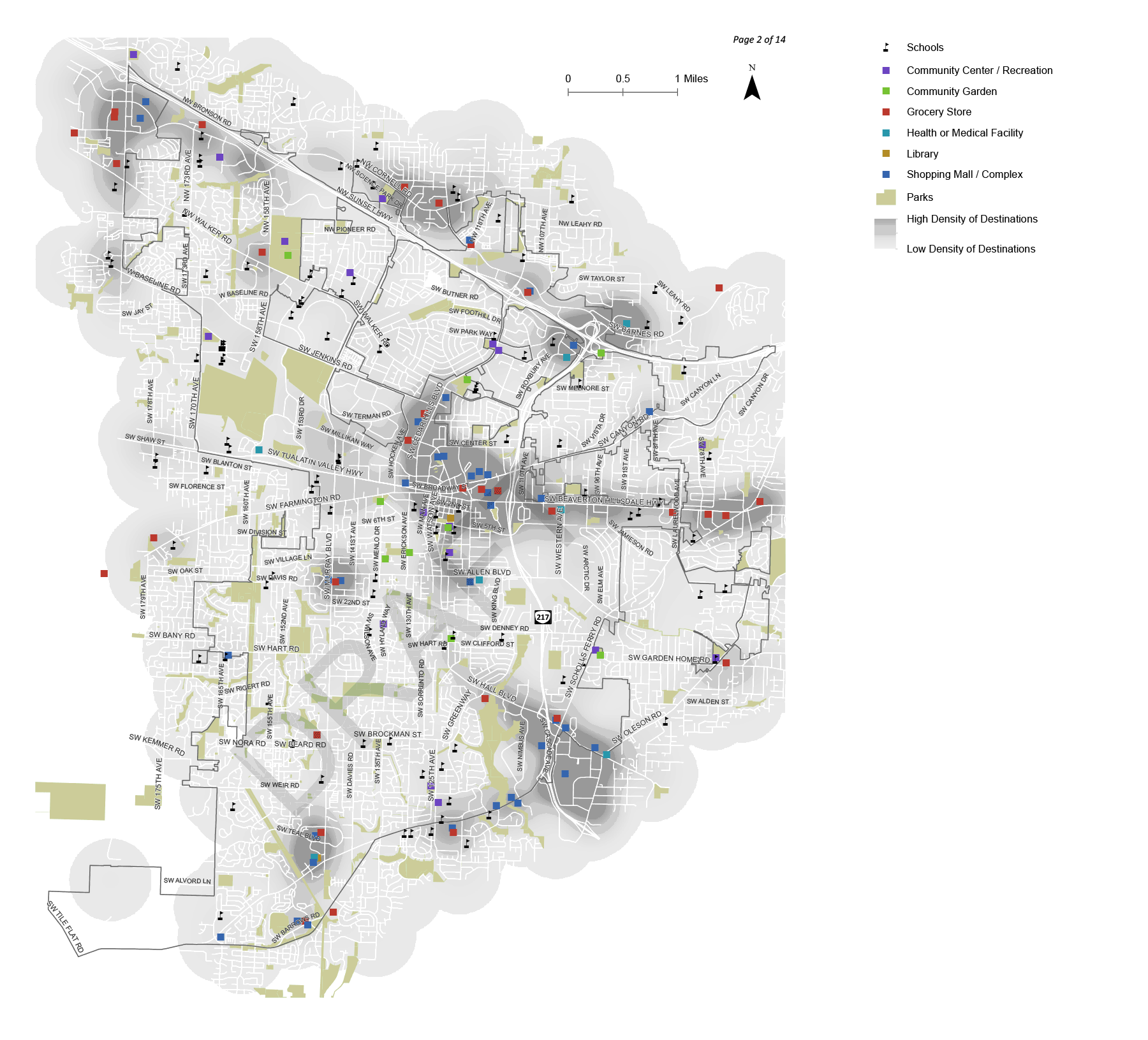
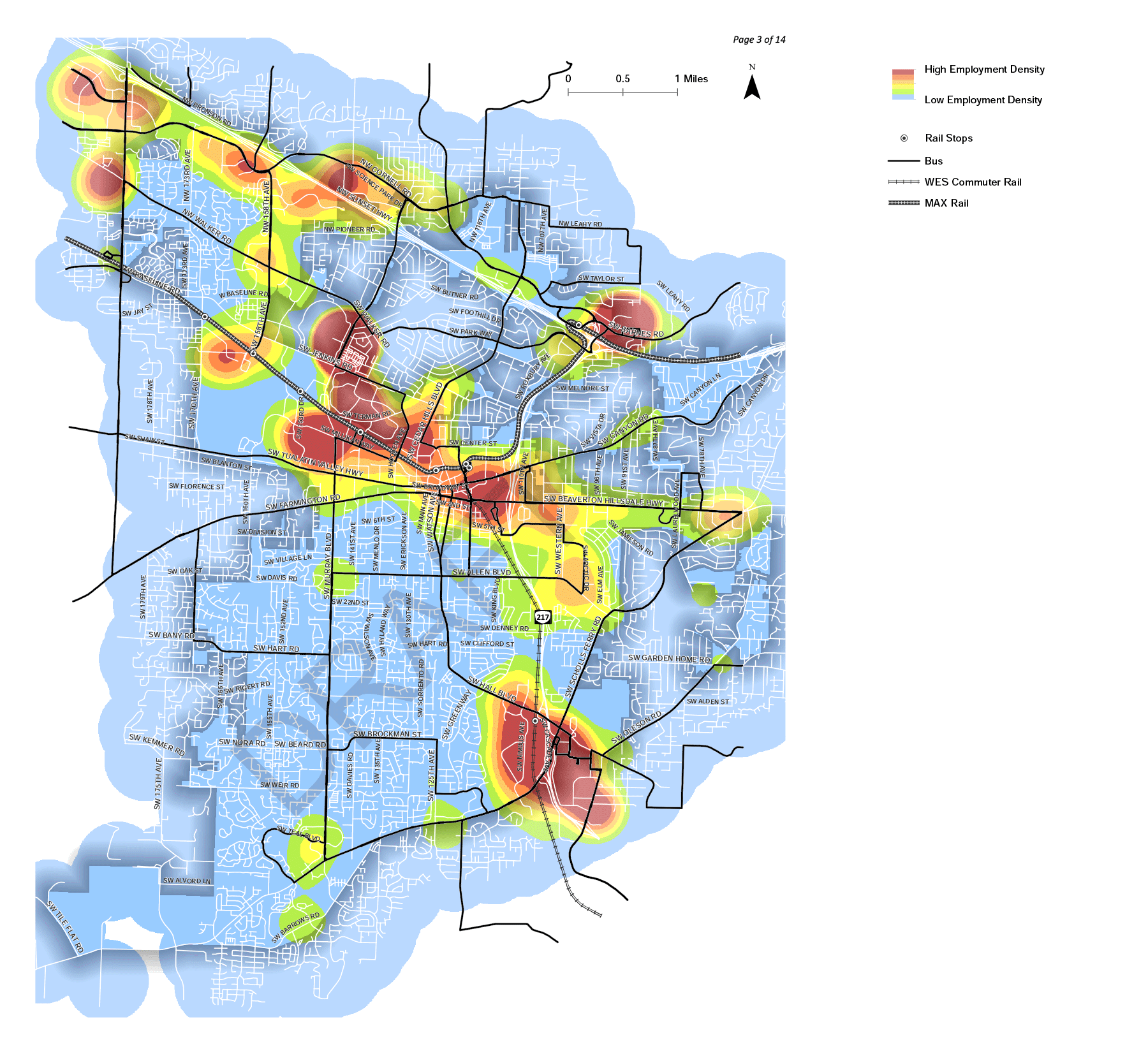
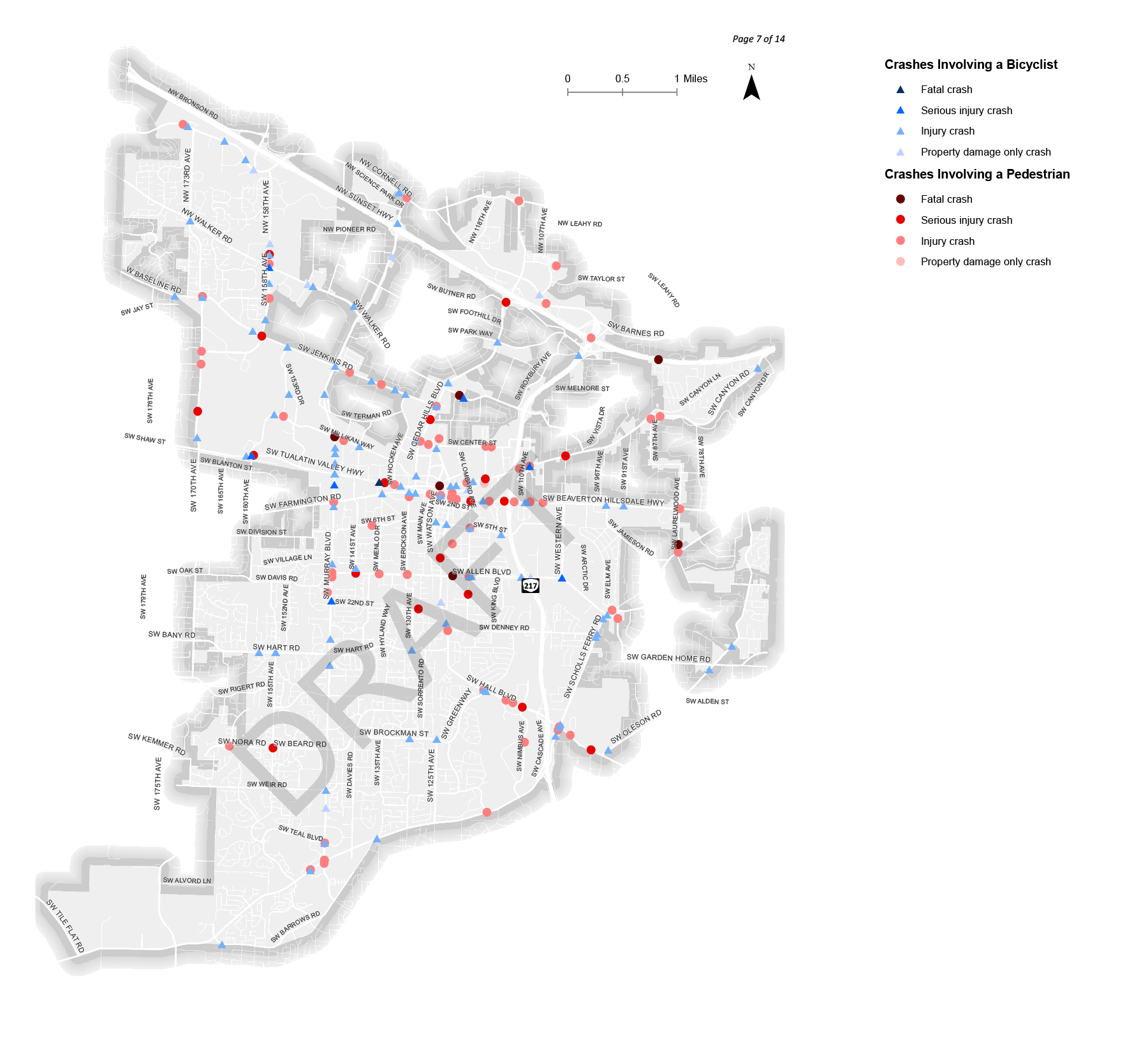
- Analyzed information, such as the location of essential destinations, employment, and crashes involving walking or biking.
- Spent time walking and biking around the City.
In the following stations, we'll describe the work we’ve done so far to identify needs and then get your input on the locations you would like to see improved.
Project Information Sheet (PDF, 1.2 MB)

What kind of bicyclist are you?
How comfortable would you feel using the following types of facilities?
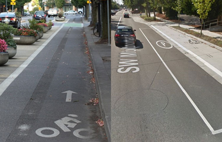
Standard bike lane (2 lane road)
A Standard Bike Lane is an on-street facility that provides space designated for bicyclists, separated from vehicles by pavement markings.
Photos: Left - SW Millikan Way, Beaverton; right - SW 5th St., Beaverton
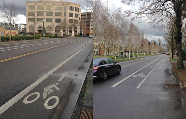
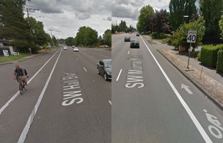
Standard bike lane (5 lane road)
A Standard Bike Lane is an on-street facility that provides space designated for bicyclists, separated from vehicles by pavement markings.
Photos: Left - SW Hall Blvd., Beaverton; right - SW Murray Blvd., Beaverton
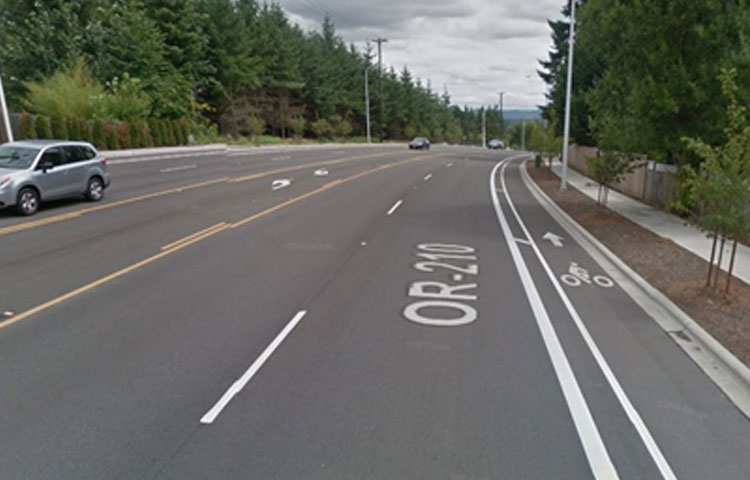
Buffered bike lane
A Buffered Bike Lane is an on-street lane that includes an additional striped buffer of typically 2-3 feet between the bicycle lane and the vehicle travel lane and/or between the bicycle lane and the vehicle parking lane.
Photo: Scholls Ferry Road, Beaverton
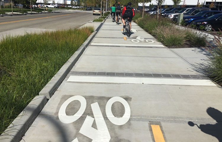
Two-way protected bicycle lane (PBL)
A Two-Way Protected Bicycle Lane (PBL), also known as a cycle track or separated bike lane, is a bicycle facility within the street right-of-way separated from motor vehicle traffic by a buffer and a physical barrier, such as planters, flexible posts, parked cars, or a mountable curb. Two-way PBLs serve bi-directional bicycle travel on one side of the street.
Photo: SW 154th Terrace, Beaverton
One-way protected bicycle lane
A One-Way Protected Bicycle Lane (PBL), also known as a cycle track or separated bike lane, is a bicycle facility within the street right-of-way separated from motor vehicle traffic by a buffer and a physical barrier, such as planters, flexible posts, parked cars, or a mountable curb. On two-way streets, a one-way PBL would be found on each side of the street, like a standard bike lane.
Photos: Left - NE Multnomah Blvd., Portland Lloyd District; Right - SW Multnomah Blvd., Portland
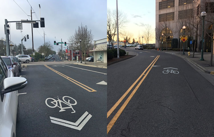
Sharrows
Sharrows are painted shared lane markings used in travel lanes indicating the presence of bicyclists and alerting motorists to share the lane. Sharrows can also serve as wayfinding for bicyclists, and can be used in conjunction with wayfinding signage and other traffic calming treatments.
Photos: Left - SW Broadway St., Beaverton; Right - SW Millikan Way, Beaverton
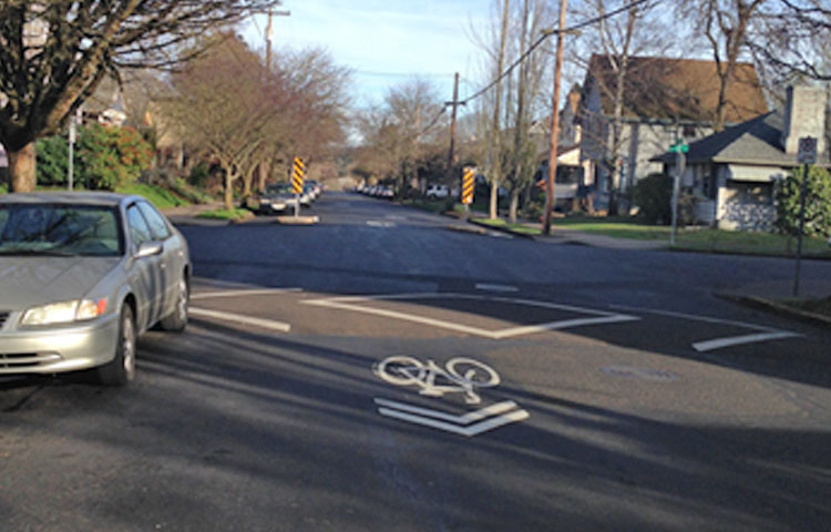
Neighborhood route treatments
Neighborhood Route Treatments can be used on low-volume, low-speed streets where bicycles and motorized vehicles share road space, but where bicycle movements are facilitated through use of traffic calming elements, intersection crossing treatments, and wayfinding. This type of route is often called a bicycle boulevard or a neighborhood greenway.
Photo: SE 19th Avenue, Portland.
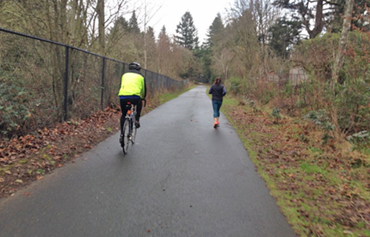
Multi-use trails
Multi-use Trails are paved, bi-directional, trails away from roadways that serve both pedestrians and bicyclists.
Photo: Fanno Creek Trail, Beaverton.


How do you feel about using the following types of facilities?
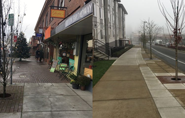
Wide Sidewalks
Wide Sidewalks can be used to provide more pedestrian space than might typically be provided. A sidewalk is a dedicated pedestrian facility adjacent to the roadway and separated from traffic by a curb. Wide sidewalks may provide 8 feet or more width, along with additional buffer space, street trees, furniture, or lighting.
Photos: Left - SW Broadway St., Beaverton; Right – NW 118th Ave., Beaverton.
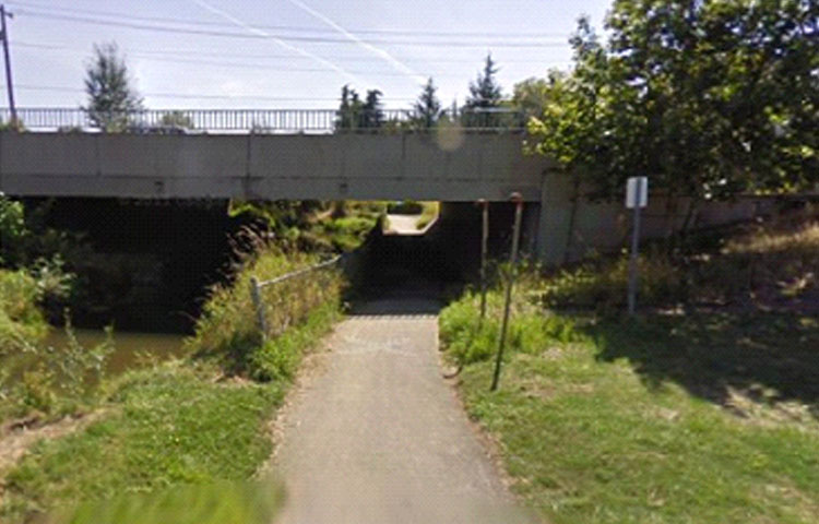
Grade-Separated Crossing
A Grade-Separated Crossing is a bridge (overcrossing) or a tunnel (undercrossing) that carries non-motorized traffic over or under a motorized corridor or other barrier to travel.
Photos: Fanno Creek Trail under Scholls Ferry Road.
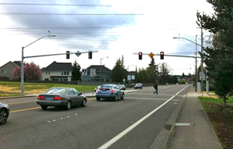
Midblock Pedestrian-Activated Signal
A midblock pedestrian-activated signal provides pedestrians with a signal-controlled crossing at a mid-block location or at a previously stop-controlled intersection where pedestrian volumes warrant full signalization. The signal remains green for the mainline traffic movement until actuated by a push button to call a red signal for motor vehicle traffic.
Photo: Waterhouse Trail at Walker Road, Beaverton.
Rectangular rapid flashing beacons
Rectangular rapid flashing beacons include signs that have a pedestrian-activated “strobe-light” flashing pattern to attract motorists’ attention and provide awareness of pedestrians and/or bicyclists that are intending to cross the roadway.
Photo: SW Millikan Rd., Beaverton. (Also features a crossing island or “pedestrian refuge” in the median.)
Crossing island
A Crossing Island, also known as a pedestrian refuge island or median refuge, provides a protected area in the middle of a crosswalk for pedestrians to stop while crossing the street. They can be used at intersections or mid-block crossings.
Photo: Westside Trail at SW Hart Road.
Raised pedestrian crossing
Raised Pedestrian Crossings bring the level of the roadway even with the sidewalk, providing a level pedestrian path and requiring vehicles to slow. Raised crossings can be used at midblock crosswalks or intersections.
Photo: SW Erickson Ave., Beaverton.
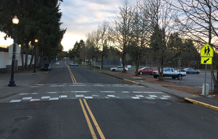
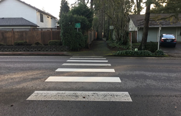
High visibility crosswalks
High visibility crosswalks consist of reflective roadway markings and accompanying signage at intersections and priority pedestrian crossing locations.
Photo: SW 22nd St., Beaverton.
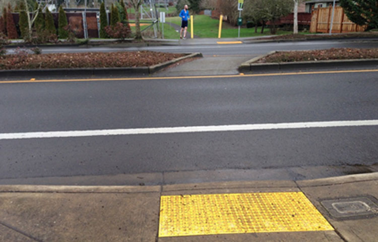
Crosswalks with texture or colored pavers
A Crosswalk with Texture or Colored Pavers is marked with a different pavement texture, different material, or different color than the rest of the street. These crosswalks may or may not also include high visibility striping and can provide an aesthetically distinct option.
Photo: NW 118th Ave., Beaverton.


Help us determine how to best prioritize projects
Review the following descriptions of factors we will consider, and let us know which are most important to you:
- Safety can be considered to prioritize improvements in areas where crashes have already occurred, or in areas where there is most risk of future crashes.
- Pedestrian or bicycle demand or access can be evaluated to prioritize improvements in areas with higher numbers of people walking or biking, or with the potential for higher numbers. This factor would prioritize areas near destinations – such as schools, grocery stores, and transit centers, among others.
- A factor related to equity would prioritize improvements in locations with higher portions of people who are either more likely to rely on walking, rolling, or bicycling, or belong to sociodemographic groups that have historically experienced under-investment.
- System completeness looks holistically at the existing bicycle and pedestrian systems and prioritizes filling gaps, addressing barriers, and making connections that are currently not available. For example, system completeness would prioritize a gap in the sidewalk on a key pedestrian route above widening the sidewalk in an area that has narrow sidewalks.
- While detailed cost information will not be available for each proposed project, using general cost to prioritize projects will elevate those with a lower order-of-magnitude cost per mile. For example, general cost would prioritize a neighborhood bicycle route using sharrows, wayfinding signage, and traffic calming treatments above a protected bicycle lane project that might require rebuilding the street.
How do we decide what to do first? Where do we spend our limited funds?
You have 15 points to assign and you can assign up to 5 points per category. Use the sliders to assign points to each prioritization option.
Safety |
0 |
Demand/Access |
0 |
Equity |
0 |
System Completeness |
0 |
General Cost |
0 |
Total Spent: 0/15
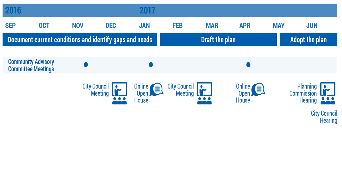
Project timeline

For More Information
- Visit the project website: BeavertonOregon.gov/ActiveTransportationPlan
- Contact: Todd Juhasz, Transportation Division Manager, (503) 526-2424
- Sign up for project updates below...
Final Questions
Mailing list (Optional)
Provide the following optional contact information if you would like to be added to the project mailing list.
Demographic Information (Optional)
This information can help us evaluate the effectiveness of our public outreach activities and tell us if we are reaching a representative cross-section of our community. The identity of individuals is kept confidential. The results are reported as totals only, and used solely to help improve future community engagement. Providing this information is voluntary and optional.
